Snowfall Totals as Storm Moves East, More Snow in the Forecast?

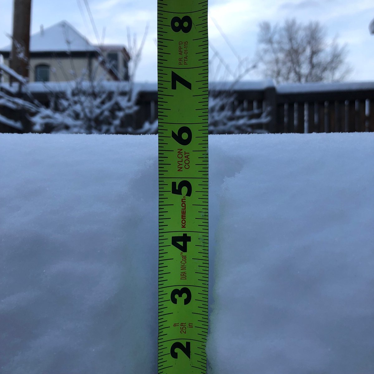
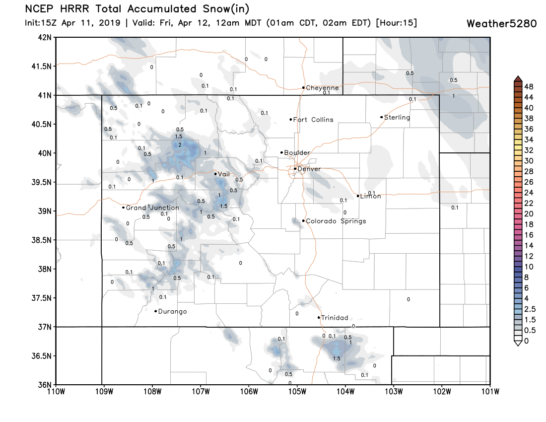
Well, how about that storm? We ended up with 5.75" of snow at our station in Denver (forecast was 2 - 6"), shaking out to be a pretty good April snow for the city. Officially Denver's total will be lower, with just 2.2" recorded at Denver International Airport.
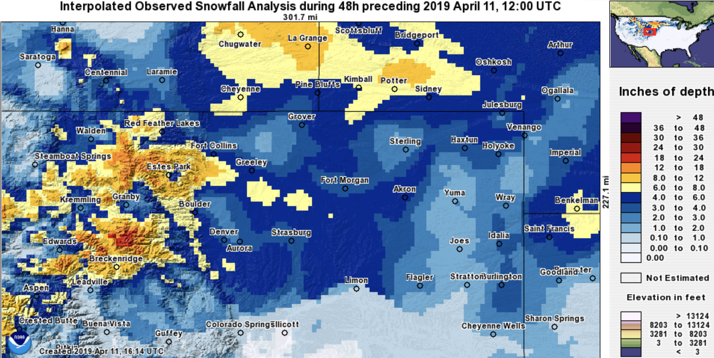
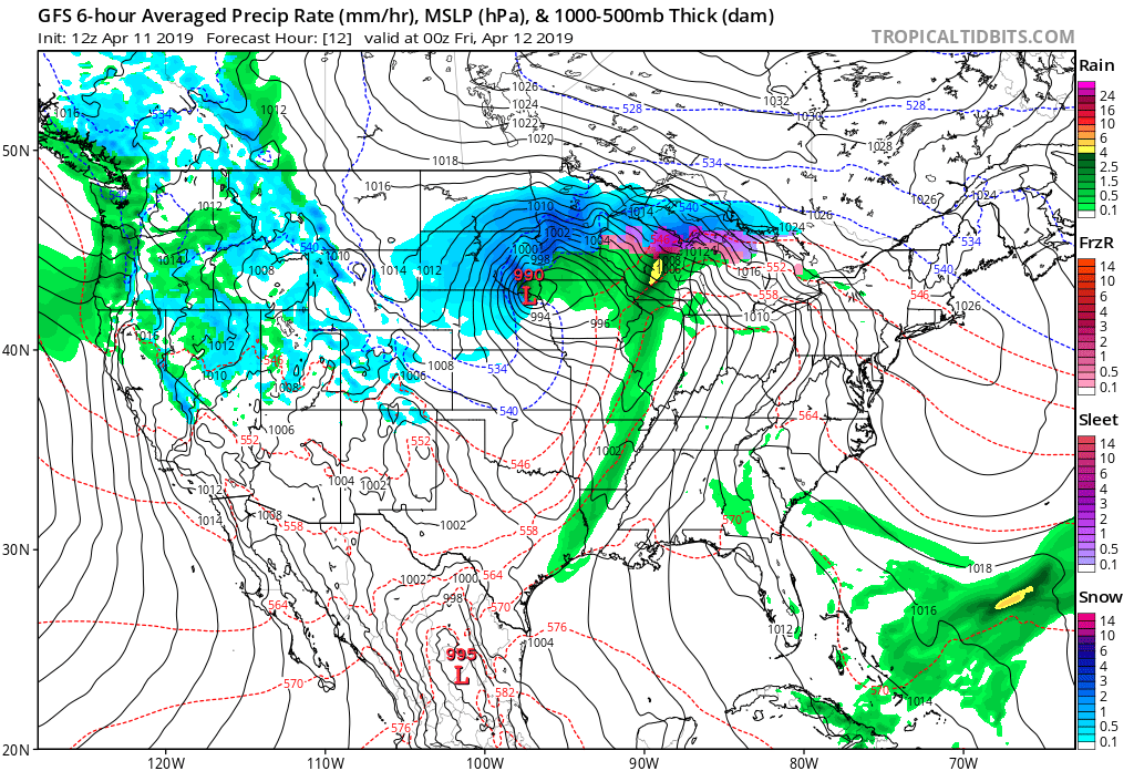
If you wondered why we kept questioning the need for a Blizzard Warning along the urban corridor with this system, I guess now you see. Some areas definitely picked up some good snow, but for most of us a blizzard it was not. The winds picked up in town a bit last night, but otherwise this was a rather straight-forward April snow for the majority of the urban corridor. Not to say it wasn't a tough call –– several models looked much windier for the urban corridor up until yesterday morning, and east of I-25 we definitely saw blizzard conditions at times. An impactful event (not a fun drive this morning!), and great moisture for the region, which I think was well communicated by all.
Overall our forecast worked out well. The big miss for us was the heavier snow we saw accumulate around Loveland, Fort Collins, and Windsor yesterday. In this swath we saw totals from 5 - 10" (something the 3km NAM definitely picked up on yesterday, and likely a result of cold air damming) and FOR ONCE a boom 💥 snowfall for these areas! Everywhere else our forecast worked pretty out well, with snow ongoing on the far Eastern Plains this morning.
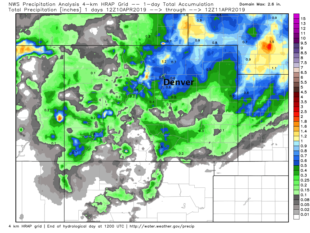
For moisture, really hard to complain about these estimates, with upwards of 1" in a few locations yesterday:
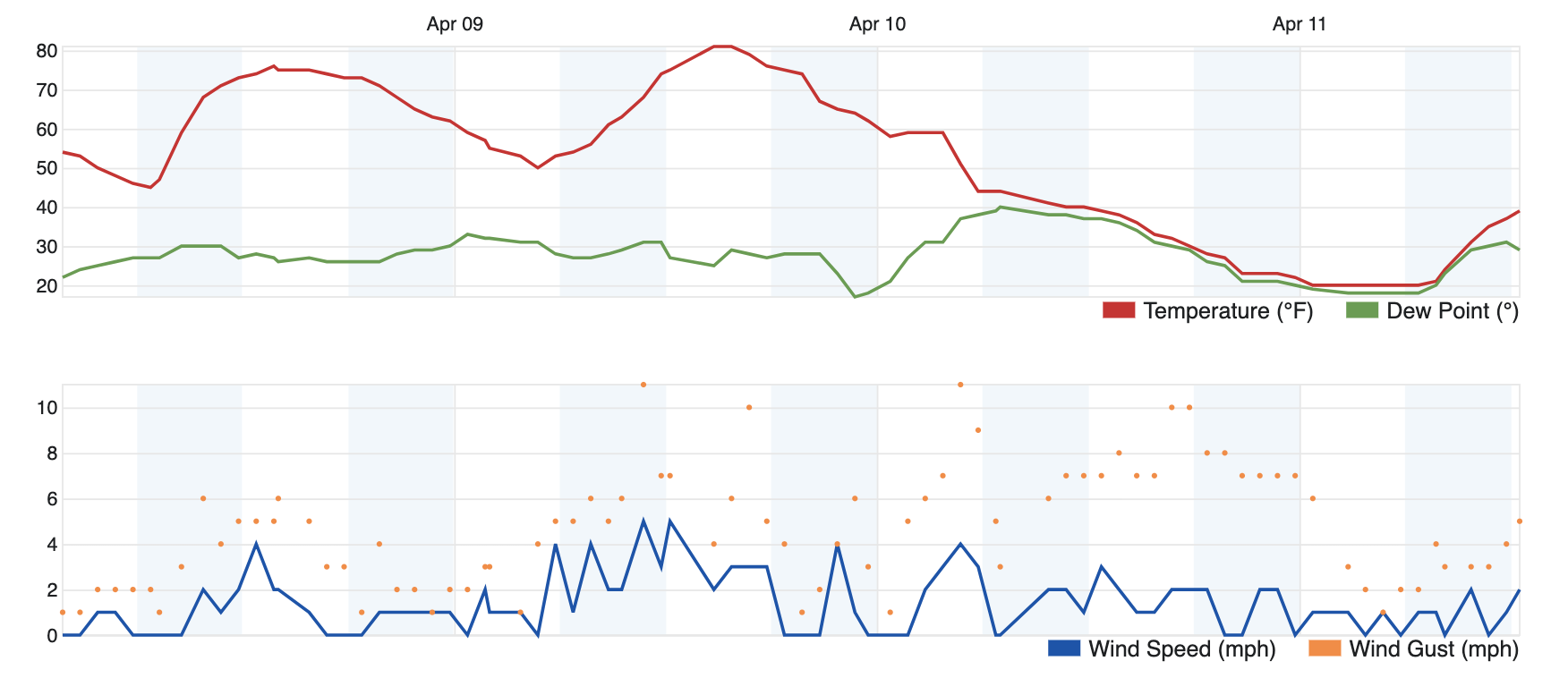
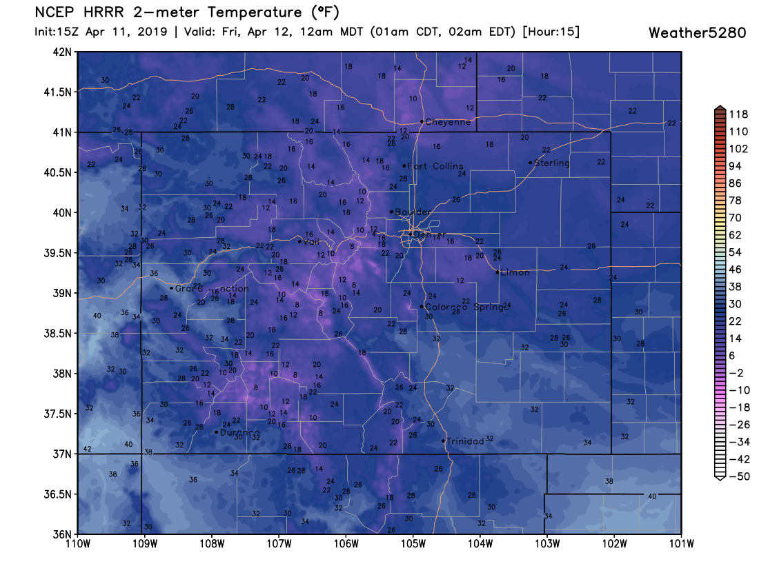
Not only did we see a good late season snow, but some impressive cold too. Our station bottomed out at 20°F this morning, some 61°F COLDER than we were Tuesday afternoon!
Today and tonight
Blizzard conditions continue across the far Northeast Plains of Colorado into this afternoon before our weather-maker finally gets east. For Nebraska, South Dakota, and Minnesota, several more hours of heavy snow and wind to contend with today:
This afternoon and evening we may see some stray snow showers move across the I-25 corridor. We don't expect these to amount to much, but with chilly temperatures where we do see these snow showers a quick coating on the roads will be possible. The latest HRRR shows those showers setting up over the Palmer Divide southeast of Denver, but really these could end up anywhere. Again, not a lot of accumulation expected, but something to be mindful of.
Temperatures will again be quite cold tonight. NAM and GFS MOS guidance both show low 20s for Denver tonight, we'll go 24°F for the city. A look at the HRRR shows teens and 20s for all of Northeast Colorado by midnight tonight:
Tomorrow into Saturday
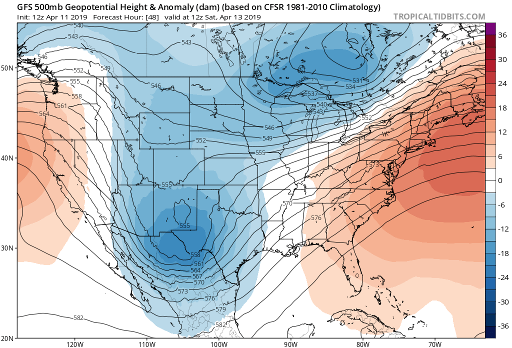
Another storm system is set to impact Eastern Colorado Friday PM into Saturday. It is forecast to track very far south of the state, and with that snowfall potential for the northern urban corridor (while it exists) looks lower than we saw yesterday and last night. For the Palmer Divide (south side), greater Colorado Springs area, and Southeast Plains, perhaps a more impactful snow is on the way... but plenty of uncertainty remains.
While a few models have been a bit excited about the snowfall potential Friday night into Saturday for the southern forecast area, the European is not. Given how far south the low is tracking, it wouldn't be shocking to see the others follow suit. Will wait for a full set of data tonight before getting too excited about snowfall potential across the Palmer/COS area. A look at our current snowfall gambler charts shows some potential, but nothing crazy. Best potential across the Palmer Divide (Castle Rock):
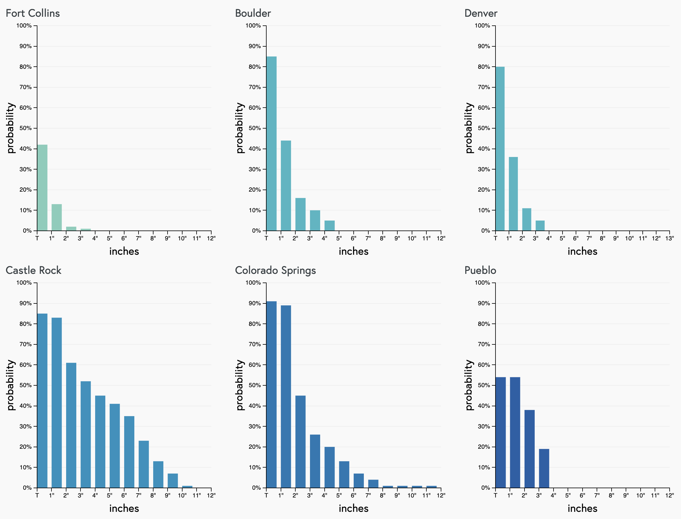
For now we're thinking maybe a spotty Trace to 2" for the Denver area Friday PM, with perhaps 1 - 4" for the southern Palmer and COS region. The Front Range foothills west of Denver could also see a bit of enhanced snowfall later in the day Friday, with perhaps 1 - 4" here as well. If the system stays too far south, less than this across the board.
Let's see how things look tonight and we'll offer an update if needed in the morning. While some models are quite bullish for snow (mainly well south of Denver), it's a bit tough to say how far north the heaviest snow will make it. For now plan on about a 30 to 40% chance of snow showers in Denver by Friday evening/night, and 60 to 70% chance of snow in Colorado Springs. If the system drops a bit further south than currently forecast, those probabilities lower a bit as well.
We'll pass along updates as needed. More active weather on the horizon for next week as well it appears, so stay tuned.