Update on Rain and Snow Potential Sunday Night Through Tuesday

We continue to track a big cool down and a damp end to the weekend and start to the coming week across Eastern Colorado and the High Plains.
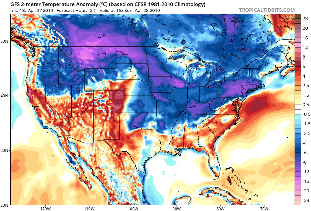
Sunday will remain warm across Eastern Colorado, with changes arriving late in the day. Cold air is lurking to the north, with much of the Central and Northeast United States already feeling the chill:
Temperature anomaly forecast midday Sunday

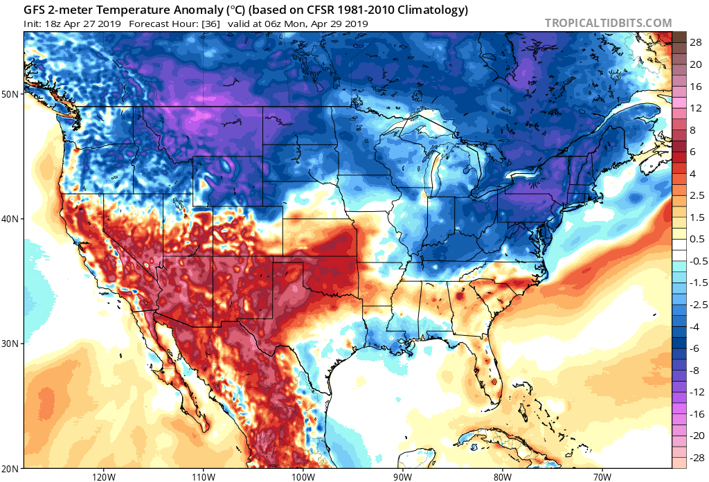
By Monday night we see the cold air pushing into Northeast Colorado
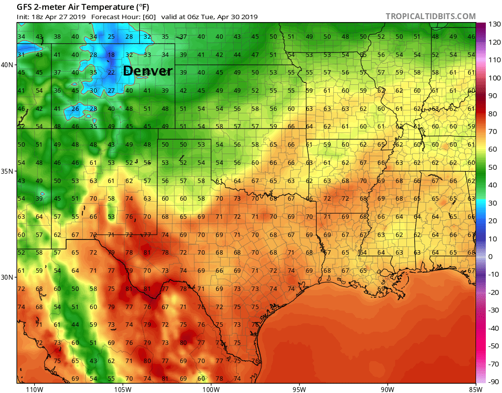
By Monday afternoon temperatures well below average across the region
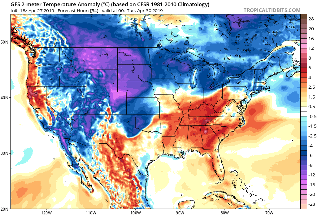
The coldest air arrives with the secondary push, due in Monday afternoon/evening. By Tuesday night we'll see lows along the urban corridor dip below freezing, with temperatures in the low 30s across the Northeast Plains and into Western Nebraska:
While we might see some snow mix in at lower elevations by late Sunday night, its's Monday afternoon/evening that appears to have the greatest potential for accumulating snow, if we are to see any.
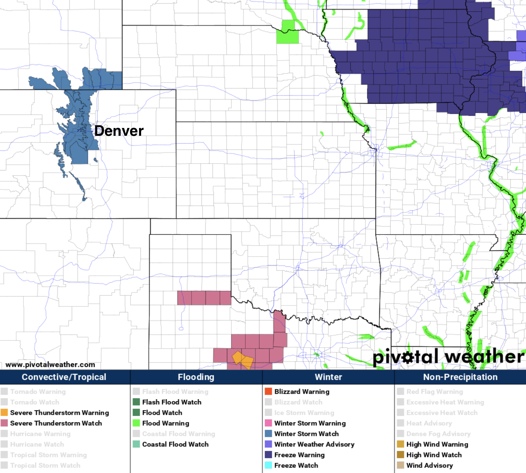
Confidence that we see accumulating snow along the urban corridor and Northeast Plains remains a possibility, maybe even a good one. Confidence in how much, however is low. Greatest potential for an accumulating, and higher-impact snowfall event will be along the Front Range foothills and Cheyenne Ridge. Here we have a Winter Storm Watch (shaded in blue), which goes into effect Monday morning and expires late Monday night. Here 6 - 12" (locally 15"+) can be expected, with very difficult travel conditions, especially late in the day Monday.
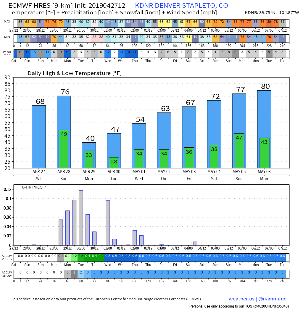
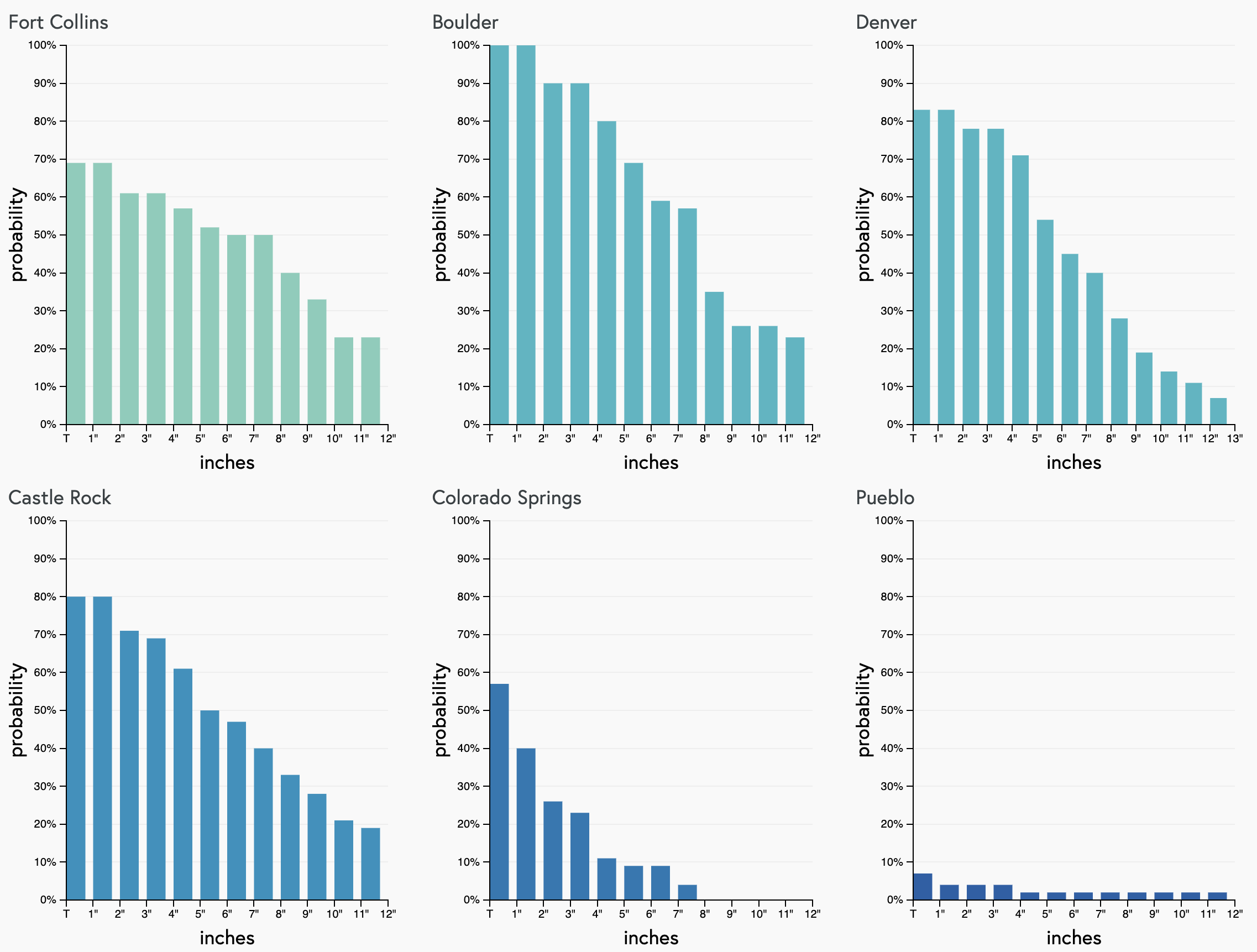
For Denver, the drop in temperature will be dramatic. From 70s on Sunday to 30s on Monday. We are likely to see snow in the city as well, but how much can actually accumulate (not melt, not compact, etc) is a tough call. Look for precipitation chances to increase late in the day Sunday, be highest Monday and Monday evening, then linger off and on into Tuesday night. Below is the forecast for Denver (temps top, precip/snow bottom) from the European model:
For snow, these two maps are good starting points:
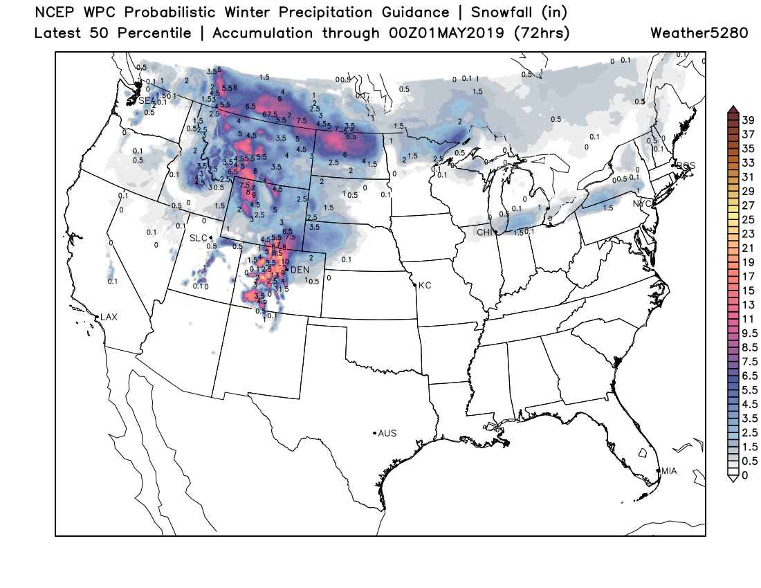
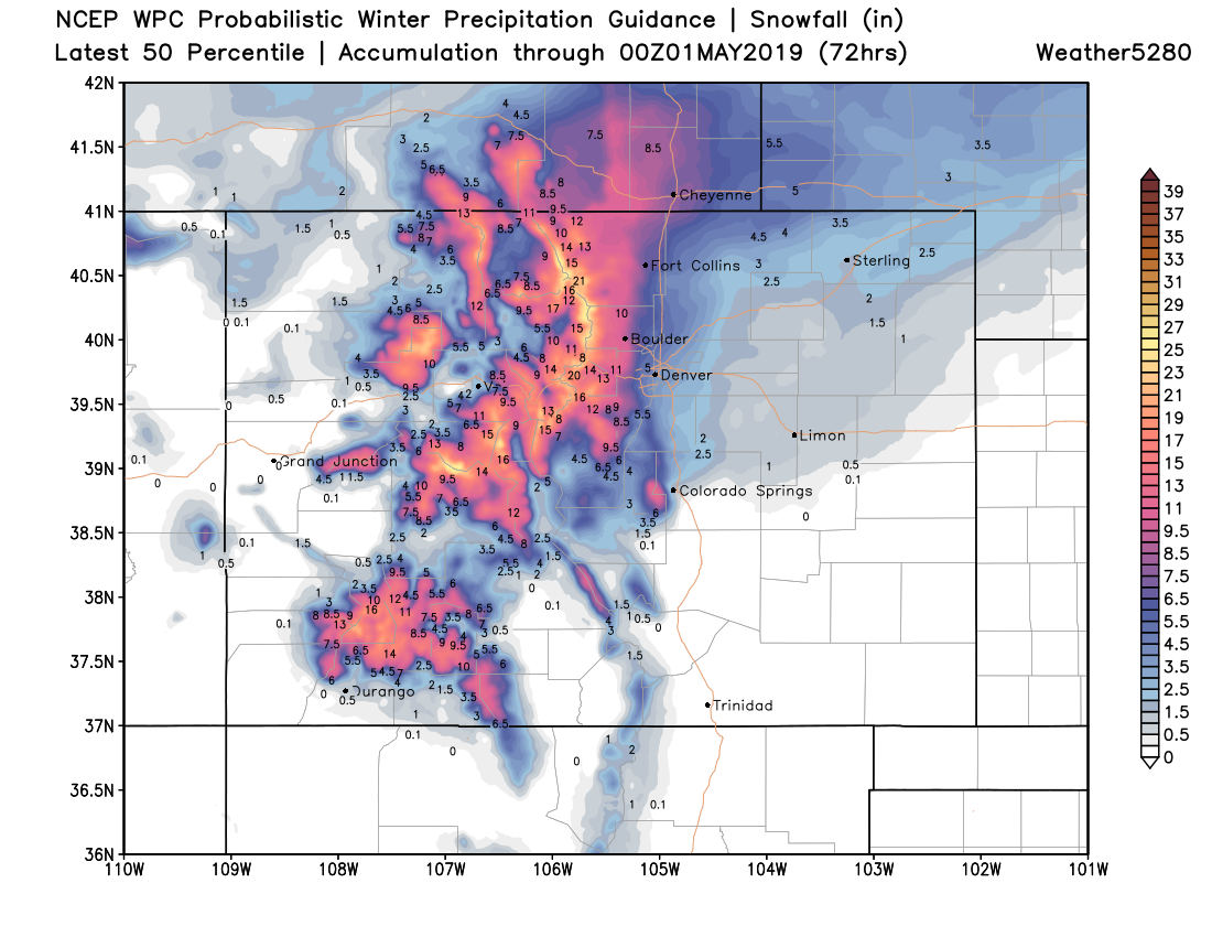
Denver proper and east will struggle to accumulate it appears, so a Trace - 2 or 3" seems reasonable, and mostly on raised surfaces. West Denver suburbs perhaps 2 - 6", with greater totals as you move into the foothills. Easy to see the scenario where Boulder picks up 6" or more, with Fort Collins having some high-end potential as well. For the Northeast Plains, some accumulation, but at the moment totals look on the lower end given temperature issues.
Our gamblers remain bullish, though especially for Denver they're likely not handling melting all that well. What falls vs what sticks won't be the same, but any snow we see after sunset Monday will certainly have better potential to accumulate, especially on those colder/raised services.
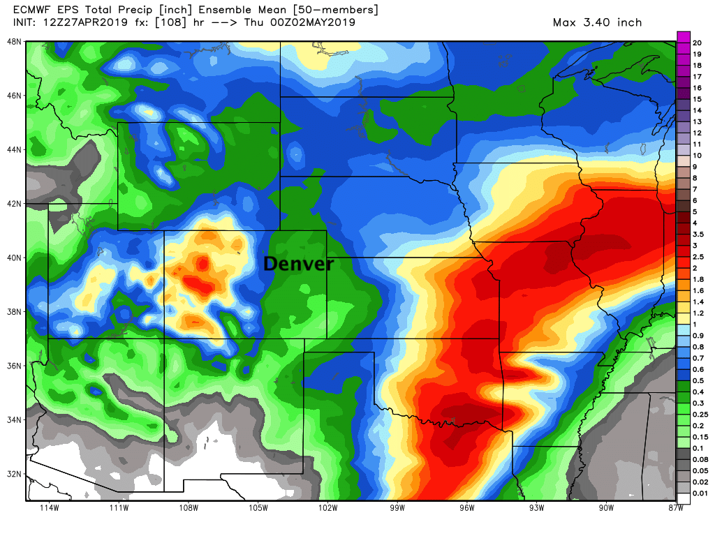
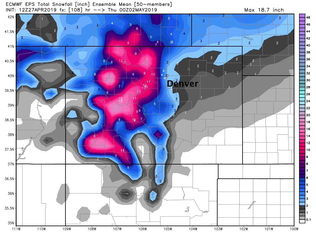
And finally, the European mean snowfall forecast shows the potential for for several inches of heavy, wet snow for higher elevations west of I-25, and perhaps across the Plains as well. Again, across the plains, melting will be the limiting factor in how much we actually see accumulate long enough to measure:
If we're going to have impacted commutes from snow, it looks like the Monday PM/Tuesday AM drives are the ones to keep an eye on. This is especially true for those areas outside the city warmth and at elevations greater than 6,000ft.
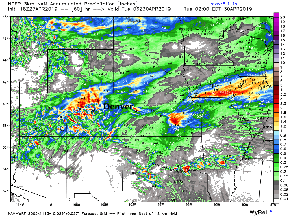
For precipitation, some good potential across the region. The high-res NAM shows totals upwards of 1" for some along the urban corridor and Front Range, with perhaps some heavier storms delivering pockets of heavy rain into Western Kansas late Sunday into Monday as well.
The European mean paints totals from 0.3" to 0.6" across the Eastern Plains of Colorado, with heavier totals for those communities immediately adjacent to the mountains: