Rain and Snow To Start the Week

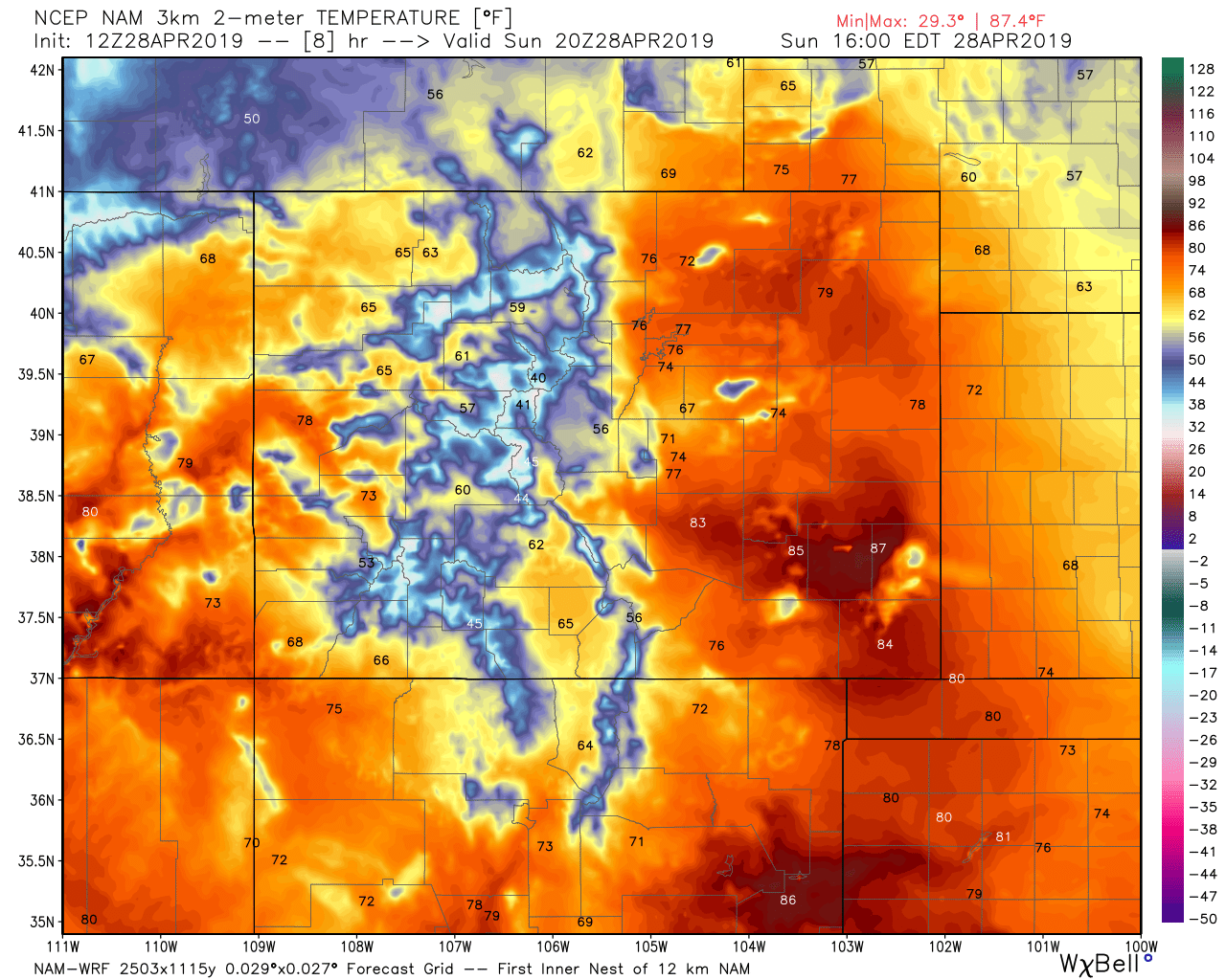
Enjoy today's warm temperatures. Highs will be quite mild across the state, with temperatures in the upper 70s and low 80s across Eastern Colorado:
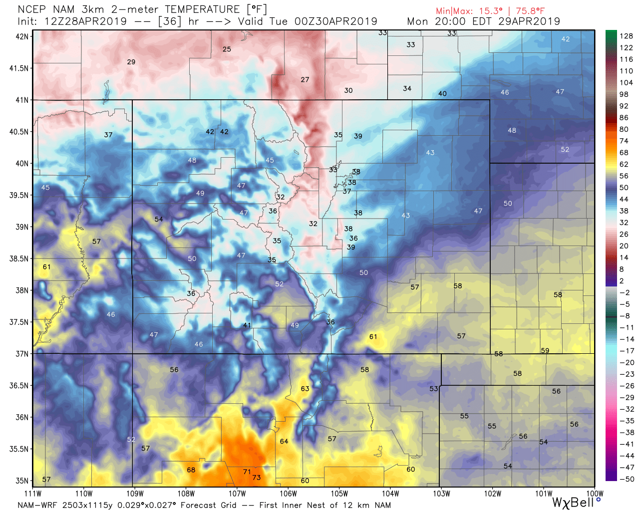
By Monday evening, temperatures have dropped into the 30s and 40s across Northeast Colorado with rain and snow across the region:
Not a fun snow forecast for the urban corridor. Some potential for several inches to accumulate (mainly on cooler/raised surfaces, think grass/cars), but temperatures may limit that potential substantially in some spots. Where elevation is a bit higher west of I-25 and south of Denver the potential for an impactful late-season snowfall is a bit higher. A Winter Storm Watch remains in effect for the Front Range foothills, but no winter highlights have been issued for the urban corridor at this time.
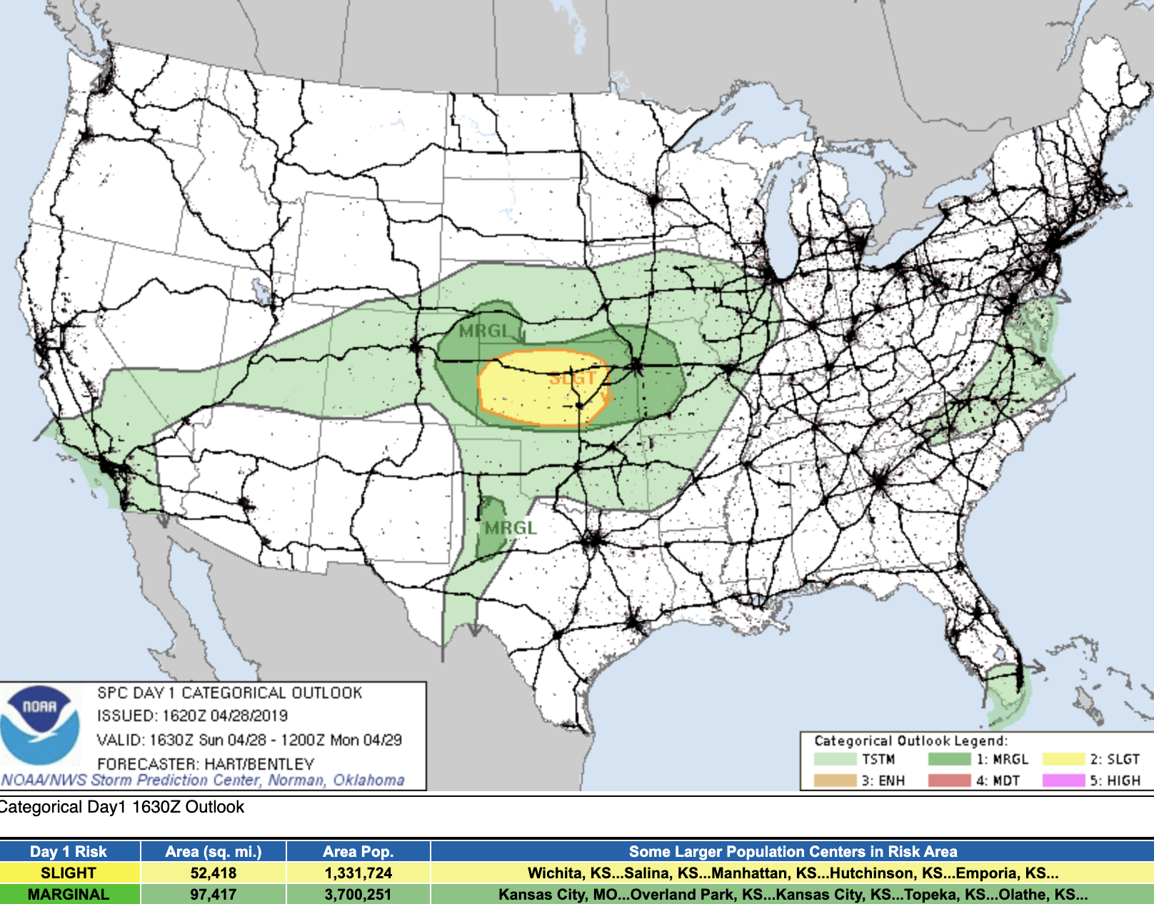
Moisture increases later today across the state, with rain and snow developing Sunday evening across the state and continuing off and on overnight. A few storms later today may become severe, especially across the far Eastern Plains and into Kansas. The SPC has issued a Marginal Risk for severe storms east of Denver, and Slight Risk for a good portion of Kansas:
A secondary push of moisture Monday afternoon/evening will feature the best chance for accumulating snow along the Front Range as cooler temperatures will be in place, but some snow could mix at times with rain early Monday morning as well.
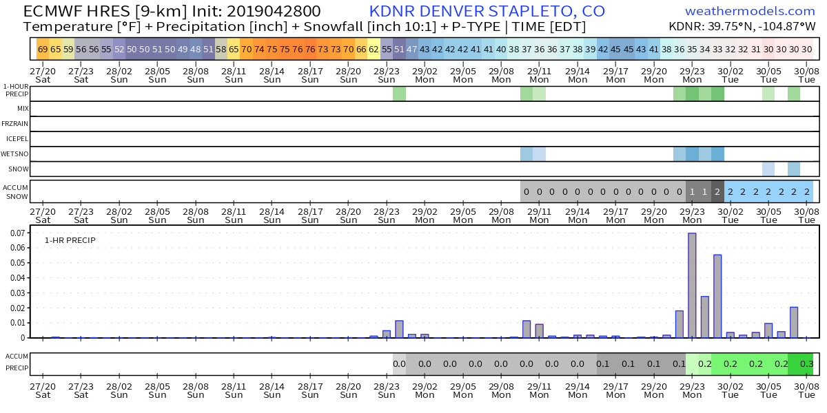
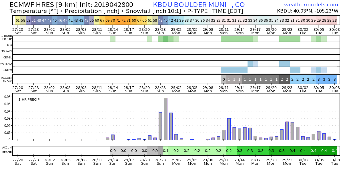
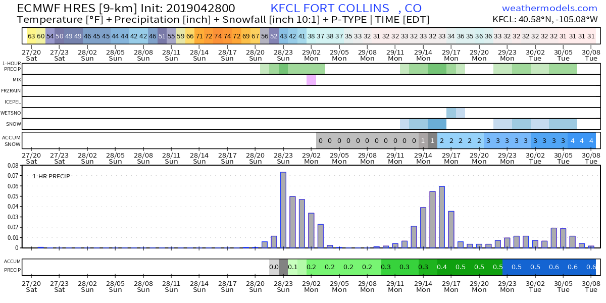
The charts below are hourly precipitation, snow, and temperature forecasts from the European model through early Tuesday morning for Denver (top), Boulder (middle), and Fort Collins (bottom).
For Denver we see some rain chances later today, but the best chance of rain (and snow for that matter) coming later Monday. It is showing 2" of snow and 0.3" of liquid for Stapleton.
For Boulder, precipitation chances look a bit better today, and you see several bursts of heavier precipitation off and on through Monday night. This model has 3" of snow for Boulder Municipal Airport, which is a bit northeast of the city, which has the potential to do a bit better if things line up right:
And finally, for Fort Collins we see those rain/mixed precipitation chances later today, a bit of a lull, then better snow chances increasing Monday afternoon and evening. This model has 4" for Fort Collins through early Tuesday morning:
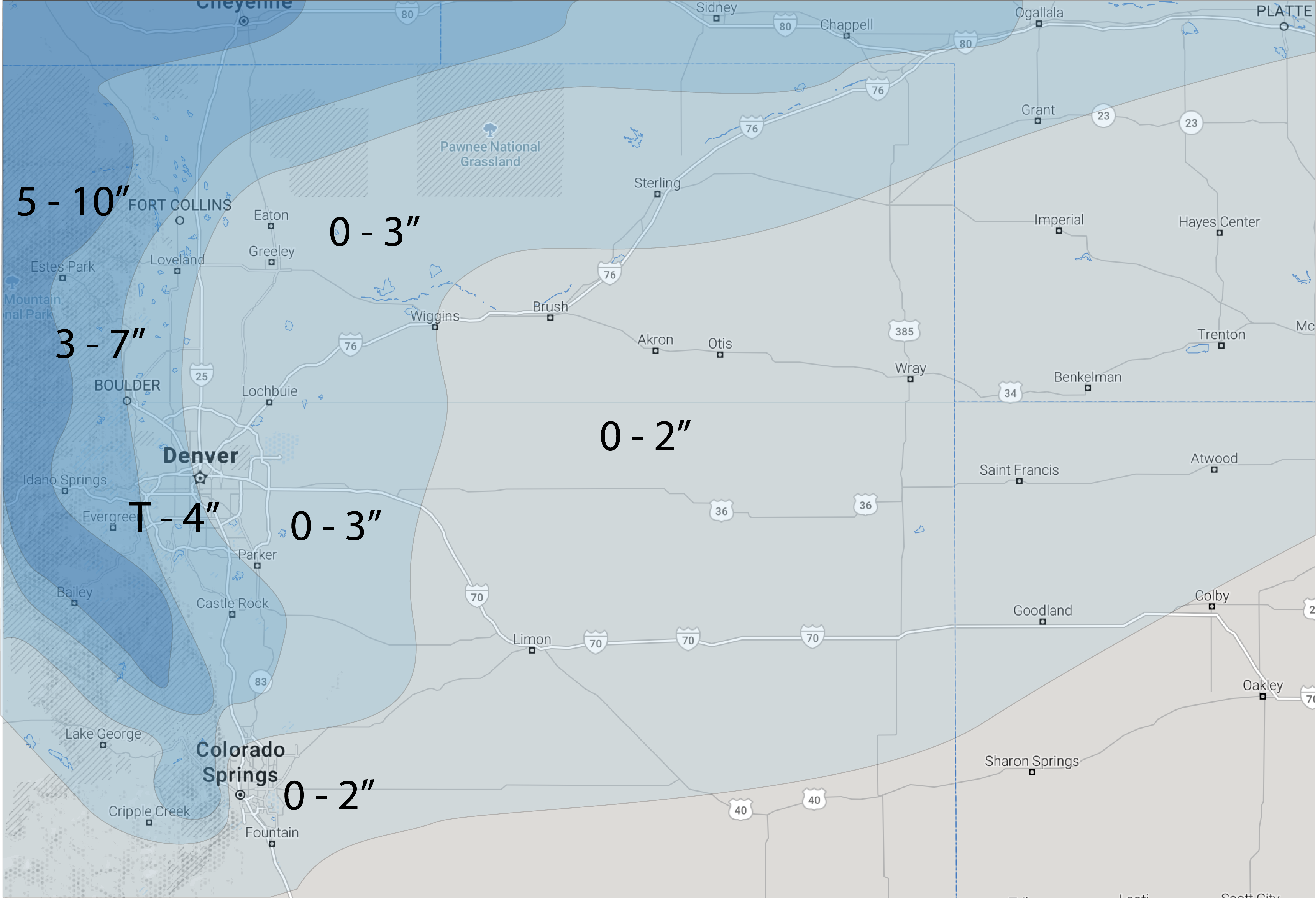
Our snowfall forecast shakes out as follows. We'll go 0 - 2" across the Eastern Plains, where rain mixing with snow and temperature issues should limit accumulation for most areas. A bit closer to Denver we'll bump the high-end up to 3", but again, low end of 0 given temperature concerns.
For Denver along and west of I-25 we'll go a Trace to 4" of wet, slushy snow. Whatever manages to stick in the city will mostly be on raised surfaces, but some icy spots for your Tuesday commute especially will be possible.
For communities right against/within the foothills we'll go 3 - 7", with some high-end potential, but a really tough call with temperatures this late in the year. Wouldn't be shocked to see places like Boulder and West Fort Collins pick up a good half foot of snow or more, but the bust potential is too high to go all in even here. s
And finally, we'll go 0 - 2" for Colorado Springs, with most data indicating most of the rain and snow potential stays north of the Springs this go-around, and if so the 2" high-end may be even too much.
Here's our forecast:
With the best snow potential coming later in the day Monday we'll see how data looks tonight and issue an update if needed. Accumulating snow or not, a chilly and wet start to the week looks like a good bet for Northeast Colorado.
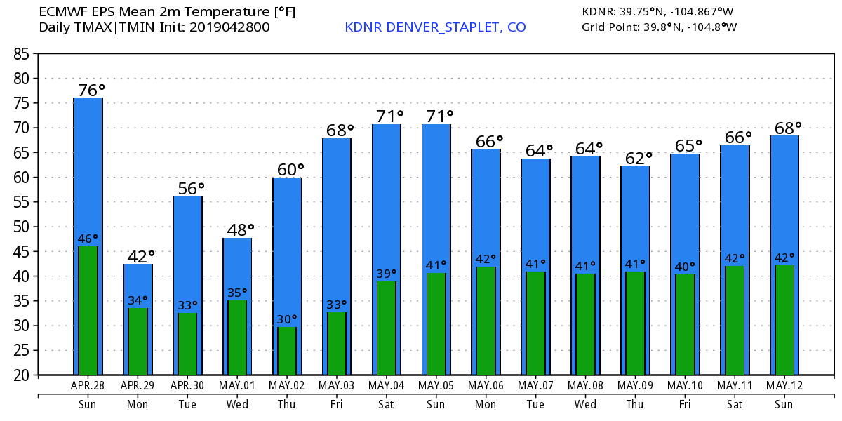
We stay cool and unsettled through Wednesday, before a warming trend kicks in to end the week: