Monday AM Update: Snow Potential Decreased, Timing on Track

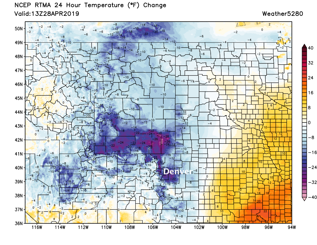
Well, there's certainly a chill in the air this morning! Temperatures in Denver are in the mid 30s, with temperatures across the region ranging from 5 to 30 degrees colder than this time yesterday:
Model trends have been for less snow, and actually less moisture in general over the last 24 hours or so. We still expect wet weather to move in by early to mid afternoon, with rain and show showers (heavy at times) pushing through the metro areas and eventually east across the Plains through tonight.
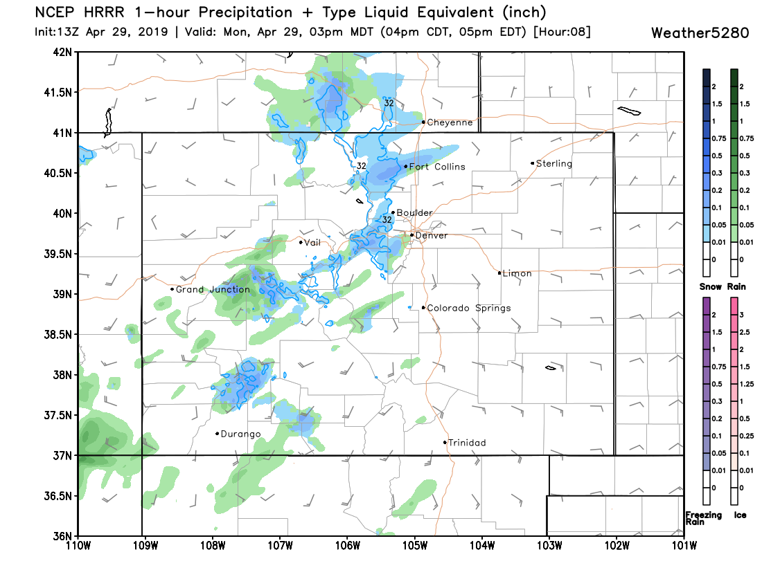
The HRRR model, which as done pretty well with the last several systems, shows a few bands of snow moving through the Fort Collins area by 3pm, and a few rain showers elsewhere:
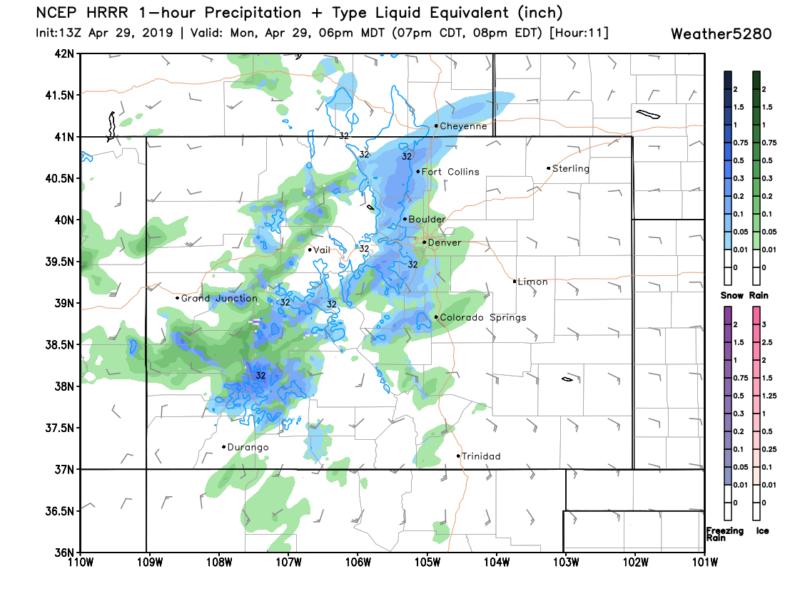
Coverage increases through the late afternoon, with rain and snow up and down the I-25 corridor for your evening rush. As you can see, it still shows many areas still with rain at this time (6pm), with the foothills seeing snow, and perhaps Fort Collins/Boulder as well:
The best chance for snow in Denver looks to come between 6pm and 11pm. Here's this particular model's forecast for 9pm, widespread snow:
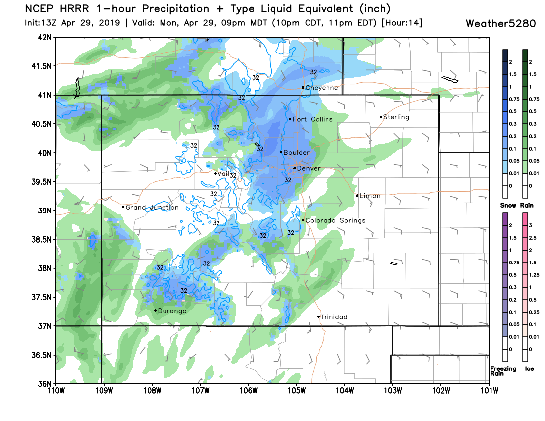
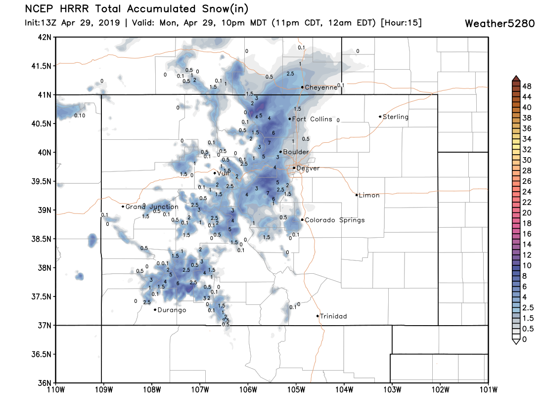
For snow lovers, the changeover may be too little too late. For the tree lovers, this is good news. This same model has a Trace or so of snow for most of the urban corridor through 10pm, with perhaps a few inches in Fort Collins, and at least the west side of Boulder:
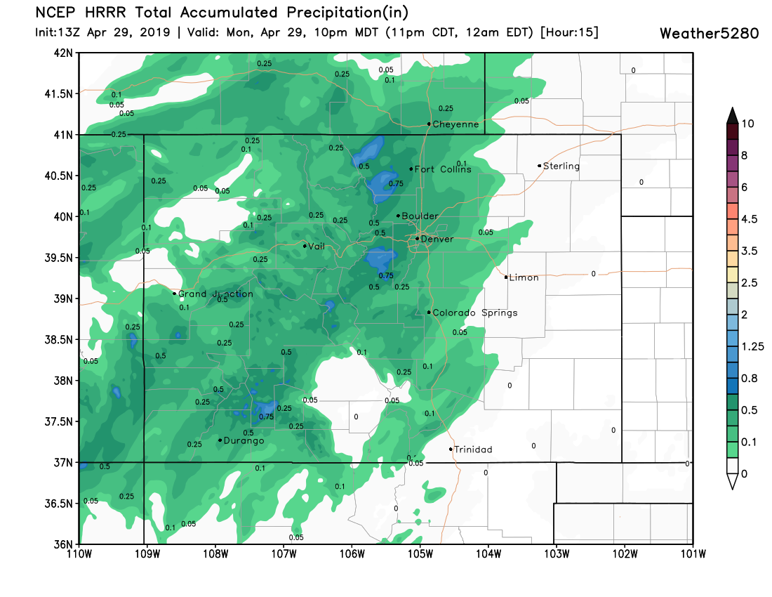
And nice precipitation for most of the Front Range through the same time, with more possible through Tuesday:
We won't bother adjusting our map at this point as our low end for the entire urban corridor was a Trace of snow. What we will say, however, is that we think the high-end potential at this time is markedly lower than it looked even 24 hours ago. A cold day and night ahead? Yes. A wet day and night ahead? Yes, for most of us. A blockbuster snow? Probably not. I'd say it's as equally likely you pick up a couple of quick slushy inches this evening as it is you see no snow accumulation (and mostly rain) at all. Temperatures right now are just looking a touch too warm for the high-end potential we outlined yesterday, but it's not an impossibility either.
A Winter Storm Warning remains in effect for the Front Range foothills and mountains where areas of appreciable snowfall still look likely. The areas likely to see the most snow are at elevations greater than 9,000ft, where totals upwards of a foot will certainly be possible. Fort Collins is the only Front Range city under a Winter Weather Advisory, with the National Weather Service forecasting 3 - 7" for the city. We agree that the Fort has the best potential with this storm –– we have Trace - 4" for central/east Fort Collins, with 3 - 7" west of the city.
For areas that do see snow this evening give yourself a bit of extra time for that morning commute. Even for those that don't see much accumulate, it could be you see a least a burst of heavy snow this evening –– which will cause some issues on the roadways and reduced visibility.
Temperatures warm to near 50 both Tuesday and Wednesday, but rain showers remain in the forecast. We'll call it unsettled. Warm up begins Thursday, with highs in the 60s, topping out near 70 on Friday in Denver.