The State of the Atmosphere: Sunday, May 5th, 2019

We hope everyone enjoyed the beautiful weekend.
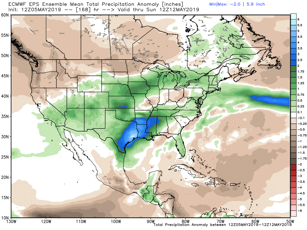
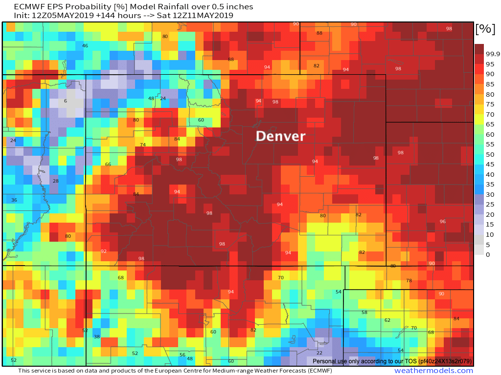
Overall not a lot of change to the outlook we put out on Friday for the coming week, with each of the next five days featuring rain chances across eastern Colorado. Most data indicates a nice wet period when all is said and done, with the latest European ensemble mean forecast showing above average precipitation for most of Colorado over the next seven days, with plentiful moisture across the Plains states as well:
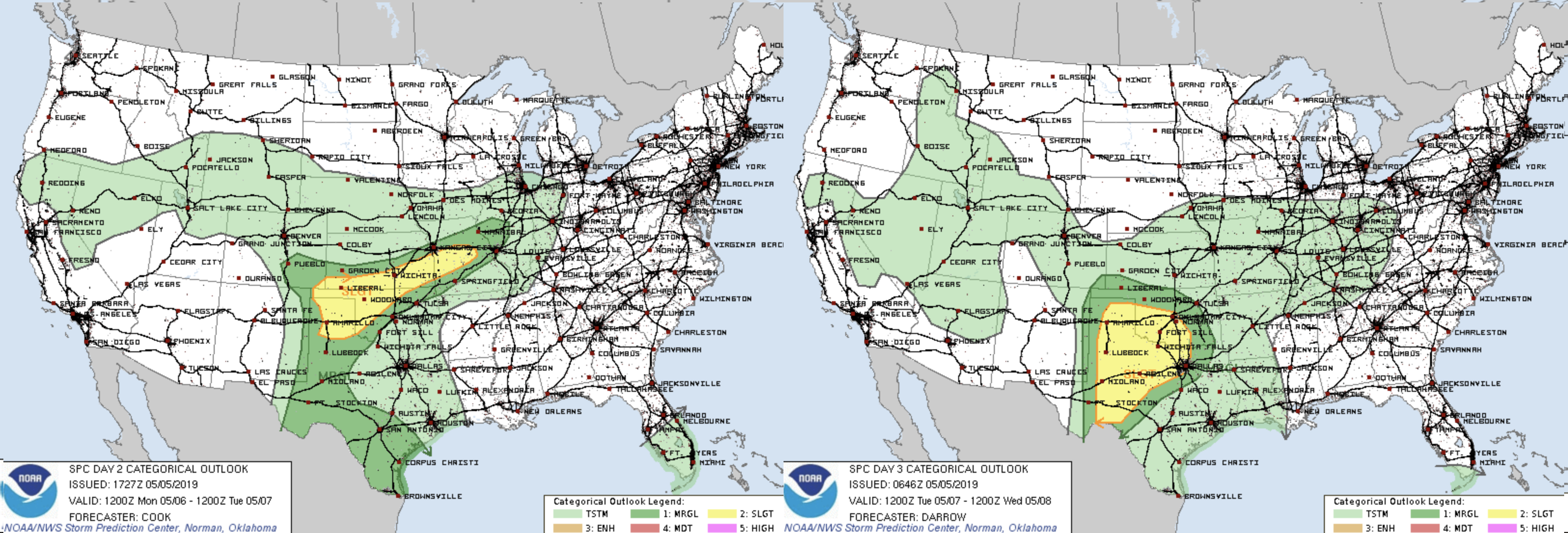
It'll be an active week for severe weather as well. Fortunately for Colorado most of those severe storms are likely to end up east and southeast of our area. Strong storms, including those that will produce tornadoes, will be likely in the areas shaded in yellow over the coming days:
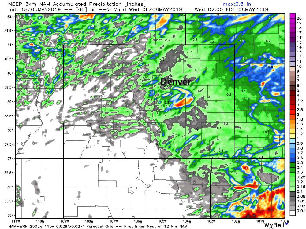
The best precipitation chances for the metro area look to be Tuesday PM through Thursday, with perhaps even some snow for some communities Wednesday. High res models show spotty storm coverage Monday afternoon and Tuesday, with a few areas seeing some appreciable moisture, but not everyone. This particular one shows some good storm activity across the Palmer divide, but only isolated rainfall for the northern urban corridor through late Tuesday night:
By Wednesday troughing moves overhead...

With a shot of cold air following Wednesday into Thursday:
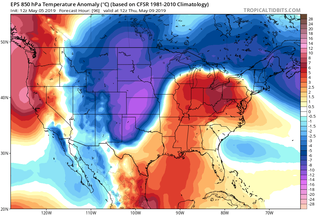
Current timing of this main trough looks to deliver a chilly day Wednesday with rain showers and storms across eastern Colorado, followed by perhaps some snow Wednesday night, and another chilly and unsettled day Thursday. These will be the two coolest days of the week (highs in the 40s for Denver), but the whole week will be cooler than the mild weather we've enjoyed this weekend.
For precipitation totals... it's a bit of a wait and see. Models still indicate upwards of 1" will be possible through the week for many Front Range cities, but as we saw last week models love to overdo QPF. Better to plan on wet and chilly weather this week, and work on the details as we go. For what it's worth, the probabilities from the European ensemble show good odds of 0.5" of liquid or more this week for a good portion of Colorado. Fingers crossed!
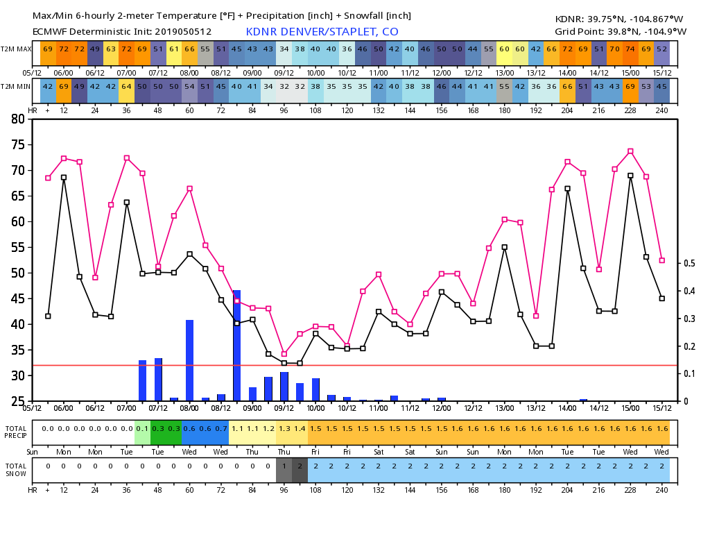
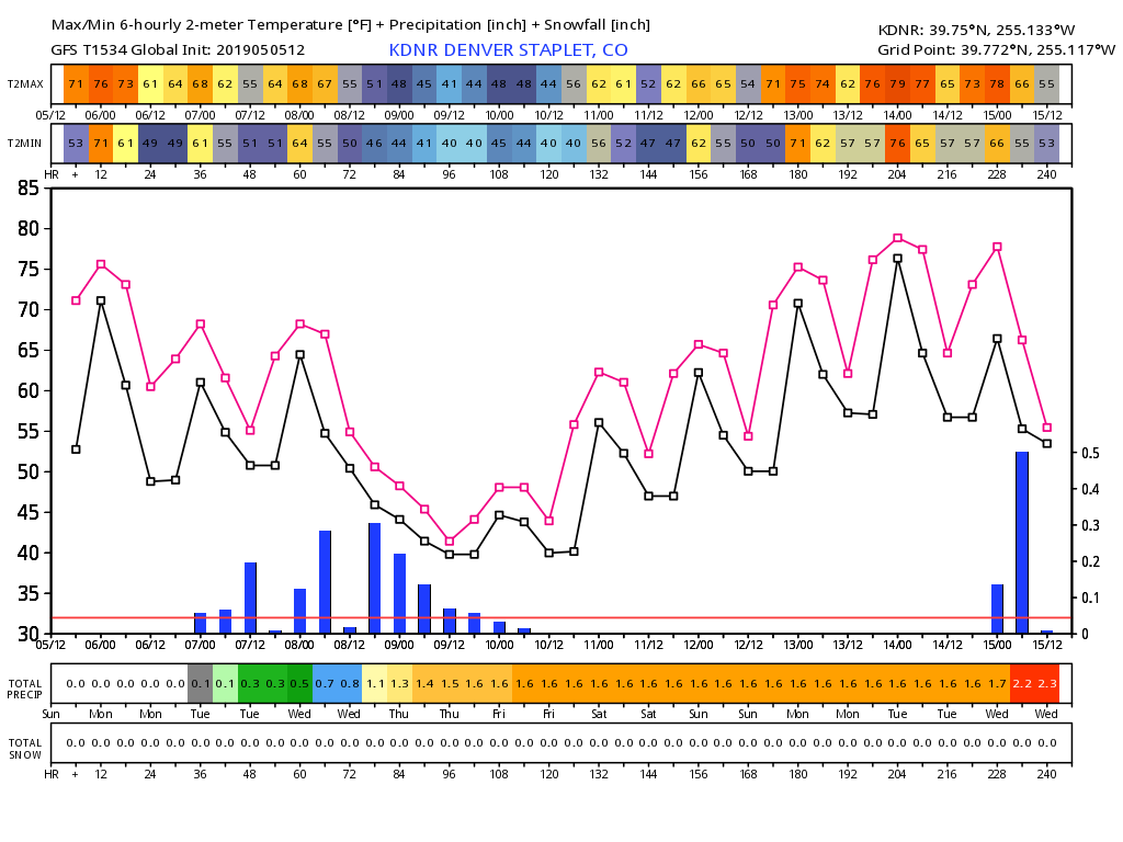
Below are two charts, one from the European (top) and GFS (bottom). Both show temperatures dropping significantly for Wednesday and Thursday (line charts), and a spike of precipitation chances (blue bars) in the Tue PM through Thur AM timeframe, with lower chances Monday and Friday.
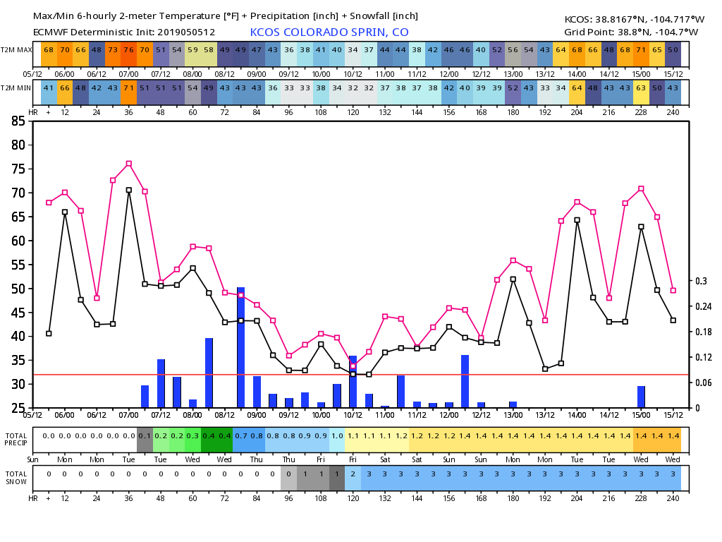
For Colorado Springs also a good temperature drop by Thursday, but lower precipitation chances overall. This particular model shows less potential for Wed/Thur compared to Denver, but overall an unsettled outlook all the way through next weekend for the Springs:
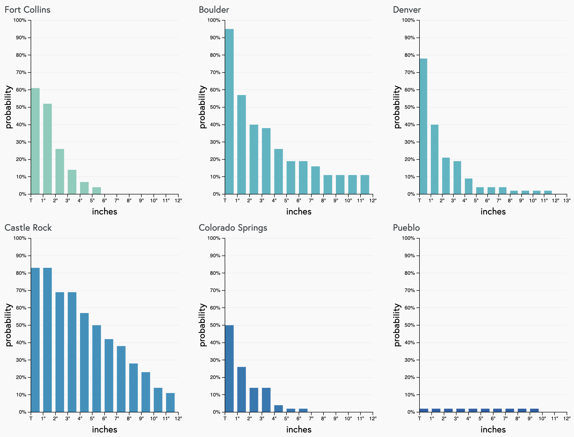
As for snow? Well, I think Denver could at least see some mix in by late Wednesday into Thursday. For the western and southern suburbs snow looks likely by early Thursday morning. Will we see some accumulation in the city? Possibly, but perhaps not hugely likely as it looks right now. Our gamblers show a nearly 80% chance of a Trace of snow in the city, but less than 40% for anything more than that –– and factoring in melting will lower this even more. Boulder/Castle Rock your chances are a bit better as elevation will help increase that snow potential midweek:
And finally, a look at the European probabilities for 3" of snow... good odds of the mountains and western Palmer Divide. Sharply lower probabilities across lower elevations:
