Snow Overnight, Heavy At Times: Monday PM Update
Snow, heavy at times, is possible overnight through Tuesday morning for the metro areas and in the mountains along with thunderstorms on the plains.
We discussed the current storm system in yesterday's SOTA, so let's get into the details of the snowfall and rainfall potential now.
These late season storms are tricky regarding snowFALL versus snow ACCUMULATION. We believe some areas will have quite a bit of snowfall, including a swath to cover the eastern plains from Limon to Sterling, but how much snow will stick is another thing.
We will now go through the details of timing, temperatures, and then accumulation estimates.
Let's break this down first with an animation showing the hourly radar picture overnight:
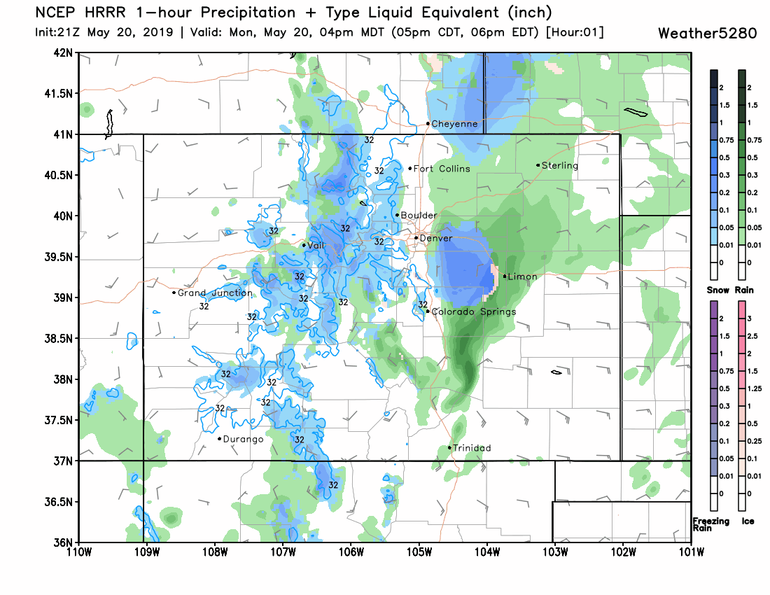
There will be a rain-snow mix in parts of the metro areas through the evening before all snow before midnight. Meanwhile, still areas of rain over the eastern plains throughout the event.
We do believe that what this model depicts as rain for the eastern plains may become heavy snowfall at times due to the thunderstorms convection, cooling the air enough to support some snow bursts. The intensity of all showers does decrease some by the morning drive, with a continued decrease expected during the day Tuesday.
Temperatures by morning, using the same short-range model, are projected to be within a degree or three of freezing in the metro areas and the plains. The colder air, 20s and teens, in the mountainous spots.

These temperatures are the overnight lows. These are critical for a snowfall accumulation forecast. Those areas certain to fall below freezing are less troublesome than making an accumulation forecast for those areas near and above freezing, i.e., the metro areas and plains.
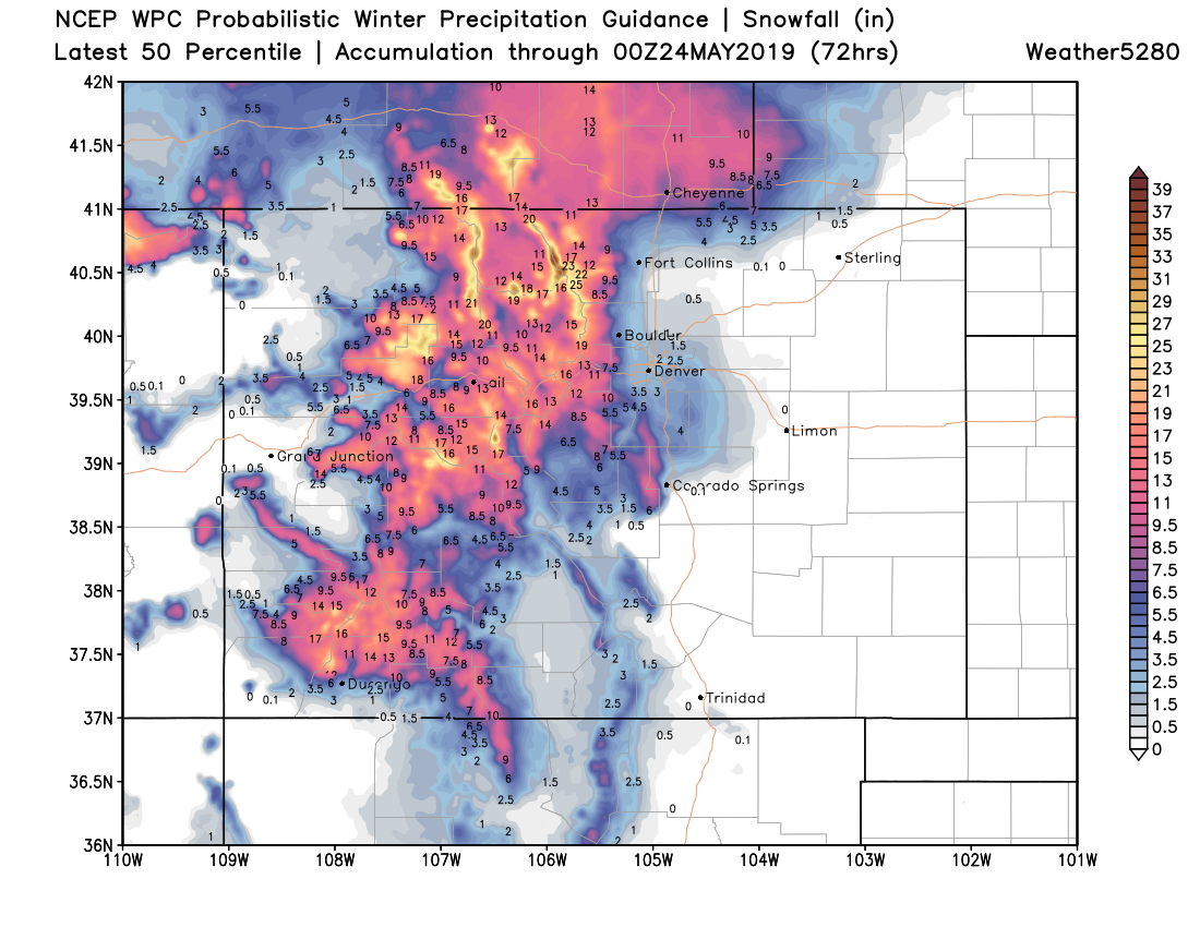
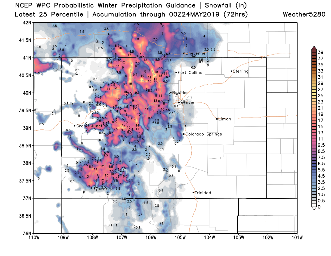
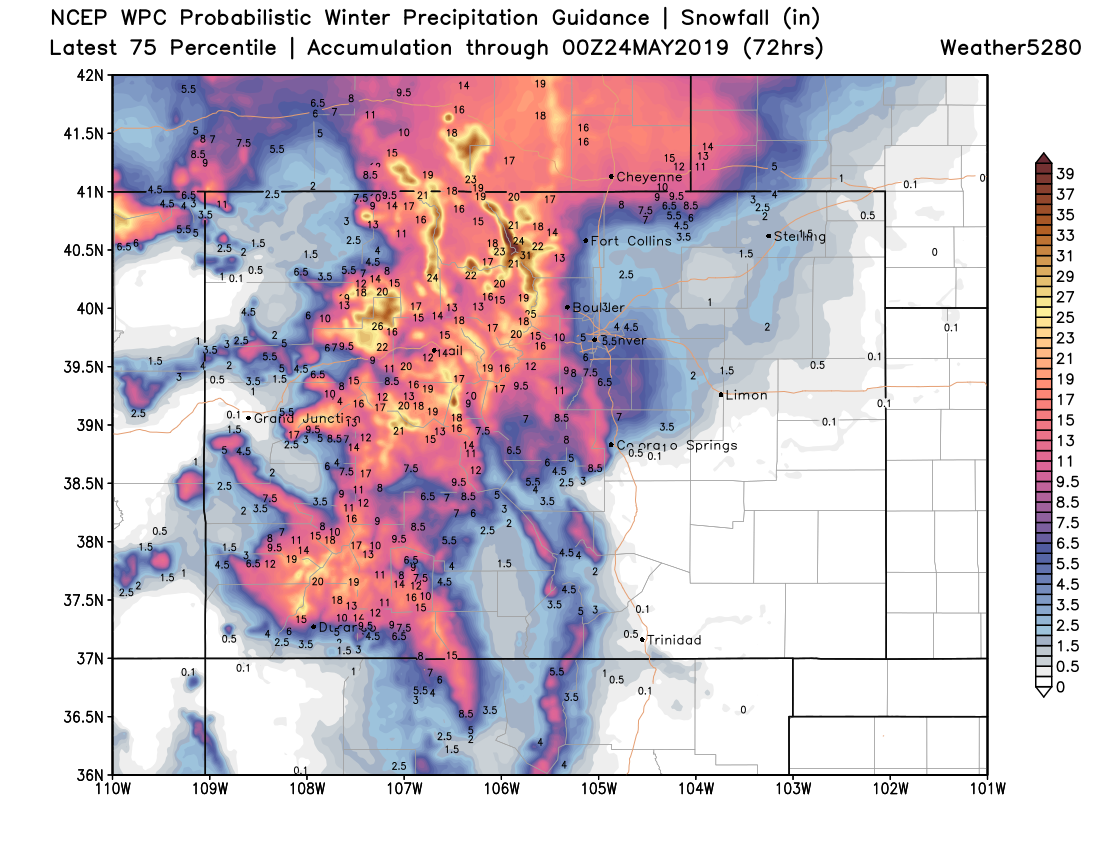
With the timing and temperatures in consideration, let's see the possible outcomes.
With the at least amount being:
With the average amount being:

And, the higher end possible amount being:
We do feel that the average amount (middle image) is the best for the metro areas. 1-3" in most areas Denver and north (including Denver, Longmont, Loveland, Greeley, and Fort Collins) and then 3-6" Denver to the south over the Palmer Divide (including Castle Rock, Elizabeth, Monument, and Parker). And, eastern parts of the Palmer Divide (Elbert and Lincoln Counties) may see more than a foot of snow in isolated areas.
Colorado Springs to see a sharp gradient from several inches near Monument and the Academy to little or no snow on the south side.
What we'd like to blend is to bring the accumulation of the higher end totals map over the plains and place that accumulation onto our preferred map...that would make us happiest. As we point out above, we feel there will be an area of heavy snowfall over the plains that accumulates a few to several inches.
With that said, here is our blend:

This is our best fit for snow accumulation overnight.
Travel impacts as a result of this? Well, certainly the mountains will have issues with slushy accumulation on the roads. Parts of the Palmer Divide may have some slushy accumulation issues too. The vast majority of metro areas, however, will not have much accumulation on the roads but will remain wet for the morning drive.
Overall, extra time is likely needed to get to work in the morning just due to the splashback concerns and having to sweep off any accumulation that is on your car.