The State of the Atmosphere: Sunday, May 26th, 2019

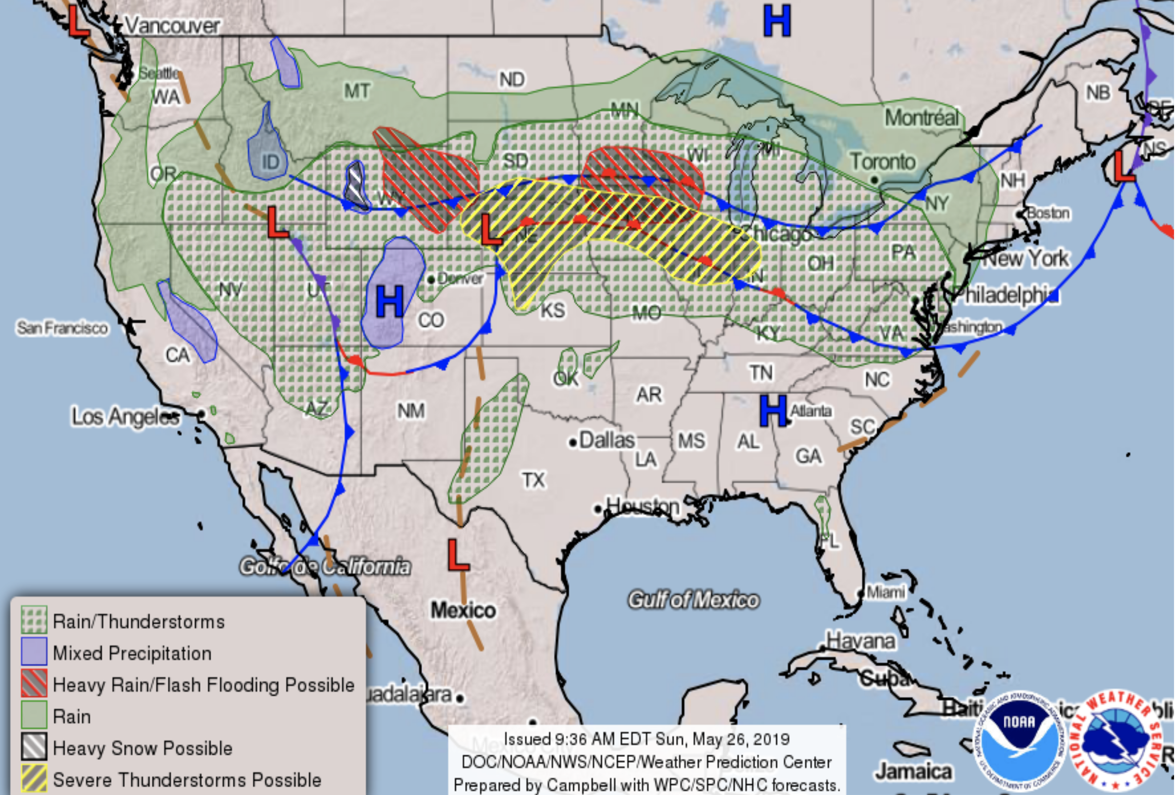
A quick look at the week ahead even as showers and storms continue this evening after what was a busy severe weather day across Eastern Colorado. The radar as of 9:00pm showed storms continuing across the urban corridor and Northeast Plains. Not as intense as storms earlier in the day, but plenty of lightning this evening!

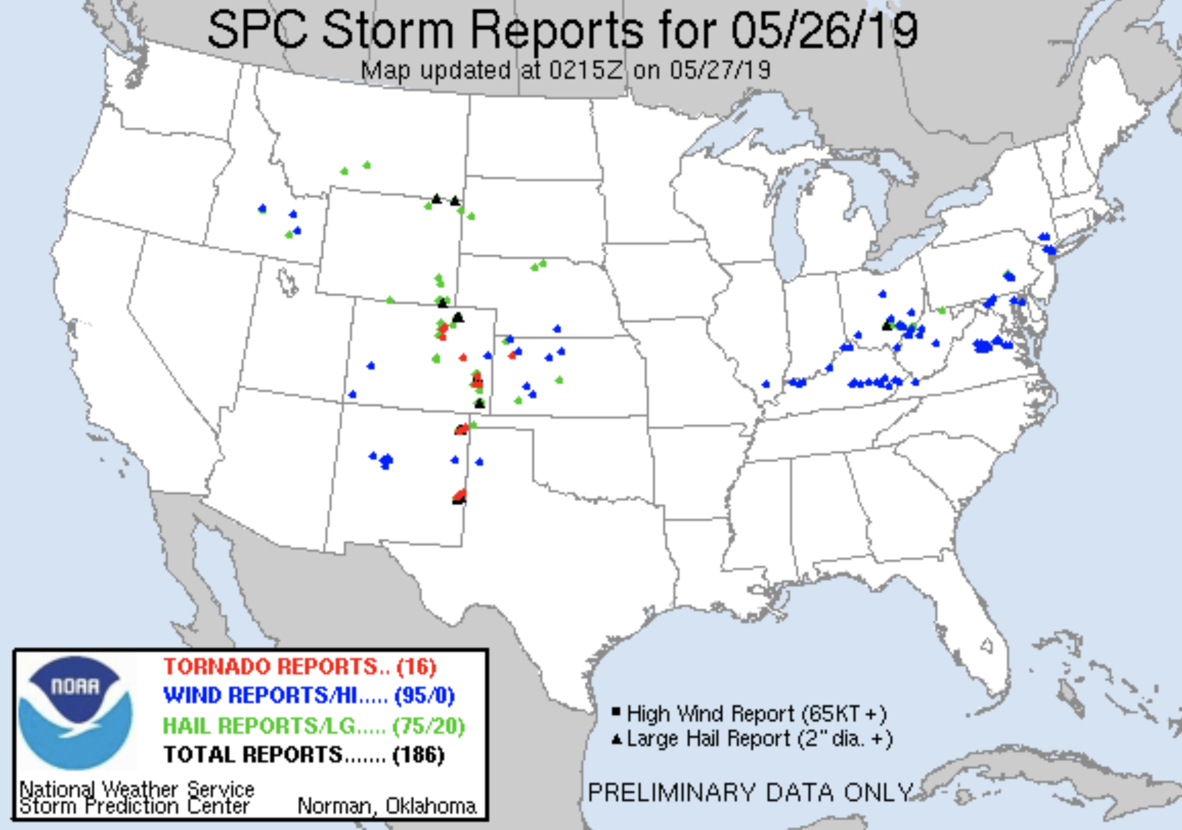
Preliminary storm reports from today's severe weather has 16 tornado reports across the CONUS, wither several of those across Southeast Colorado and just east of the urban corridor across Northern Colorado. Despite the snow earlier in the week, today certainly acted to remind us we were heading into peak severe season across Eastern Colorado as we move into June.
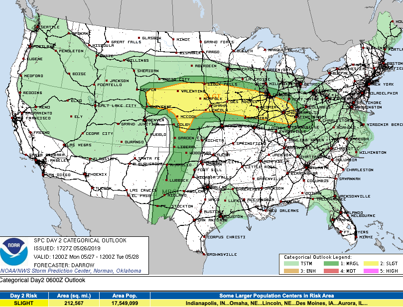
The severe threat Monday moves north of where it was today. Some potential for Northeast Colorado to again see some strong storms on Monday, but the severe threat overall much lower for the state to start the week.
We will, however, see a good chance of showers and storms across Northeast Colorado (even if not severe) especially as we head into Monday night and Tuesday. A cold front will knock highs down from the mid 70s on Monday to the 50s on Tuesday with that chance of rain. Wednesday will remain on the cool side, but should be at least a bit warmer than Tuesday (the Euro below may be overdone with the cold?). Thursday into next weekend will feature afternoon storm chances, but overall a warming (and drier) trend.

As for how much rain we'll see this week? Models are a bit all over the place, but it looks like at least the far northern forecast area (Fort Collins east across the Plains) will see a decent chance at some appreciable moisture. The NAM shows good storm coverage well into the Denver area Monday night with totals upwards of 1" under the heavier storms, while the GFS is less bullish (below).

We'll go with a 30 to 50% chance of storms Monday night and Tuesday across Northeast Colorado. Greatest chances north of the metro area, but hopefully a good soaker for the city too. Plan on those cooler temperatures at least Tuesday, perhaps Wednesday, before we warm back into the 70s to end the week.