The State of the Atmosphere: Sunday, September 8, 2019

Latest observations from DIA show Denver's high topping out at 79°F today, a few degrees below the average of 82°F for the date. On the west side we did even better, just 72°F for a high after an overnight low of 50°F. While not exactly cold for September, a refreshing break from the early month heat we experienced last week.
Not only did Denver set a new record high for the month of September last week, it managed best that previous record high of 97°F THREE times -- 98°F on September 1st, 100°F on September 2nd, and 98°F on September 5th. Absolutely remarkable.
Since the 5th, we've seen more seasonal weather. Temperatures Friday dropping into the mid 80s, followed by upper 80s Saturday, followed by a quick trip below average for a change today.
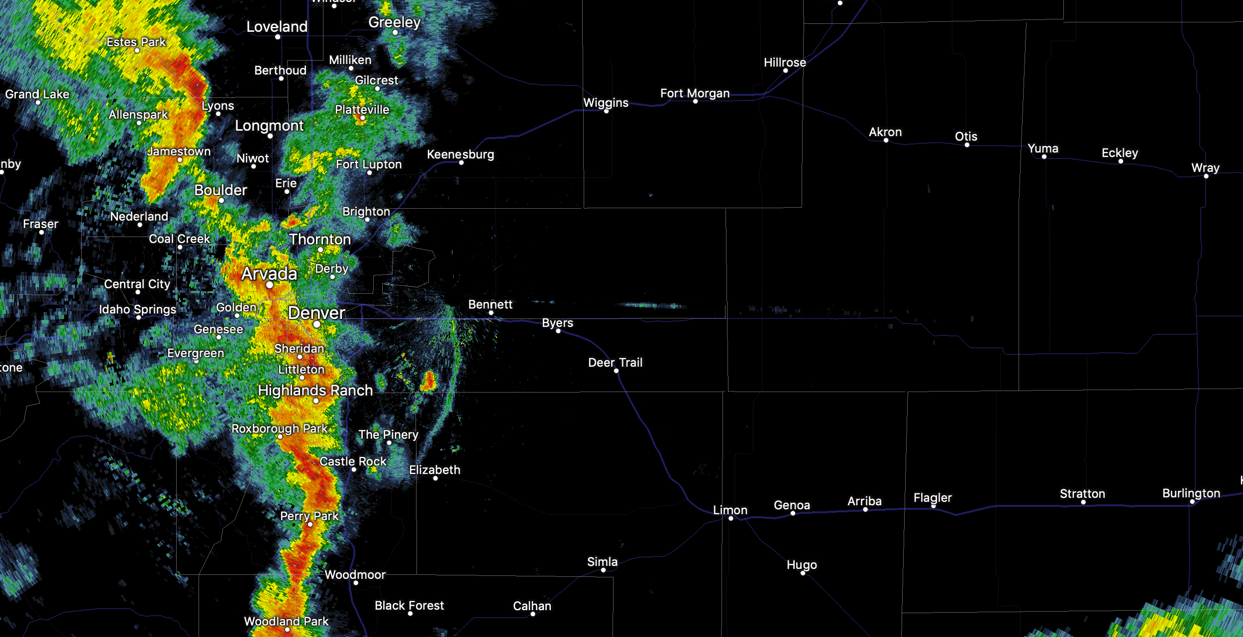
Today's storms have hit a greater area, but Friday's storms were in many respects more impressive. Totals upwards of 2.5" were reported on Denver's south side –– an area of the city that has been largely left out of many of the summer's storms.
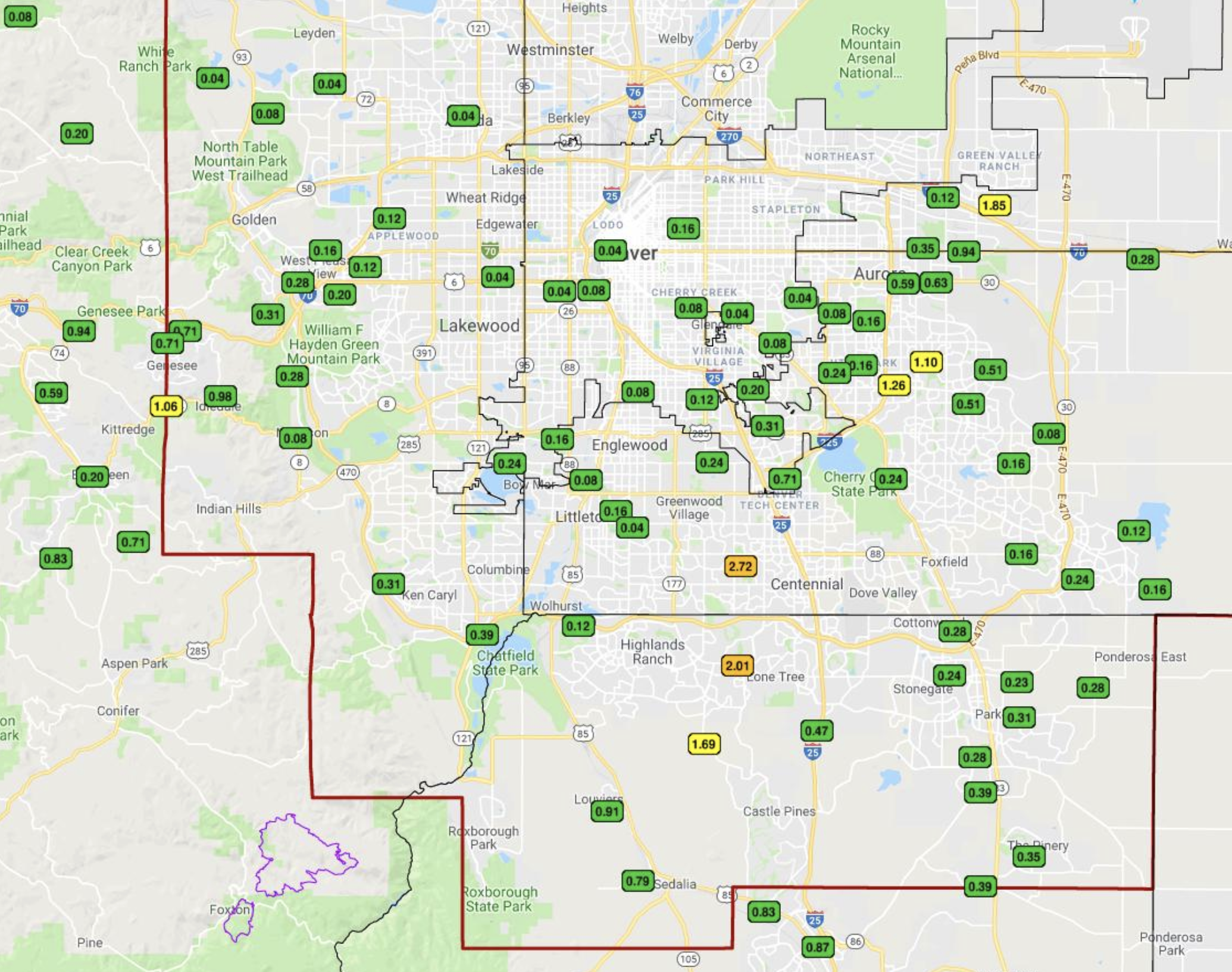
Today's storms were zipping east off the Rockies. Still, we've seen some good totals in spots, with radar indicating totals upward of 0.5" in a few locales, and a widespread 0.2 - 0.3" across much of the Denver area:
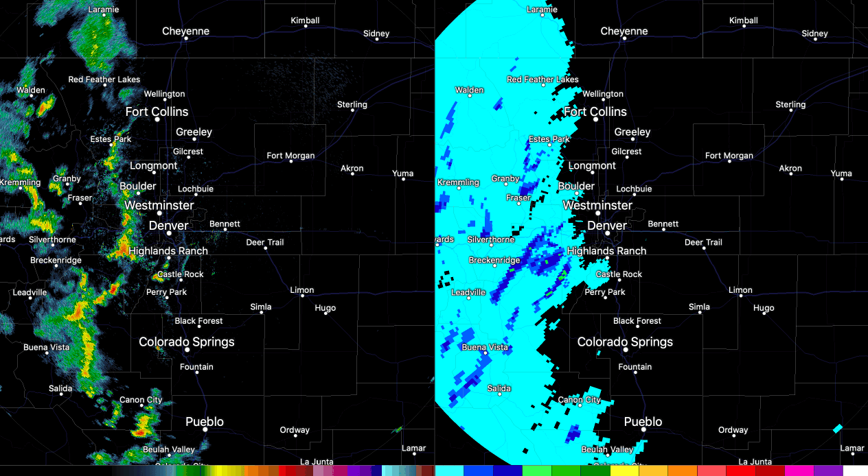
Tonight storms are east of the urban corridor but ongoing across the Eastern Plains:
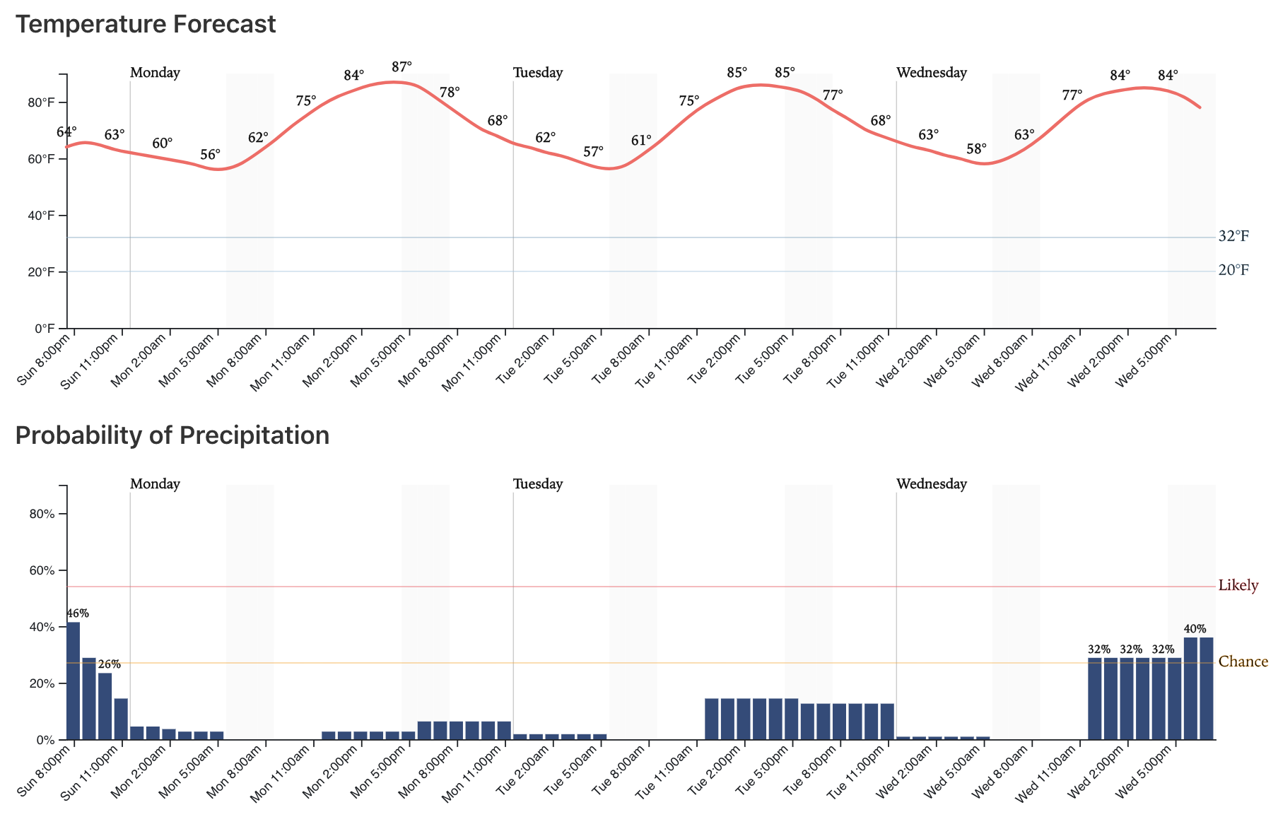
The week ahead
The big takeaway for the week ahead is that we won't be dealing with anymore record heat like we saw the first week of the month. In fact, there's a chance we won't hit the 90 degree mark in the city this week, which would certainly be a change coming off the last month or two. While we currently do not have any 90 degree days forecast, a couple will be close -- including an 87°F high we currently have forecast for Monday. So, not a sure bet we don't reach 90 this week, but we're leaning no for the time being. Denver's average last 90+ day is September 4th which has come and gone. The latest date the city has broken the 90 degree mark? October 1, which happened in 1892. I'm betting we're not quite done with the 90s this year... but hoping we don't break that record too.
So, we start the week off warm and mostly dry with just an isolated storm possible on Monday as it looks right now. We shave a couple degrees off the forecast for Tuesday and Wednesday, as well as increase precipitation chances -- with Wednesday chances creeping back to the 40% mark perhaps:
Thursday and Friday look drier once more, but perhaps cooler too. Latest MOS guidance has temperatures in the upper 70s for highs in Denver on Thursday, with overnight lows near 50. Might this be the week we see our first overnight low drop into the 40s? Perhaps, and if so it looks like either Thursday or Friday morning will be our best chance.
Looking ahead to next weekend we don't see much to discuss in the weather department. Perhaps a bit warmer, but for the time being things look pretty quiet across the region. In fact, a few models are showing a 90 degree+ run by Sunday, we shall see.