The State of the Atmosphere: Sunday, September 22, 2019

We've managed to piece together two very nice (and very climatologically average) days here this weekend in what has otherwise been a very warm September across Colorado.
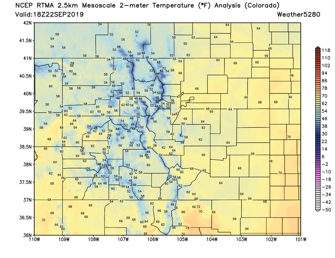
At our station on Denver's west side we've climbed into the mid to upper 60s here as of early afternoon, with midday temperatures across eastern Colorado all very pleasant indeed –– perhaps even on the chilly side(!) for some mountain locations:

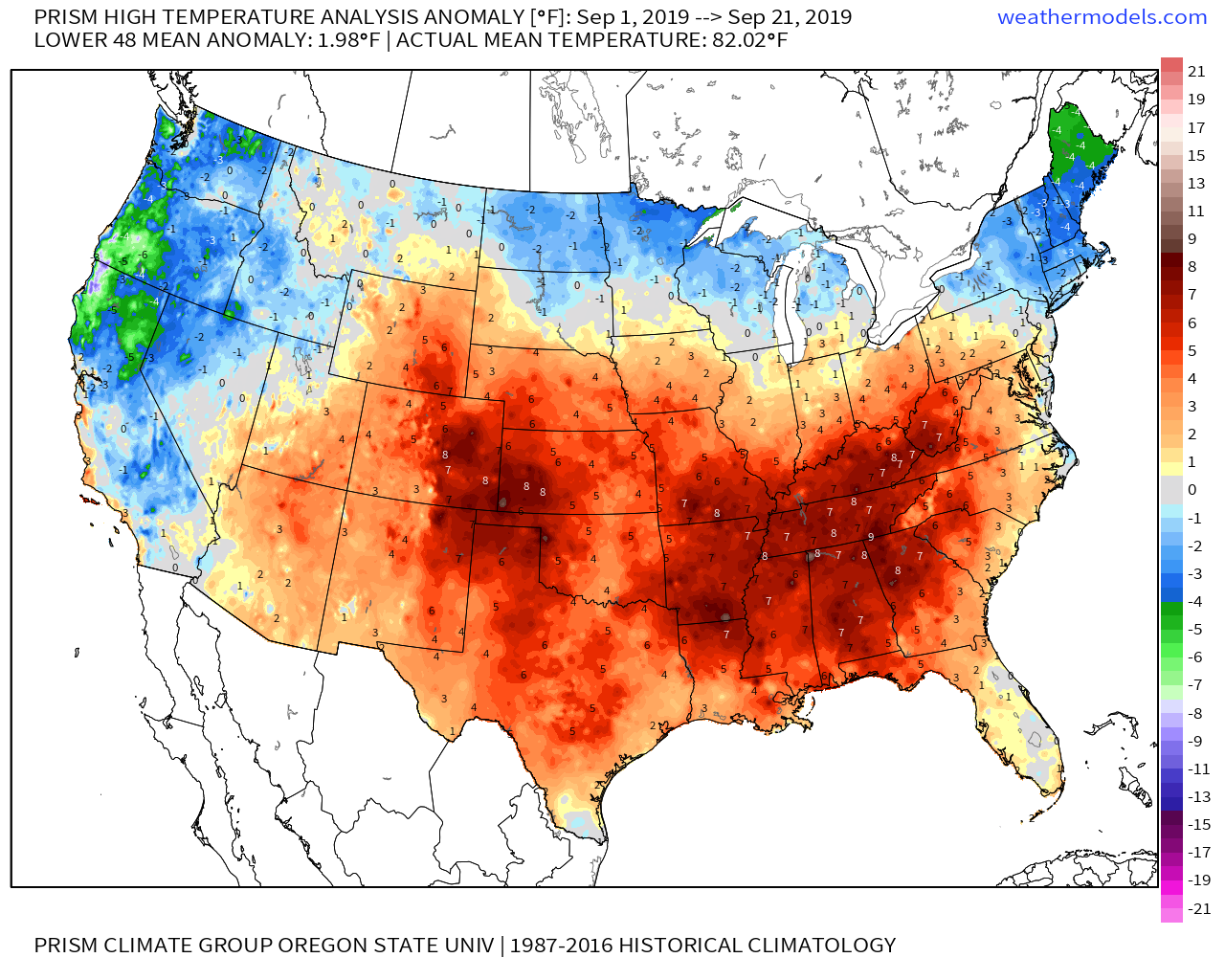
Month to date it's been a different story. Month to date the city is running 6.3°F above average... and its not alone. All of Colorado has seen a warmer than average September, with east-central and Southeast Colorado seeing the greatest departures from average:
Denver also saw its coolest temperature of the season this morning, bottoming out at 40°F at DIA early Sunday. This is I believe the first low of the month to be below average, with the average low for September 22nd coming in at 46°F. The record low for the date? 27°F, set back in 1895.
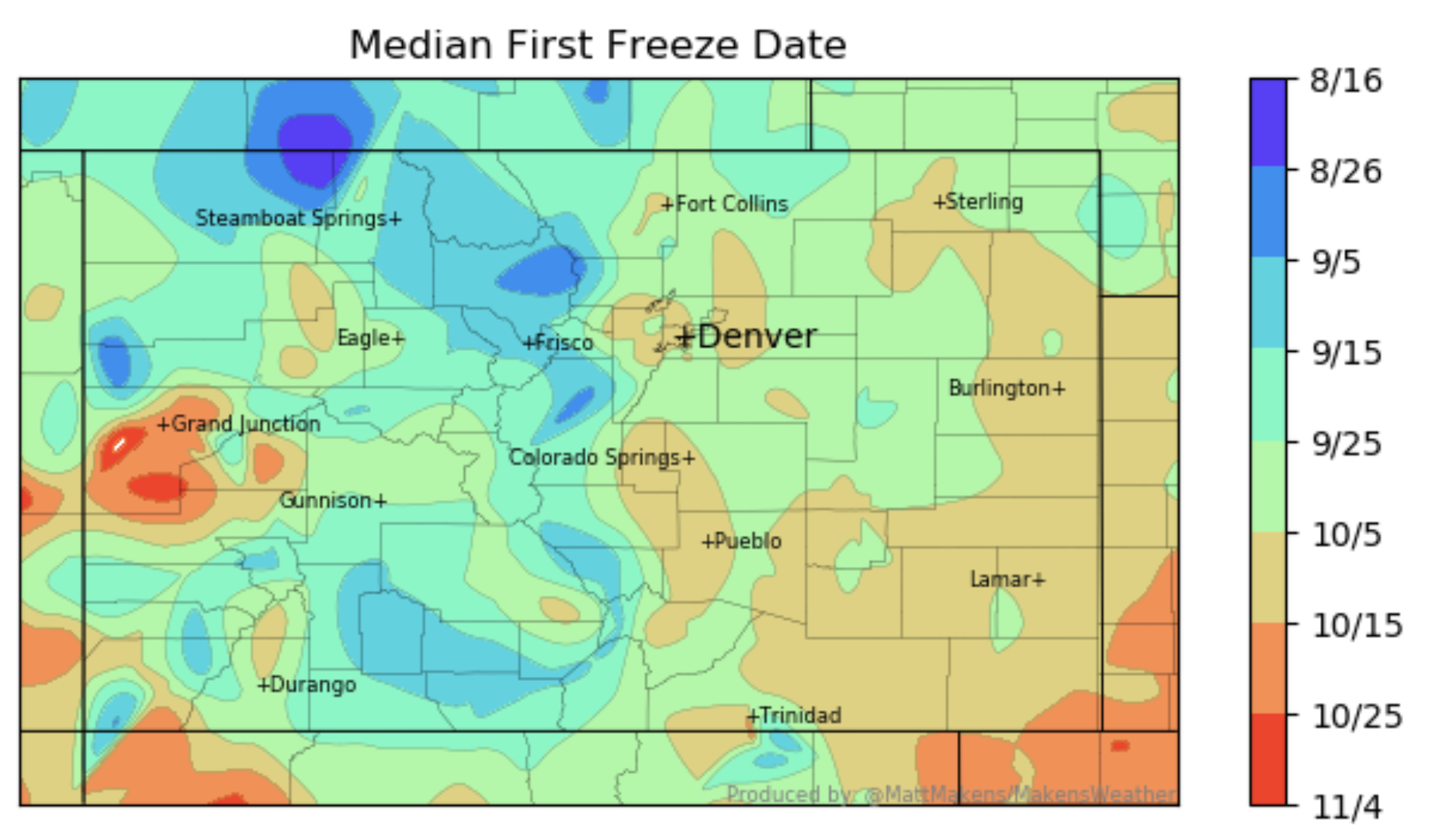
So, no freeze yet for Denver, but our average date is quickly approaching. The average first freeze for the Denver area ranges from the the last week or so of September for the Denver suburbs, to the first and second week of October for the city:
Denver's official average first freeze comes on October 7th, so a couple of weeks still. The latest first freeze on record for the city? November 15th, set back in 1944.
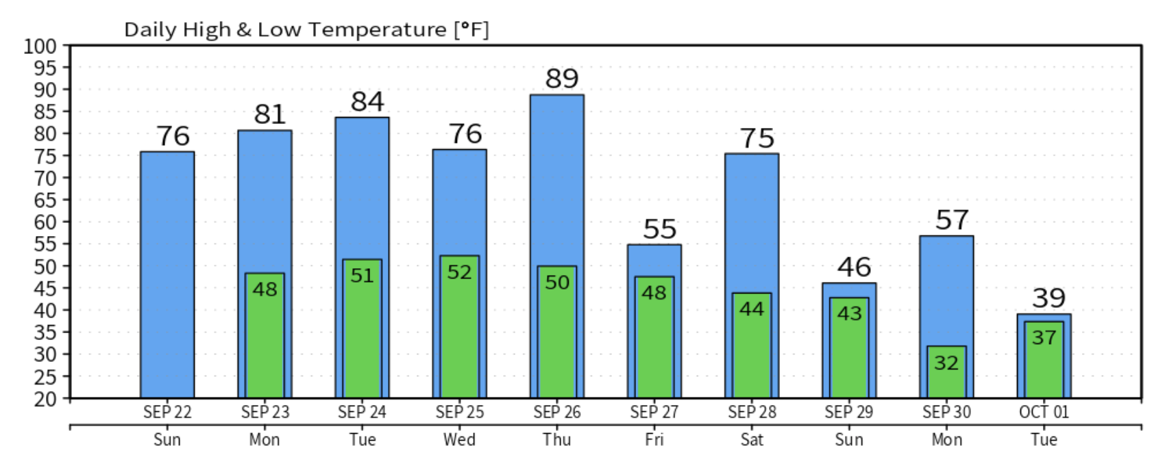
The week ahead
More warm weather to come over the next several days across the region, with temperatures jumping between highs in the mid 70s to highs in the mid 80s for Denver.
Some uncertainty as we get late in the week with models diverging a bit on some potentially cooler (and wetter) weather as we head into next weekend and beyond. The European model ensemble mean just isn't showing much change to the going pattern for awhile... it's got very mild air forecast for Denver through the next 15 days at least:
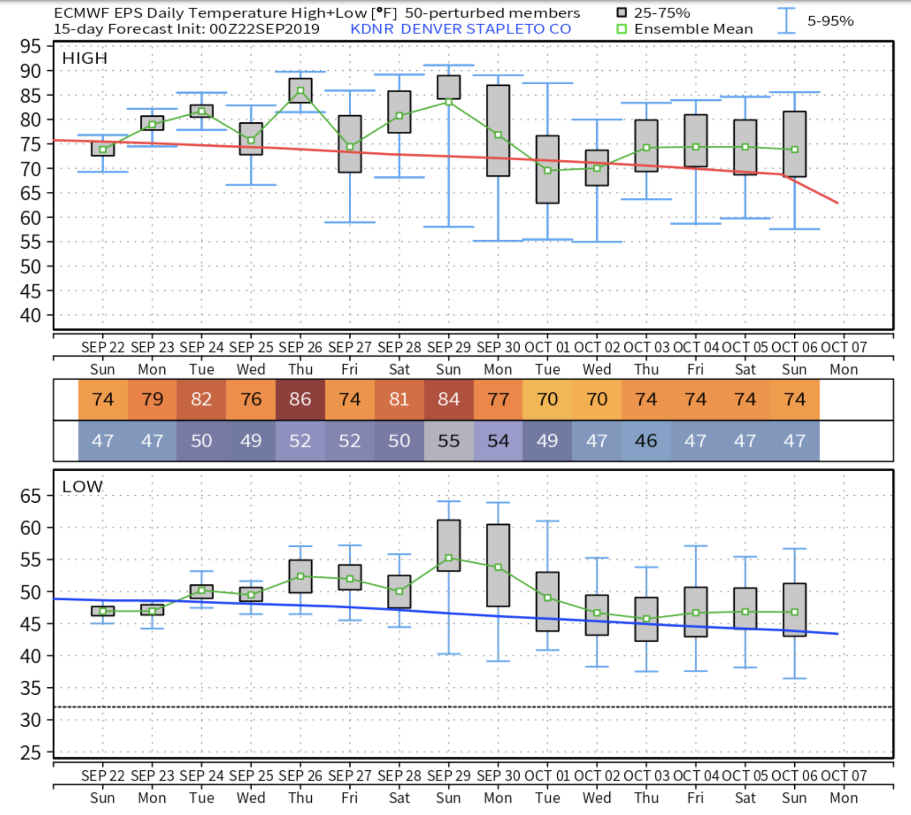
Its operational run, however, is showing some colder air pushing in first late this week, then late next weekend and into next week:
I'll hedge my bets on the ensemble mean for now, but let's keep an eye on things. Definitely some colder air in the west over the next 10 days+, question is how much of it makes it east of the mountains or not.
The GEFS is closer to the Euro ensemble as well, but does show some hints of moisture next weekend, and perhaps a cool down showing up for the start of October:
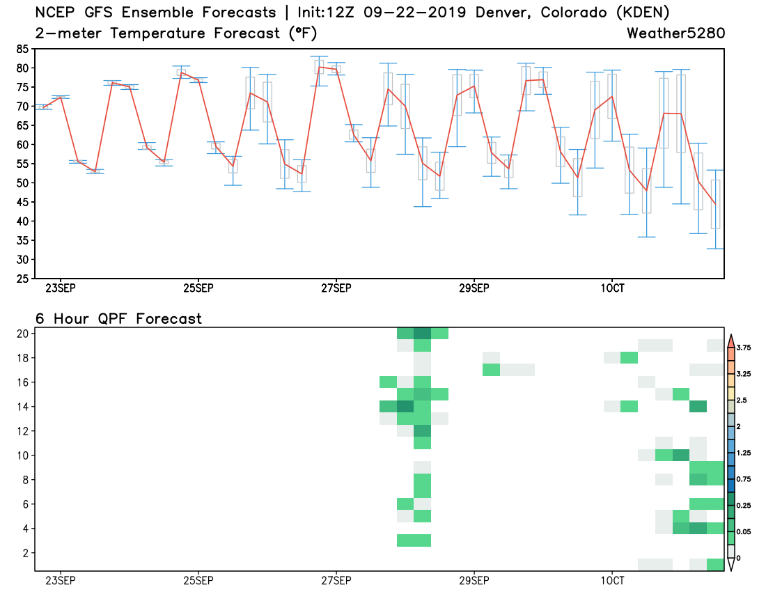
It's operational run shows a chilly west and warm east to start October as well:
Time will tell. For now, I don't see much reason to get too excited (or worried) about any big time cold coming our way. Medium range models have been showing some changes for awhile, and we're starting to see it show up in a bit more data as well –– so something to watch. For now, plan on a beautiful stretch of late September days, and we'll touch base this week to see how things are looking for next weekend and beyond.