
The State of the Atmosphere: Sunday, September 29th, 2019

We continue to track some of the chilliest air of the season due to arrive late Monday into Tuesday across Northeast Colorado. It won't be an epic cold front by early October standards, but will finally serve as a reminder as to the (eventual) change of seasons across the region.
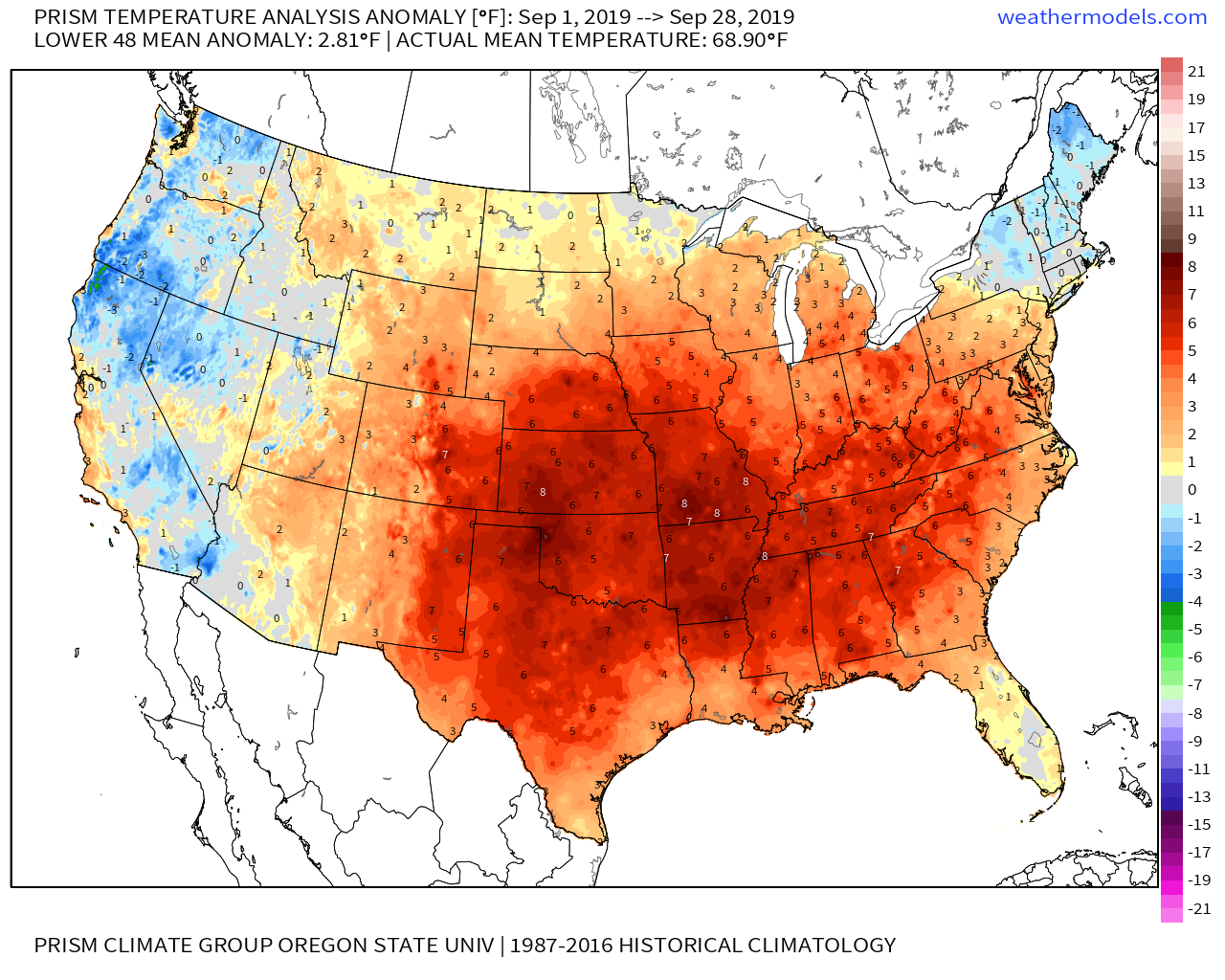
But first, we wrap up a very warm September with more warm and dry weather across the state. As we covered last week, the month to date is the warmest on September on record for Denver. The current average temperature for the month is running a warm 69.6°F through yesterday, just beating out the previous record of 69.4°F set back in 2015. Given the warmth across the state today and tomorrow, it does appear that this year will set a new record.
And... we aren't alone. Most of the country saw above average temperatures this month, with the Western United States and New England being the exception:
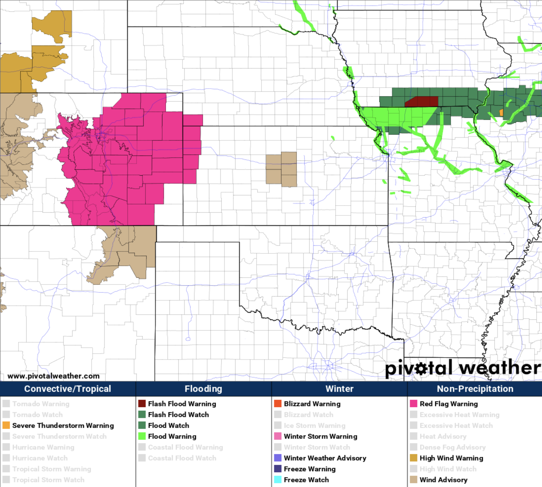
The warm temperatures and dry air, in concert with gusty winds we expect through this evening and again on Monday, will lead to high fire danger across much of the state –– with a Red Flag Warning (below, pink) in effect for most of Eastern Colorado through Monday evening:
Changes coming
For the Denver area the worst of the winds will likely be today, with gusts near 40mph at times. More gusty winds are expected tomorrow afternoon as well, but perhaps not as strong as shown in the hourly forecast below.
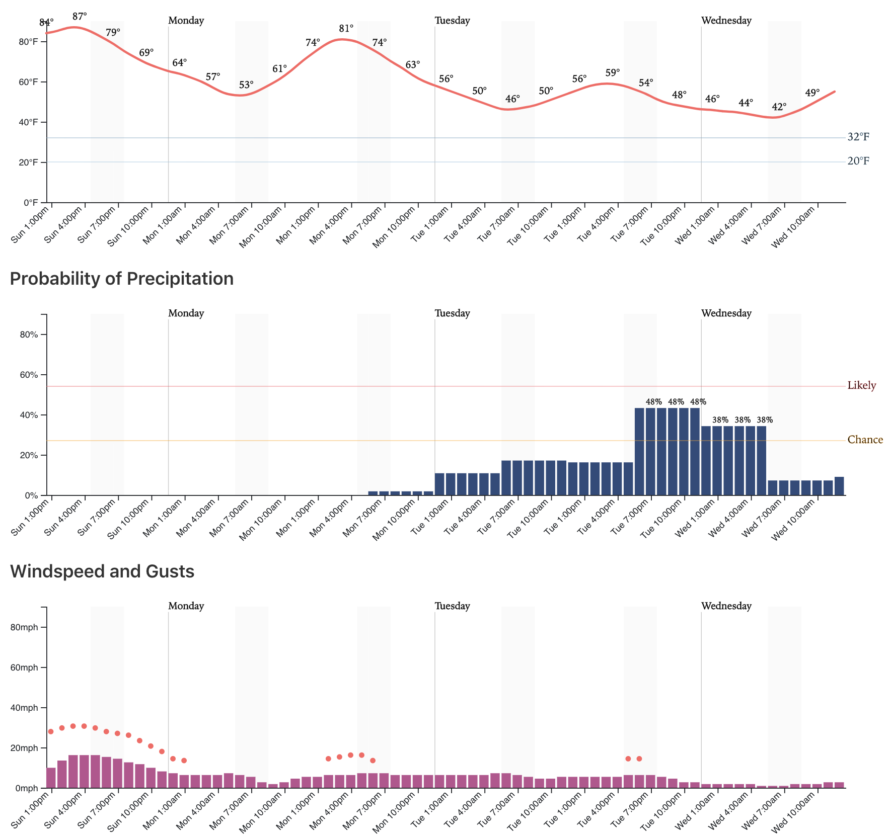
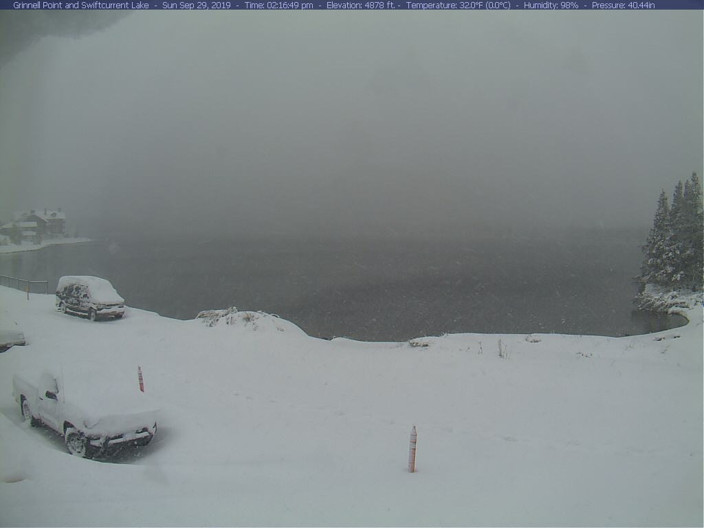
What you'll also observe in the forecast above, is a pretty good drop in temperatures by Tuesday –– with highs near 90°F today, and perhaps not breaking 60°F in the city on Tuesday. The cool air is about all we'll do, however, from a system that is dropping record early-season snow across the north. Check out this scene from Glacier National Park today!
As for precipitation as the system swings through here Tuesday? Well, it's not looking like much. We'll go with showers and drizzle across Northeast Colorado from say Monday night through Tuesday, but I don't see anyone across Eastern Colorado doing much better than that with this one. If we look at the GEFS forecast below, we see the sharp temperature drop (top chart) with some faint precipitation indications in the bottom chart... but not one ensemble member all that excited about moisture this week:
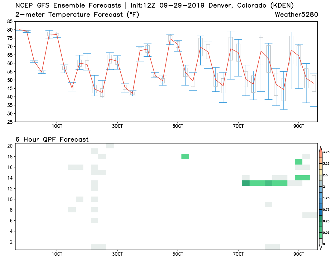
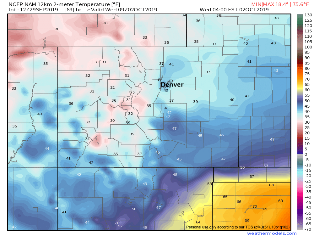
It could be some locations do see their first frost of the season either Wednesday or Thursday morning. We're currently thinking Denver bottoms out in the low 40s, so perhaps no frost in the city... but surrounding areas certainly have a good shot. The NAM model, for example, shows Denver bottoming out around 40°F early Wednesday morning... but has some 30s showing up on Denver's west side, across the Palmer Divide, and even for some of the northern urban corridor and Northeast Plains:
Temperatures slowly warm through the remainder of the week... we'll be back near 80 for highs on Friday, perhaps cooling a few degrees next weekend.
So, no snow in the forecast yet! Last year our first snow came on October 6th –– a date it looks like this year we'll not beat that date. If you haven't entered in this year's First Snowfall Prediction Contest, now is the time!