Wednesday AM Update: Here Comes the Cold, Latest Snowfall Forecast

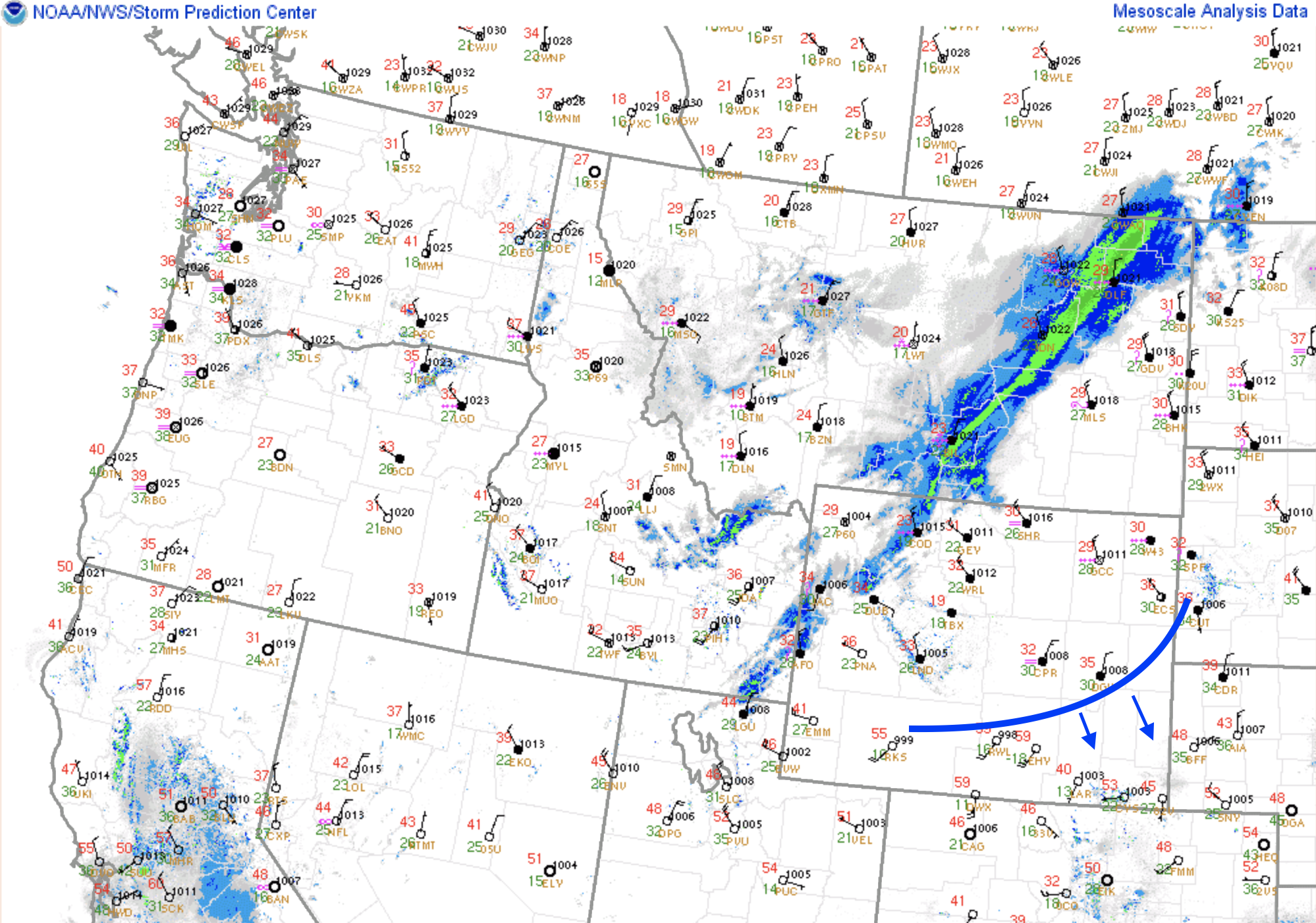
The latest surface analysis shows the front pushing into Southeast Wyoming this morning, set to arrive across Northern Colorado later this afternoon or early this evening.
If we take a look at the hourly forecast for Fort Collins, we see temperature really drop off in a hurry this evening. Current guidance would have the front moving through after about 6 pm this evening, but fronts tend to come in faster than anticipated a good deal of the time –– so I could see everything needing to be moved up a couple of hours. In any event, warmest temperatures of the day come mid-day to the early afternoon before the front pushes through and we drop into the 30s overnight along the urban corridor:
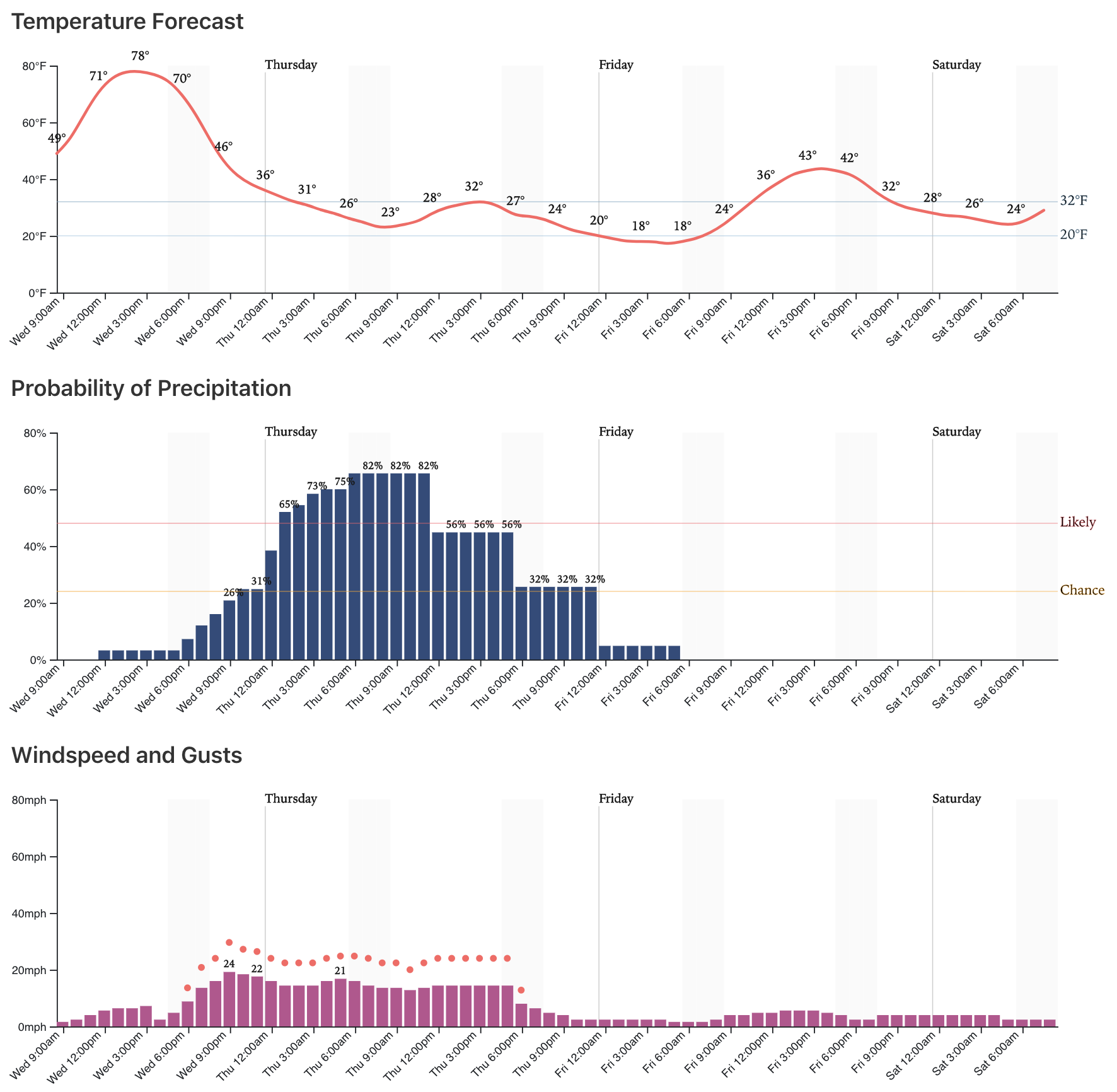
As you can see, some good probabilities above for precipitation starting tonight and carrying through tomorrow afternoon. It could be we see drizzle and freezing drizzle tonight across the Plains before transitioning to snow early Thursday.
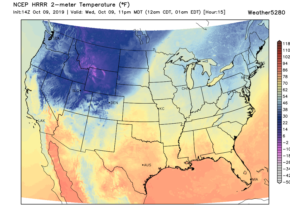
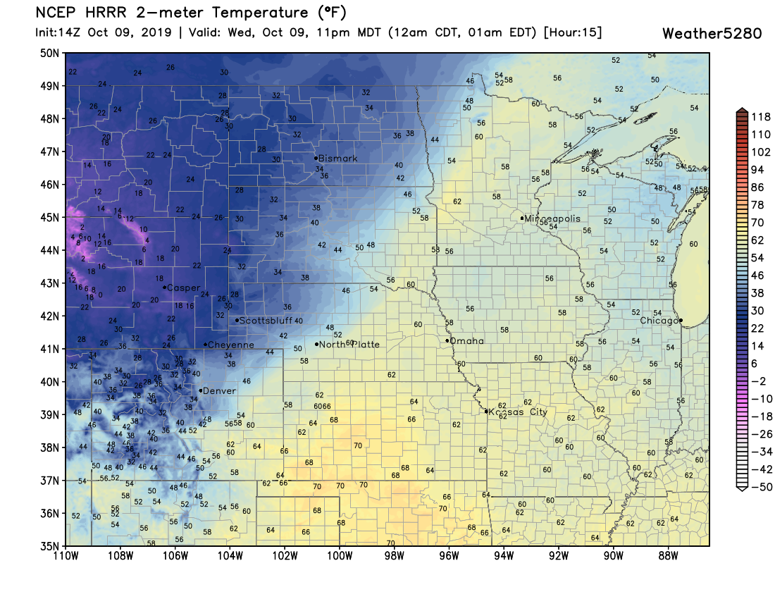
We expect the best chance of snow along the Front Range mountains, urban corridor, and adjacent plains to lag the cold front by several (many) hours. If we look at the HRRR model forecast for 11 pm tonight, it's easy to spot the front draped over Northeast Colorado, with the coldest air still up north along the border and into Wyoming.
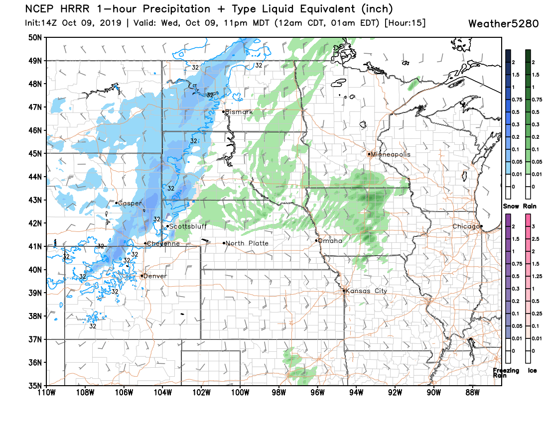
The main snow band, however, is still north of the area, with snow just getting going in the north-central Mountains:
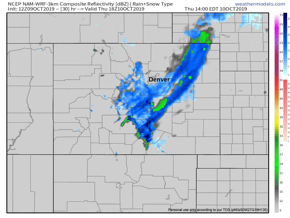
Some models are a bit quicker with the snow band, others a bit slower. Overall they look a bit faster than yesterday, so it could be your morning commute will involve snow –– especially for the northern metro areas. The 3km NAM model, for example, has a bit of snow developing along and west of I-25 after midnight tonight, with that mix precipitation we mentioned out east across the Plains:
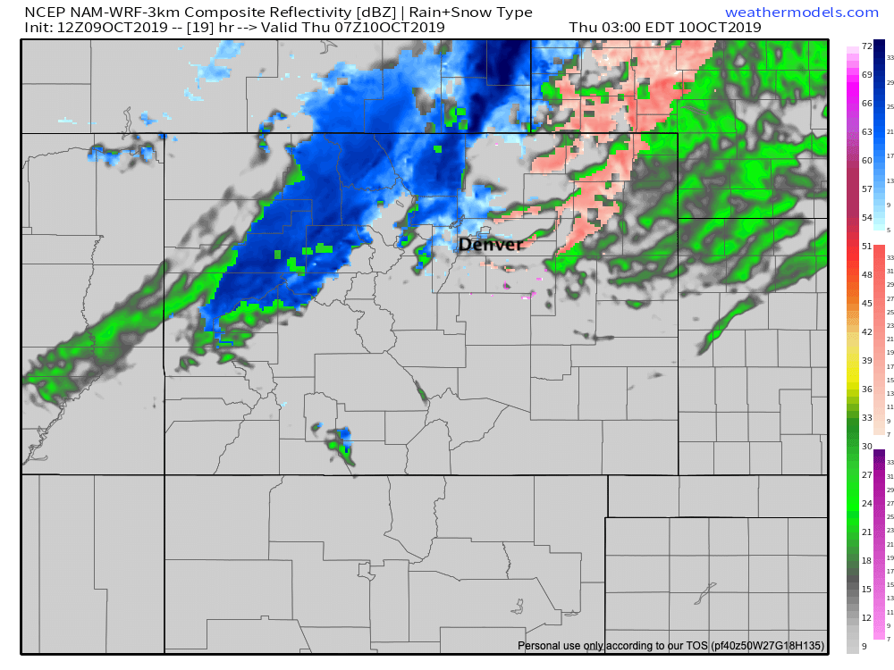
It moves the main snow band through the northern urban corridor between 6 am and 11 am Thursday morning:
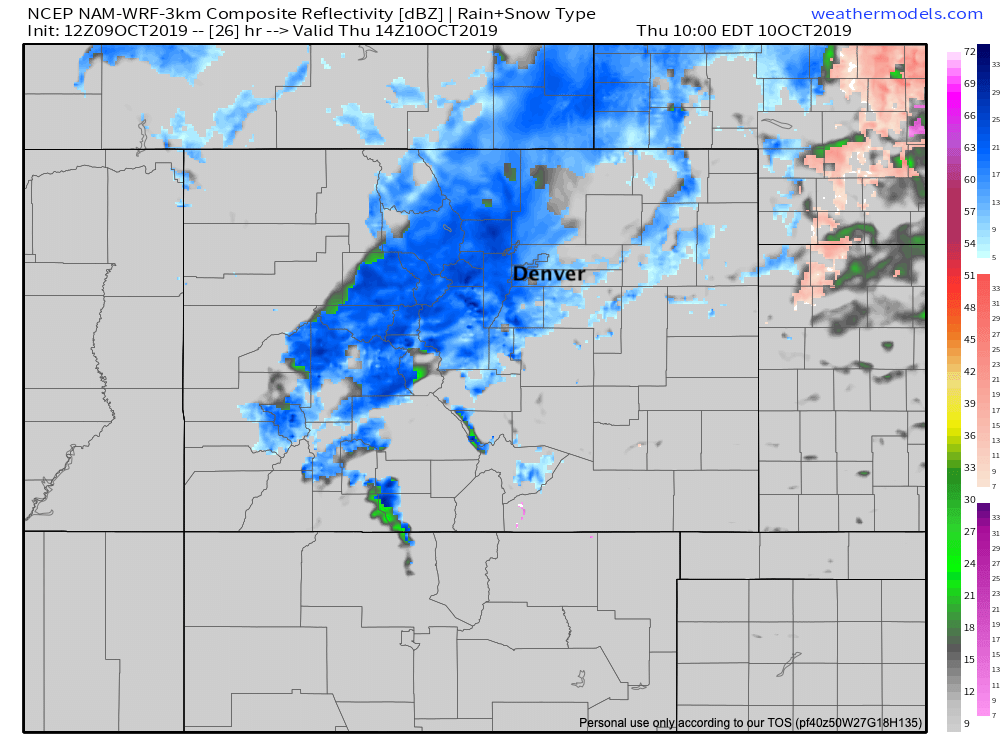
With the snow pushing south and east by early Thursday afternoon:
I tend to agree with this timing. Generally, these bands move through earlier than anticipated by some of the global models a few days out, and given where the front is this morning, it feels like this one will come in fast as well.
Related: Largest temperature drops in Front Range history
So, plan on the cold air arriving this evening with a strong northerly wind developing behind the front. Precipitation will lag the initial push of cold air, but drizzle, freezing drizzle, and snow will slowly develop across Northern Colorado tonight.
A band of heavier snow will push from north to south across Eastern Colorado Thursday. Under this band, some heavy snowfall rates will be possible (1 to 2" per hour), but it's not likely to last long. Best to plan on some snow for your morning commute, and hope it arrives after.
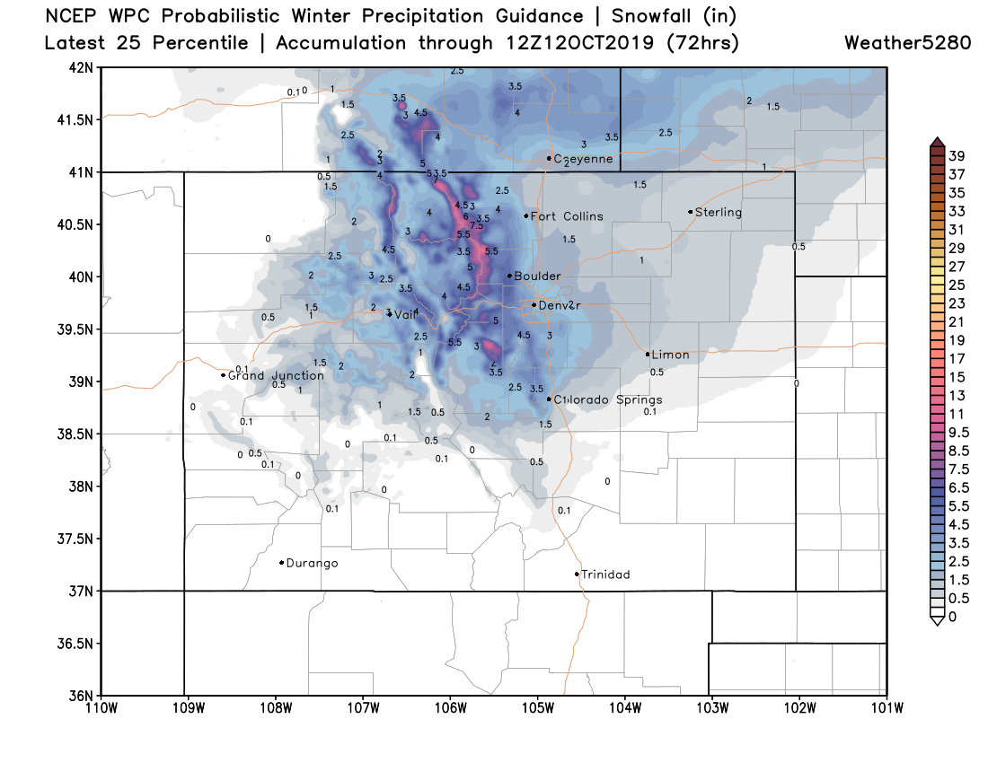
Snowfall totals
As for totals? As we've said with each update over the last week it's not likely to be big snow for most of us. Gamblers have backed off a bit since our update yesterday... but still, show the potential for 1 - 3" for cities along and north of the Palmer, with 0 - 2" for those south:
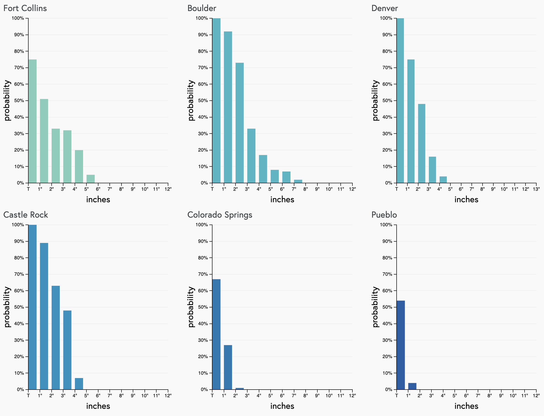
For our Insiders, we've broken down the probabilities for multiple locations. You can catch that post here.
For a few select cities... we're thinking for snowfall (again, accumulation on vegetation and shaded areas):
- Fort Collins: Trace - 2"
- Boulder: 2 - 5"
- Denver: Trace - 3"
- Castle Rock: 1 - 4"
- Limon/Fort Morgan/Sterling: 0 - 1"
- Colorado Springs: 0 - 2"
Which graphically should shake out something like:
Again, a huge change in the weather but not epic snow. That said, even some snow can cause plenty of issues on the roadway, especially if that band decides to roll through for the morning commute. Plan on giving yourself some extra time on the roads tomorrow, and make sure to bundle up! After daytime temperature just near freezing on Thursday we're still expecting widespread teens for lows across much of Eastern Colorado Friday morning before temperature begins to moderate Friday afternoon and for the weekend: