The State of the Atmosphere: Sunday, October 20, 2019
Fall-like conditions have returned and will remain this week with the potential for snowfall by Wednesday night.
The past week featured a pair of 80s for high temperatures (likely the last of the year, as we wrote previously) before the cool off through this weekend.
Outside of wind –– and related fire danger, there was little impact with the colder pattern change for the Front Range. The mountains had some snowfall, with several inches reported in many areas, including around 5" in Breckenridge.
The next system will arrive by mid-week with additional snow in the mountains and perhaps some in the metro areas as well.
Insiders had the first look at the potential and the remaining questions for the incoming system. Those questions:
- Are we tracking a potential impact for the week ahead? Yes.
- Is the potential impact trending toward a snowier scenario in the control products? Yes, in the Saturday runs.
- Is the potential impact trending toward more snowfall in the ensembles? Yes, in the Saturday runs.
- Is their reasonable uncertainty in the ensembles to believe that bigger totals are potentially overdone in the models' control? Yes.
Let's take a look at Sunday's today as it relates to those questions and how your week will be impacted.
First, let's take a generalized look at the weather pattern from Monday through Sunday. You'll see a storm system (trough) move through the state Wednesday and Thursday.
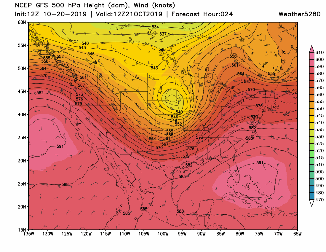
As that trough, shown in the middle atmosphere, swings through, we'll have a temperature drop along with snow chances. You may also catch a more prominent system developing to our west by next weekend that, if verifies, is a much more likely impactor for us before Halloween.
Focusing on the Wednesday through Thursday timeframe, the American model (GFS) produces this snowfall accumulation forecast:
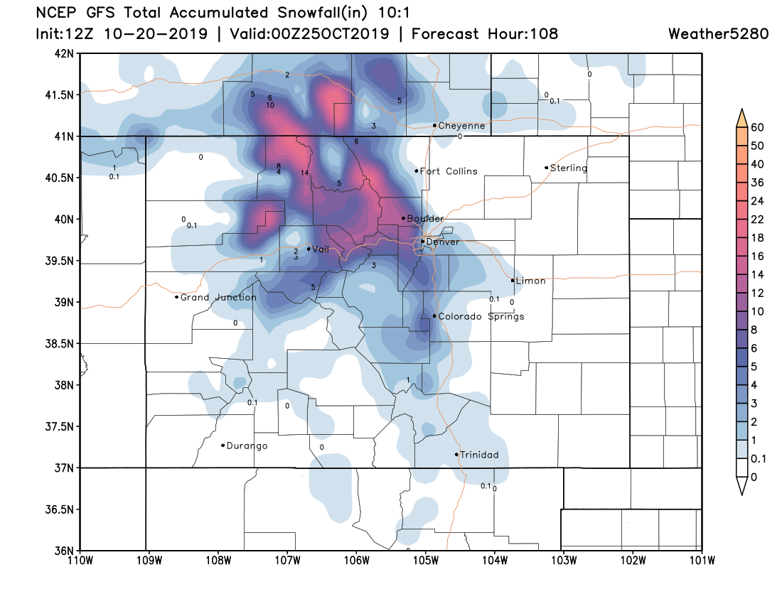
We see snowfall potential for the most metro areas and another snow event for the Flat Tops, northern Park Range, and the Mummy Range. In this depiction, there are far lower totals south of I-70 through the Pikes Peak region to the Raton Mesa.
This is one depiction. Higher totals can be found on other models, too. During the past few days, the models have indicated snow for the mountains and fluctuated on the snow totals for the Front Range. The depiction shown here is a good "middle of the road" out of the models recently.
This particular model has reasonable confidence that we see snowfall but isn't particularly convinced on higher snowfall totals. Our generalized Gambler Charts shows the overall 'confidence' which has grown slightly versus the data Saturday. (Insiders, we will have the higher resolution charts for you this week again as we did last time).
Let's revisit and update the questions from above:
- Are we tracking a potential impact for the week ahead? Yes.
- Is the potential impact trending toward a snowier scenario in the control products? Yes, in the Saturday and Sunday runs.
- Is the potential impact trending toward more snowfall in the ensembles? Yes, in the Saturday and Sunday runs.
- Is their reasonable uncertainty in the ensembles to believe that bigger totals are potentially overdone in the models' control? Yes, as well as a remaining probability for little to no snowfall, too.
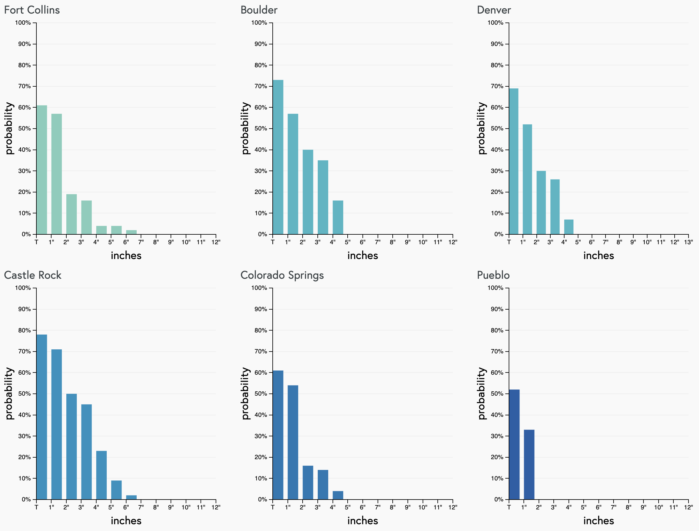
The last question will be the remaining one to resolve early this week, and that will come from the exact speed and location of that previously mentioned trough to swing through. If it trends farther south and slower, we will conceivably have some higher totals and more considerable travel impact.
As it stands now, history can show that the lower end totals will likely be the outcome north of Denver, and higher totals south of the city, namely across the Palmer Divide.
The trough is relatively shallow for Colorado and swings through quickly.
So, we've given you the heads up that there is potential for snowfall to impact your week. We'll post more as we get closer and will give you timelines as well as the snowfall forecast.
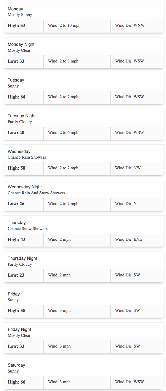
Let's give you the daily forecast for Denver as we see it now, and will keep you posted on the week's developments.