Round One Snowfall Totals, Winter Storm Warning Posted for Tuesday into Wednesday

Monday evening update:
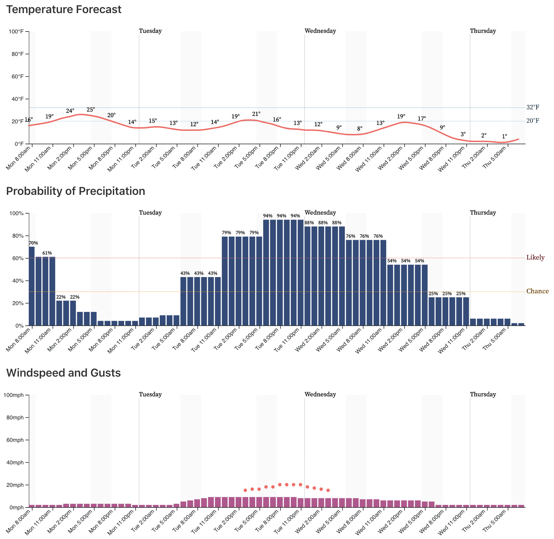
Latest snowfall and temperature timeline for Denver, the chance of snow goes up at about 5am Tuesday:

Weather5280 Insider: A look at PM model runs, latest snowfall gambler charts, and our thoughts on storm's potential
Round one underperformed in some areas, but for others delivered exactly the winter wallop promised. Main areas that saw totals below forecast totals were across the northern urban corridor. Here the forecast of cold, timing, and impacts held up –– but snowfall totals in many cases missed our low-end criteria.
The NAM had a pretty good lock on this, the did GFS too to a certain extent (we discussed this in both of our last two updates). As did our gamblers, which showed the potential for a snowfall bust for Fort Collins and the surrounding area. Winds never quite cooperated and the best jet dynamics ended up south.
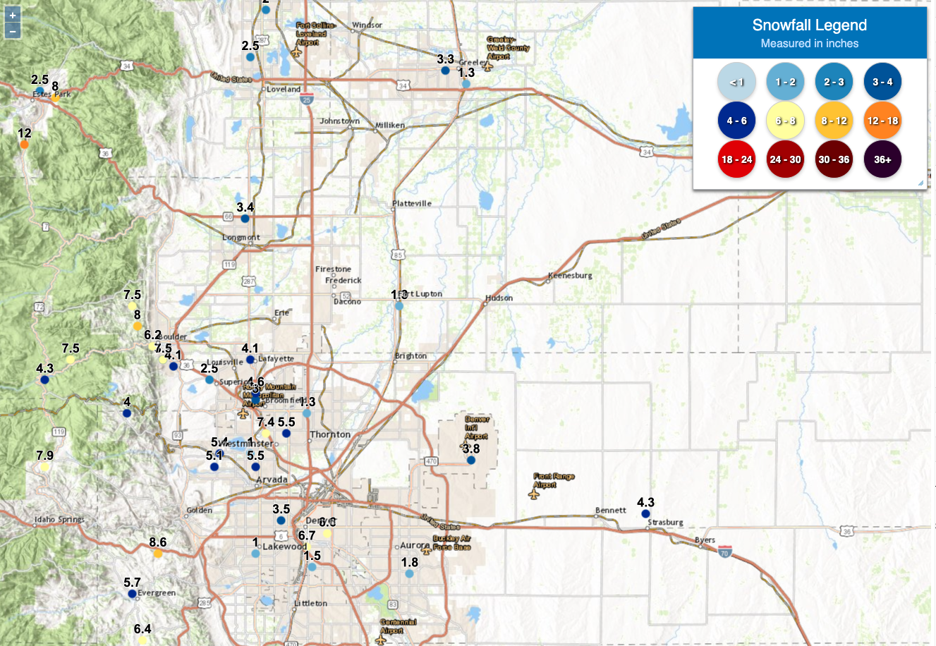
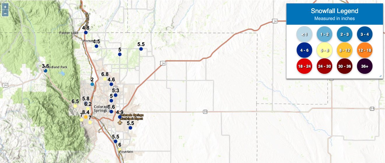
Closer to Denver it was a different story. Through 8am Boulder had picked up 8.8" of snow (our forecast had Boulder in the 6 - 12" range). Our station picked up 6.0" through 7am this morning, we were also in the 6 - 12" range on the west side of Denver. Snowfall totals out of central Denver have largely been in the 5 - 8" range, with our forecast for the city being 5 - 10". The Palmer Divide saw 4 - 7", and the Colorado Springs area 5 - 8" this morning.
Officially, Denver recorded just 3.8" of snow (at Denver International Airport), with our 5 - 10"/3 - 7" line being JUST northeast of the airport. So technically a bust, but I'm going to go ahead and say not really given it was close to the cutoff and it's so silly that Denver's official station is at DIA, it should be moved. This month DIA has recorded 4.8" of snow, while our station reach the 15" mark this morning. Central Denver is sitting at 9 to 12" on the season, more than double that of DIA.
Below are some other totals from across the region, with an interactive map here. (Note: not all the totals shown below are the most recent reports, some are from yesterday afternoon).
Chance of snow returns Tuesday
Our next snowmaker is close on the heels of this storm. Snowfall will diminish through the day across Eastern Colorado, before probabilities start to climb once more as we head into early Tuesday morning.
For Denver, the timeline for the best chance of snow will follow a similar track to this last one, with best chances coming Tuesday PM and overnight into Wednesday morning. Several more inches will be possible with this system, along with a reenforcing shot of cold air across the plains:
Snowfall forecast
As shown above, the snow ramps up Tuesday and will last into Wednesday with a continued impact on all drivers and school districts. A Winter Storm Warning has been issued for much of Northeast Colorado for tomorrow morning through midday Wednesday. From the NWS:
...WINTER STORM WARNING IN EFFECT FROM 6 AM TUESDAY TO NOON MDT
WEDNESDAY...
-
WHERE...Portions of east central and northeast Colorado.
-
WHEN...From 6 AM Tuesday to noon MDT Wednesday.
-
IMPACTS...Travel is expected to be very difficult. The
hazardous conditions are expected to impact the Tuesday evening
and Wednesday morning commute. The cold wind chills as low as 15
below zero could result in hypothermia if precautions are not
taken.
The incoming snow will be falling in cold air and will be crystals that make compaction-ice easy to accumulate on roads and driveways.
The accumulation forecasts are relatively consistent in the modeling with several inches in/near the metro areas and a swath of heavier totals over the eastern plains.
Our gambler chart data indicates a 4 to 8-inch range is most probable for metro Denver, a 2 to 6-inch range is most probable for NoCo, and 1 - 4" for the Springs. In the Springs a northerly wind will be present with this system that wasn't with the previous systems, and this will likely limit snowfall totals south of the Divide. There'll be a 6 to 12-inch swath over the eastern plains, how far west that sets up is a bit of question. Perhaps DIA can make up a little lost ground in snowfall totals this month with tomorrow's storm? Again, these are the most probable ranges in our data compilations.The morning modeling didn't deter us from our internal data. Most models agree with this idea.
With that said, here's our forecast:
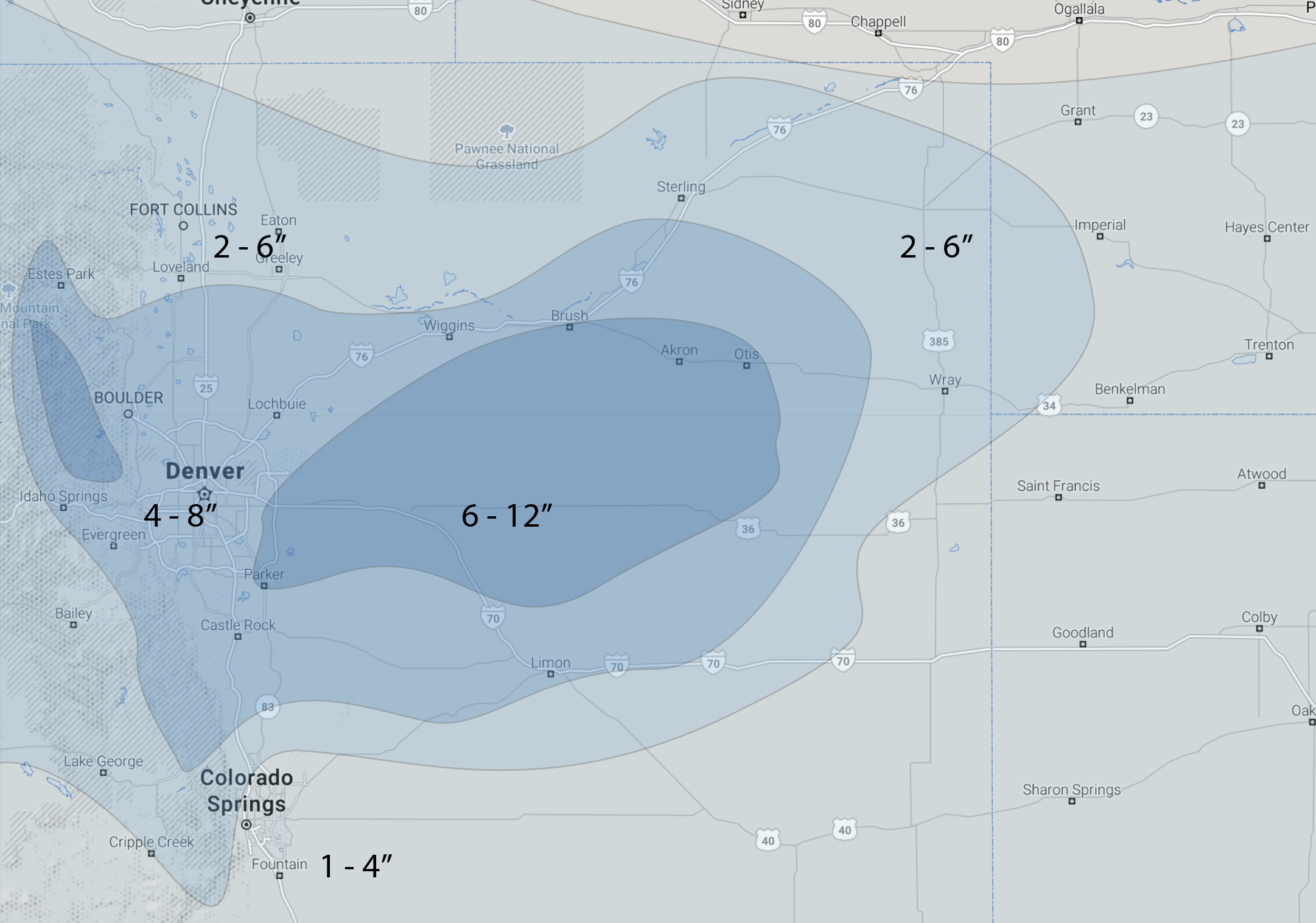
While the NWS has Denver in the 6 - 12" range under the warning, we will run a bit lower. With models showing QPF in the 0.4" range, it's not impossible to see some areas approaching a foot under heavier bands that set up, but we think the greatest likelihood for this will be east of the I-25 corridor. We shall see.
We have indicated lower confidence in the totals in NoCo and are cautious about the swath over the plains, too. Cheyenne Ridge downsloping may again impact northern areas, plus the modeling may have overreacted to the Monday morning radar imagery in depicting the deep snowfall over the plains...two things to watch out for in the data tonight. We're hoping that even if QPF is being over forecast, high snowfall ratios will kick us over the finish line with the above forecast. Overall these numbers feel a bit high, but data has been consistent so will run with it for now and adjust this evening if need be. Someone is likely to do well with totals by midday Wednesday, we'll have to see exactly who.
Impacts
With temperatures staying well below freezing, the cold is a continued impact. Not only with the roads not be able to recover between snow events, but the kids will have some hope for additional delays or cancellations in some school districts. Bottomline: high or low end totals with round two will be impactful to your travel over the next two days.
The commutes most likely to be impacted across the region with round two will be Tuesday afternoon and Wednesday morning, though it's not an impossibility that we have some slick spots for the Tuesday morning commute as well, especially across the northern areas. The Warning goes into effect at 6am, and snow will impact travel across the region throughout the entire day.
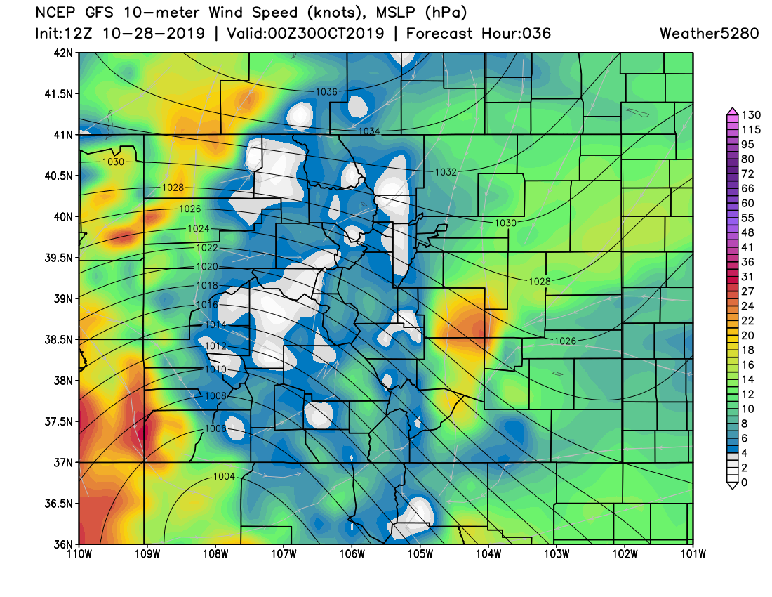
WIND will be a bigger factor with this system as well, especially east of Denver on Tuesday where blizzard conditions will be possible with heavy snow at times.
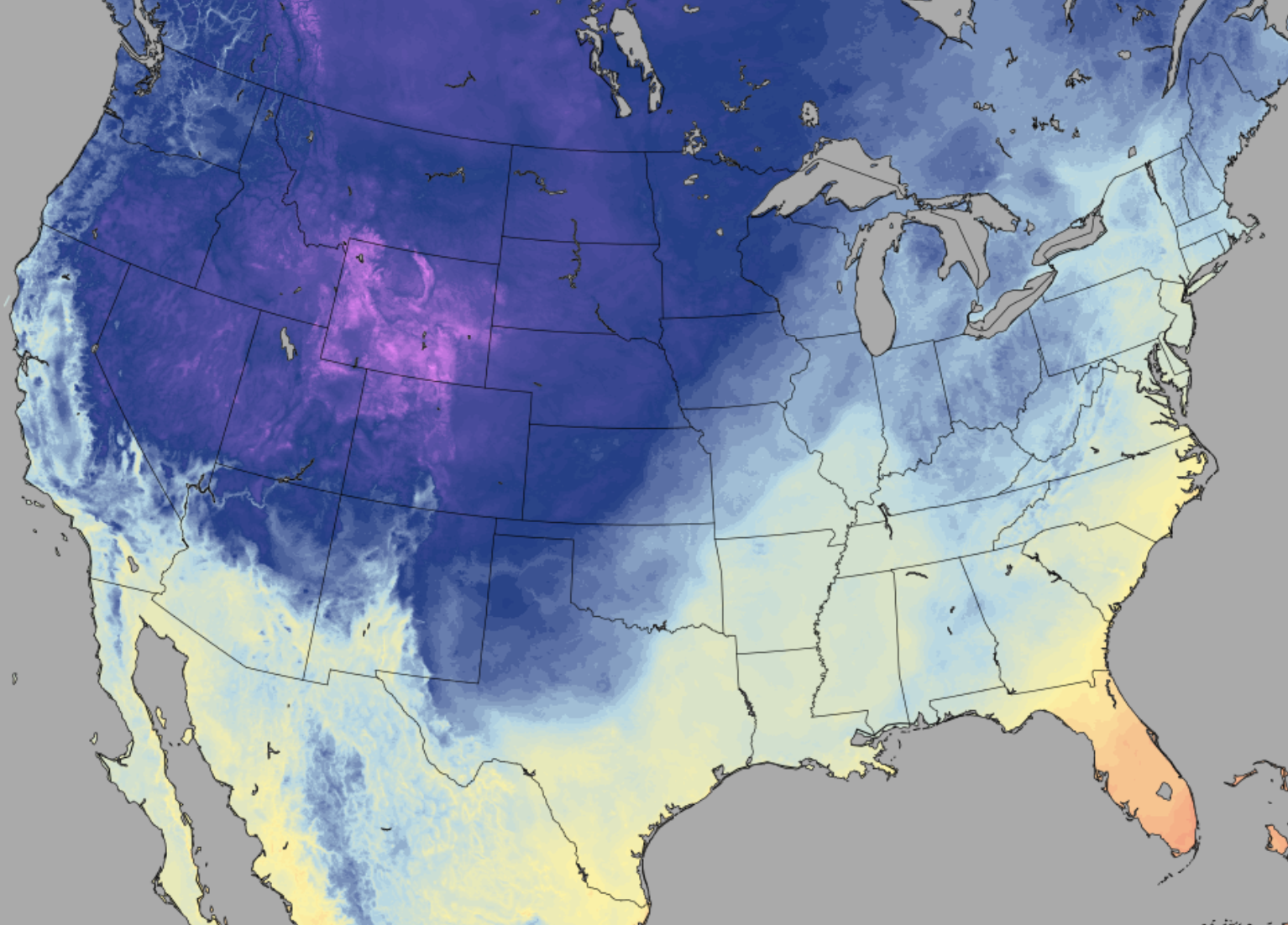
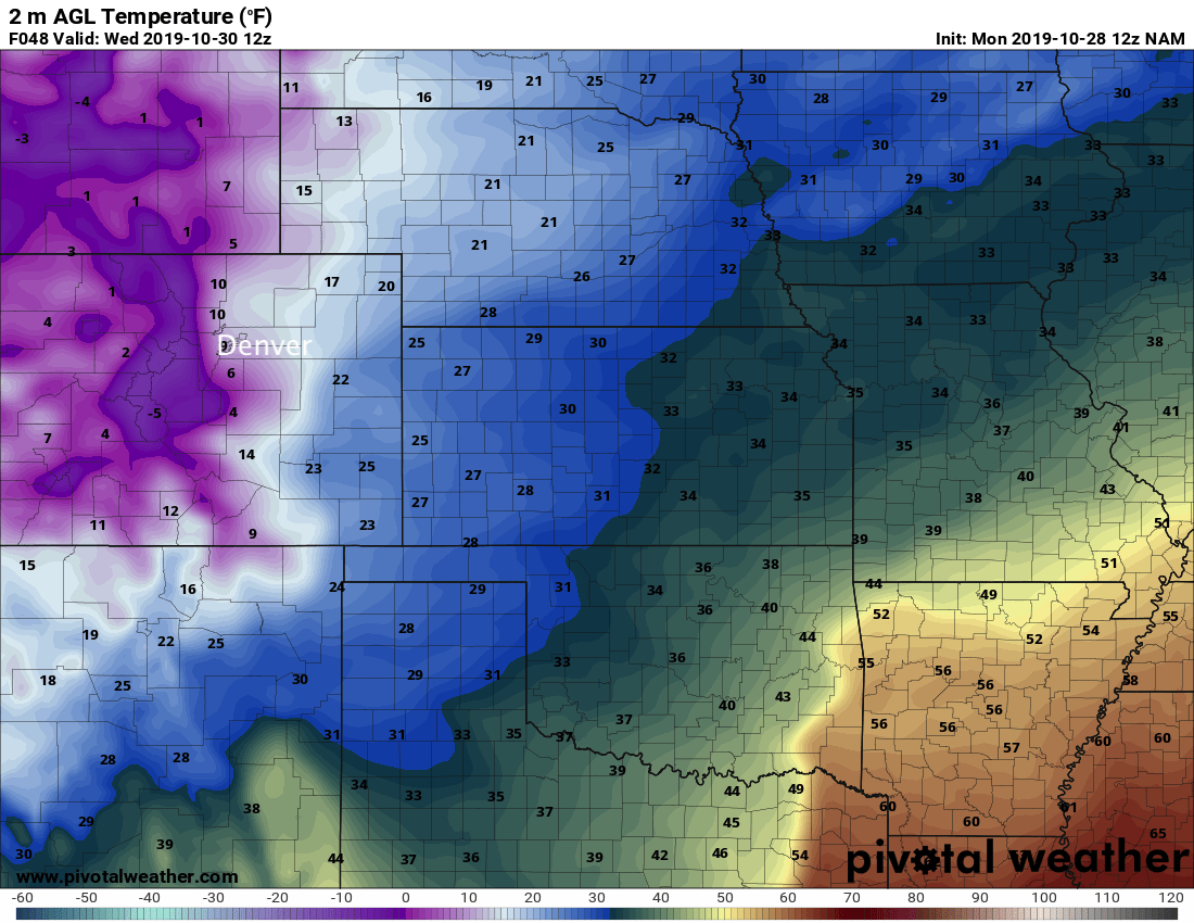
MOS guidance continues to show lows in the single digits both Wednesday and Thursday morning for Denver. Spatially, here's a look at the cold we're expecting Wednesday morning with snow ongoing. The NAM shows single digits and below zero reading for the mountains, with single digits and teens along the urban corridor, and teens and 20s across the eastern plains. It's not at all out of the question that Denver could end up below zero Thursday morning.
Halloween
Hallowing looks chilly, but otherwise a quiet day weatherwise. Look for highs in the 30s across the greater Denver area, with mostly sunny skies.
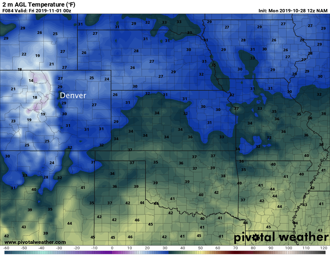
Trick or treating will be pretty cold this year, so plan to bundle up. Temperatures will hover in the upper 20s to low 30s for most of us Thursday evening before dropping into the teens overnight. With plenty of snow and puddles to look out for and those chilly temperatures holding on... a warm costume will be a winning costume this year! Below is a look at temperatures Thursday evening across the region:
Keep those snow reports coming! Stay warm everyone.