
Tuesday PM update: Tomorrow's snow chance ahead of a warm weekend

Yesterday's rain and snow showers delivered the first helping of precipitation to many communities along the Front Range in 2020. Denver officially picked up an accumulating snow as well, with 0.5" recorded at Denver International Airport, and 0.13" of precipitation, breaking the precipitation-less streak for Denver at 29 days.
Today we are between systems, with another chance for a brief round of snow showers on the way Wednesday.
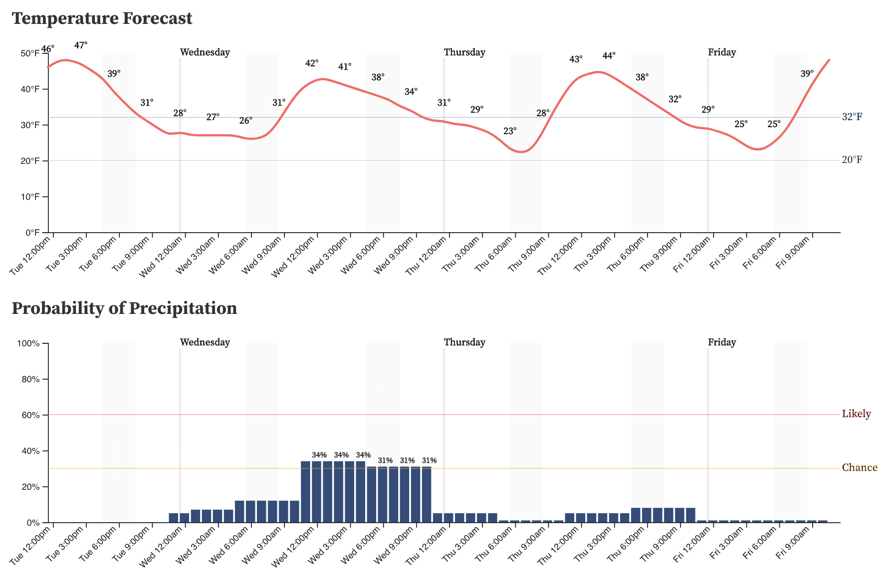
Latest data suggests temperatures will be in the low 40s or upper 30s as these snow showers move through, so impacts are expected to be minimal. Additionally, we're talking scattered showers at best (about a 30% chance for snow in Denver on Wednesday), so not everyone will see the flakes fly either. Here's the hourly planner for Denver:
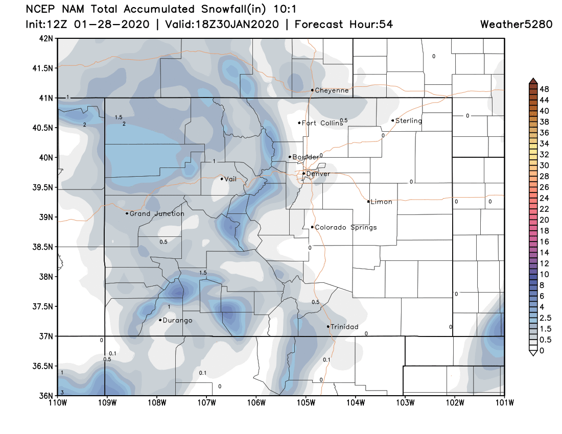
The latest NAM model shows a spotty Trace to 0.5" of snow along the urban corridor will be possible, mainly on raised surfaces and really the exact location of any accumulation we do see will be hit-and-miss:
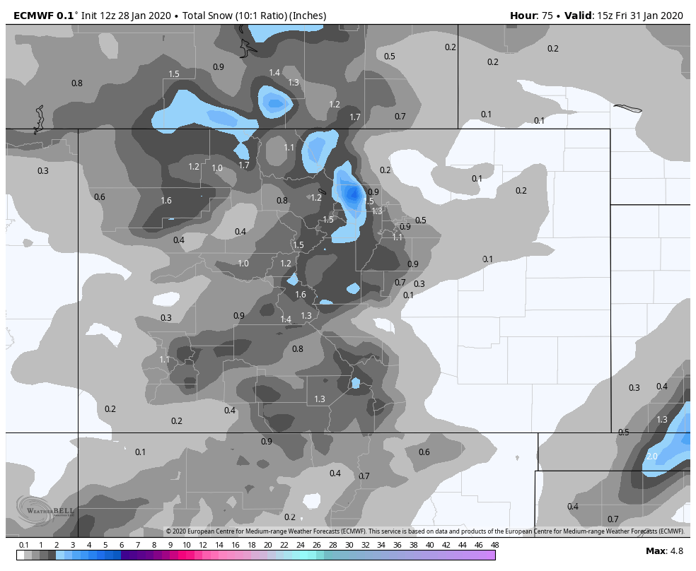
The European model remains a bit more bullish (if you want to call it that). It's got a swath of 1 to 2" totals from Boulder southeast across the Western Palmer Divide. Possible? Perhaps, but at this point would throw this in the low-end probability bucket. In either case, a nice accumulating snow looks likely for the immediate Front Range mountains, so if you plan to travel west Wednesday and Wednesday night be prepared for winter driving conditions.
For the urban corridor we expect most areas will see no accumulation, with a spotty Trace to 2" if heavier showers do materialize. The best chance for this appears to be in the immediate foothills, and once again across the Palmer Divide.
The weekend
The weekend is looking absolutely amazing. Perhaps not exciting news for those eager for our next snow, but it'll be hard to complain too much with highs in the 60s both Saturday and Sunday.
With ridging in place, we expect much of the country to see anomalous warmth this weekend, with some of the greatest anomalies expected across Eastern Colorado and the adjacent plains states. We currently have highs in the low 60s on Saturday to near 70°F in some spots on Sunday! While quite warm for this time of year, the record for February 2nd at this point looks safe, as even the warmest solutions right now are a few degree short of the record 74°F set back in 1934.
Next week
Our attention then turns to next week when changes may finally come knocking.
The European continues to lead the charge in consistently bringing a little round of snow and sharp cold front to Northeast Colorado Monday afternoon and night which lends some credibility to it maybe actually coming to fruition. The GEFS ensemble package is also starting to pick up on this, with less uncertainty today as compared to when we last shared this chart. Notice more ensemble members showing precipitation, and less of a spread in the temperature drop as well:
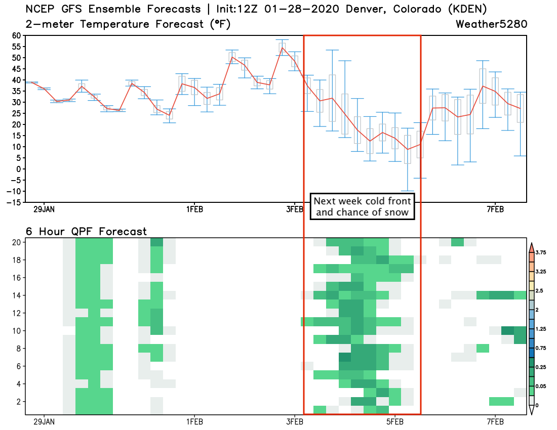
No need to worry about this one all that much given we're nearly a week out and thus far storms in 2020 have been nothing but a swing and a miss! That said, perhaps something to keep in mind over the coming days, and perhaps a need to watch the weather for the first time in some weeks coming up.
We'll continue to track and pass along updates as needed. Until then stay warm tomorrow, and enjoy the amazing weekend ahead!