Beautiful weekend ahead, cold and a chance of snow return for first week of February

MOS guidance continues to paint highs in Denver in the mid to upper 60s this weekend as ridging moves overhead and quiets our storm track for a couple of days.
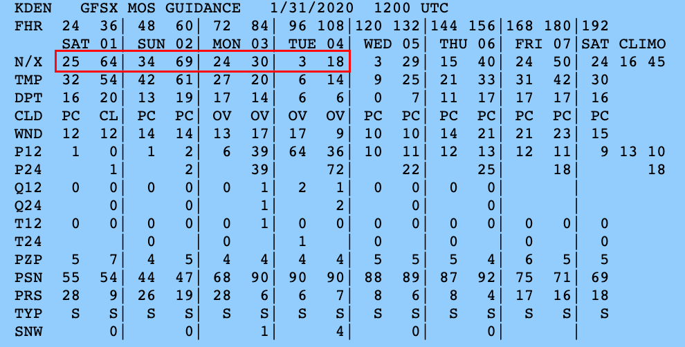
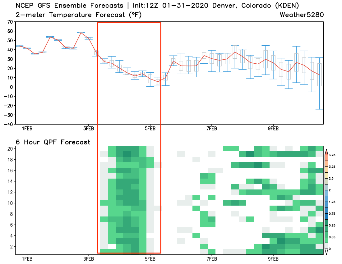
Latest guidance shows highs around 64°F on Saturday to near 70°F Sunday. We think Denver has a good shot at the 70° mark, but should land a few degrees shy of the record for the date which is 74°F set back in 1934. Highlighted in red below are the GFS high/lows for the next week, with a 69°F currently for Sunday and dropping into the teens by Tuesday.
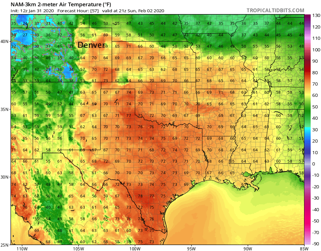
Sunday should be pretty darn nice across the entire region. For those across the Palmer Divide highs will likely be a bit cooler (about 5 degrees cooler than Denver or so), with low-lying areas across Northeast Colorado staying a few degrees cooler as well. Otherwise, 60s and 70s in place across most of Eastern Colorado Sunday afternoon:
Looking ahead to next week
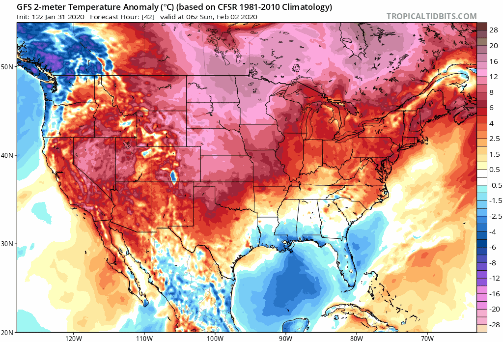
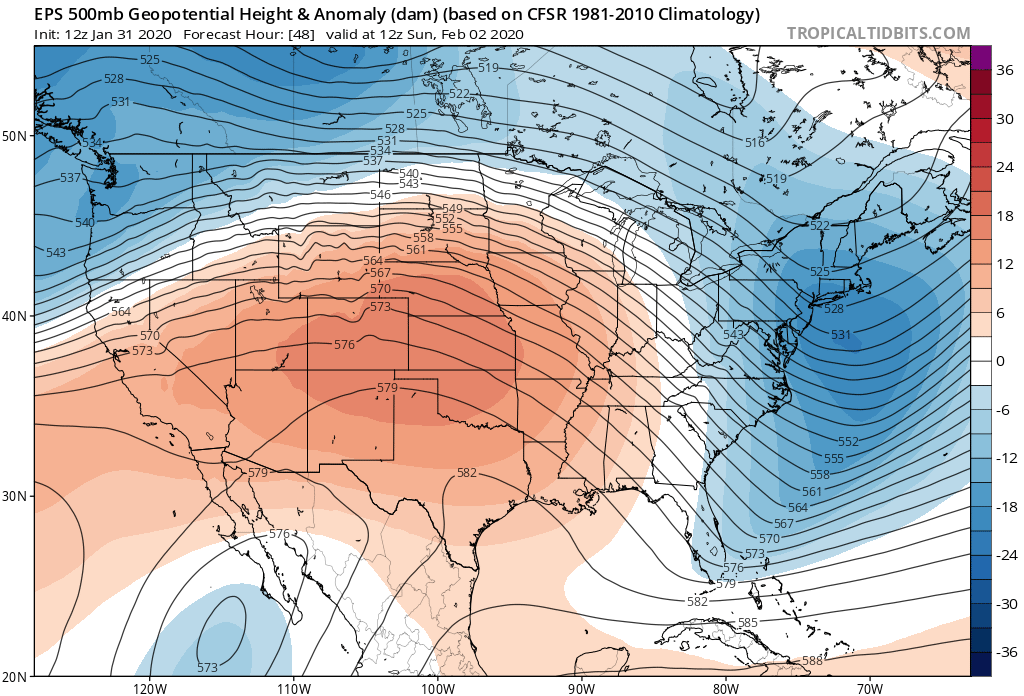
We continue to track our next cold front and chance of snow that's been showing up in the outlook for some time now. Pretty good confidence that Monday and Tuesday will be dramatically cooler than this weekend, with anomalous warmth (reds below) being replaced by colder than average temperatures (blues/pinks) Monday:
The ridge in place Sunday...
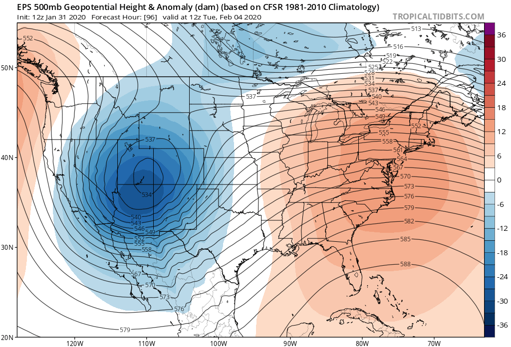
Will be replaced by a closed low moving into Western Colorado Monday night...
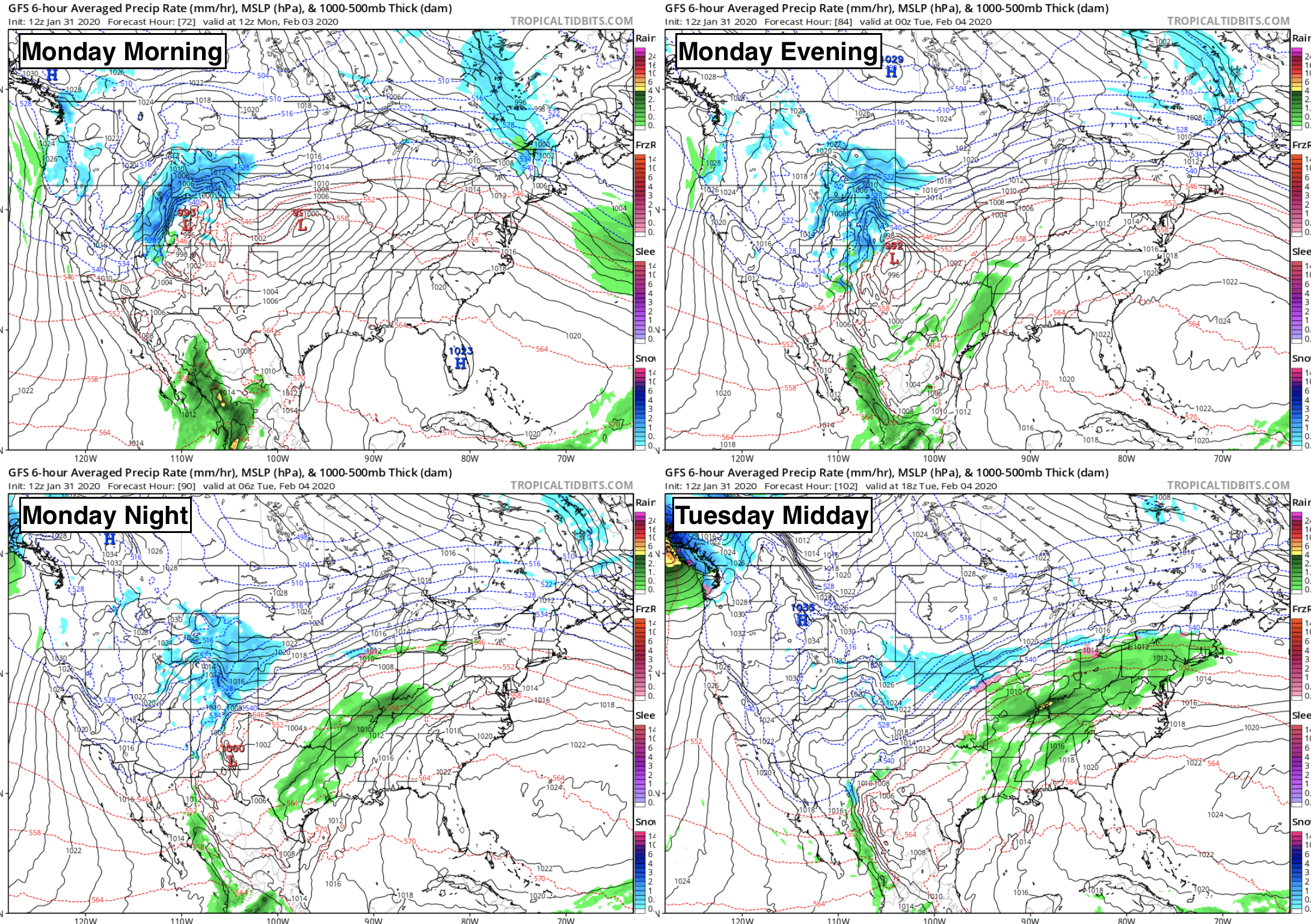
Timing will be worked out over the coming days. An early idea would be something like the following. Rain and snow should begin across Northwest Colorado early Monday and spread across the mountains during the day. By Monday afternoon the chance of snow will increase along the Front Range and urban corridor, with widespread snow across Eastern Colorado expected Monday night into Tuesday. Snow will gradually come to an end Tuesday across Eastern Colorado, with highs topping out in the teens.
Some snowfall is generally expected for all, but with a good duration and cold temperatures expected those at elevations west of I-25 may see totals add up a bit depending on how this storm eventually evolves.
A look at our trusty GEFS chart we often share shows good agreement between the various ensemble members that we should see some snow Monday into Tuesday after a dry weekend. You'll also note that the remainder of next week looks to remain chilly and unsettled, with some models bringing a second system through late next week or next weekend.
As for our gamblers... well, they are showing some potential. The two images below show probabilities at 10:1 ratios, and 15:1 ratios –– depending on exact timing we're likely to end up somewhere in between?
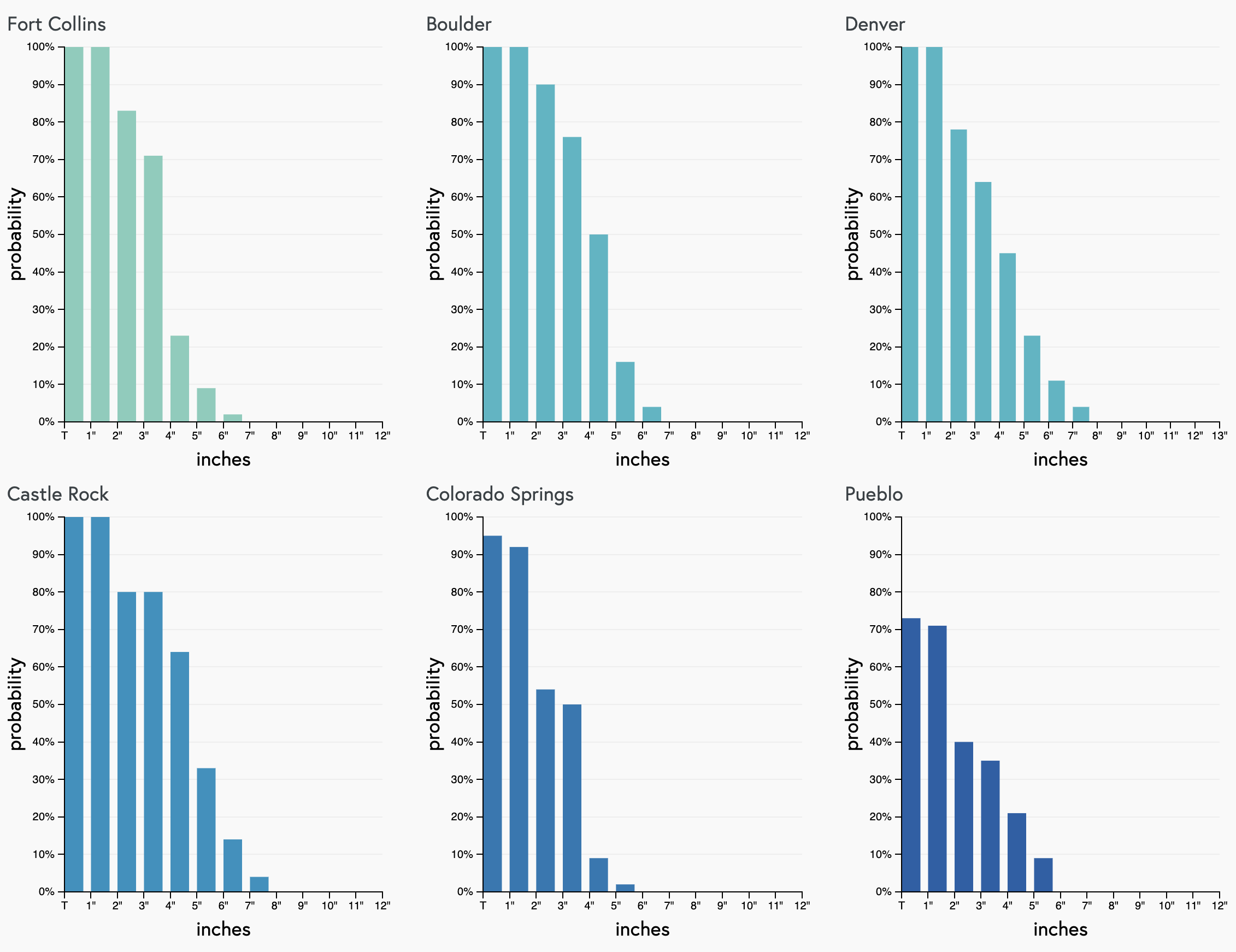
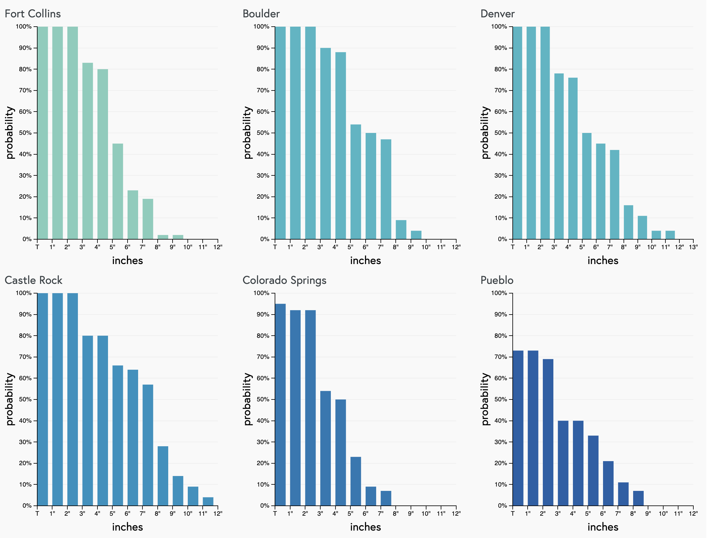
As you can see from Castle Rock north good probabilities for 3" of snow, with slightly lower odds south of the Palmer. With higher-end ratios it's easy to see how a few locations could see some higher totals (again, if nothing changes over the weekend).
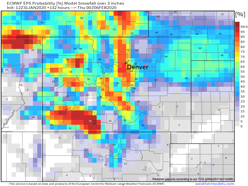
If we look at probabilities from the European ensemble, we see areas along and west of I-25 with good looking odds as of today to see 3" of snow or more Monday/Tuesday:
If nothing changes this weekend we'd likely be looking at a 1 - 4" east of I-25, 3 - 6" along and west of I-25, and perhaps a few 4 - 8" totals for the foothill communities. This is ROUGH idea, as things will move around quite a bit over the weekend.
We'll keep tabs on things over the coming days and push updates as needed. For now enjoy the weekend and keep an eye on the forecast for next week!