
Incredible banded snowfall event comes to an end, map of latest snowfall totals

What an event!
We've been discussing internally that we really can't recall a setup like this producing the widespread heavy snow that we've seen over the last 24 hours. While snow events along a northwest flow such as this very often produce boom snowfall (I wrote a horrible ode to this a few years back), it's usually over a much narrower geography, and to see so much of Denver/Monument/Colorado Springs get buried is also unique.
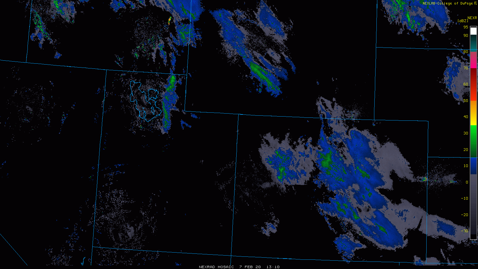
Below is a look at the radar from the last 24 hours. A persistent flow of moisture from northwest to southeast across the state, which absolutely buried the mountains and delivered upwards of 6" to much of the urban corridor and adjacent plains. Pretty neat to see some of the more persistent (and lonnnggg) snow bands that parked themselves over the south metro and Palmer Divide last night and today:
Given this setup, it is hard to be too upset about our forecast overall. While we knew this setup had the potential to deliver a foot of snow in spots, there was just no way to know that was going to end up over a good chunk of the metro area. Perhaps a better forecast instead of our "2 - 6 inches (locally 5 - 10 inches)" would have been "5 - 10 inches (locally 2 - 6 inches)" instead! 🙃
From our forecast on Thursday morning:
The bands will be capable of producing up to 10" of snow, but for areas outside the heaviest snow 2 - 6" (or likely less in some cases) should cover.
So, even with this, we came up a bit short in spots, but who's counting anyway, right? In the end, an impactful and meteorologically fascinating event. I hope everyone stayed safe today, and if the snow canceled your school or plans, you enjoyed a cozy day at home!
Snowfall totals as of 8:45 pm
Here's a look at the interpolated snowfall totals map from the National Weather Service in Boulder. It was created a bit before the heavier snow moved through areas around Fort Collins, so expect this map to look a bit different once all that numbers are tallied. For Denver and points south and east –– plenty of 8 - 12" totals in the books!
For Denver's official number still no word yet. As of 11 am DIA had reported 4.5" of snow. When I landed at DIA around 4pm it looked like there was perhaps a bit more than that, but nowhere near what what fall across other parts of the metro area.
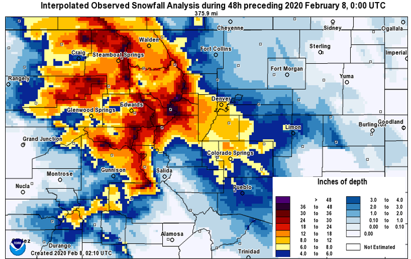
You can find an interactive version of the reports that went into making this map here: https://www.weather.gov/source/crh/snowmap.html?zoom=8&lat=39.27&lon=-104.99&hr=24. This map will be updated as more reports are submitted to the NWS as this storm wraps up.
Quick break Saturday
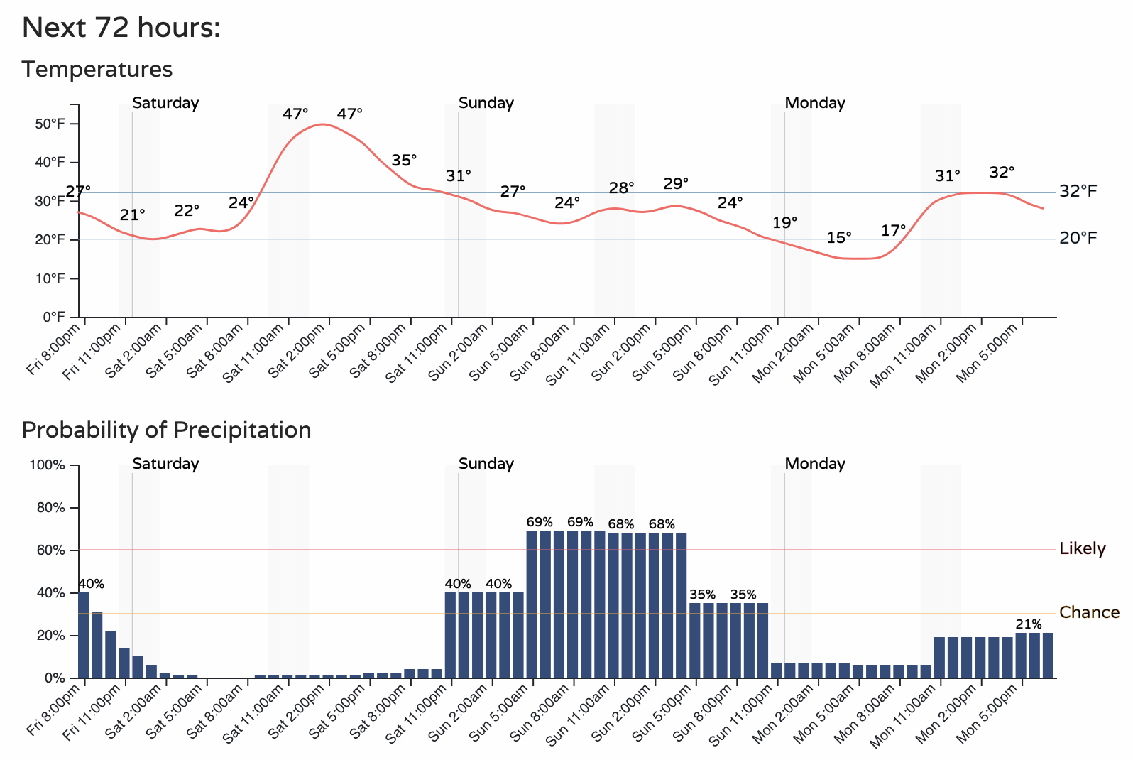
Saturday should be pretty quiet across the region. Our next system moves in Saturday night and will bring another chance of snow from late Saturday through Sunday to the Front Range.
The word on this one is... let's wait until tomorrow to see how it looks. This one will have a bit more of an upslope component to it, but plenty of disagreement on how impactful it'll end up being east of the hills. A few things are more certain... and one of those things is that the Sunday event won't have as much upper level energy to tap. That in itself would suggest to us that it will undoubtedly offer much less heavy snow potential outside of the mountains. Right now, the Palmer Divide looks to have the best chance to see some accumulation from it. We'll see.
For now we'll go with a decent shot of snow for the urban corridor Sunday, with much colder temperatures as compared to tomorrow as well. We'll see how things look in the morning and talk totals if need be.
We've SO enjoyed all of your reports today on here! Keep them coming, and stay warm tonight!