Another round of snow showers for the evening commute

Today's snowfall is likely to not be as widespread as Monday, but where we do see snow today it could come at poor timing for the evening commute.
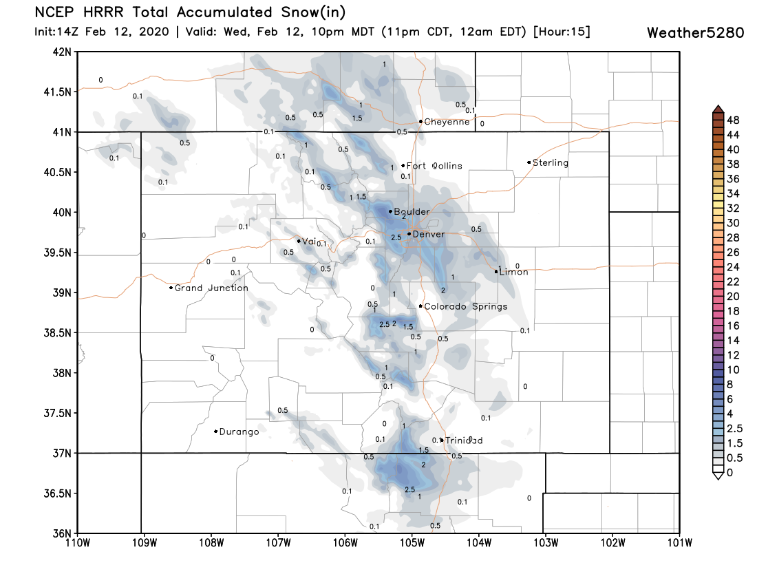
Last night we showed the NAM model which showed the focus of today's snow northwest of Denver. Today we see the HRRR showing a similar look -- with a swath of snow from Boulder across the western Denver suburbs, then southeast across Parker and the Palmer Divide. The HRRR has handled our last several systems pretty well, and so far today has been pretty consistent in this placement. Where it does have snow, we see the potential for a Trace to 3" from this model:
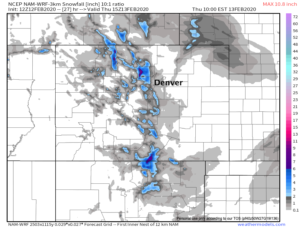
The 3km NAM shows a similar look. Mostly a coating to 1" for the urban corridor (at most), with some 3 - 5" totals for the foothills:
Note that not everyone sees snow. Where we do see those snow showers set up, however, some **brief heavy snow will be possible with a coating to 3" possible across the urban corridor **before the snow comes to an end tonight.
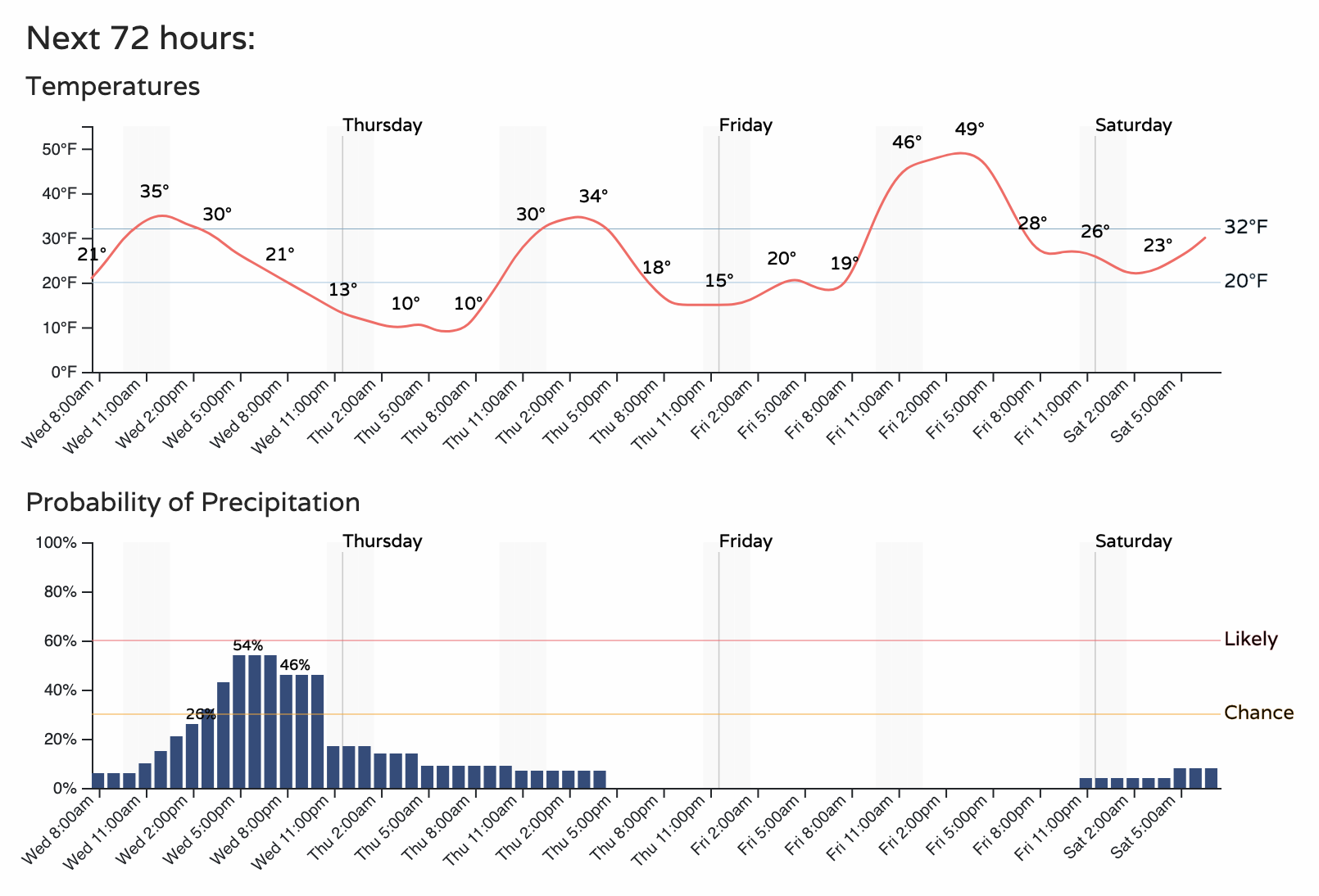
A look at the timeline shows the best chance of snow for the Denver area moving in this afternoon and ending after about 10pm. Of course this could spell a snowy commute for some areas across the metro area this evening.
After this evening, quieter weather returns for the remainder of the week.