Tuesday PM Update: Another chance of snow Wednesday before a quieter end to week

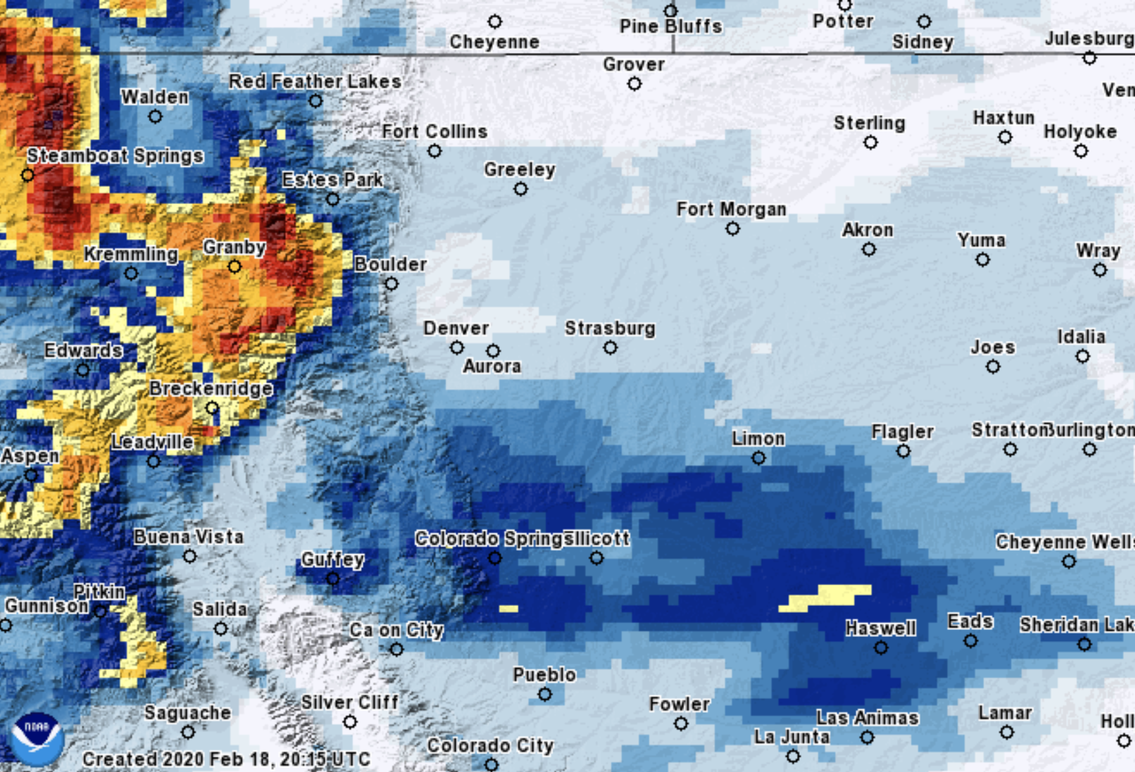
Yesterday's snow event had a few surprises up its sleeve, but for the most part panned out as expected: largely a dud across the Denver area, with Colorado Springs again seeing a pretty healthy snow, some 4 - 6" in many spots.
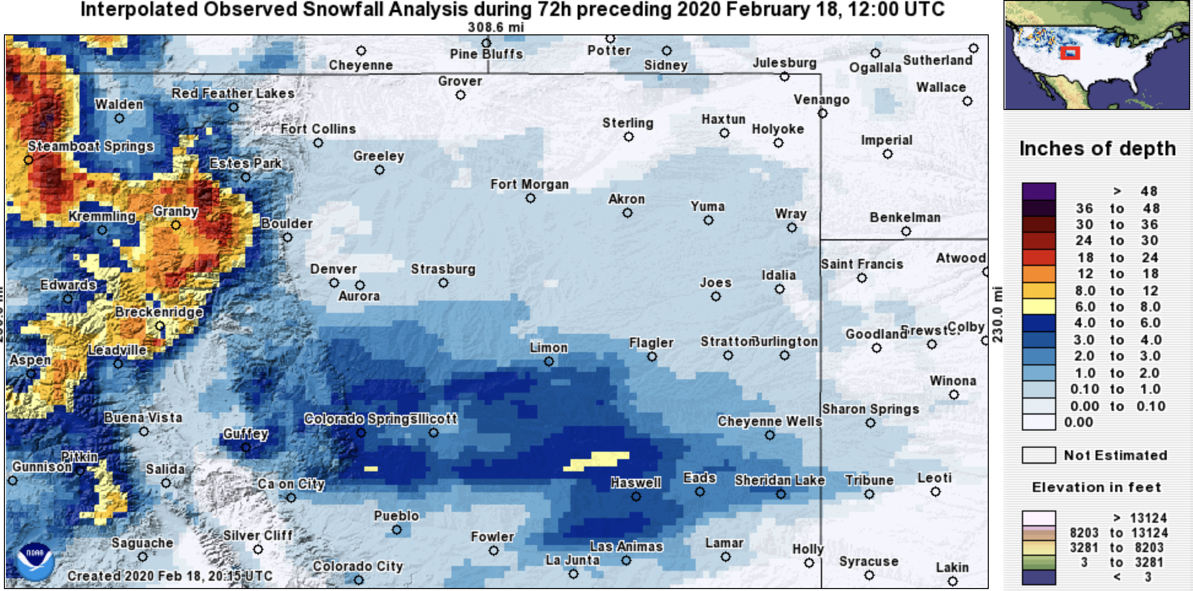
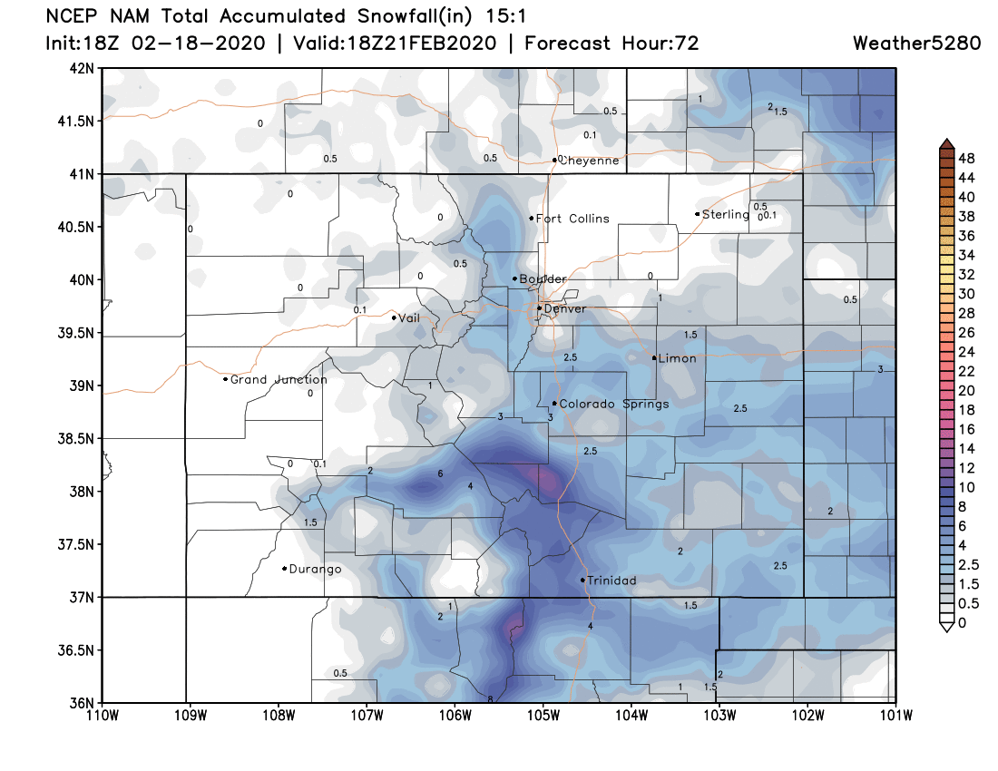
The map below is a fairly good representation of the snowfall over the last 72 hours. Big snow totals across the northern mountains, and the heaviest snow across Eastern Colorado focused along and south of the Palmer Divide. Last night we saw a band set up well north of Denver as well, with 2" or so reported in and around the Fort Collins area. This is not really captured in this map.
Timeline
Tomorrow's snow chance again will favor Southeast Colorado vs Northern Colorado. The main chance for snow in Denver arrives midday and sticks with us through the evening commute. If we see some snow that could of course be an issue for the evening drive. HOWEVER, many models keep the accumulating snow west of Denver, well into the foothills of Boulder and Jefferson counties.
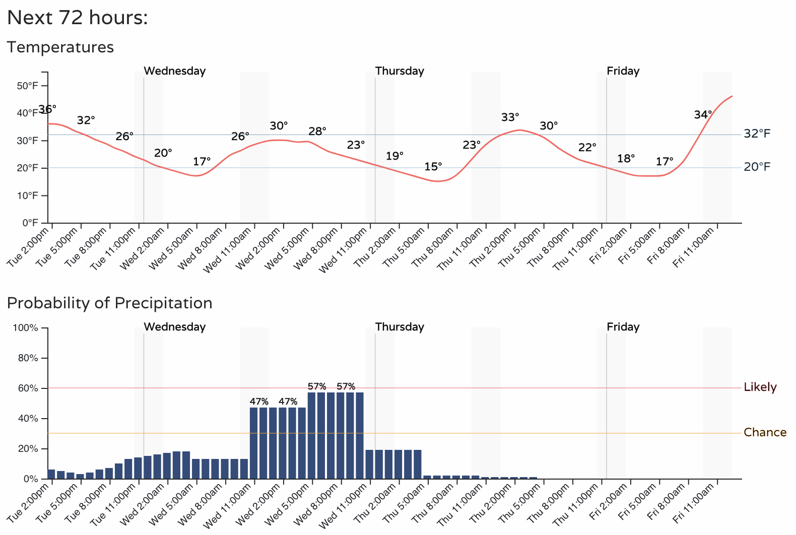
Denver's planner is as follows:
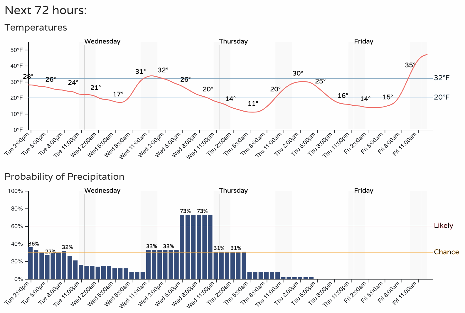
For Colorado Springs the chances will be a bit higher, with the potential for another 1 - 3" or even 2 - 5" across the region on Wednesday and Wednesday evening:
Snowfall totals
For the Denver area and points north models are again not showing much potential, very similar to last night. The general consensus is we see another 0 - 2" across the northern urban corridor (Denver, Loveland, Fort Collins), with 1 - 4" for the foothills, and another 1 - 4" / 2 - 5" for the southern Palmer Divide and Colorado Springs area.
Here's a look at the 18z NAM:
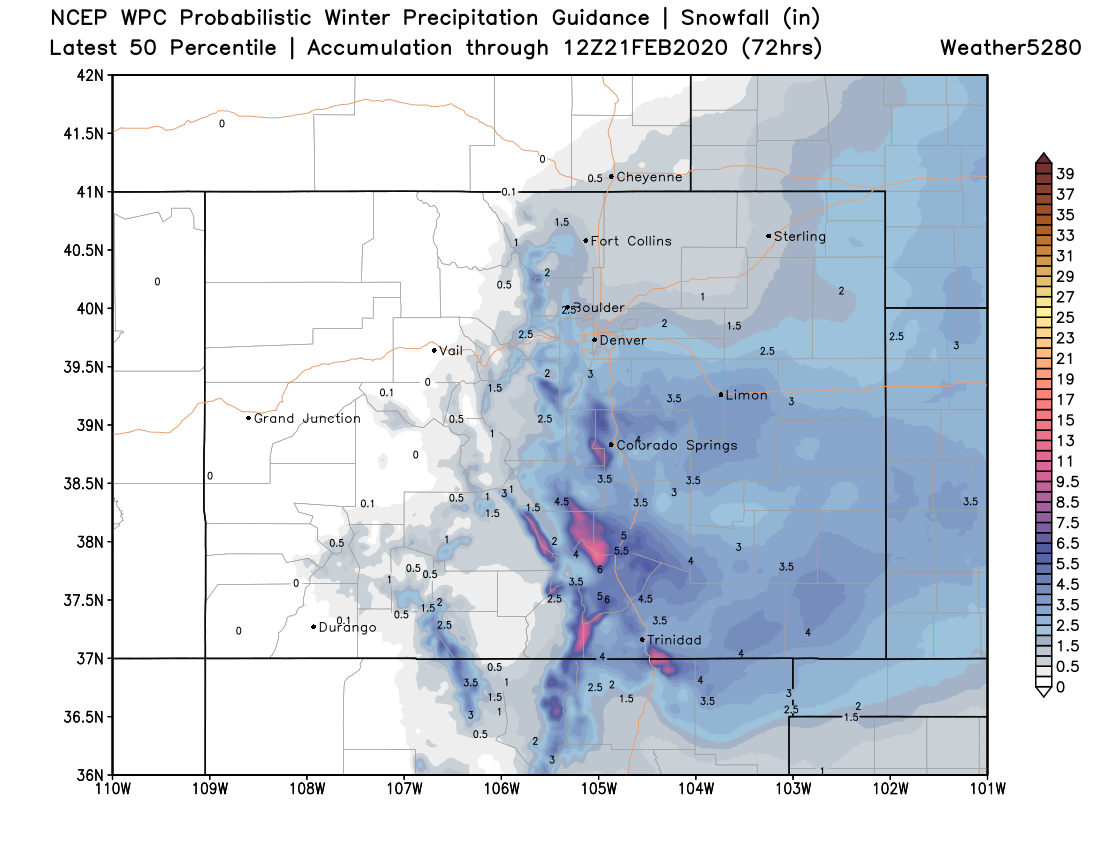
And a similar idea from the WPC:
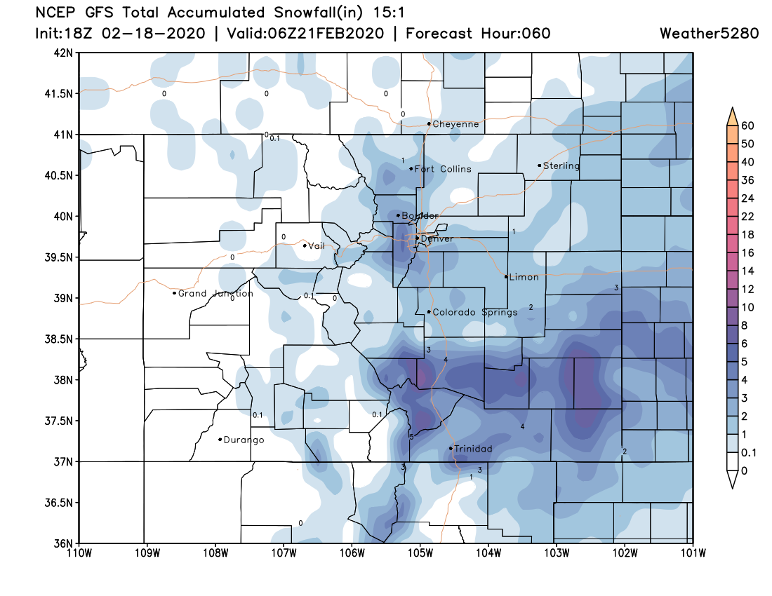
And finally the GFS, which shows a break for Colorado Springs, but another 1 - 4" for the western and southwestern suburbs of Denver:
The last of the snow will exit Southern Colorado Thursday morning. Behind the snow we'll see another chilly day across much of the state.
For Friday and Saturday we see milder temperatures return, with highs in the low to mid 50s expected in Denver.
Another system will traverse the state Saturday into Sunday, but at this time it looks to stay well south of our area. We'll keep an eye on it nonetheless.