
Weekend storm to bring more snow to Eastern Colorado

As we discussed earlier this week on Weather5280 Insider, the next system to bring rain and snow (perhaps heavy for some) to Eastern Colorado arrives this weekend.
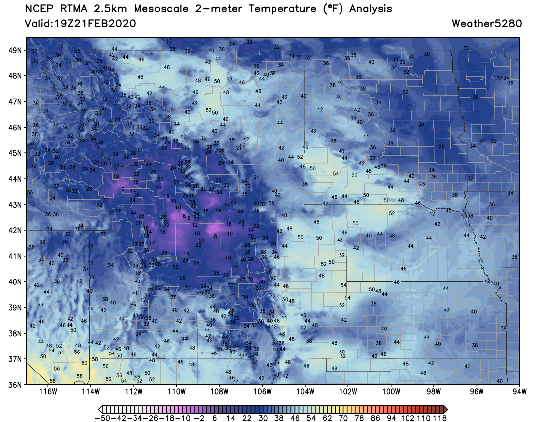
Ahead of that system? Beautiful mostly clear skies along the Front Range, with temperatures in the 40s and 50s across much of Eastern Colorado.
Our weekend system will move onshore later tonight over Southern California, and then into the Four Corners region Saturday night. Sunday the trough moves east of the mountains –– and as it does the eventual exact track will determine what impacts this storm will have across our region.
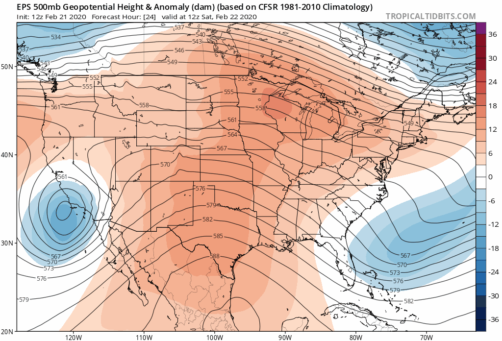
Models today are in better agreement with how this event will play out, but there is still a huge amount of uncertainty around the details as there always is with cutoff lows.
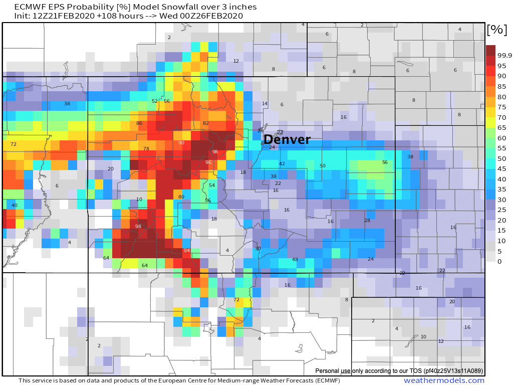
As it looks as of midday Friday, probabilities for the greatest impacts will be worst across the mountains, Palmer Divide, and far east-central Colorado. If we look at the European ensemble probabilities, we see greatest odds for 3" of snow or more are focused south and east of Denver:
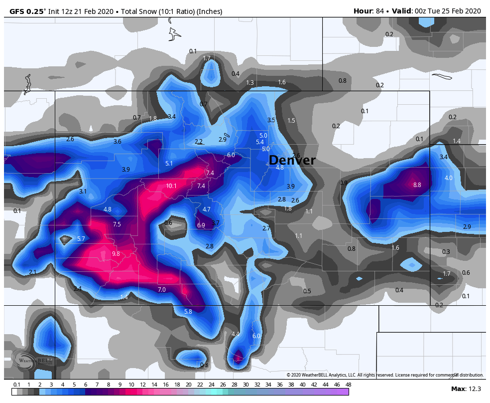
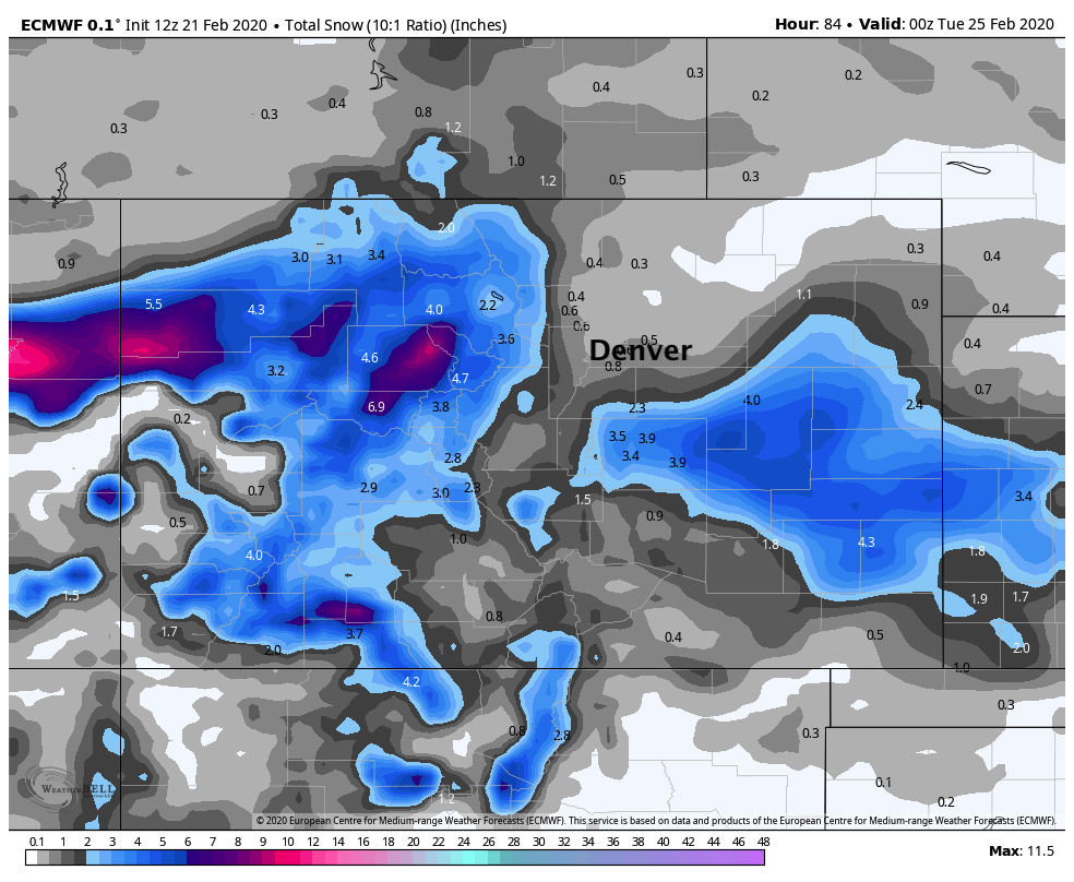
Using 10:1 snowfall ratios with this one we can look at where a number of models are currently tracking the heaviest snow. Currently the trust European has the lowest impact for the Denver area of any models. The GFS is somewhere in between, and the NAM is (while a bit all over the place) rather bullish for snow –– to say the least.
12z GFS:
12z Euro:
12z NAM:
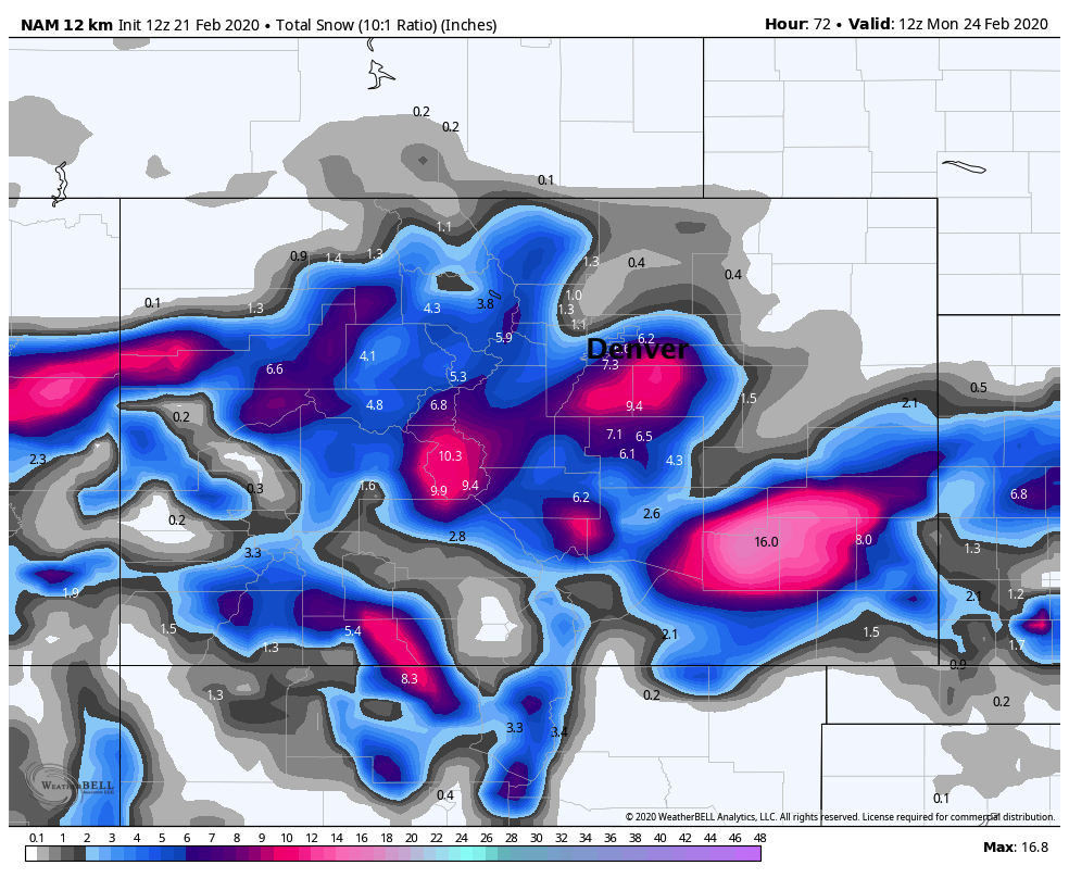
As you can see, there's a large spread in scenarios area. AND, the more models you look at –– the more extreme the spread in scenarios becomes. The 12z NAM above is clearly very snowy... and the latest run today is just bananas (not pictured!🍌).
So what's it going to be?
Hard to say. There's decent agreement between the models on the eventual track of this low (which is not usually the case with cutoffs), but how much QPF (precipitation) each is producing is vastly different. The NAM overall is wettest, the Euro driest. Aside from differing depth of upslope and available moisture, the NAM overall keep the system better organized as it moves over southeast Colorado early Sunday, where the European is more influenced by a trailing trough dropping out of the Northern Rockies. If the system can stay cutoff from the flow, and generally more organized as the NAM would suggest... a snowier (and more widespread snow) would become more likely. We have see the Euro come in a bit wetter in recent runs as compared to this time yesterday... so something to watch.
The bottom line is that this storm has the potential to produce heavy snow and strong winds across the region, mainly from late Saturday night through Sunday night. Where the heaviest snow sets up we still just don't know. Again, greatest probabilities currently favor locations south and well east of the Denver area –– but a slight shift in track, or slightly deeper upslope flow as the low ejects east of the mountains, and suddenly that heavy snow could be blanketing the urban corridor as well. What we do know, is this won't be a terribly cold system, so what snow does fall will be heavy and wet.
Timeline
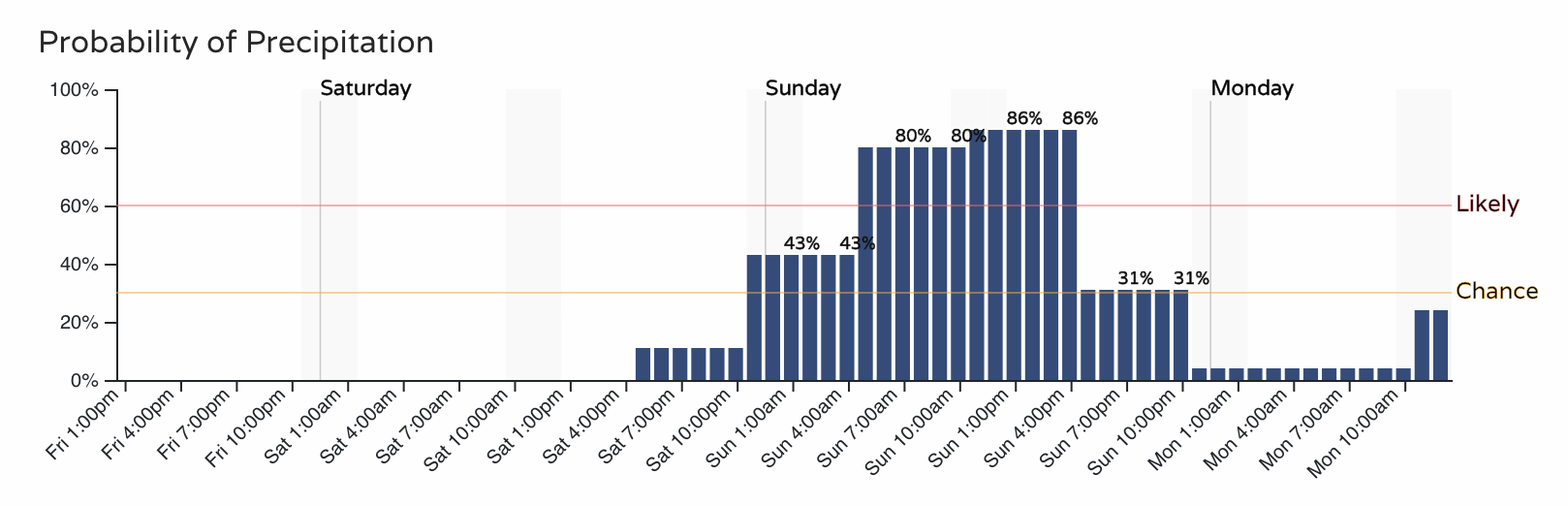
Barring any changes in speed, the main chance for that rain and snow across Eastern Colorado looks to come late Saturday night and through the day Sunday.
For Colorado Springs the current timeline is as follows:
For Denver:
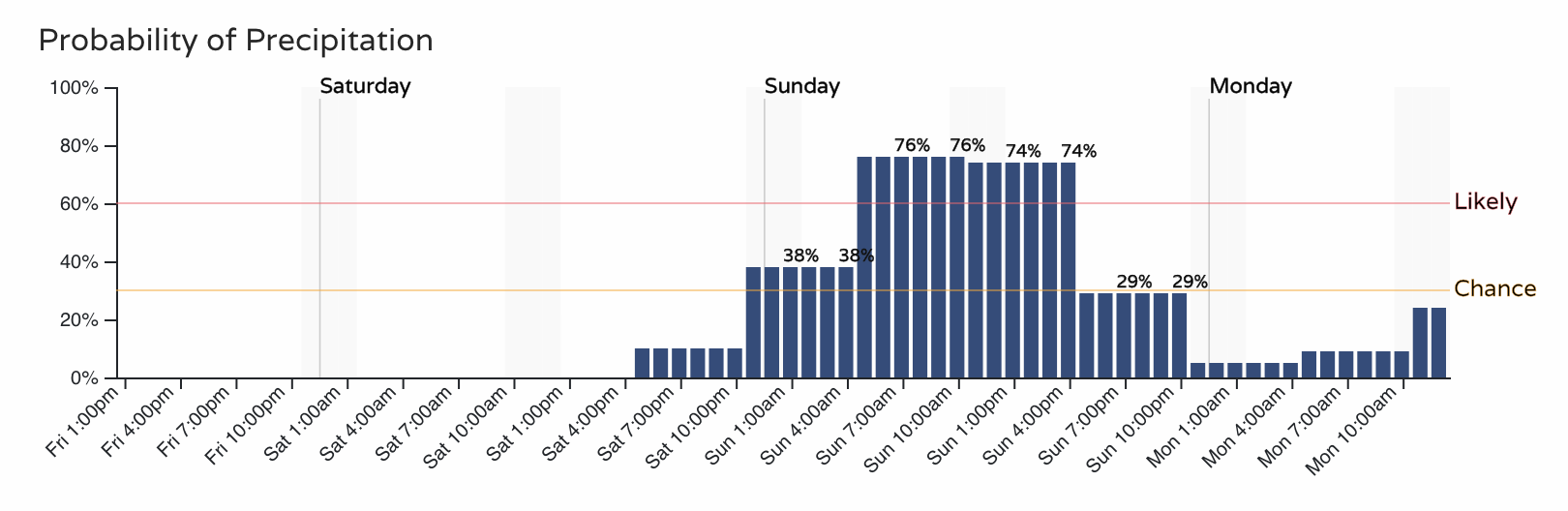
A similar look overall.
Planning
For now plan on a chance of rain and snow beginning Saturday night and continuing through the day Sunday. We'll be eagerly watching data roll in tonight and tomorrow morning and offer updates as needed.
For totals, we'll lean heavily on the Euro probabilities shown above. As hopefully better consensus comes tonight and early Saturday we will zero in on our forecast totals.
This is exactly the type of system that could quickly turn into a big snow producer for the region, so it's important not to get caught up in one solution or another. While odds are favorable for the heaviest swath of snow to end up across the Eastern Plains, those living in and along the Front Range and urban corridor should keep an eye on the forecast as we head into the weekend.
More to come.