A snowy February comes to a warm end, March begins with a chance of snow on Sunday

February 2020 will end colder and snowier than average for Denver, and really much of Colorado.
Denver's official snowfall for the month will end at 16.5", more than double the average of 7.7" for the month of February. This brings the season to date snowfall total to 46.4", also well above the average to end February of 35.1".
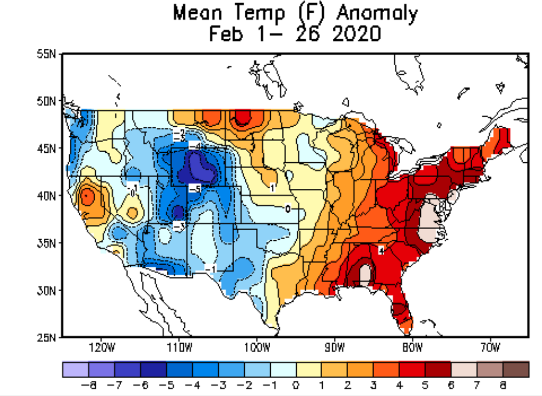
For temperatures, the month looks to end well below average, even with highs expected to push 60°F today in Denver. Month to date DIA is running -5.5°F below the monthly average, with those colder than average temperatures true statewide. The warmth in February continued to reign across the Eastern United States:

Today and Saturday
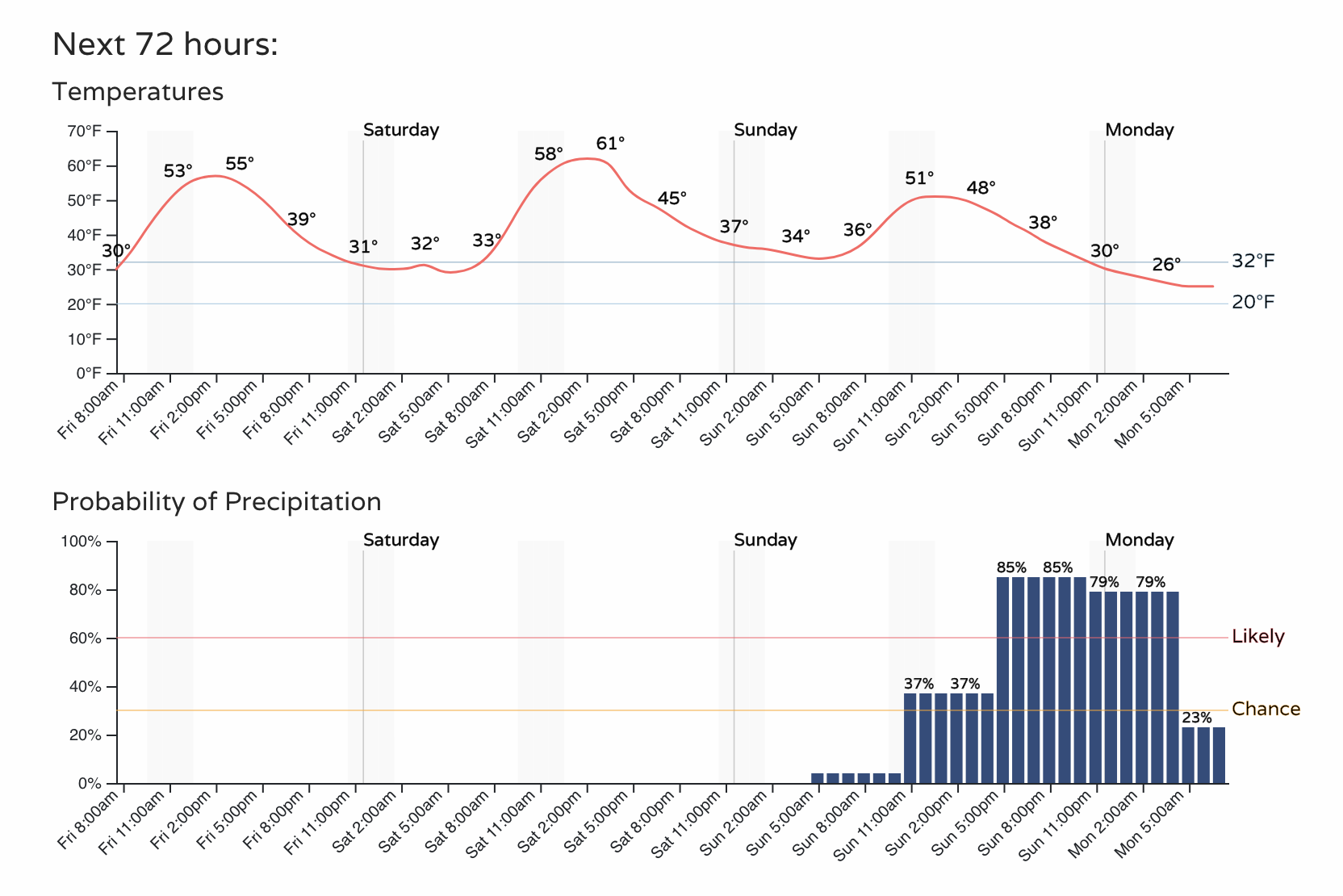
The snowy month comes to a quiet and mild end today. Highs in Denver will approach 60°F, with the low 60s in the forecast for Saturday across much of the region.
A look at the hourly outlook for Denver shows those mild temperatures, and the corresponding lack of precipitation in the forecast today and tomorrow. By Sunday, however, that changes, as our next cold front drops in from the Northwest, and brings with it our next chance of snow:
Next chance of snow
This next system has been long-advertised in the models. As we get closer, models have changed the overall look of this setup, leaving most of the upper level energy well to our west –– dropping the mid level low south of of the Pacific Northwest into southern California Monday morning.
This means we'll largely be depending on a moist southwesterly flow aloft and a surface cold front forecast to arrive Sunday evening to deliver some (light?) snow across Northeast Colorado Sunday evening and overnight into Monday.
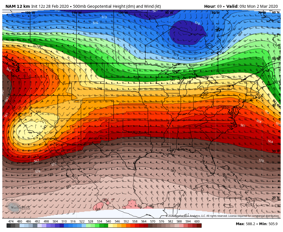
Here's a look at the NAM forecast for very early Monday. You can see the main trough centered over south-central California, with the flow (wind barbs) streaming out of the Southwest over Colorado:
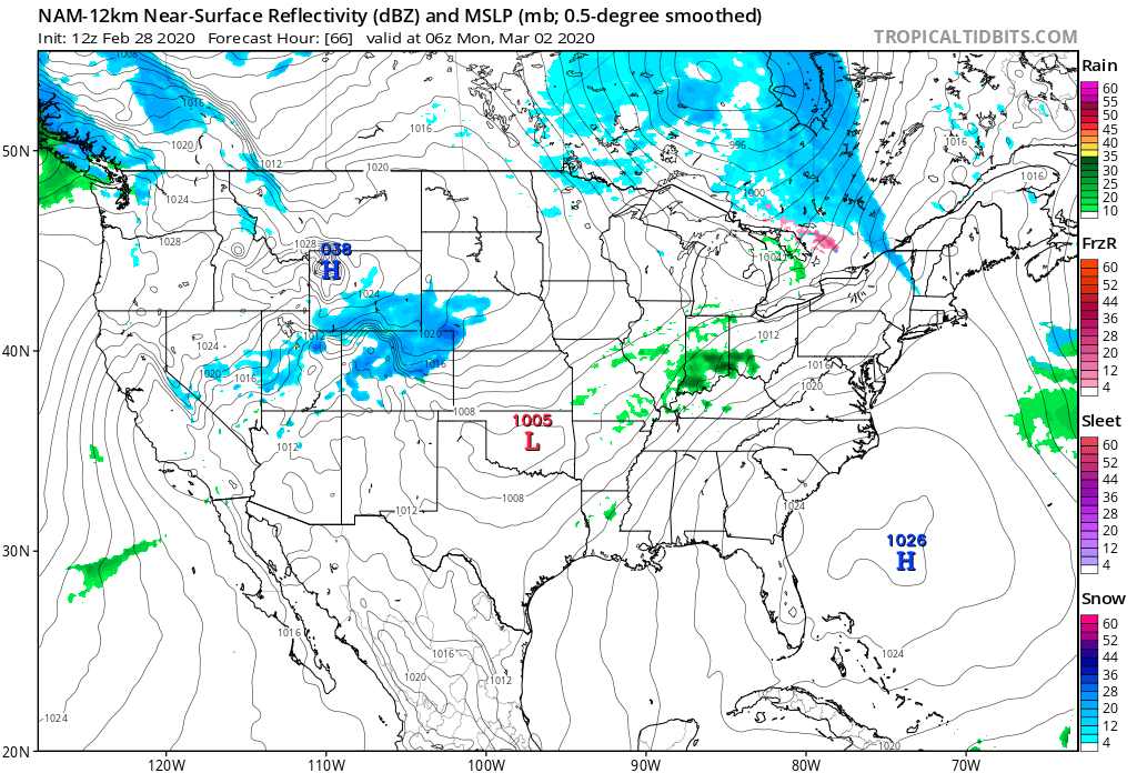
It's at this time, we expect the best ingredients to come together for snow to Develop across the state, with this particular model showing good snowfall coverage Sunday night behind the cold front:
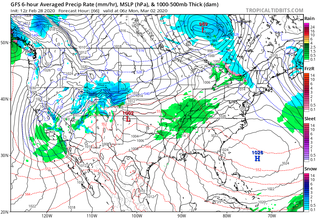
And seconded by the GFS:
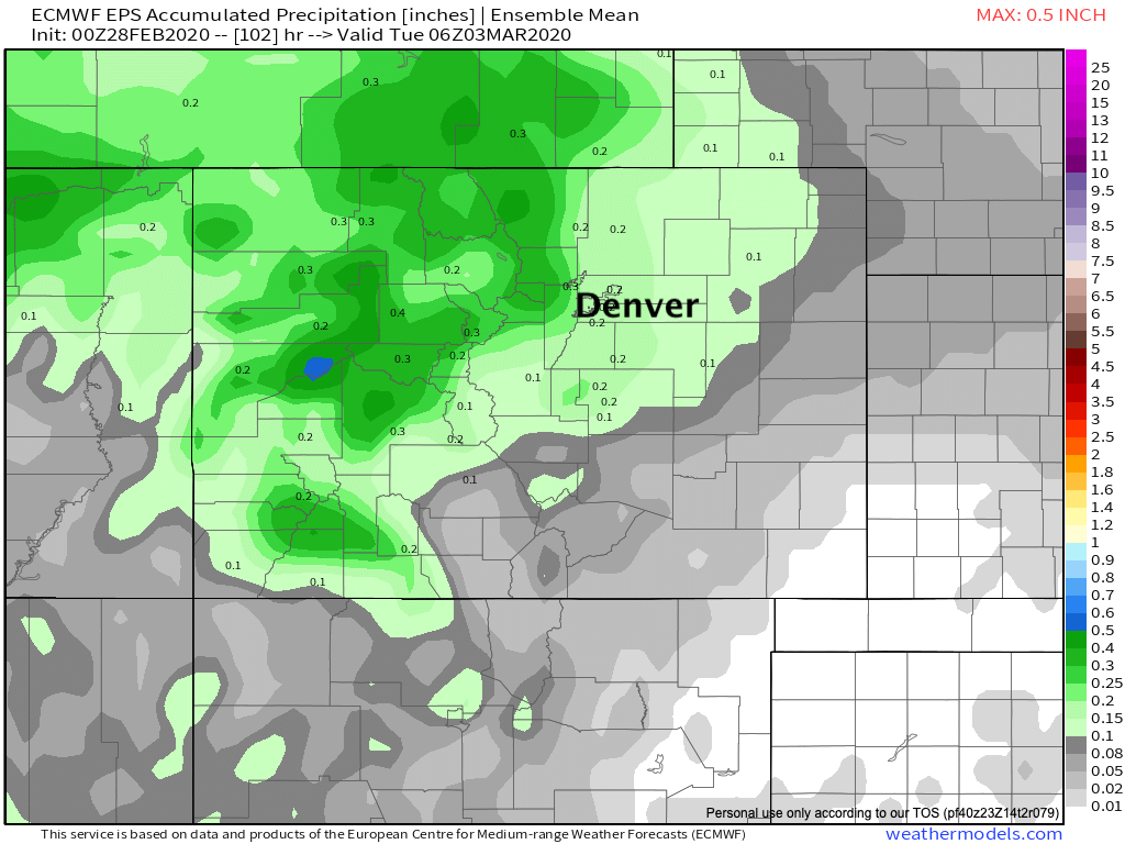
The European, which has perhaps had this system in the cards the longest, has looked less impressive in recent runs. However, its ensemble continues to show okay moisture for Northern Colorado, with a good shot of snow too –– at least for the Northern Rockies and urban corridor.
Its mean precipitation forecast is showing 0.2 to 0.3" liquid from Colorado Springs north through Fort Collins through Monday. Even at 10:1, this would suggest a widespread 2 - 3" snowfall event for the urban corridor should this forecast hold:
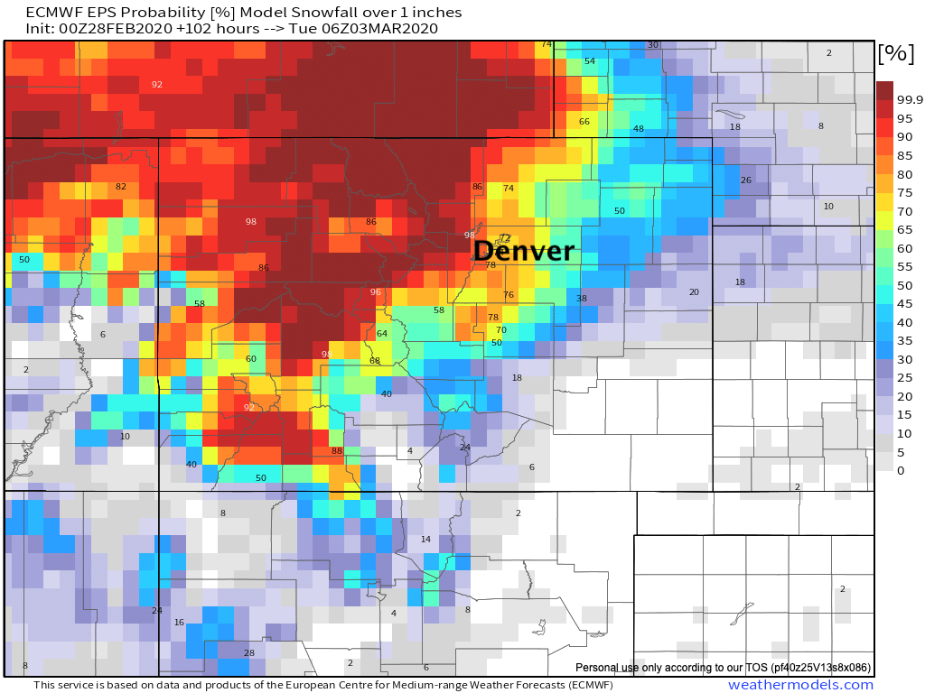
In its probabilities, we see 70 to 90%+ probabilities for the same areas to see an inch or more of snow:
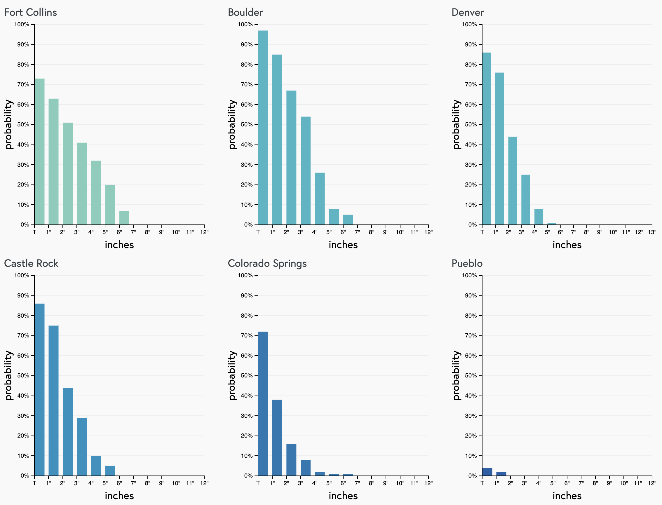
A check on our gamblers shows the support for a couple inches of snow as well, mainly across the northern cities, but Colorado Springs showing some odds for a bit of snow as well:
Planning
For now, best to enjoy the mild weather on the way today and Saturday. Evening Sunday itself doesn't look all that bad, perhaps a few degrees cooler as clouds will be on the increase... but right now it looks like the cold front will hold off until later in the day.
By Sunday evening and overnight a good chance of snow across the region looks to take hold. While totals right now do not look huge –– some accumulation certainly looks possible.
Without huge changes in the outlook over the next day or two, this would suggest a slow commute for your Monday drive, especially along and west of I-25 from Colorado Springs north through Fort Collins.
We'll be tracking this through the weekend, and offer updates as we get closer!