Rain and snow back in the forecast for Denver, Northeast Colorado tomorrow

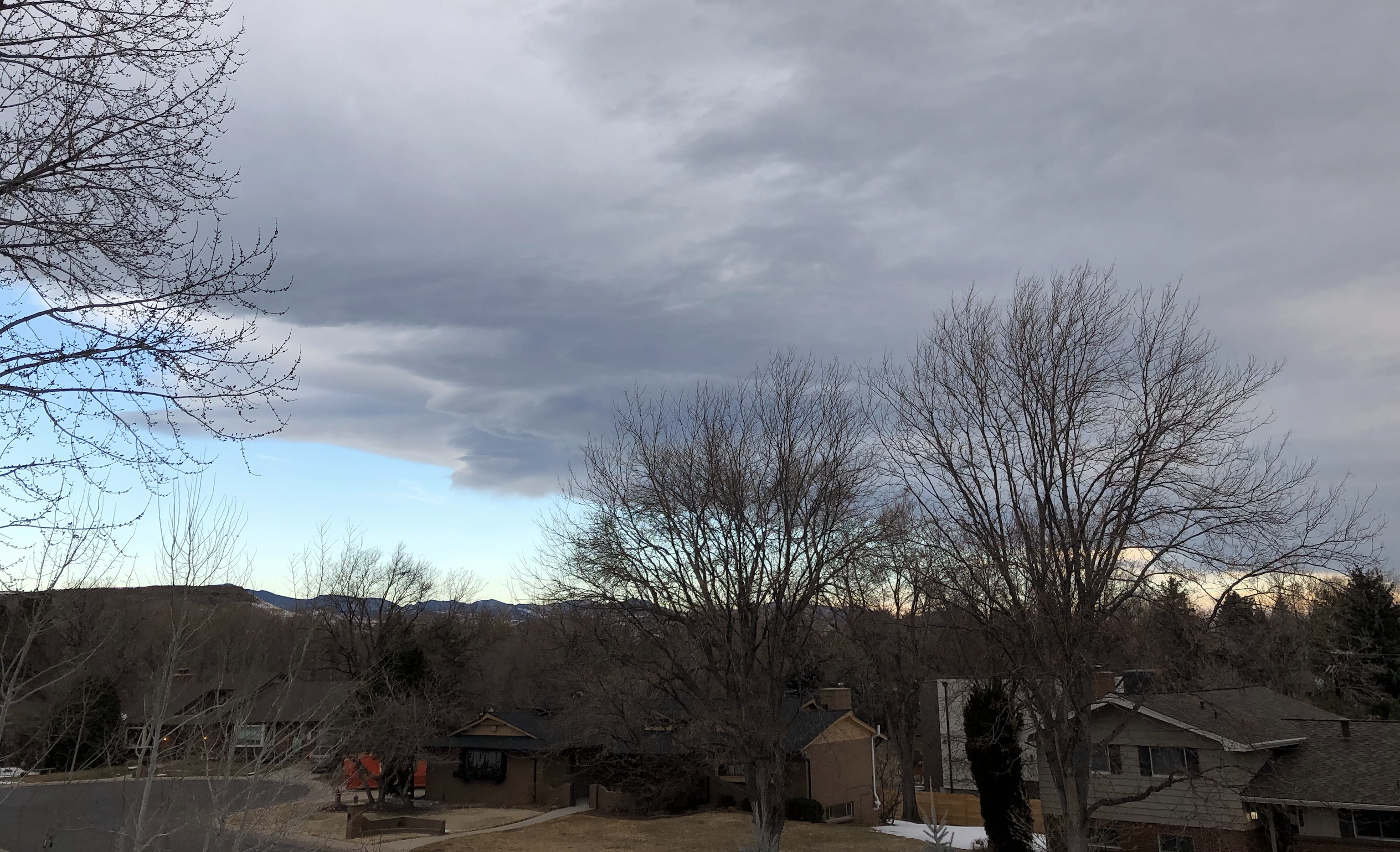
If you look to the west today you'll notice a lack of clouds along the Front Range foothills, even as most of us across the urban corridor are under a thick cloud deck. This is called a mountain wave cloud, and will likely be responsible for holding back temperatures a good 5 to 10 degrees below what they could have been this afternoon.
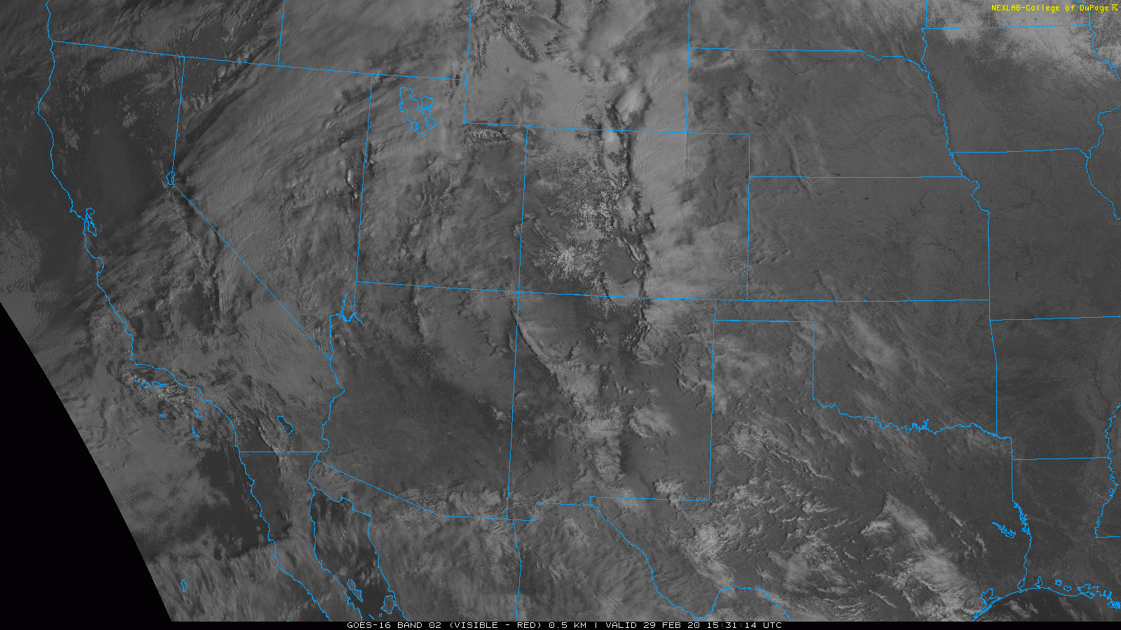
From above, it's quite easy to pick out this feature on satellite. At the mid levels we see a westerly flow across the state, with the bright white wave cloud (not moving) right along the the front range and extending a short distance onto the adjacent plains:
So, while MOS guidance still has highs in the low 60s for the metro area, it may be that we come up short due to this cloud cover. Given our current temperature, the mid to upper 50s looks more likely at this time.
Changes arrive tomorrow
As we outlined yesterday, our next cold front and associated rain and snow chances arrive tomorrow.
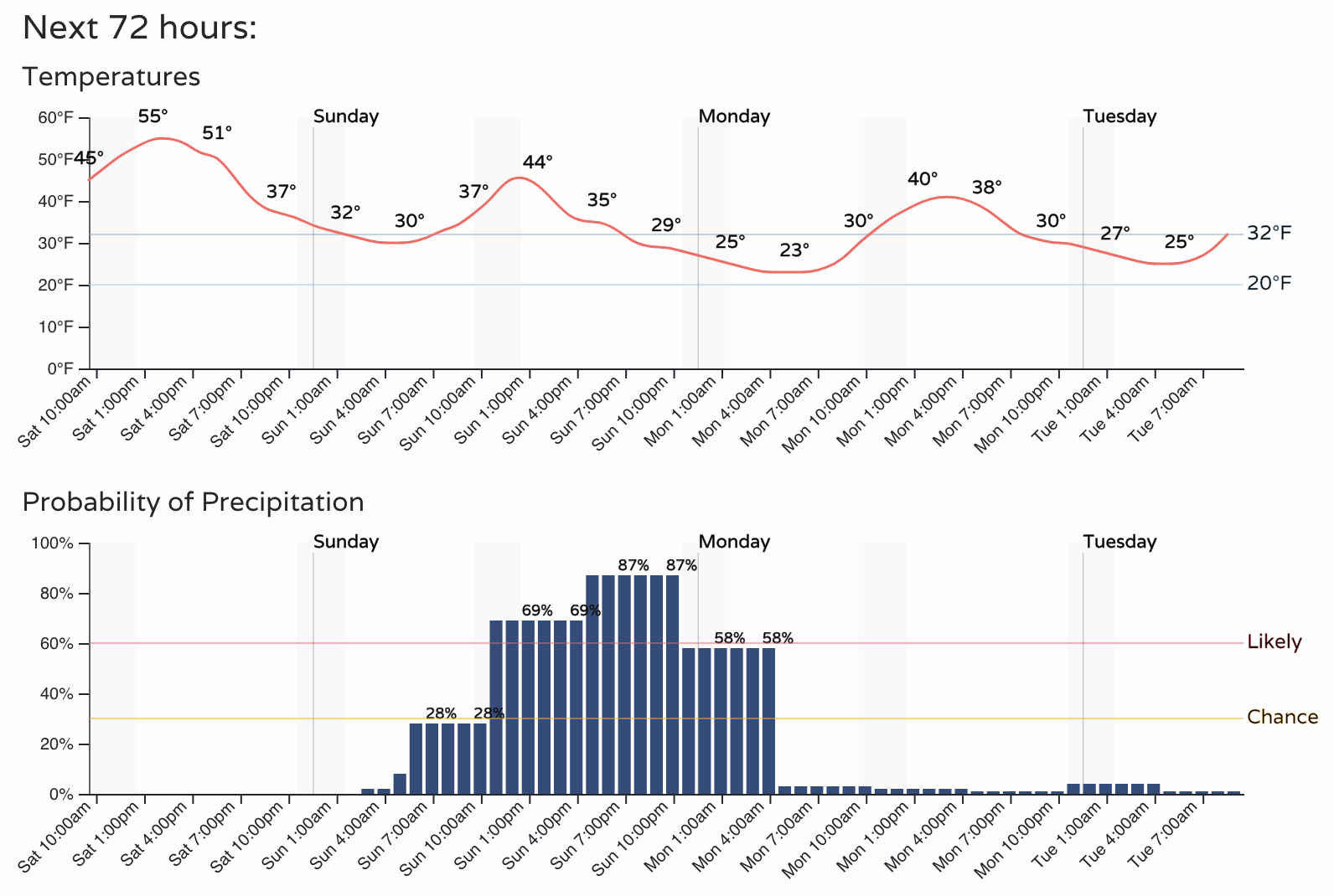
For Fort Collins we see temperatures climb in to the low to mid 40s on Sunday ahead of the front, with precipitation chances on the increase through mid to late morning, and peaking Sunday evening:
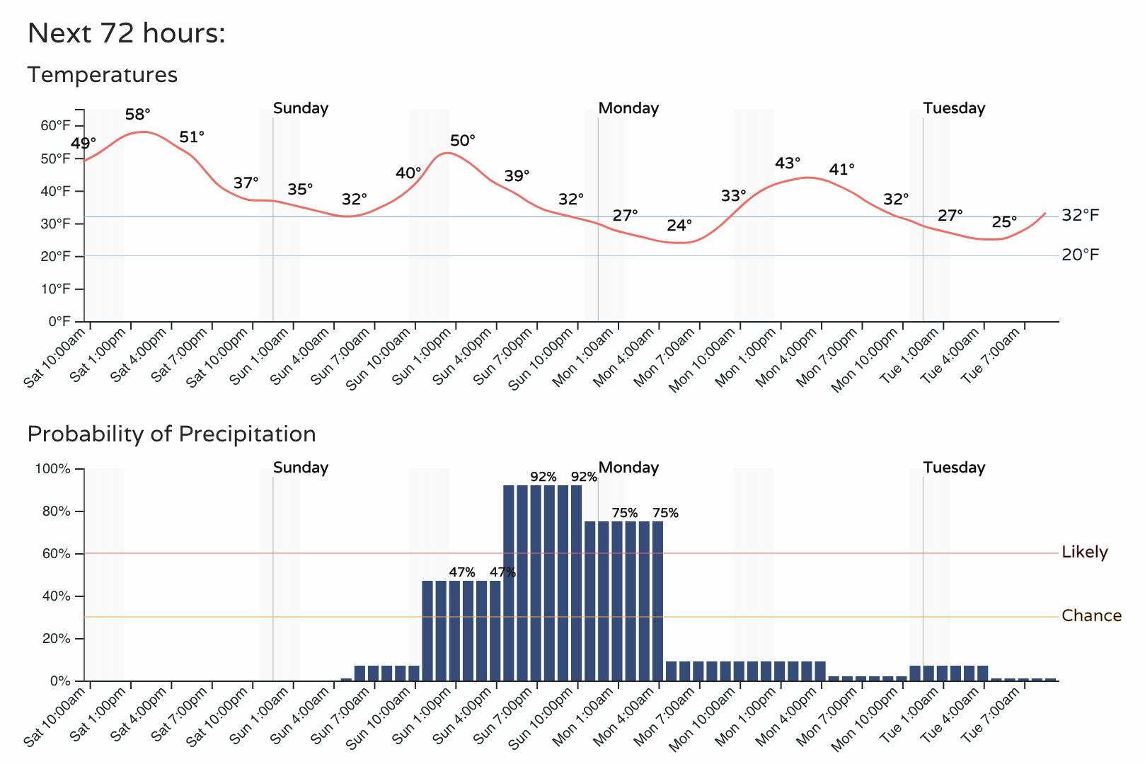
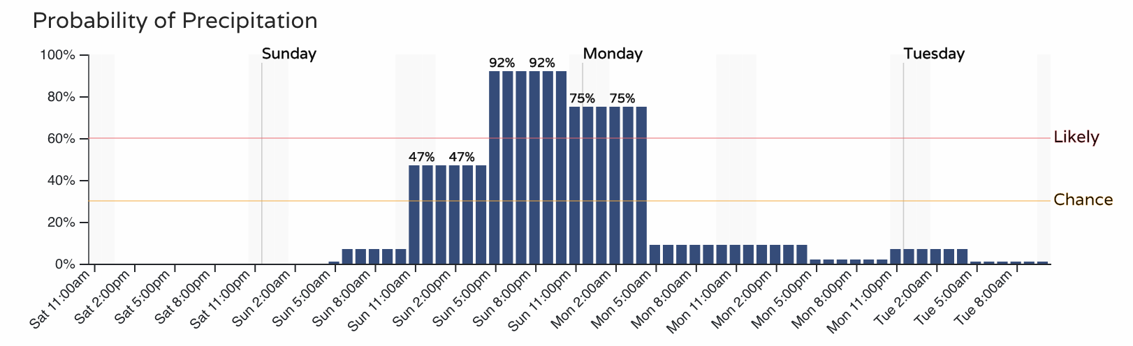
A bit further south, temperatures may manage 50 degrees or so as the front will be a couple hours slower to arrive. Still, cooler than today, and a quick change in the weather expected by midday or early afternoon across the region. Here's the hourly outlook for Denver:
The setup looks about as it did yesterday. While the main energy will drop south Sunday into Monday across California, a shortwave and cold front will move through our region and are expected to provide enough lift and cold air for a period of snow across much of the state.
Snowfall totals
A general 1 - 4" seems like a good range for most of us with this system. If we see things get going on the early side Sunday totals may end up a bit lower, whereas if the best snow holds off until Sunday evening this will help promote higher totals as we won't be fighting the warm daytime temperatures and sun.
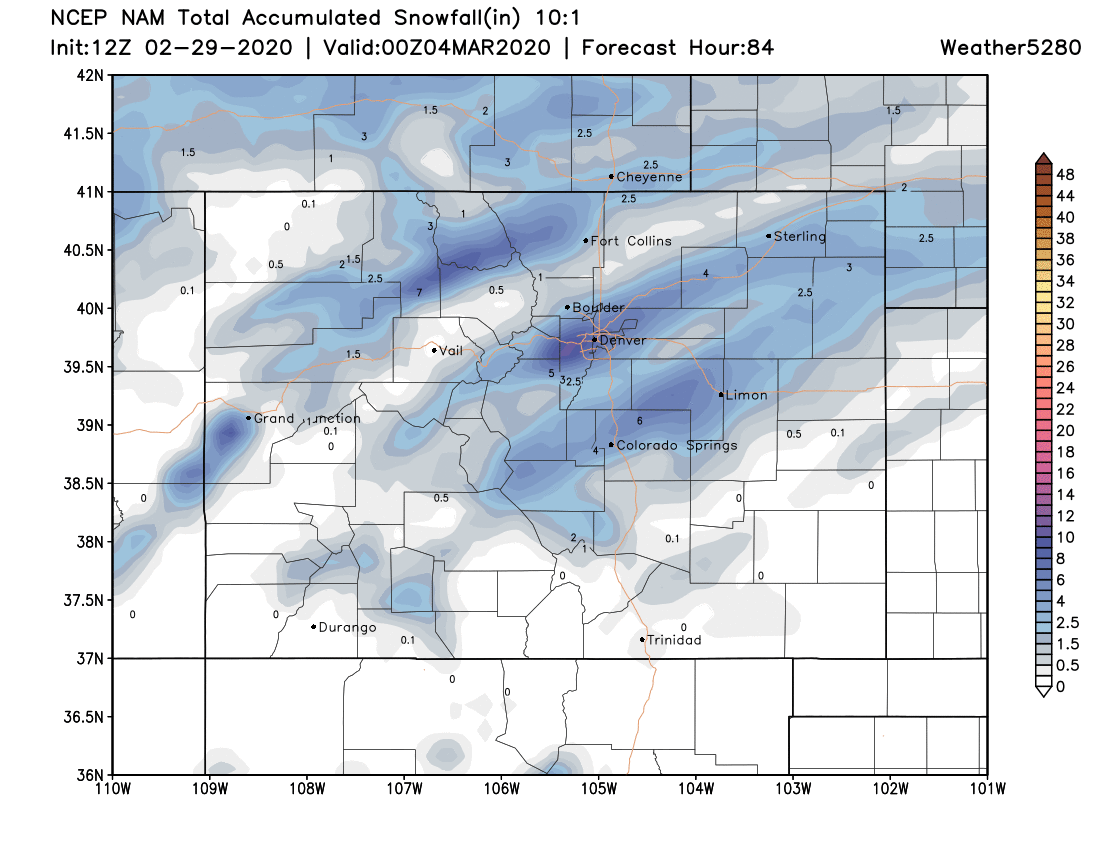
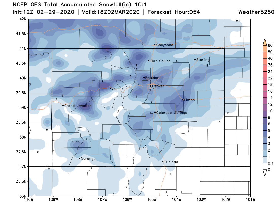
While we don't see that the jet influence will be as extreme as we saw with some of our snowfall events in February, models are rather streaky with the heavier totals. The NAM (below, top) is the extreme example of this. The GFS is a bit more generalized with its QPF, but shows those southwest to northeast bands of greater totals as well. The NAM of course would be a huge boom for the Denver area (totals upwards of 6" in its latest run), but 1) it was grossly overdone with our last system, and 2) has a lot riding on the exact placement of that heavier band (see a few miles north of Denver).
Our gambler show some high-end potential, likely only the case if we see some embedded heavier snow bands develop. Otherwise for Castle Rock, Denver, Boulder, the 1 - 4" range looks good. For Fort Collins and Colorado Springs confidence in those totals is lower.
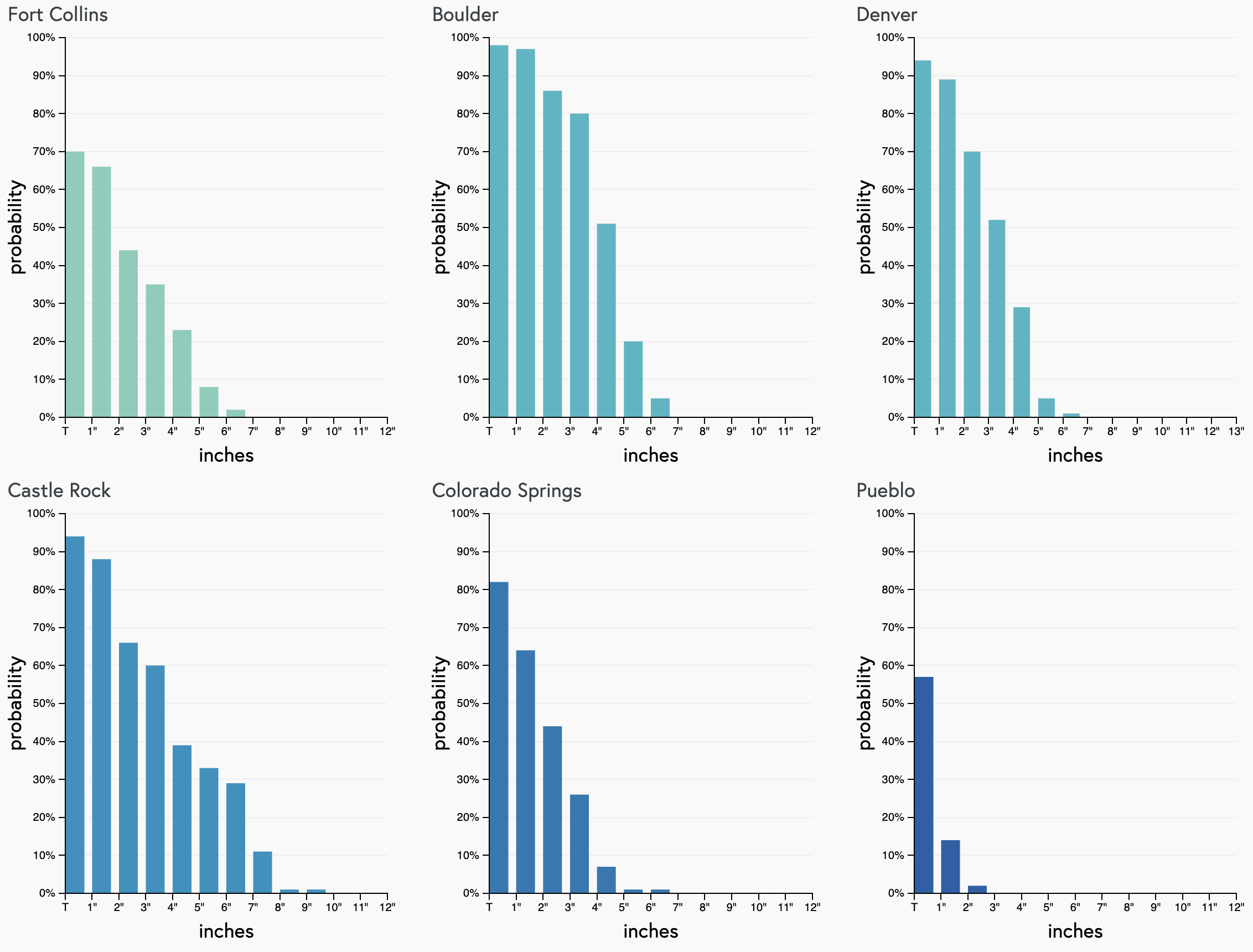
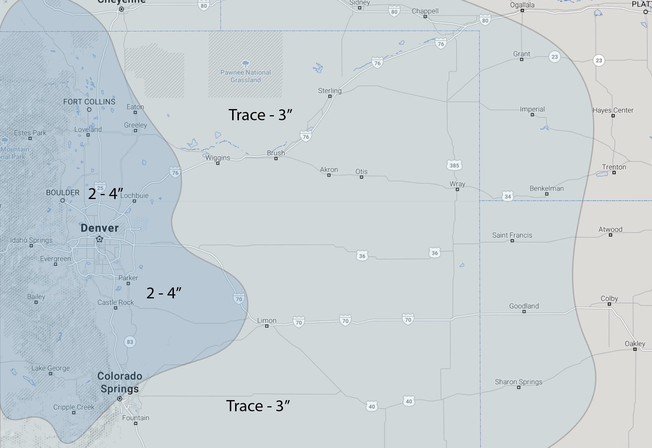
With all that said, the following is our snowfall forecast for Sunday afternoon through Monday morning. If we see more rain and snow early on these totals may be too high, plus we'll be dealing with some melting coming of some warm days.
- Fort Collins: 2 - 4" Confidence: low
- Boulder: 2 - 4" Confidence: medium
- Denver: 2 - 4" Confidence: medium
- Castle Rock: 2 - 4" Confidence: medium
- Colorado Springs: 2 - 4" north, Trace - 3" south, Confidence: low
Timing and impacts
Right now it looks like the best ingredients will come together after sunset Sunday for snow. It'll take some time for the atmosphere to saturate and cool enough, and this is when we see the best lift as well. That said, these fronts usually run ahead of schedule... so to see rain and snow develop earlier in the afternoon (especially across Northern Colorado) should not come as a surprise.
Again, we've got probabilities for rain and snow pushing 50% by late morning in Denver, but greatest odds coming during the evening hourss:
Most data has the snow coming to an end before the morning rush on Monday, but if we see things come together as expected Sunday night, the morning commute is likely to be slow and slick nonetheless.
We'll continue to watch trends today, and pass along further updates as needed! Enjoy the mild weather here to end Feb (even if the mountain wave dampens that a bit!) and get ready for another round of wintry weather on Sunday.