Winter storm update: timing on track, boom and bust potential in latest data

Our must trusted models have backed off snowfall potential this evening for Northeast Colorado, even as many of the high-resolution models continue to show pockets of "boom" snowfall totals across the urban corridor.
Look: Denver's Top Five March Snowstorms
The NAM has consistently shown the potential for some banded snowfall this evening. We continue to think it's likely overdone on that potential... but should this set up, some 4 - 7" totals do not seem out of the question. The area with the greatest potential for this seems to be from between a Boulder/Erie line and Castle Rock/Elizabeth line. This is where the NAM has shown a band of heavier snow now for several days, and most recently we see the HRRR placing some heavy snow over the metro area as well.
These models are in stark contrast with the global models, especially the European. This was the case with the last system as well, which should lend pause. Still, it could be that we see a period of moderate to HEAVY snowfall this evening across portions of the urban corridor if the high-res models are really on to something.
On Weather5280 Insider: Outlook for March 2020, a bias toward warmer and drier weather for Eastern Colorado
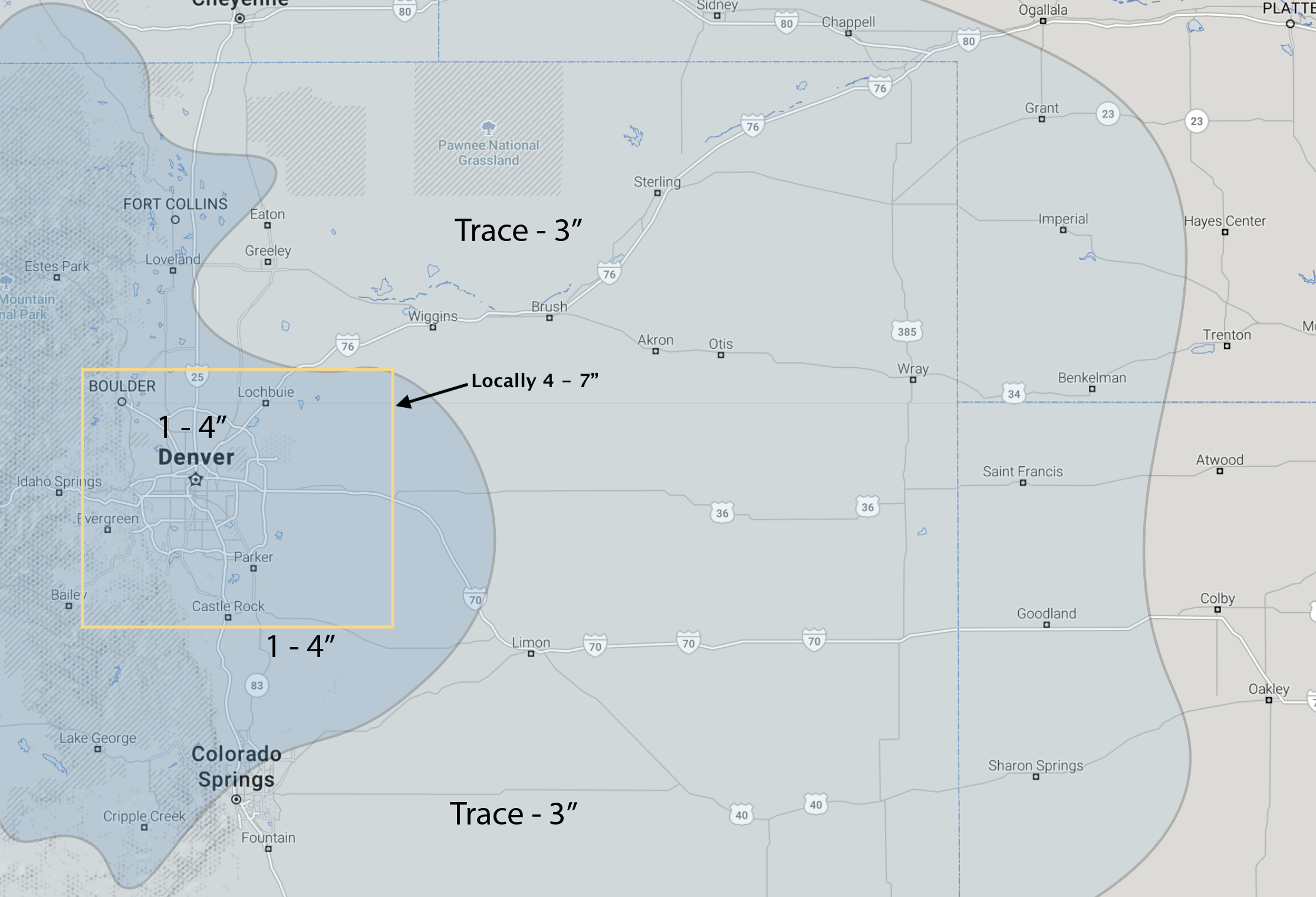
Snowfall forecast
We will shave an inch off our low-end forecast as some areas are likely to struggle to reach an inch, and certainly to reach two inches.
For the most part we'll leave the 4" high-end in case we see the heavier snowfall setup. We've pulled that line north a bit for Colorado Springs as high end totals south of the Palmer will be harder (not impossible) to achieve, as well as carved out some lower totals south of Fort Collins as this area may very well be shorted of snowfall.
Otherwise, mostly sticking with our outlook from yesterday:
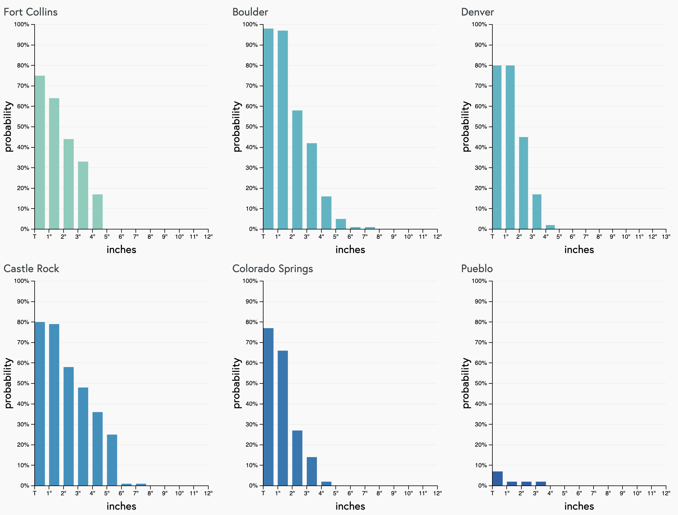
If there's a boom coming, our gamblers are not picking it up. Greatest odds are in the Trace to 2" range for most metro areas, with Castle Rock seeing the greatest odds at 3"+:
For areas that see the accumulating snow this evening, expect a slick drive for your Monday morning commute.
The window we see for the best chance of snow for the Denver metro area looks to be between 4pm and midnight tonight, though some showers before and after are no doubt possible. In fact, we're seeing showers along the urban corridor here already this morning, even as we expect the main event to arrive later in the day. Here's the latest hourly, showing those snow chances on the increase after noon today:
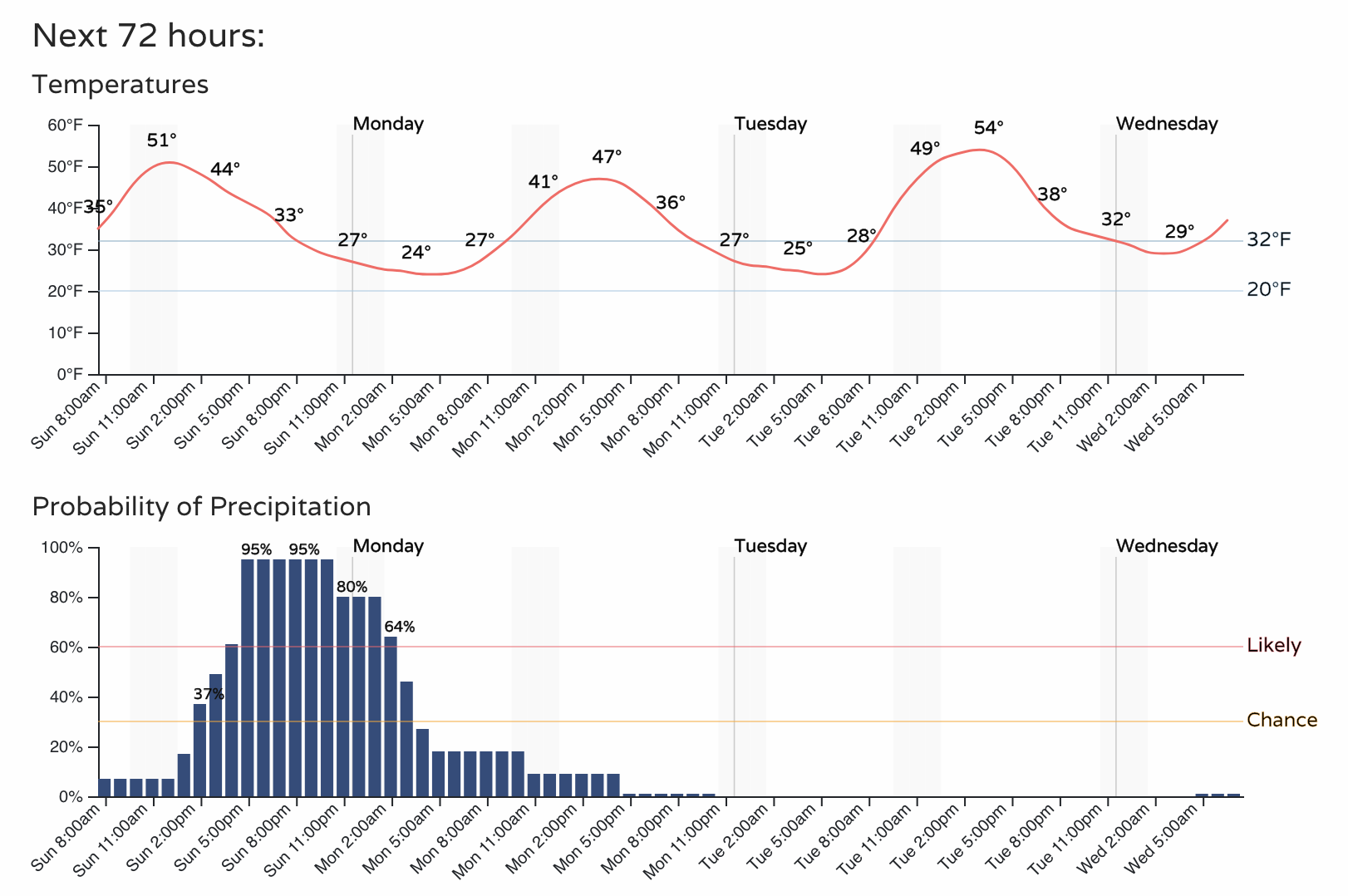
This is a not a terribly cold system. By Monday afternoon highs will climb into the mid to upper 40s for Denver. Tuesday those temperatures will be back in the mid 50s.
Let us know how things shake out at your place! Happy meteorological spring!