The State of the Atmosphere: Sunday, March 15, 2020

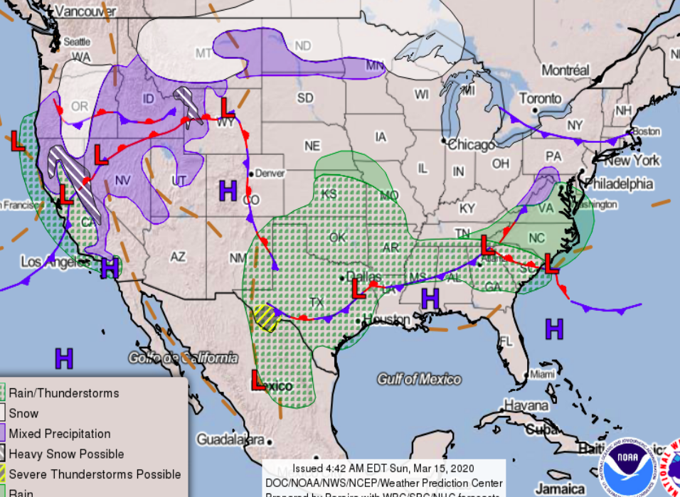
Persistent fog and drizzle has clear most of Eastern Colorado this evening, though the far Eastern Plains and Western Kansas will see areas of dense fog through tonight and into Monday morning.
Along the Front Range a mild Monday is on tap. Highs will be near 60°F (perhaps into the low 60s for some), with mostly sunny skies for most of the day along the Front Range.
By Monday evening and overnight we see a bit of a disturbance move through and bring areas of patchy fog and light rain. It shouldn't amount to all that much for most of us, but it'll keep Tuesday cool and unsettled across the area before things dry out in total Tuesday night.
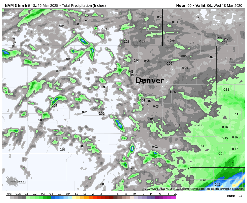
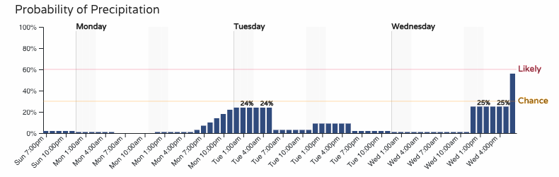
Might some of this fall in the form of snow? Perhaps. The best chance of that will be early Tuesday morning (about where we see the greatest precipitation probabilities below), and where we do see that snow (or mix) it should only be a coating or so in most cases if at all.
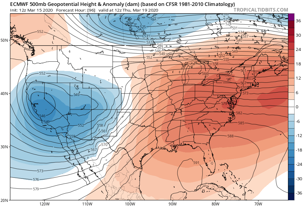
After a brief break Wednesday, more active weather moves in Wednesday night and through the day Thursday.
It's a bit tough to say what eventual impacts here will be, but a bit more potential for a more impactful event than we've seen most of this month –– especially across Northern Colorado with regard to snow. Still, a ton of uncertainty with the evolution and track of this system, and with that a wide range in temperatures (rain vs snow) and how much of either.
We'll see a trough across the Western United States Wednesday split and send a bit of that energy through Colorado Wednesday night and Thursday. Where this wave ends up tracking will be key to watch as we head into the week.
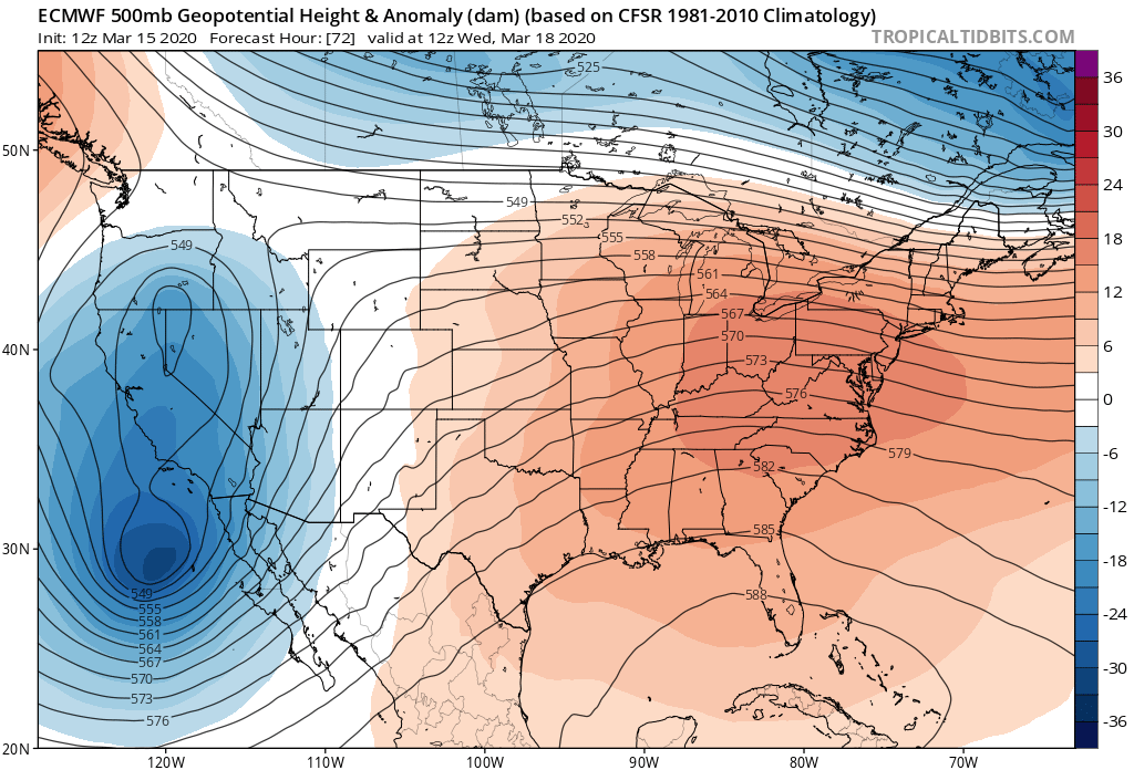
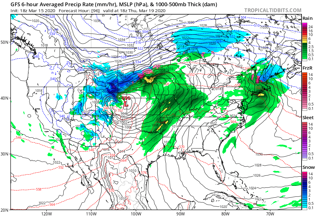
Should nothing change between now and Thursday, it looks like a soggy end to the week for the Denver area and points north and east. Ensemble mean QPF forecasts show anywhere from a 1/2" of liquid for the Denver area, to upwards of 1" for portions of the Northern Front Range Mountains and Southeast Wyoming.
Of course if this falls in the form of snow it could equate to a pretty good March snowfall for some communities late this week, whereas a slight track shift or warmer solution would mean a far less impactful event. Importantly for now is to keep an eye on the forecast as we head into the week. Right now the bias is to take this thing north of many of us, but we think there's reason enough to watch for a southern play.
Enough agreement in the modeling that something will move through, so plan on some wet weather Wednesday evening through perhaps Friday, with thunderstorms and snow both possible (if even likely) across northern and east-central Colorado on Thursday.
Please keep yourself and your family safe and healthy this week. We will be keeping an eye on the weather for you, and pass along updates as needed.