
Winter storm will bring rain and snow to portions of Colorado Wednesday night through Thursday

While some of us will see fog and drizzle overnight tonight and Tuesday, we continue to track a larger storm system due to arrive for the latter half of the workweek.
Data do not show a tremendous amount of change from how things looked yesterday. Models continue to track the system more north than south, putting the Palmer Divide, northern urban corridor, and far northern Plains under the heaviest rain and snow Wednesday evening through Thursday night.
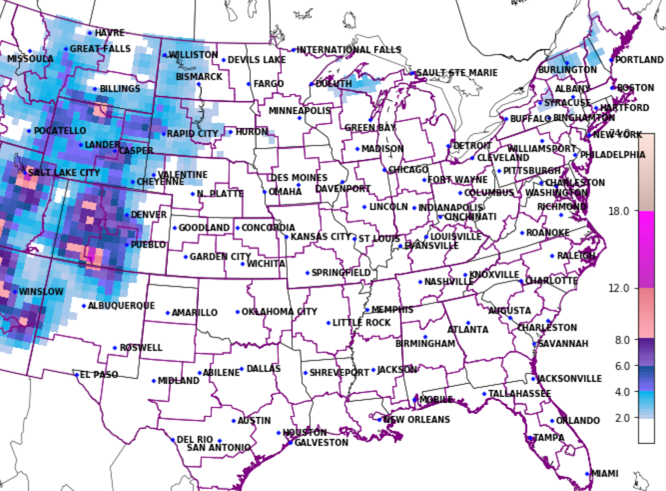
Now, we continue to see a scenario where this ultimately ends up farther south. We see this showing up in some of the models as well, and looking at the latest CIPS analog package you can see a southern bias as well –– lighter snowfall from Denver north vs. Denver south:
Wherever this system tracks, it's likely to pull in some pretty good moisture –– both in the form of rain initially and eventually as snow (for elevations above ~5,000 feet at least), by Thursday afternoon and evening.
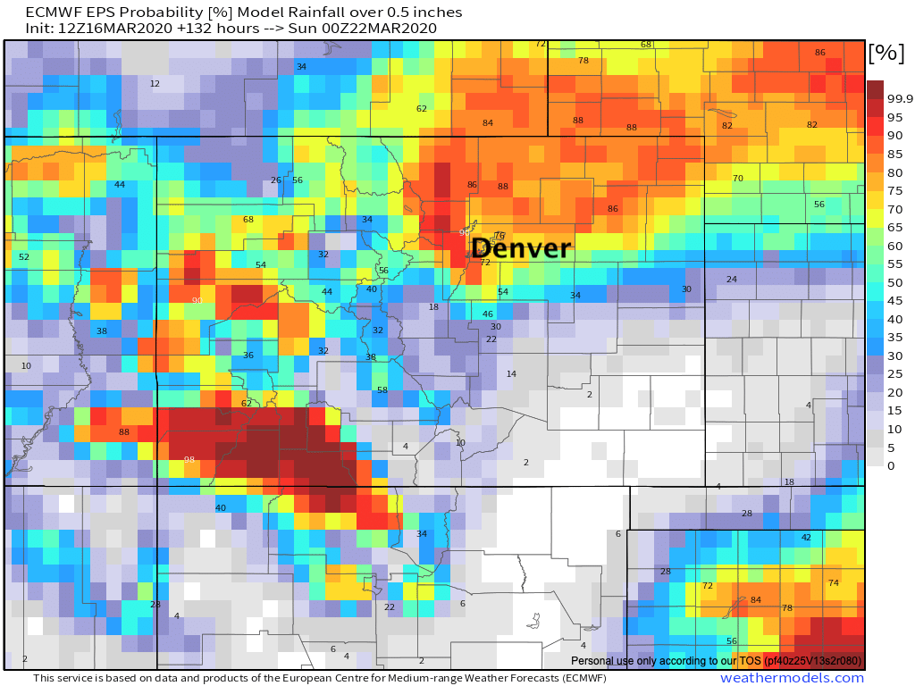
Model guidance shows pockets of 1" QPF (liquid) wherever the heaviest sets up as a possibility (it won't all be snow at lower elevations). A look at the European ensemble probabilities for 0.5" of liquid or more shows pretty good odds for most of Northeast Colorado. These odds could move north or south over the next days depending on the final track, but you get the idea: a nice wet March storm wherever it ends up:
When the rain does change to snow, it's likely to be heavy at times. Accumulations will be wet and heavy, with temperatures not all that cold until late in the day on Thursday when we see a surge of cold air push through northern Colorado. The hourly outlook for Denver shows those drizzle chances tonight and Tuesday, followed by our big change headed in for Wednesday afternoon/evening and Thursday. Temperatures will be WARM Wednesday ahead of this system, and it'll take some time to drop us below freezing on Thursday:

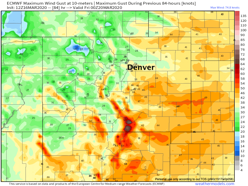
Along with the expected rain and snow, we're likely to see some gusty winds too. The Euro shows gusts from 40 to 55 mph, mainly south and southeast of Denver Thursday afternoon/evening, which if coinciding with the heavier snow would potentially produce blizzard conditions across the Palmer Divide.
So, how much snow? Too early yet to get all that specific. If nothing changes (it will), we think several inches will be possible, especially along and west of I-25 from the north side of Colorado Springs clear through Fort Collins and points Northeast. If we see a shift south, this could hurt totals north of Denver a bit but would keep the Palmer Divide in play.
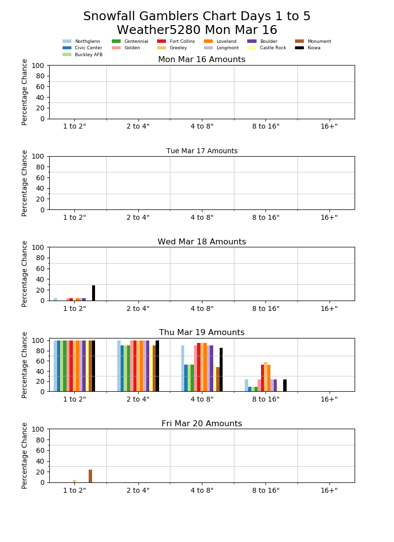
Our latest gamblers show high probabilities for 2 - 4" for all cities listed, with pretty good odds some areas see 4"+ as things look right now. The window for accumulating snow at this time looks to be from late morning Thursday through about midnight Thursday night.
We will continue to narrow in on the details, but plan for a soggy end to the week and likely some accumulating snow for some communities along the Front Range before all is said and done.
Be safe, stay healthy, and if you want to chat weather we are here for you! Let us know below, are you ready for a March snow?