Snow, heavy at times, on Thursday for Denver and Front Range

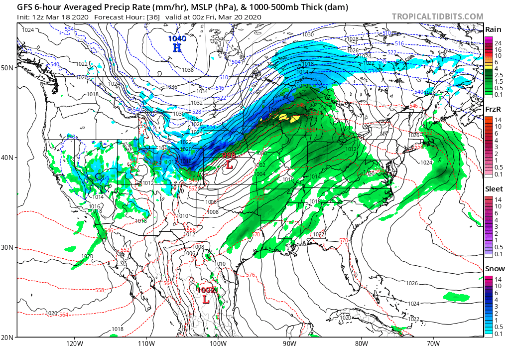
We continue to track the arrival of a strong storm system late tonight to impact your day Thursday with blizzard conditions to come for many.
Rain, snow, and strong winds will be the story tonight through Thursday, with chilly temperatures –– and even some snow –– lingering well into Friday across Northeast Colorado.
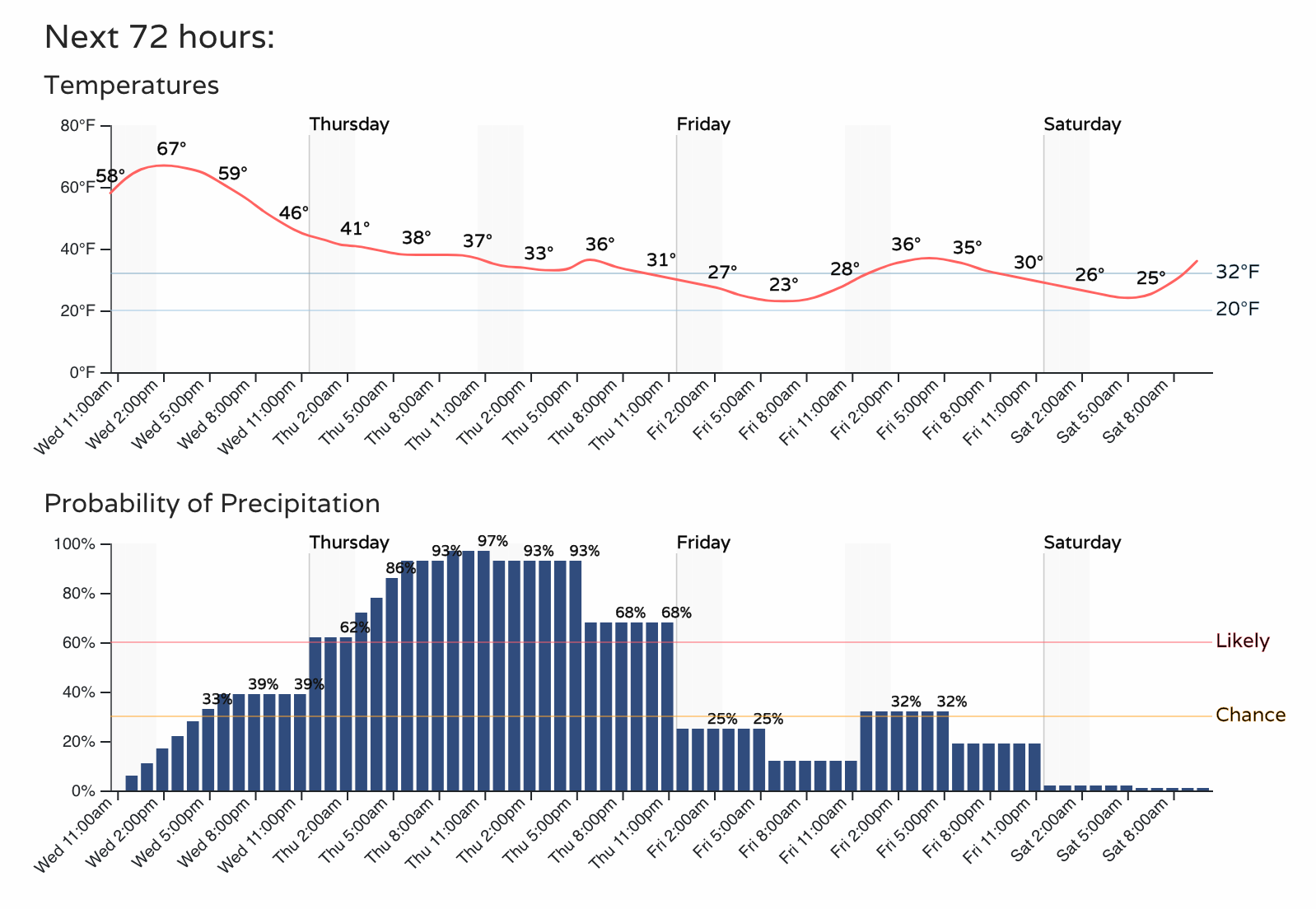
The hourly planner for Denver shows the steady increase in showers (perhaps even some thundershowers later today!) expected through late today and tonight, with temperatures gradually falling from a high of 68°F today in Denver to the low 20s by Friday morning.
The highest chance for accumulating snow comes Thursday morning through Thursday evening. When snow is at its heaviest is also when the wind gusts over 40 mph.
Snowfall totals
What falls vs. what sticks/accumulates is a tough call.
There are some rather bullish snowfall totals in some of the modeling, but temperatures will be pretty mild for a lot of us most of the day Thursday. That warmth will mean a lot of melting and compaction of the snowfall.
So, at lower elevations, we are being fairly conservative in our forecast. As you go up in elevations west of I-25 and south of Denver, there's a bit more potential for the snow to add up –– especially if we hold the more substantial snowfall off until late in the day Thursday. Plus, these slopes are such that ground temperatures aren't as warm as other orientations.
Some totals:
- Fort Collins (west): 2 - 6"
- Fort Collins (east): 1 - 4"
- Denver (downtown): 2 - 6"
- Denver (West/South/Southeast): 4 - 9"
- Boulder: 4 - 9"
- Castle Rock: 4 - 9"
- Monument: 7 - 14"
- Colorado Springs (downtown): Trace - 3"
- Foothills/Front Range mountains: 7 - 14"
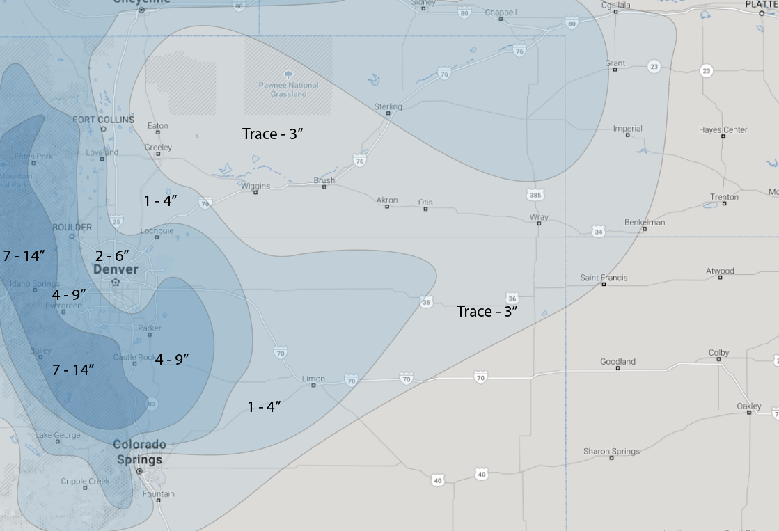
We'll see how this works out. Again, many models show a good foot of snow for the areas we have in the 4 - 9" range, and even 5 - 10" for Denver vs. the 2 - 6" we have downtown. We think with melting and "warm" daytime temperatures it's best to lean lower, at least at elevations less than 5,600 feet or so.
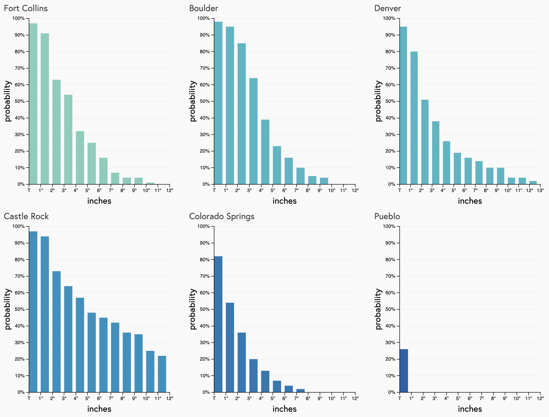
Our gamblers agree. Trailing high-end probabilities show the potential for some areas to boom, but greatest confidence in the lower-end totals. Castle Rock (Palmer Divide) perhaps sees the best chance at those heavier totals:
Lots of wind
As of right now, the strongest wind will likely occur on Thursday afternoon and evening. Gusts over 40 mph will be common, with some areas possibly gusting over 55 mph. The areas most likely to see those gusts will be areas east of Denver along I-70, areas along the Palmer Divide, and El Paso County...as well as most of the East/Southeast Plains. We've highlighted areas that will likely see the best snow, so if you are in an area that will receive snow with the mentioned wind, blizzard conditions will be likely. Thus, if you have travel planned east/southeast of Denver, or along the Palmer Divide, you will likely want to postpone that trip.
Regardless of totals, we know that travel impact is coming due to the intensity of the wind and periodically heavy snowfall rates.
That travel impact is likely lesser than otherwise due to the number of closures in place that has limited traffic volume. Blizzard conditions are possible over the plains.
Following this system will be a gradual warming trend through the weekend so that you can get back to the outdoors soon.