
Thursday PM brief: Winter Storm Warnings posted; keeping a close watch on latest data for any needed changes to forecast

A quick update this evening as we watch another round of 0z data come in. No real change in our thinking from earlier today, which is a good thing. On the table is a significant winter storm for the Front Range and immediate adjacent plains.
You can find our full discussion from earlier today below. We will aim to have our next full update on the weekend storm posted by midday Friday.
Thursday AM update: Storm track wobbles continue, latest probabilities for significant snowfall across northern Colorado
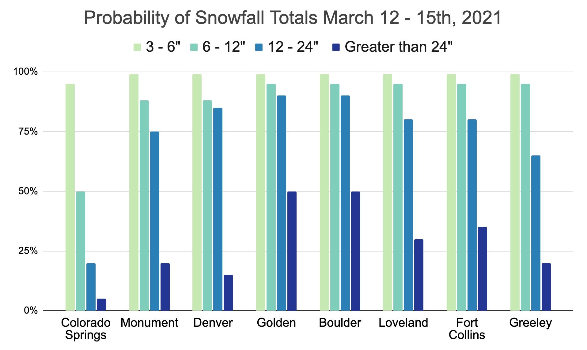
We continue to track a potentially significant snowfall event on the way for
north-central and northeast Colorado this weekend. While widespread totals in
excess of one foot of snow are possible, if even likely this weekend, there
remain some caveats to that depending on exact storm track, which thi…
Highlights this evening include:
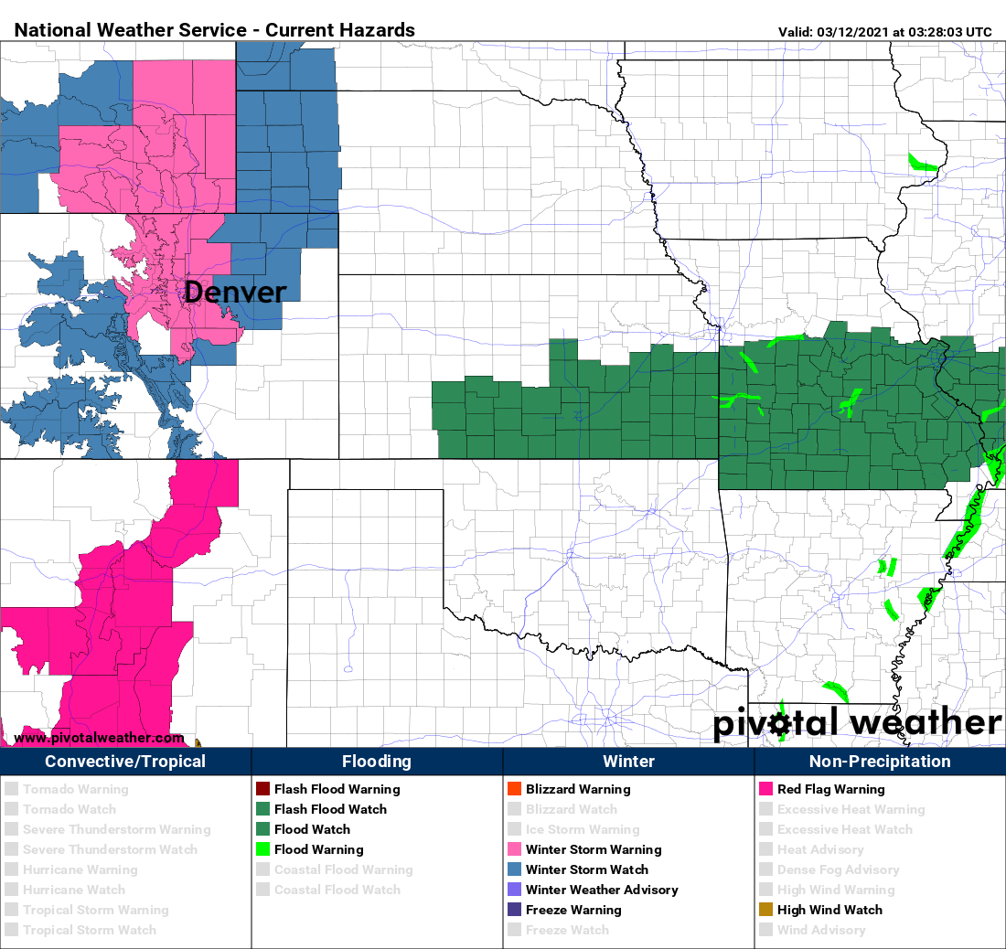
- The National Weather Service in Boulder has issued a Winter Storm Warning for the Front Range mountains, foothills and urban corridor. The Watch remains in effect for the Northeast Plains where more questions around warm air and ultimate snowfall totals keep uncertainty higher.
- The Warning goes into effect at 5am on Saturday, and ends 6am Monday. This will be a long duration event!
- Below is a look at the latest Watches and Warnings. The pink over north-central Colorado is the Winter Storm Warning, surrounding by the continued Watch.
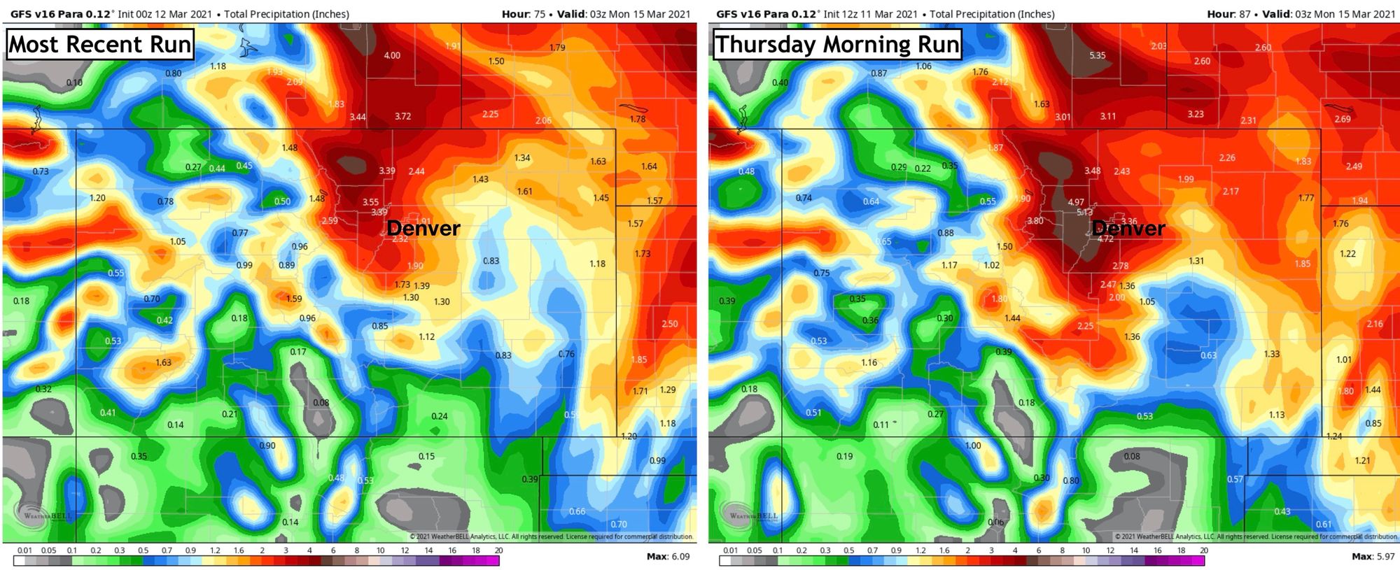
- While modeling today was pretty steady, there were some concerning elements. We won't read into most of them just yet, and see if it's a trend or a wobble problem. The short of it is – the GFS model continues to try and pull too much warm air too far west on Saturday, which if true would obviously hurt snowfall totals, at least in places like Denver. We continue to think the cold won't be the biggest concern with this storm, and the new version of the GFS remains much colder – in line with the other models. East of Denver temperatures may prove a bigger issue. We'll also give an honorable mention to the NAM model, which remains pretty darn far north with the heaviest snow, and not ideal for our forecast, so we'll ignore it.
- The GFS has steadily cut QPF today, even though it hasn't changed the track much. This too is probably okay, and is more than likely just getting us closer to reality after its printed jaw-dropping precipitation totals all week. The image below (left) is the latest run, and right is the run from this morning. Notice far less browns (4"+ totals) for our area:
- Tomorrow is going to be a big day. Can we hold this thing together and put together a top 10 snow event for Denver? Time will tell, but it's never easy. What do you think? Feeling good?
Finally, we won't tweak the probabilities tonight, and see if/what we need to adjust in the morning. You can find our snowfall forecast map here.
Until tomorrow.