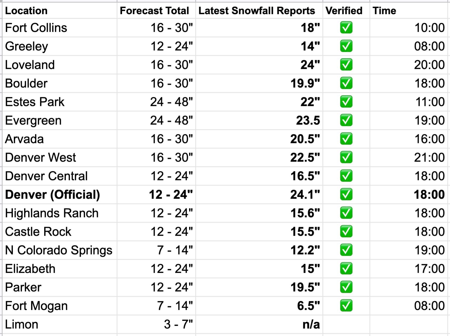
With 24.1" of snow recorded at Denver International Airport through 6pm, storm becomes 4th biggest on record

7:30pm: This post has been updated from a previous version to reflect the 6pm total at DIA. Some of the information will be out of date!
Well, we said we would just continue to update the post from earlier today with updated totals through the day, but given the news from DIA, and it looking like every location in our forecast area will verify, I thought a quick new post was warranted.
At 6pm Denver International Airport reported a storm total of 24.1", moving it into the 4th spot for snowiest storms on record for the city. It'll likely add to that total, but probably not move into the 3rd spot.
Elsewhere totals continue to come inline with our forecast. It appears the ongoing deep upslope will get all locations within range if they aren't already. You'll note some of the reported totals are several hours old at this point, and we will continue to update them through the remainder of the day.
Updated March, 14 9:30pm
A look at the top 10 snow events for Denver shows a number of them may be in jeopardy. The number 10 spot is 1883, with 19.3" of snow. It's almost guaranteed we've beat that at this point. Only about 3" separate #10 from the next five!
- 45.7 | Dec 1-5, 1913
- 31.8 | Mar 17-19, 2003
- 30.4 | Nov 2-4, 1946
- 23.8 | Dec 24, 1982
- 23.0 |Apr 23, 1885
- 22.7 | Oct 20-23, 1906
- 21.9 | Oct 24-25, 1997
- 21.5 | Nov 26-27, 1983
- 20.7 | Dec 20-21, 2006
- 19.3 | Jan 29-31, 1883
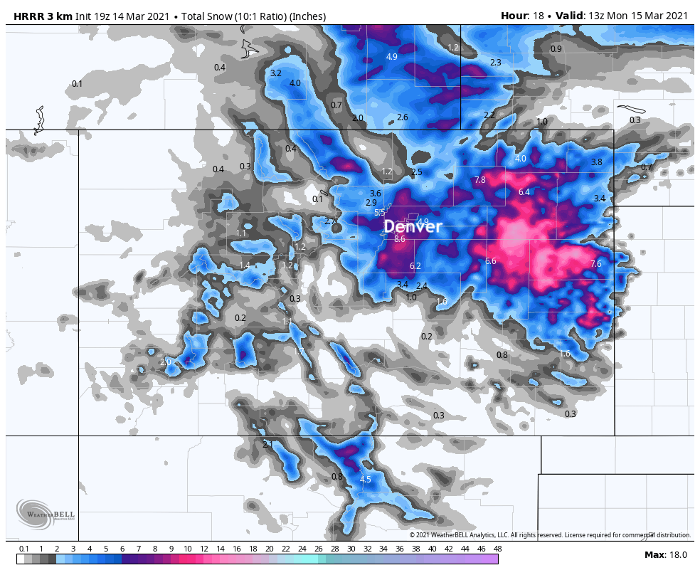
The trusty HRRR suggests parts of the metro area could see another 5 - 8" or so through tonight, and this includes DIA! Would make an impressive event all the more impressive if we can close in on #3 on that list!
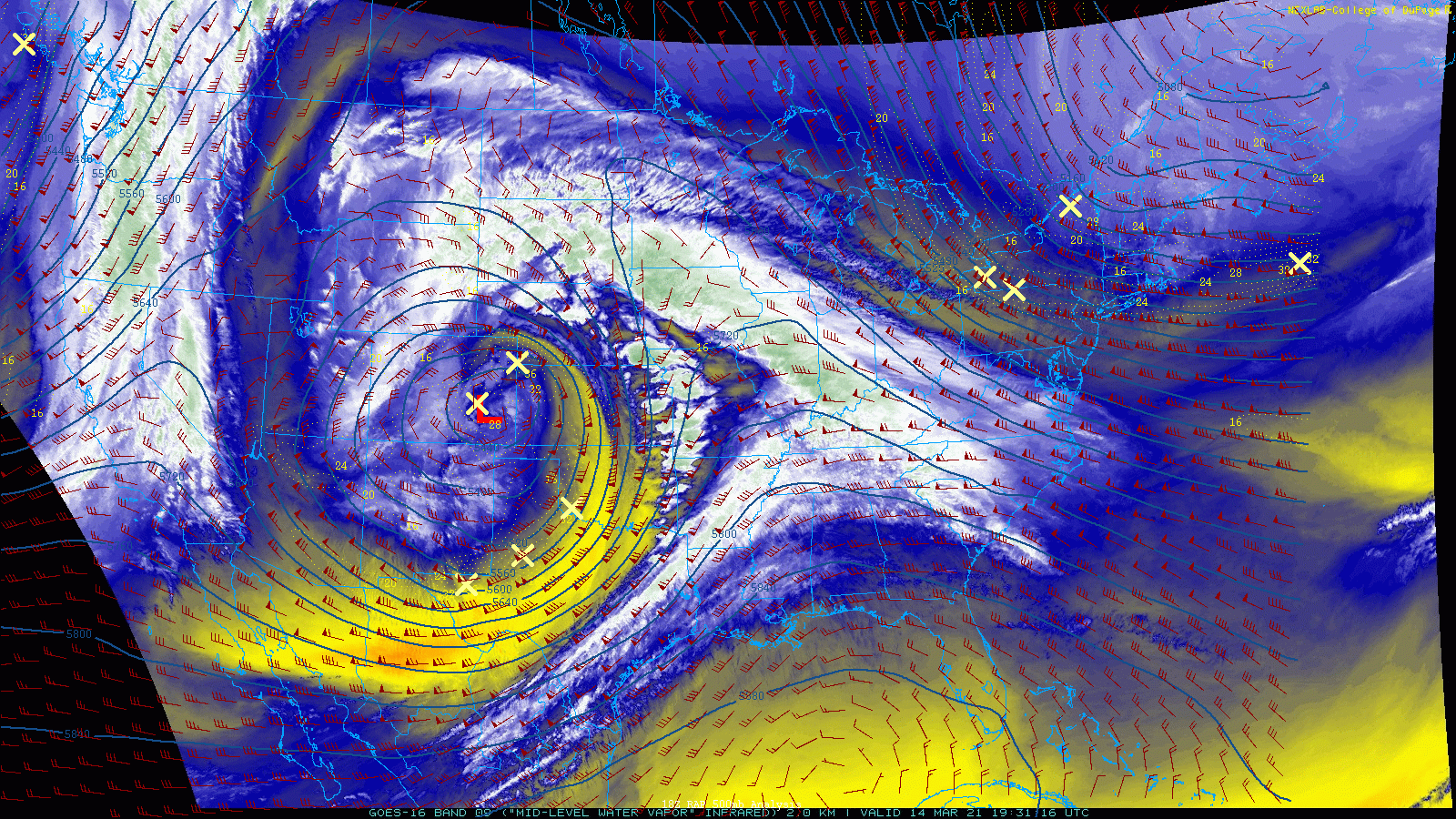
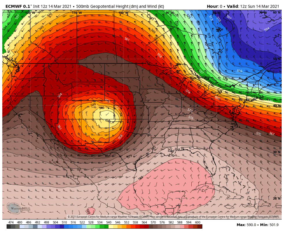
If we look at our system over the last hours, it's not all that hard to believe this, frankly. The Low is just not moving, and won't for some time. As soon as it does, snow will wind down, but until then we will continue of see pockets of very heavy upslope snow. I don't know how many times we hit on this over the last week, but such a favorable track and a storm that's virtually not moving, had so much potential to produce big time snow over a large area this weekend, and here we are. An absolutely stunning image right here:
It'll take awhile, but eventually the Low will kick east and northeast. When it does we'll see snow taper off across Northeast Colorado and will put this storm behind us.
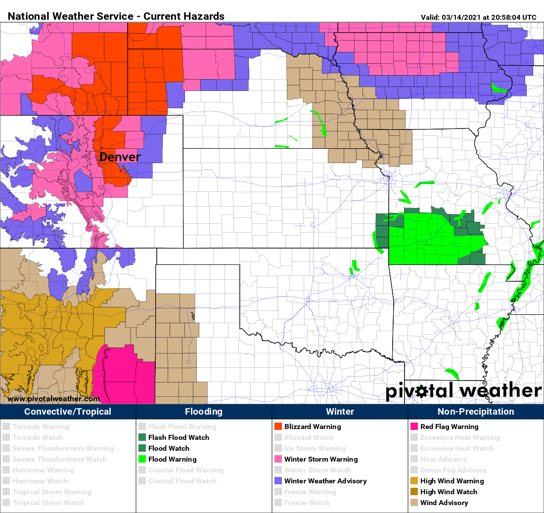
One last note, in case you haven't looked outside in awhile, the wind will continue crank through the remainder of the day. Gusts to 45mph will be possible, and with that the NWS in Boulder has issued a Blizzard Warning for the entire urban corridor. It is set to expire at midnight tonight.
Conditions will improve tomorrow, but it'll take some time. There will be a LOT of snow to melt, plentiful downed trees, and increasingly more folks without power.
Stay safe, stay warm, and keep the snow reports coming!