Sunday AM storm update: Heavy snow pushing many to forecast verification, others remain short; a running list of snowfall totals

First, thank you! We have the best, most thoughtful, and engaged readers in the region. All of your comments last night meant the world, and we are happy to report it's much harder to hear all the internet trolls this morning through all this snow! ❄️💨
While some areas haven't made it to forecast verification just yet, others have hit the low-end forecast and some, with still many hours of snow ahead today and into tonight.
Below is a look at snowfall forecast numbers and totals for number of cities across the region. Note that many of these reports are from 8am this morning (or earlier even), so much of the great snow we have seen over the last couple of hours has not been counted! We will continue to update this table through the day, so check back.
Last updated: March, 14 9:30pm
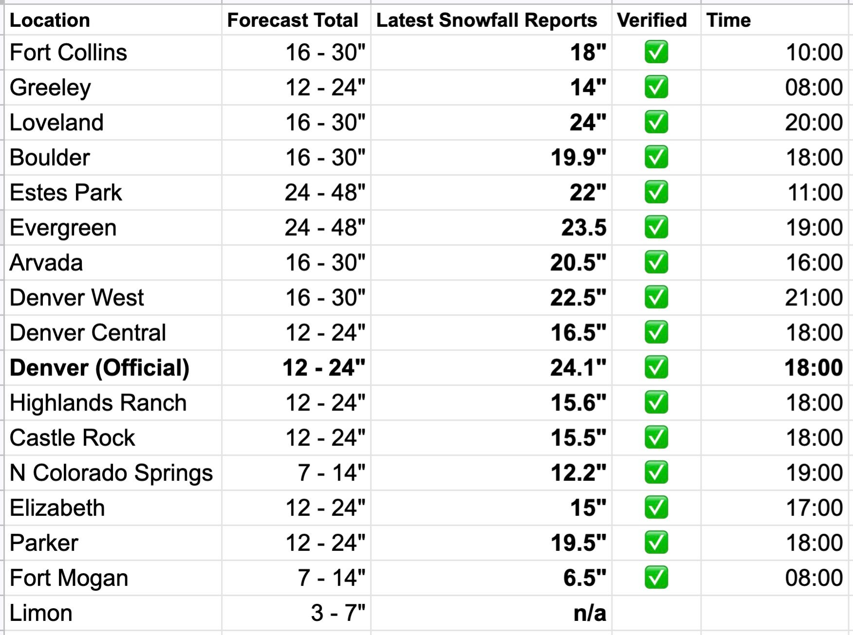
As you can see, we've got a few green checks rolling in, and expect some more to be added to that board as we get updates through the day.
Denver International Airport reported 11.1" as of 6am. It's been dumping snow out there much of the morning, so we have no doubt the forecast will verify at the airport, and thus Denver officially.
As of 10:00am our station on the west side of Denver had picked up 7.0" of snow, with heavy, wet snow continuing. Obviously a ways to go if we want to hit our low-end. We'll see how close we manage to get.
Again, many of these totals are very outdated. We have received reports of close to 20" for many foothill locations this morning, and expect today's continued upslope to drive totals in the foothills much higher in some spots.
Northern cities buried
The greatest totals along the urban corridor have come up north of Denver, as expected! Loveland and Fort Collins are both reporting totals from 15 - 18" this morning, with snow continuing. Our forecast of 16 - 30" will verify wonderfully there. The snow is extremely wet and heavy.
Playing catchup
Other than the airport, a good portion of the Denver area remains below forecast totals this morning, even as we finally have some heavy snow pushing through with well-established upslope flow in place.
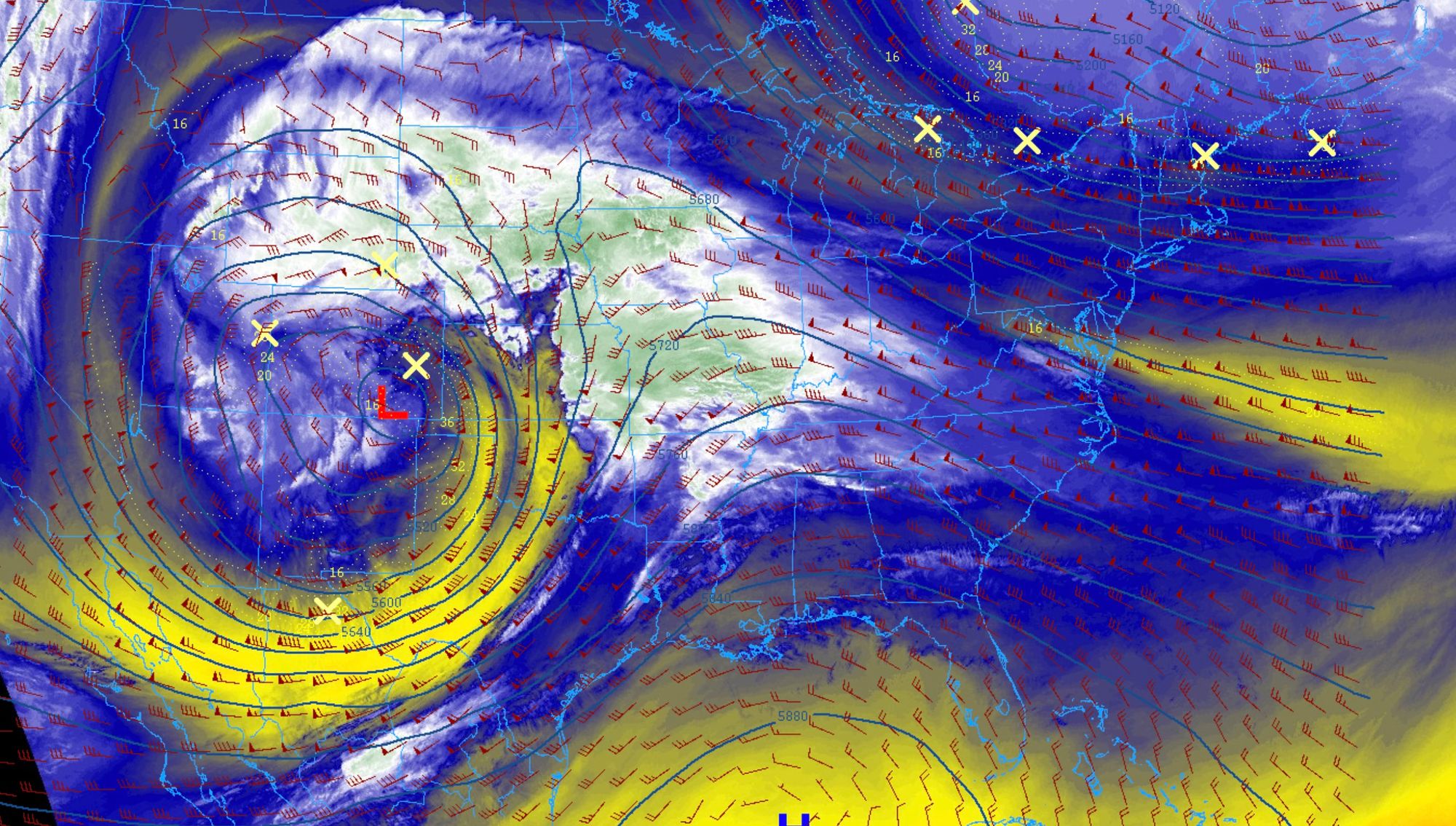
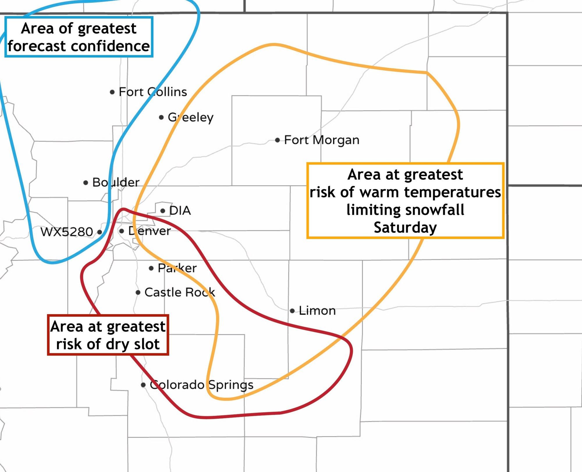
We've been play catchup all morning, after being dry-slotted much of Saturday and overnight. Even as things picked up overnight, it took quite awhile for this area (show in radar last night at 10:30pm) to overcome that dry air. Once true upslope took place the dry-slot was no longer an issue, but for the metro area that put us well behind some of the surrounding areas. You'll recall our post earlier this week that outlined this potential.
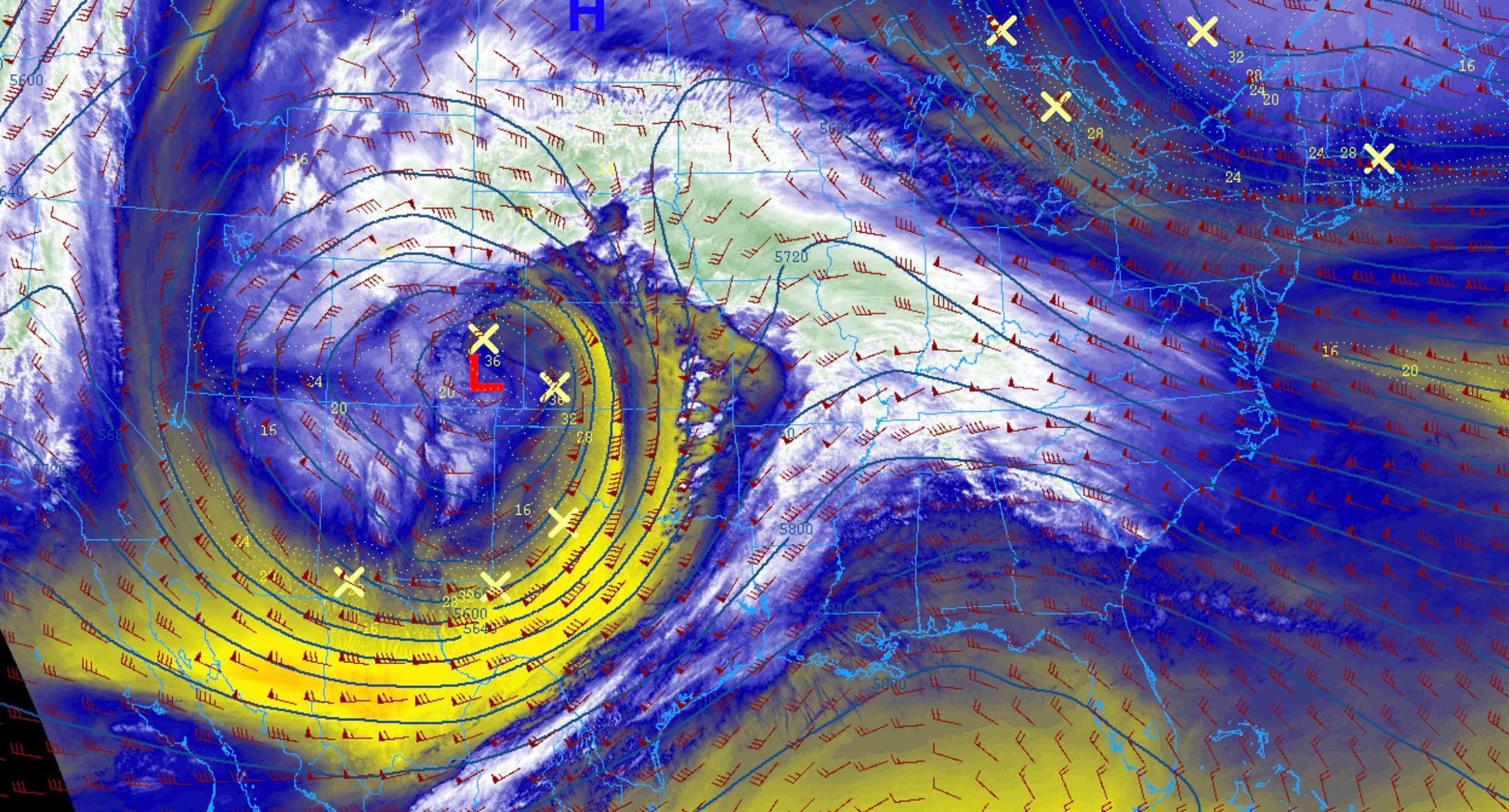
A look at water vapor satellite imagery valid the same time last night we can very clearly see that "slot" of dry air pushing right into Denver. Drier air is indicated by the more yellowish colors, vs the whites and greens indicated more moisture.
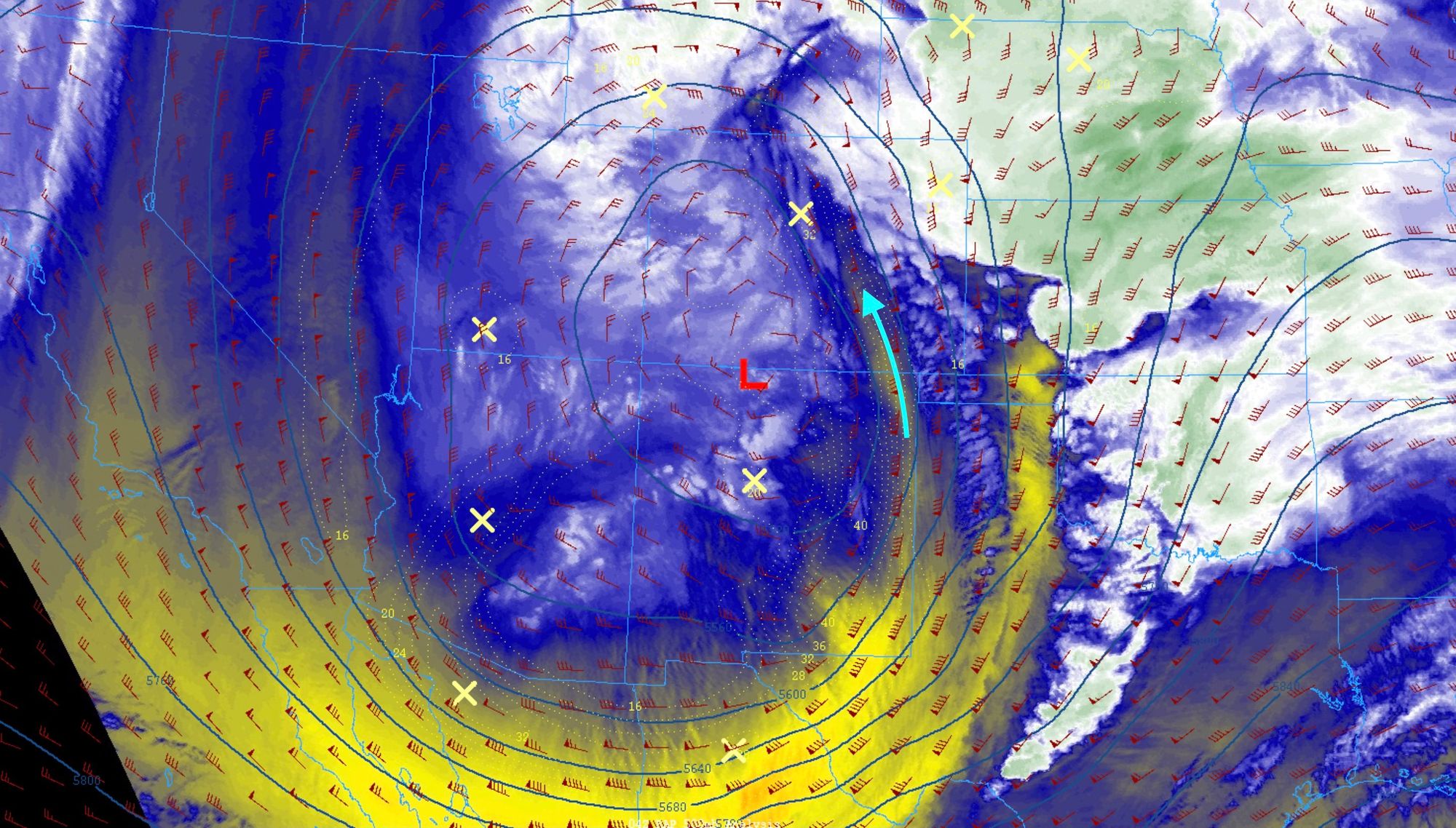
If we match up the areas that snowfall totals have verified this morning for (Loveland, Fort Collins, foothills, etc) and the areas which have not with our handy graphic from Friday, we can see we indeed had a pretty good idea of where to be concerned about dry air impacting forecast totals, and where confidence being higher proved correct!
Today and tonight
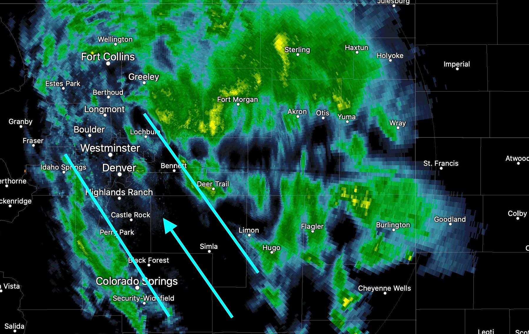
As of mid-morning the mid level low is focused over Southeast Colorado. The low continues to move slowly east/northeast today, and as it does we'll see good upslope flow continue for several more hours, and eventually likely capitalize on some wrap around moisture late into tonight for many locations across Northern Colorado.
Remember when everyone called it quits on this thing LONG before it even got east of the mountains yesterday? How is that even possible?
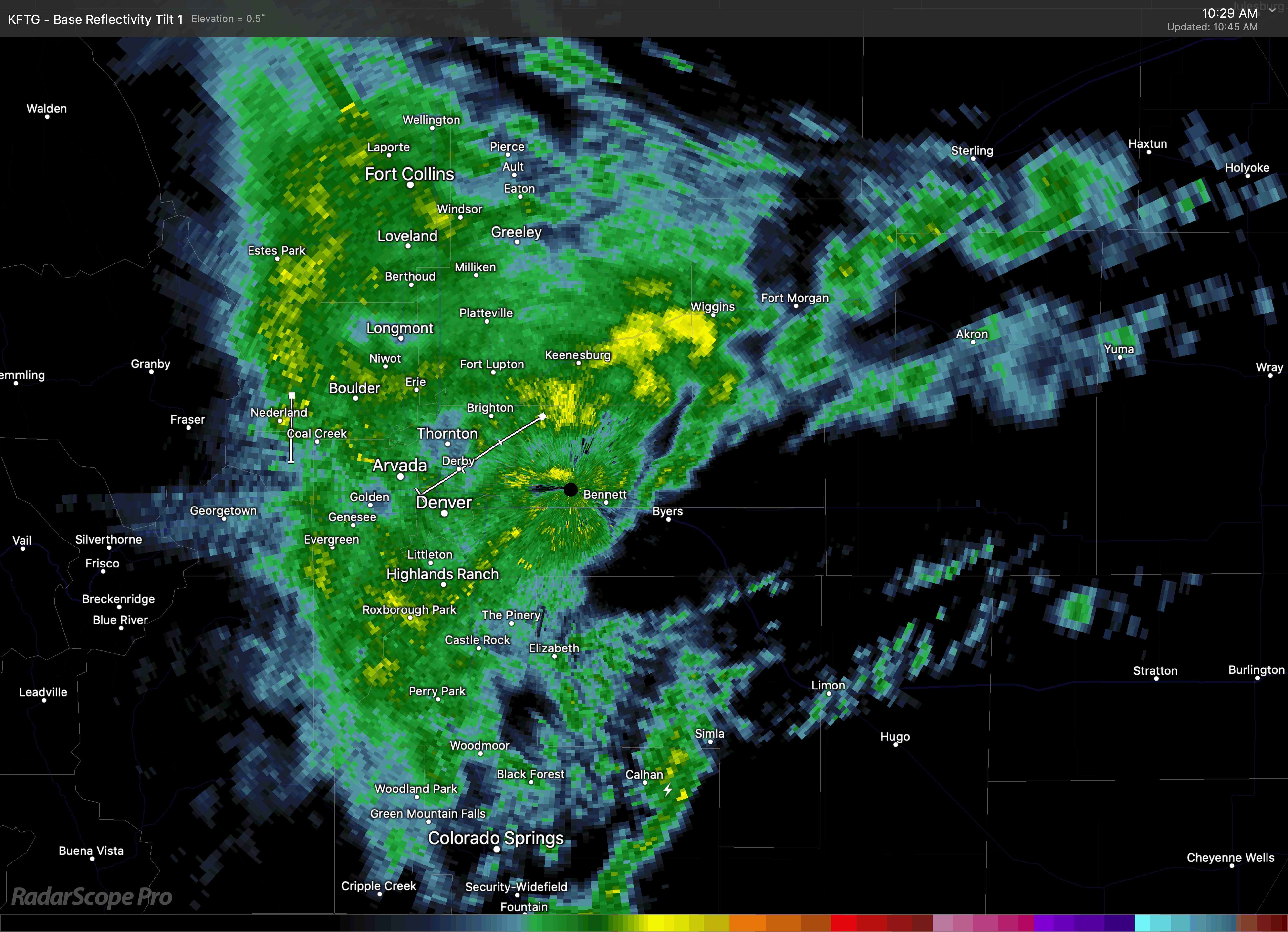
Upslope flow is evident in the radar here this morning. A lot of moisture being thrown up against the Front Range of the Rockies today, with some locations likely to pick up quite a bit more appreciable snowfall today and tonight before this system finally kicks east.
It's beautiful, isn't it?
So, how much more snow?
Well, we think some locations will manage another 5 - 10" or more additional snow by Monday morning. At lower elevations and closer to the city core those totals may be closer to 3 - 6", depending on melting, compaction, and that high March sun angle! The system isn't going to move all that much for the next several hours, so expect periods of heavy snow and wind to continue into Sunday evening for much of the region.
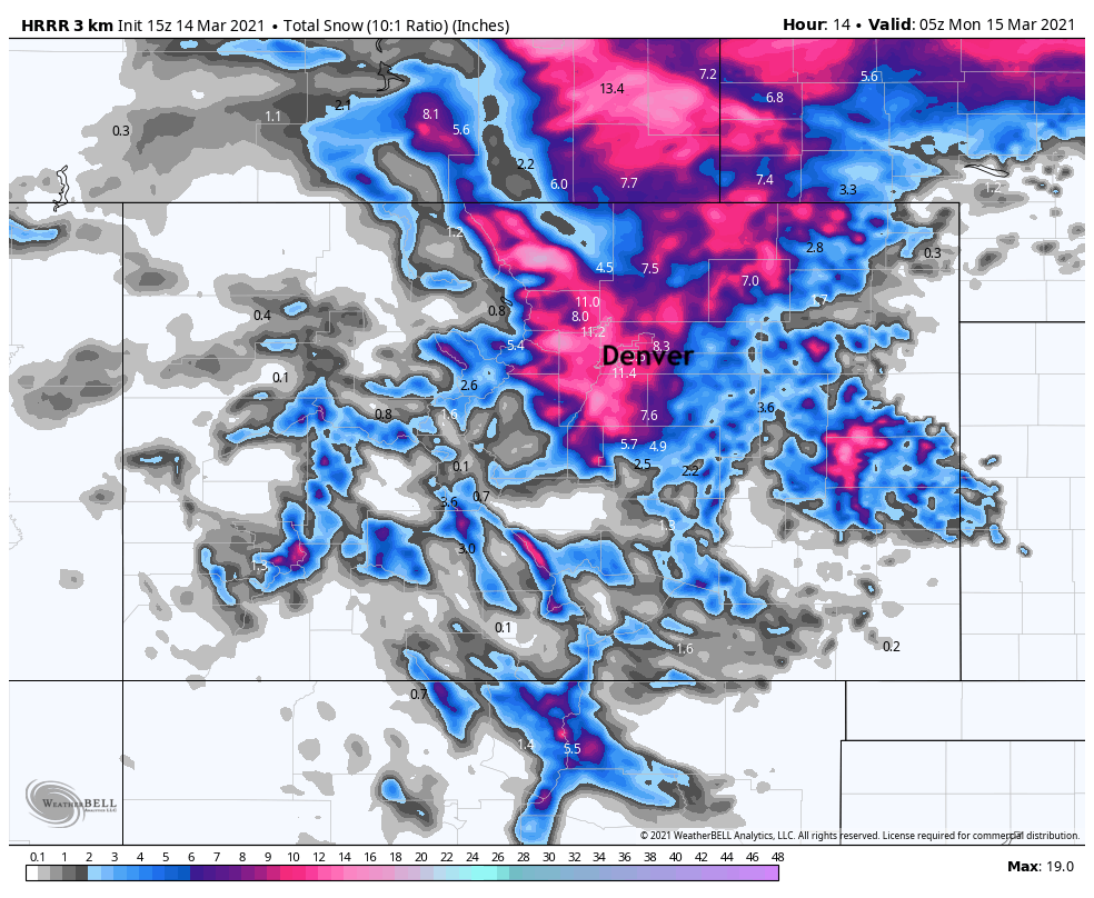
The HRRR remains rather bullish for additional snowfall, showing 8 - 12" for the Denver metro area, which would get everyone within our forecast range if it is to verify. With good upslope in place, we do see snow continuing well into Sunday night (off and on), but how much snow will accumulate today will depend on rates. We have to consider the fact this is VERY wet, heavy snow, and it will compact quite a bit today. So, does Denver see a measurable additional 8 - 12"? Perhaps not, but at least we'll see several more hours of snow, and several more inches before all is said and done.
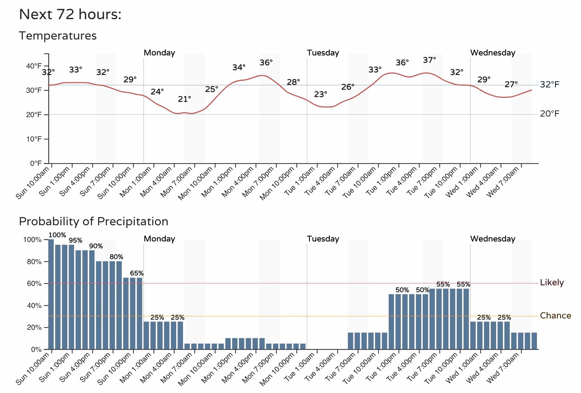
With that, here's the latest hourly planner for Denver. The chance of snow will diminish after midnight tonight, but some models keep at least showers lingering into Monday morning, we'll see how fast the storm clears.
Yes, there's another chance of rain and snow in the forecast Tuesday afternoon and evening. Right now most guidances keeps the most impactful weather well south of our area, but we'll keep an eye on things and start to roll out updates for Tuesday's system if need be.
It's been quite a week, and quite a storm! Please stay safe today, and stay home if possible! Things will begin to improve late tonight and Monday, but until then the roads will remain a mess, and downed trees/power lines will be a possibility and likely an increasing issue through Sunday evening.
The snowfall totals listed above will be updated through the course of the day, so please check back! We hope to fill out that list with plenty more ✅ before the day is through.
As always, let us know how things are where you are, and if able share some pictures in the comments below!