
Wednesday PM update: A check on the region's next chance of snow

A quick-hitting, weak shortwave swings through the region tonight. This system, which we noted in this week's SOTA as not looking all that impressive, looks even less so today.
At 500mb, it's hard to even discern, just a little wrinkle in the flow over Colorado:
A few isolated showers will be possible, mainly along the higher terrain of the Front Range foothills and Palmer Divide, with little to no shower activity for the northern urban corridor expected. There will also be an uptick in wind across the region, especially at higher elevations as this system passes through.
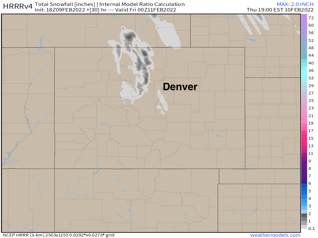
The HRRR shows who may see some of that snow shower activity, the north-central mountains could see a coating to 3", with only a quick trace for the hills southwest of Denver on this model:
Thursday will be a mostly quiet day across the state ahead of our next wave set to move through Friday into Saturday. You can see in the 500mb map from Friday morning through Saturday a bit more of those blues traversing the state, where this wave is a at least a little stronger than the one today.
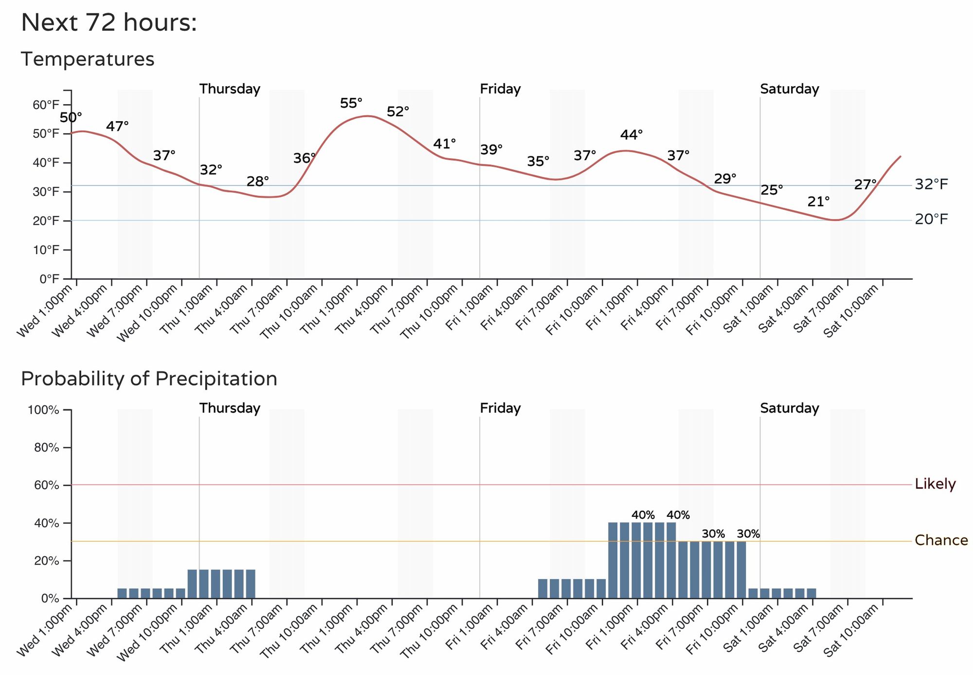
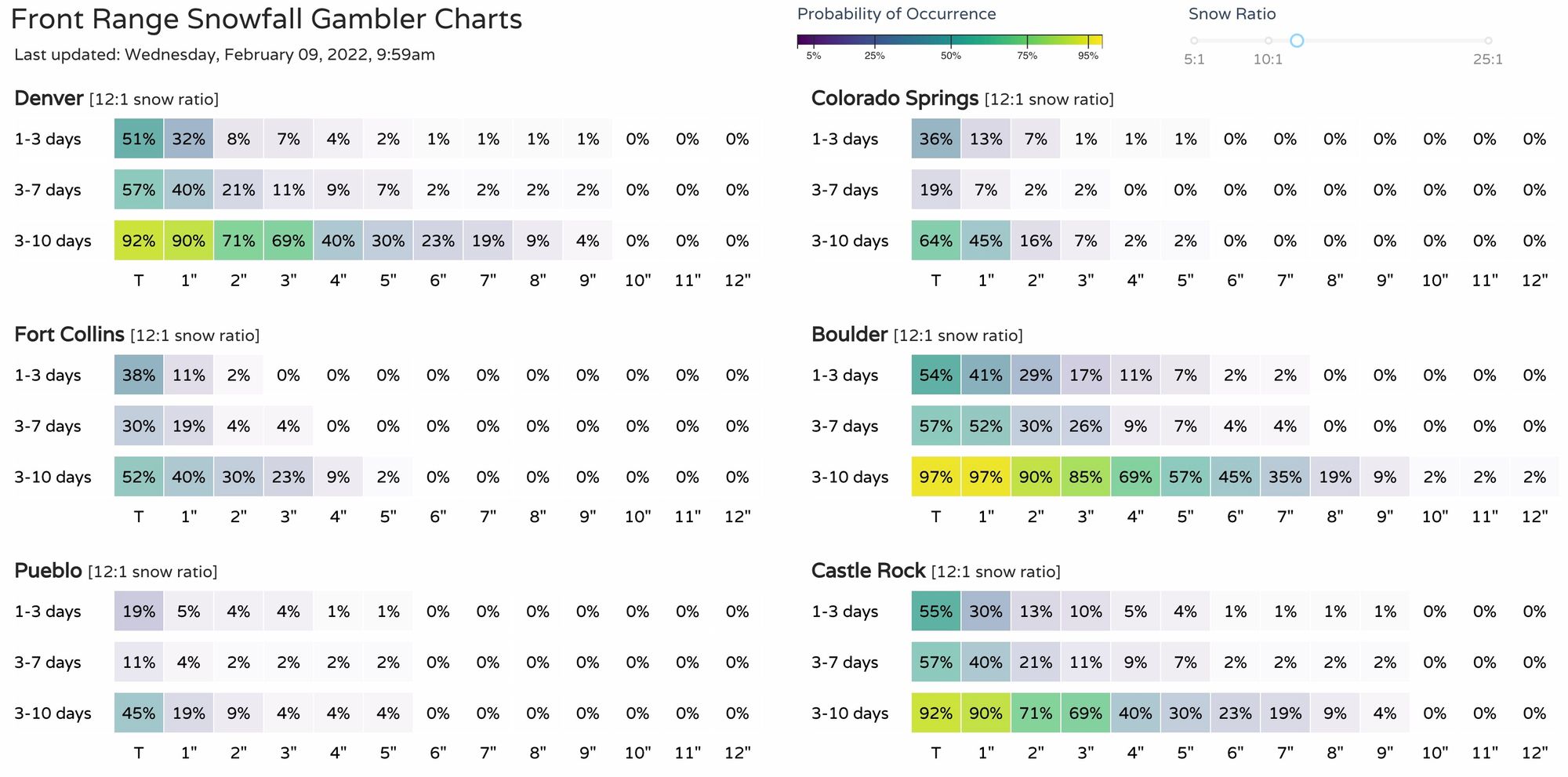
This will equate to a slightly better chance of snow on Friday into Friday evening, with about a 40% chance for Denver at this time. Chances will be a bit better for the foothills west of town. Temperatures won't be all that cold, but where we do see snow on Friday could lead to a slow/slick evening commute.
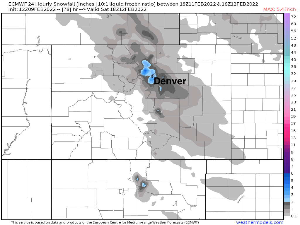
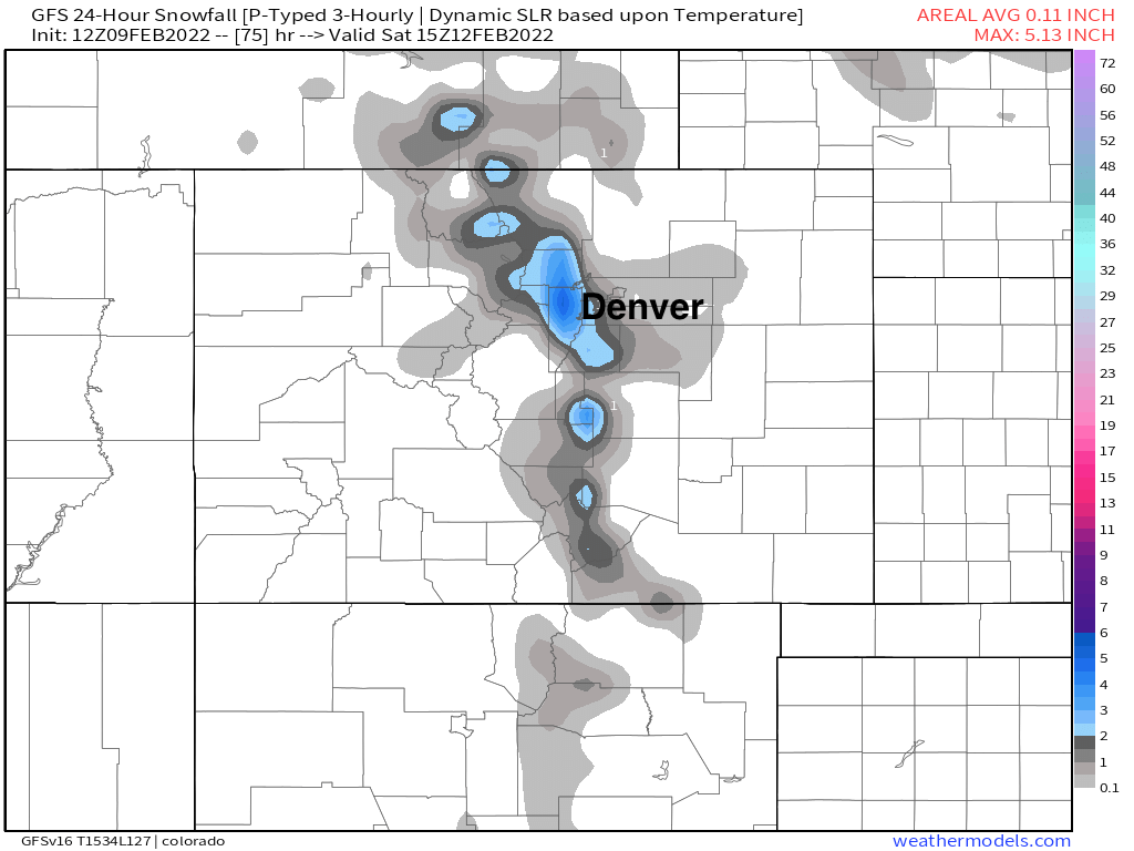
The GFS and Euro are in reasonable agreement now with regard to Friday's snow chance, both showing the potential for a band of 1 - 4", but not a particularly widespread snow event.
Both favor Boulder and Jefferson counties for the best snow potential Friday, but some of those heavier showers could spill onto the adjacent plains, so certainly worth watching the forecast as we get closer.
Euro 24 hour snowfall forecast Friday into Saturday
GFS 24 hour snowfall forecast Friday into Saturday
The snowfall gamblers reflect this idea:
Despite Friday's snow chance, temperatures won't turn all that cold today through the weekend. Highs in the 40s and 50s most afternoons, with highs possibly back into the low 60s by late weekend for Denver.
A system drops into the Great Basin early next week and will eventually move through Colorado – bringing with it colder temperatures and a chance of snow to much of the state by the early to middle part of next week.
More to come!