Monday PM update: Cold, cold, and more cold while eventual snow totals remain a big question

A quick update this evening to let you all know the cold has arrived! (Could you tell?) At 10 pm DIA was down to 9°F after topping out at 51°F this morning just before 11 am. The front was impressive, with the bottom falling out in a hurry, and the temperature rebound won't begin for several days now.

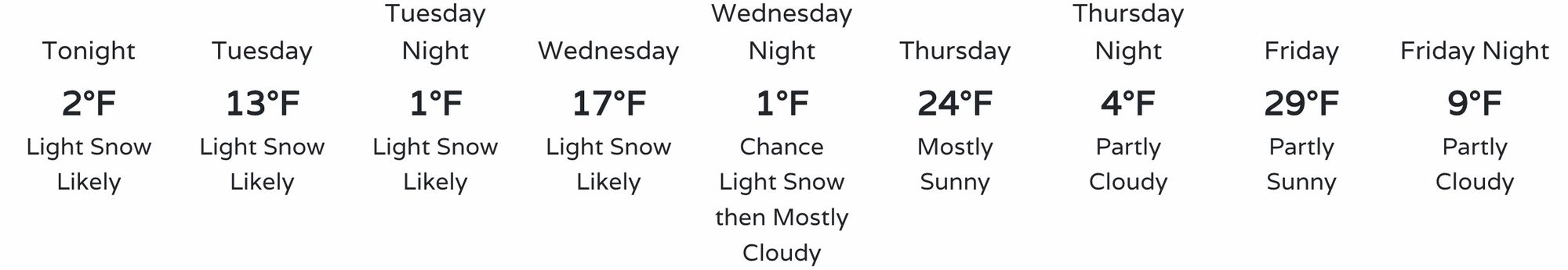
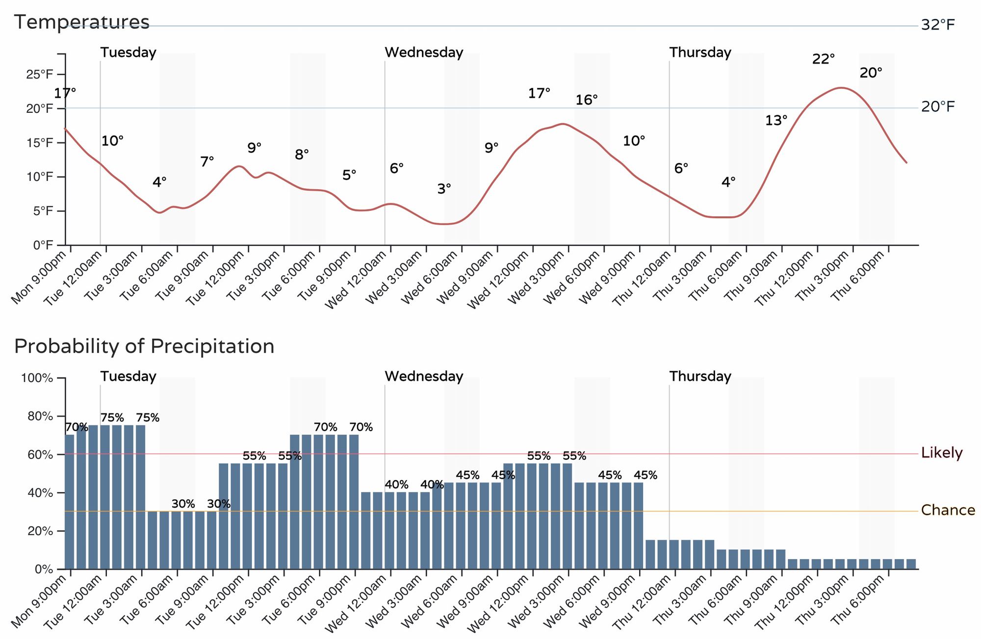
For the urban corridor, this means the well-advertised cold air is here to stay through at least Thursday, and depending on what you consider cold a bit beyond that as well. Tuesday and Wednesday will be the coldest days of the week with some moderation thereafter. "Highs" both of these days will be in the teens, with single digit lows in the forecast through the end of the week.
Quite honestly we've been struggling a bit with the snowfall potential with regard to this week's setup. As we outlined in the SOTA, the mountains west of the Divide will do very well, but Eastern Colorado, particularly right along the urban corridor and Front Range could still go either way.
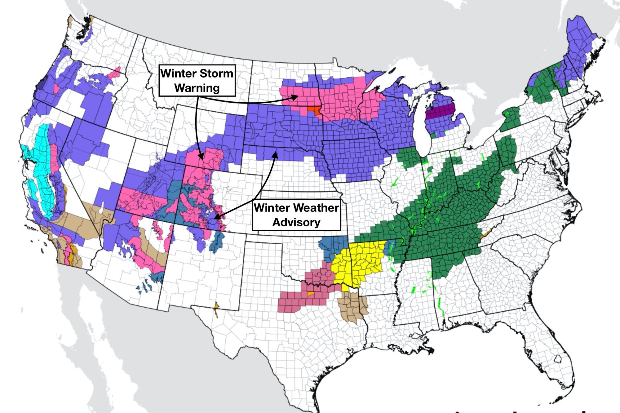
With the continued uncertainty around totals, and the long duration of light snow potential for the eastern half of the state, no snow-related NWS advisories are in place at this time for our area.
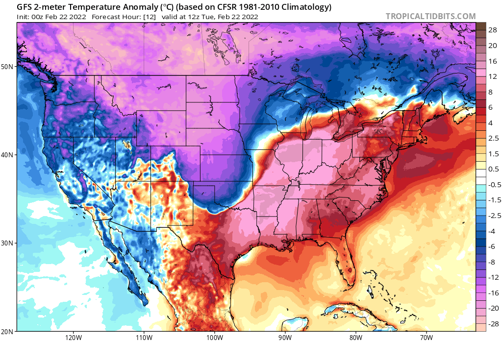
Across the western half of Colorado, and really a good chunk of the CONUS, this is not the case – with lots of winter weather highlights in place from the intermountain west across the High Plains and into the Great Lakes.
As we discussed at length in yesterday's update, what snow we do see this week won't all come tonight. In fact, the best potential may hold off until Tuesday and Wednesday for many areas.
Through Tuesday afternoon the latest HRRR shows about a Trace to 3" for the urban corridor from COS through Fort Collins, with the greatest totals again west of I-25. For the foothills perhaps a few locations see some 4 - 5" totals by tomorrow afternoon. For Denver specifically, this model has 1" of snow between now and then.

The blend of models is hardly even this excited, showing just 0.5" (maybe?) for Denver through early Tuesday evening, and really focusing any meaningful accumulation between now and then right in the foothills west of Boulder and Loveland, as well as also hinting at a band for COS as the HRRR has above.
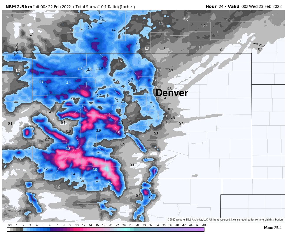
By the time things are done with Thursday the NBM has about 1 - 3" for Denver (and most of the northern urban corridor), with 3 - 7" right along the foothills, and some locally higher totals as you head into the foothills. It's hard to argue much with this idea, especially acknowledging this is a low-confidence forecast.

With all that said, here's our latest forecast through Thursday for snow. The greatest bust potential is for the 2 - 5" range, as there are some models that really struggle to even accumulate that much for the Denver area, with greater confidence in snow accumulations as you get closer to the hills. West Fort Collins, Golden, Castle Rock, and West/North COS we have in the 3 - 6" range, with western Boulder and immediate foothills in the 5 - 10" range. We'll see!

The snow won't come all at once, but the cold will! The hourly planner shows temperatures hovering in the single digits and teens over the next couple of days, with snow chances increasing and decreasing over time, but eventually dropping off come Thursday.
Stay warm, and let us know if and when you see snow!