The State of the Atmosphere: Sunday, February 20th, 2022

The state of the atmosphere remains very active here to start 2022, with the coming week featuring more snow and bitterly cold temperatures across the Front Range.
The upcoming week will also thankfully feature some good mountain snow as well. While last week's system did deliver some snow to the high country, the pattern overall has favored the eastern slope far more than the central and western mountains where snowpack has fallen behind a bit since December.
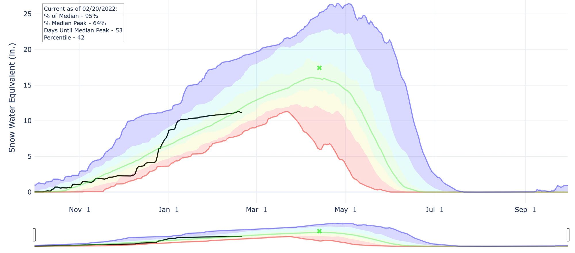
Here's a look at the latest SNOTEL data from the Colorado River basin, where median snowpack is still 95% of average, but a rather remarkable flat line since climbing well above average during the active end of 2020:
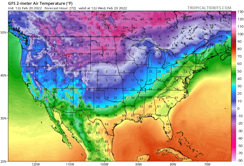
The week ahead will feature both a remarkable push of cold, and several shortwave disturbances which will bring off and on snow to much of the state Monday PM through Thursday.
We talked about the cold in the last post, but will offer greater detail into the snowfall forecast now.
These setups are difficult to forecast for many reasons, not the least of which is the duration. Snow totals discussed below won't come all at once! We'll go ahead and talk numbers between Monday evening and Wednesday afternoon (a long event!) with the possibility that we could add to that Wednesday evening into Thursday. With that, do not wake up Tuesday expecting to see the totals discussed below, but instead know that what snow we see will take several days to accumulate.
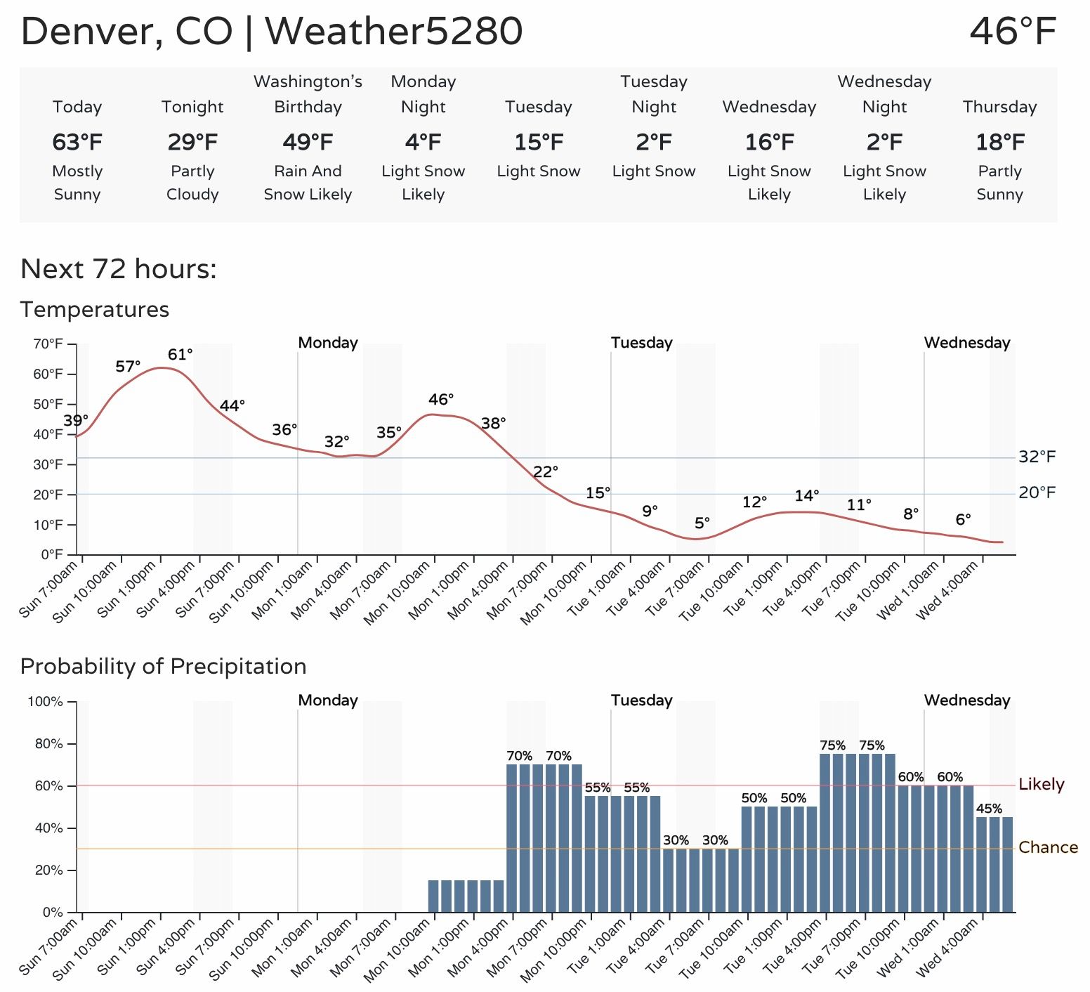
We'll be warm again today ahead of the cold changes on the way late in the day Monday. While some models warm Denver into the 50s Monday before moving the cold front through Monday evening... these fronts, more often than not, arrive ahead of schedule. Highs Monday are far from certain, but know we could see at least a few hours of relative warmth before the cold moves through – but it's coming!
As you can see above, the chance of snow will increase Monday evening as well as the cold air moves in. We'll see that chance of snow off and on through Tuesday, Tuesday night, and Wednesday!
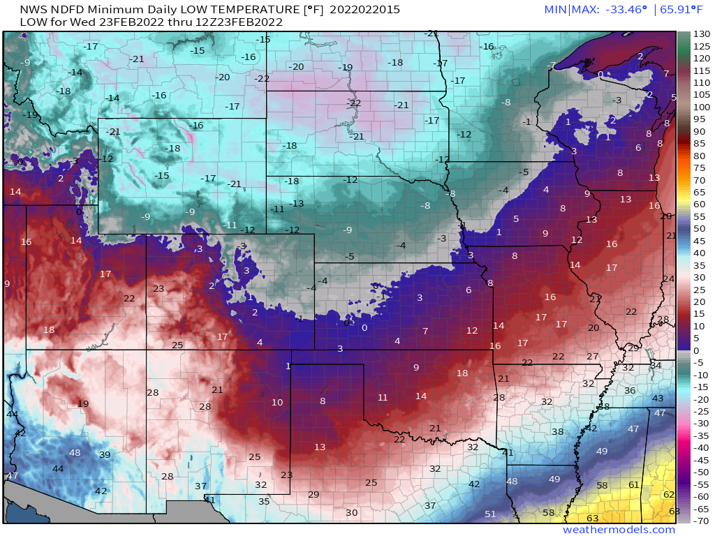
Daytime highs will be in the teens Tuesday, Wednesday, and likely even Thursday before temperatures begin to moderate for the weekend. Overnight lows will be in the single digits to below zero each night.
As for how much snow...
Not a fun setup to try to make a meaningful snowfall forecast. Here are the key takeaways:
- Mountain snow will be likely Monday PM through Thursday, with snowfall totals from 1 to 2 feet possible (locally higher) over the period, especially along and west of the Continental Divide.
- A prolonged period of light snow will begin Monday PM for the Front Range and urban corridor, and continue off and on through Wednesday. Snow chances and subsequent totals will be greatest along and west of I-25, where several inches may add up this week.
- The combination of the very cold air in place, and ongoing light snow, will equate to poor travel across the region for much of the week.
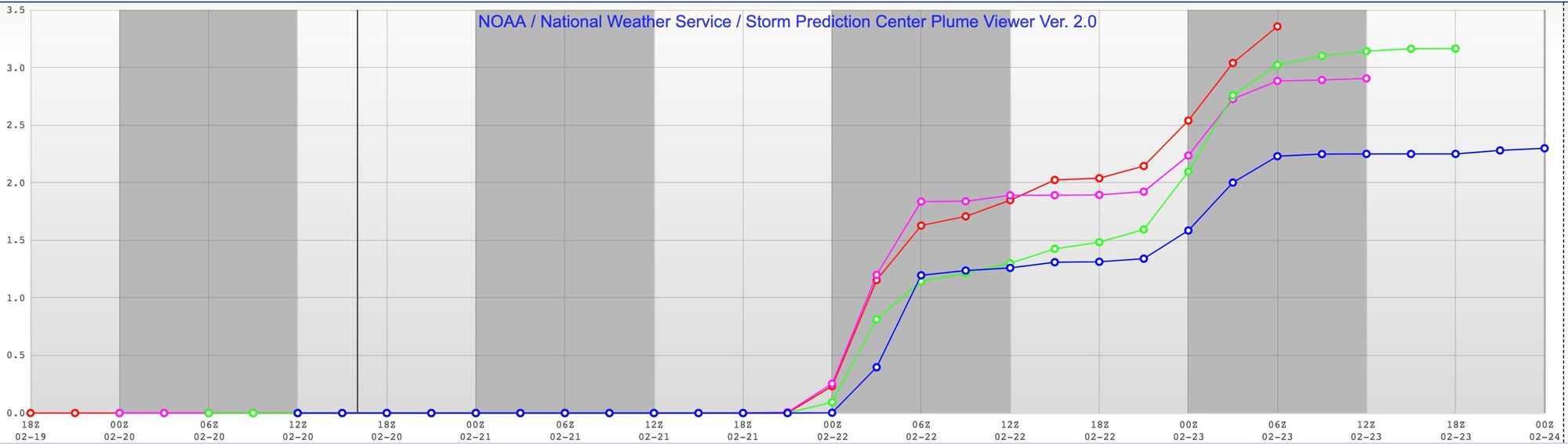
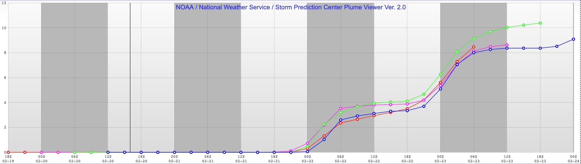
Models aren't in great agreement for how much snow we are likely to see along the urban corridor. There are two camps – those with greater snowfall totals and those with very light totals over the course of several days. What they all agree on is the best snow accumulations will be seen further west.
The SREF, for example, has just 2 to 3" at DIA for the week (with the most recent run showing less snowfall potential), but it has roughly 8" total (~4" in the first wave, 4" in the second).
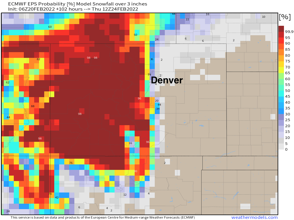
The probability for 3" of snow or more from the European ensemble model reaffirms this idea. West of I-25 decent odds, especially up around Boulder and west Loveland/Fort Collins, but odds dramatically drop off east. Across the high country, odds are there will be at least 3" of snow this week, and again, likely far more than that in most cases.
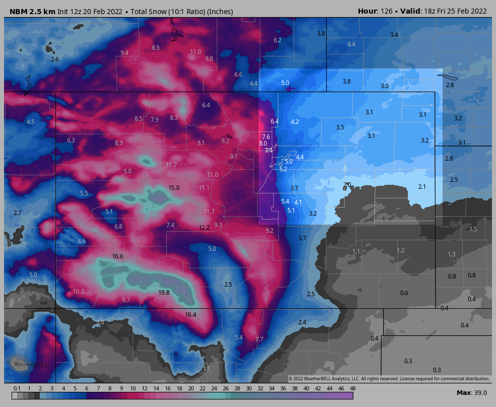
The National Blend of Models is very bullish on totals, and the ones below are considering 10:1 snowfall/liquid ratios, which will be far too low. For Western Colorado, highlighted, widespread accumulations of more than 10" of snow or more on the way:
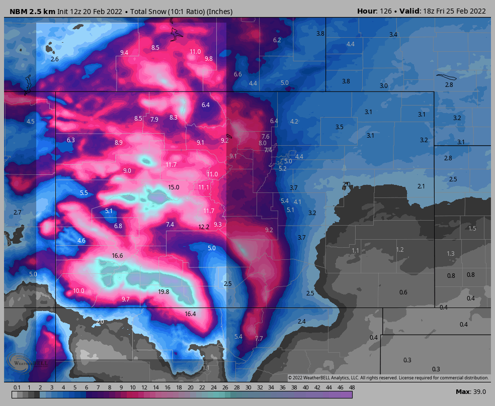
Across Northeast Colorado it too is bullish... that's 5.0" or so for Denver along and east of I-25, and upwards of 6.0" for the western suburbs. Considering some models aren't quite so bullish on QPF as others (and QPF is often overdone with these arctic setups), this could be a good place to be. Several days of off and on light snow could add up in many locations even if moisture lacks.
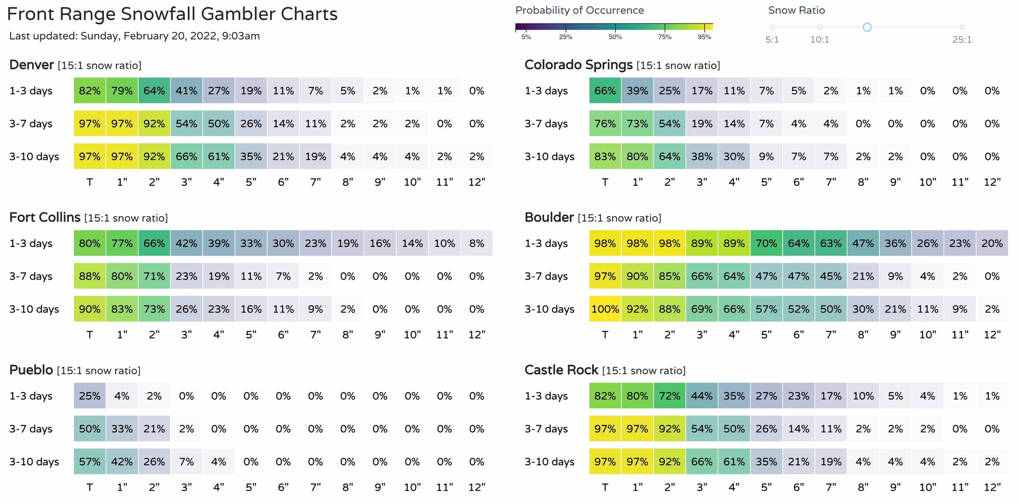
Our snowfall gamblers show a similar idea, with high-end totals being favored west (Boulder has a greater than 60% chance for 6" of snow or more), with lower totals east. Fort Collins is intriguing with probabilities for high end totals showing up, with Denver proper most likely to see 4" of snow or less taking these verbatim.
And finally our snowfall forecast. This takes of from Monday afternoon through midday Wednesday, with additional snow possible Wednesday into Thursday.
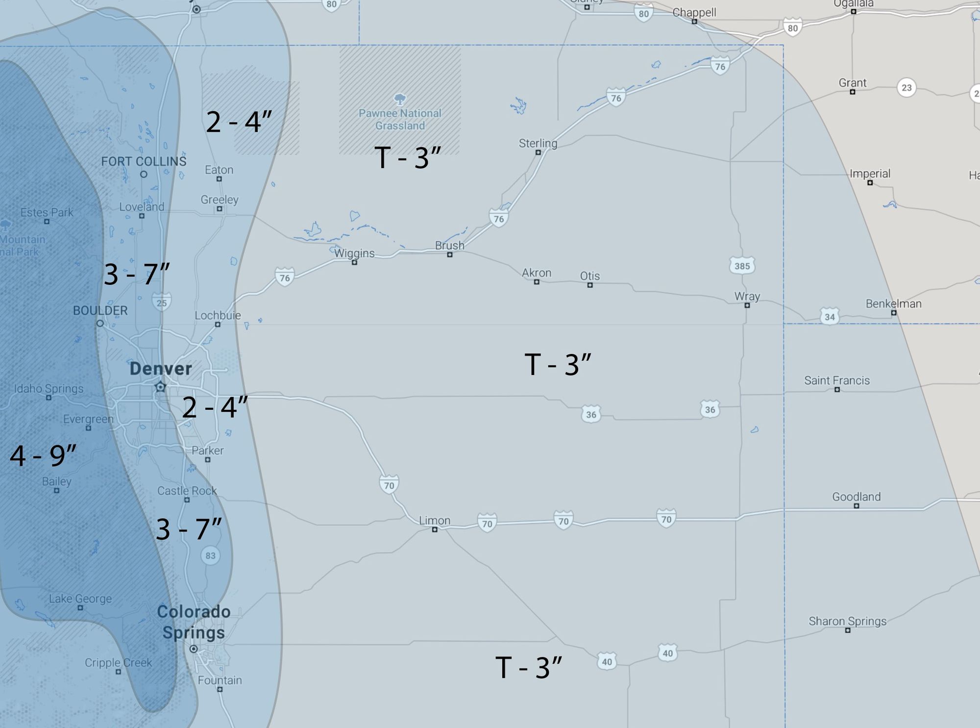
This is a low to medium confidence snowfall forecast, but high confidence temperature forecast. With that, we'll adjust snow totals as needed, as we see how wave one pans out Monday into Tuesday and how the following pushes of snow look thereafter. These totals will be updated and refined over the coming days.
For now, get out and enjoy the warmth, and get ready for sharply colder temperatures on the way Monday PM through Thursday!