La Niña update: Weakest SOI in over two years

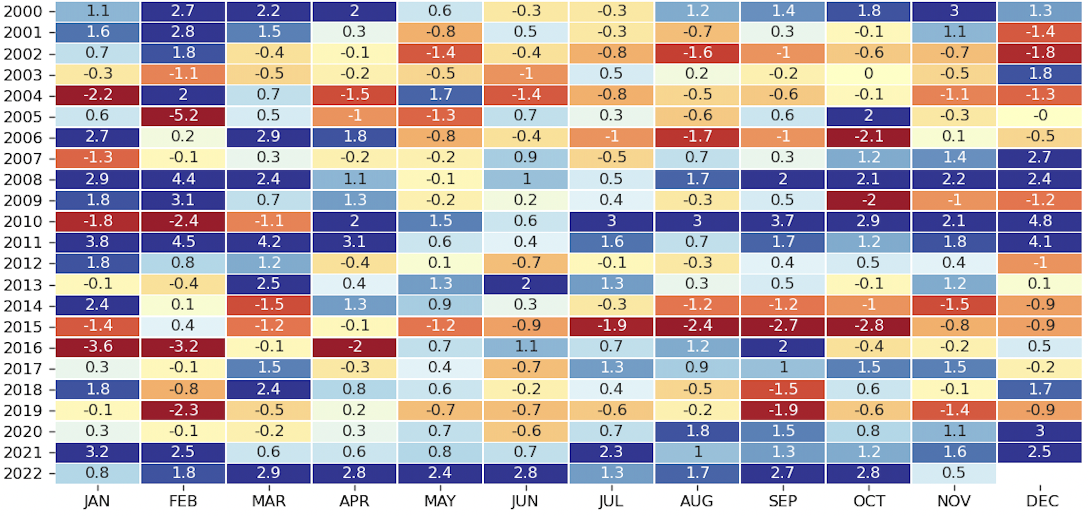
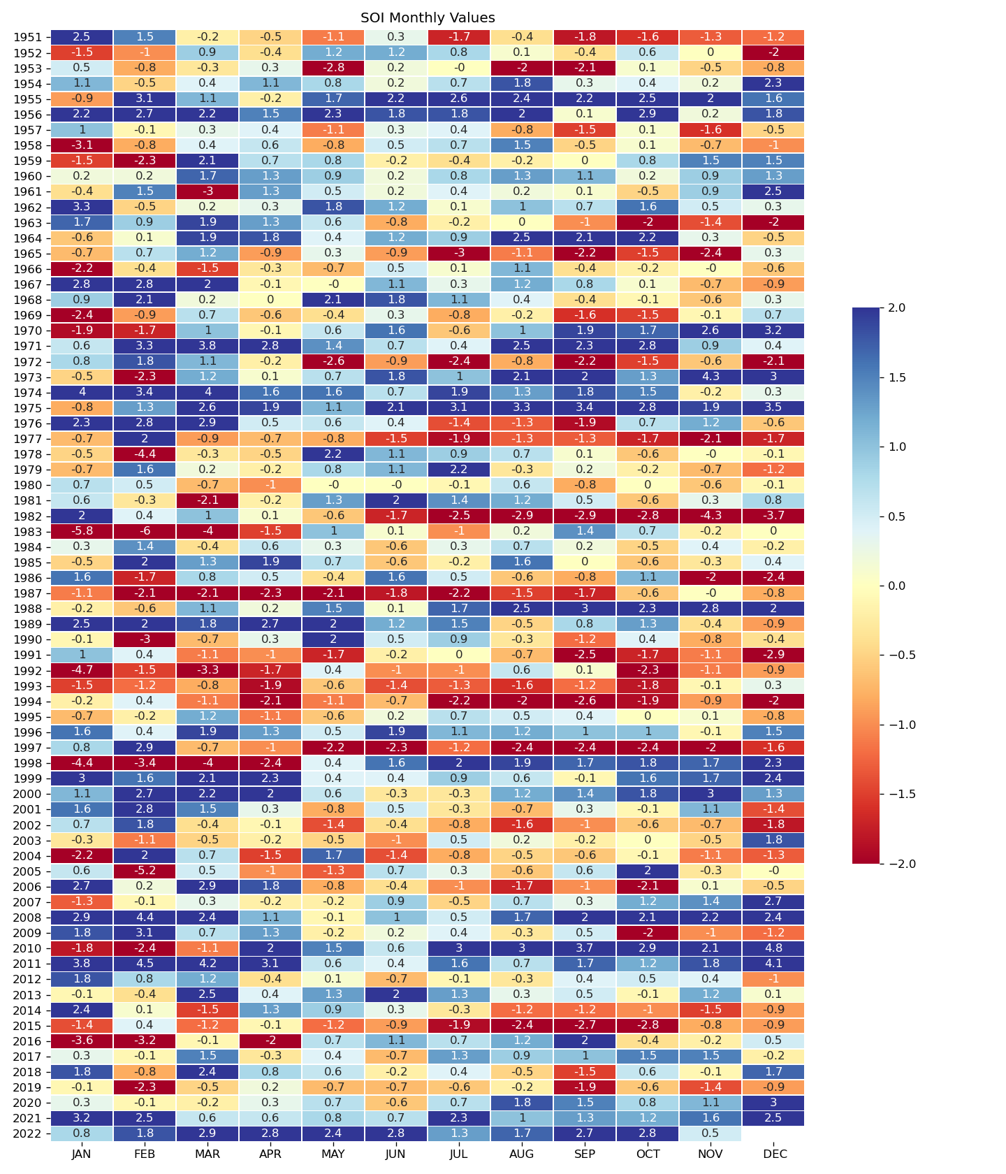
La Niña is now the weakest it has been in over two years, using the SOI (Southern Oscillation Index) index for monthly values since 1950. The SOI is one measurement tool for calculating the strength of La Niña atmospherically, in this case using sea level pressure values.
How does this change the winter outlook, or does it? I discuss that in this video and will present a research image below.
Here's the latest monthly SOI data including November to show you the strength relative to all other periods since 1950. Notice, the current value of 0.5 is weakest since this La Niña event began. We did have a 'weak' period during March and April 2021, too.
That said, the measure of sea surface temperature conditions reveals very little change to the ongoing La Niña event in November and early December, but there was some warming (weakening in this case) in the 1.2 ENSO region – the waters nearest South America.
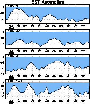
As you can see from looking at sea surface temperatures of the four ENSO regions, La Niña remains firm despite the weakening atmospherically over the ENSO region.
Continuing with the sea surface conditions, projections through winter continue to diminish La Niña in sea surface conditions, too. Here's the latest probability guidance from the CPC.
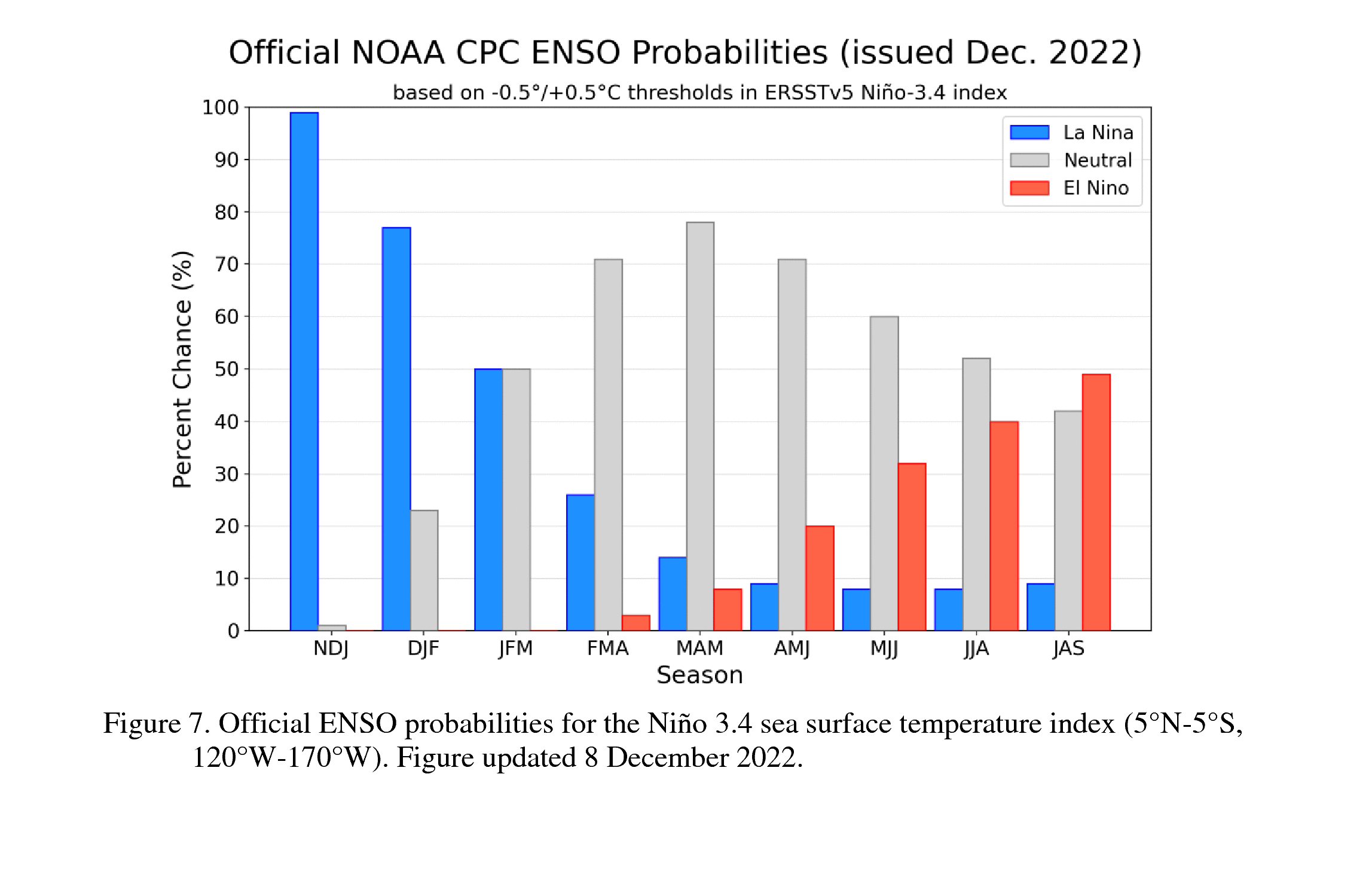
We will continue to have La Niña through the winter in the ocean conditions, but it remains to be seen if the atmosphere's response is to regain strength or to remain uncoupled from the ocean. Again, I discuss that in greater depth during the video.
In that video I also point out what a weaker versus stronger La Niña means for the precipitation pattern around the U.S. Here's that imagery and shows that some areas get drier with a weaker La Niña versus a stronger one.
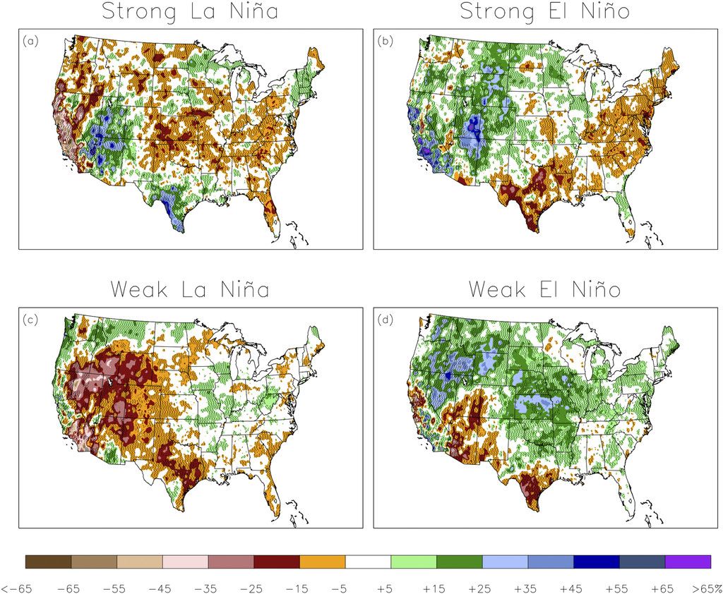
The bottom line here is that we continue to watch La Niña control our overall ocean-atmosphere pattern, but data and history indicate that influence is likely weakening with various impact on the winter outlook by shifting precipitation patterns based on La Niña's strength. Our winter outlook from months ago, remains on track.