
Colorado weather: Incoming system to deliver wind for some, snow for others, chilly air for all!

We continue to track our next weather-maker on the way early this coming week. As we mentioned in our last update, it looks like a potent storm for a good portion of the country, but the details on exactly how things will shake out along the urban corridor here remain a bit elusive.
What's known
- A powerful storm system will cross the Rockies and move onto the Plains from Monday through Wednesday.
- The exact path of the storm may change and bring increased impact to Colorado, however, data through Saturday morning has been quite consistent on a big impact hitting to the north and east over the Dakotas.
- Snow is likely, in widely varying totals, for many of us across Colorado (Monday night through Tuesday for metro areas), so winter driving areas are expected during that time.
- Travel for the Northern Plains states and Upper Midwest to slow greatly, and is discouraged, early to middle days of this week.
What's on the watch-list
- Changes to the path of the storm, a southern shift brings a much bigger impact into the metro areas and for the Plains.
- Speed changes, a faster trek will shift the winter-driving conditions into Monday evening's commute, or extend the issues into Wednesday if the system slows considerably.
For a video discussion:
Let's take a look at the latest data.
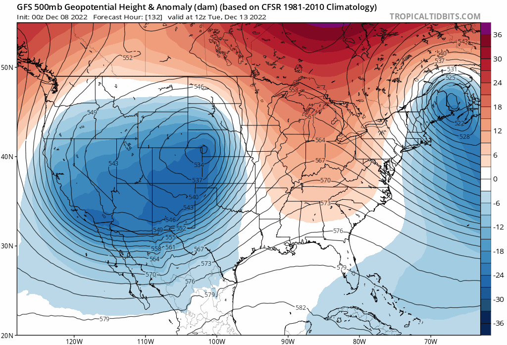
First, let's look at the upper level pattern. In the animation below, we see a strong trough at 500mb coming onshore today into early Sunday morning along the California coastline. It gradually will move through the Great Basin becoming a bit disorganized as it does. By early Tuesday we see it reorganizing somewhere over Eastern Colorado, before eventually ejecting northeast of the state by the middle to latter half of next week.
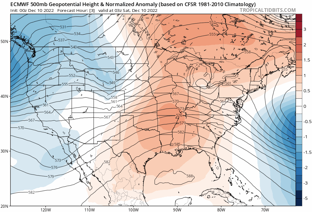
This storm will bring a whole host of weather impacts to the western two-thirds of the country as it moves through over the coming days. First, in California and the Western CONUS.
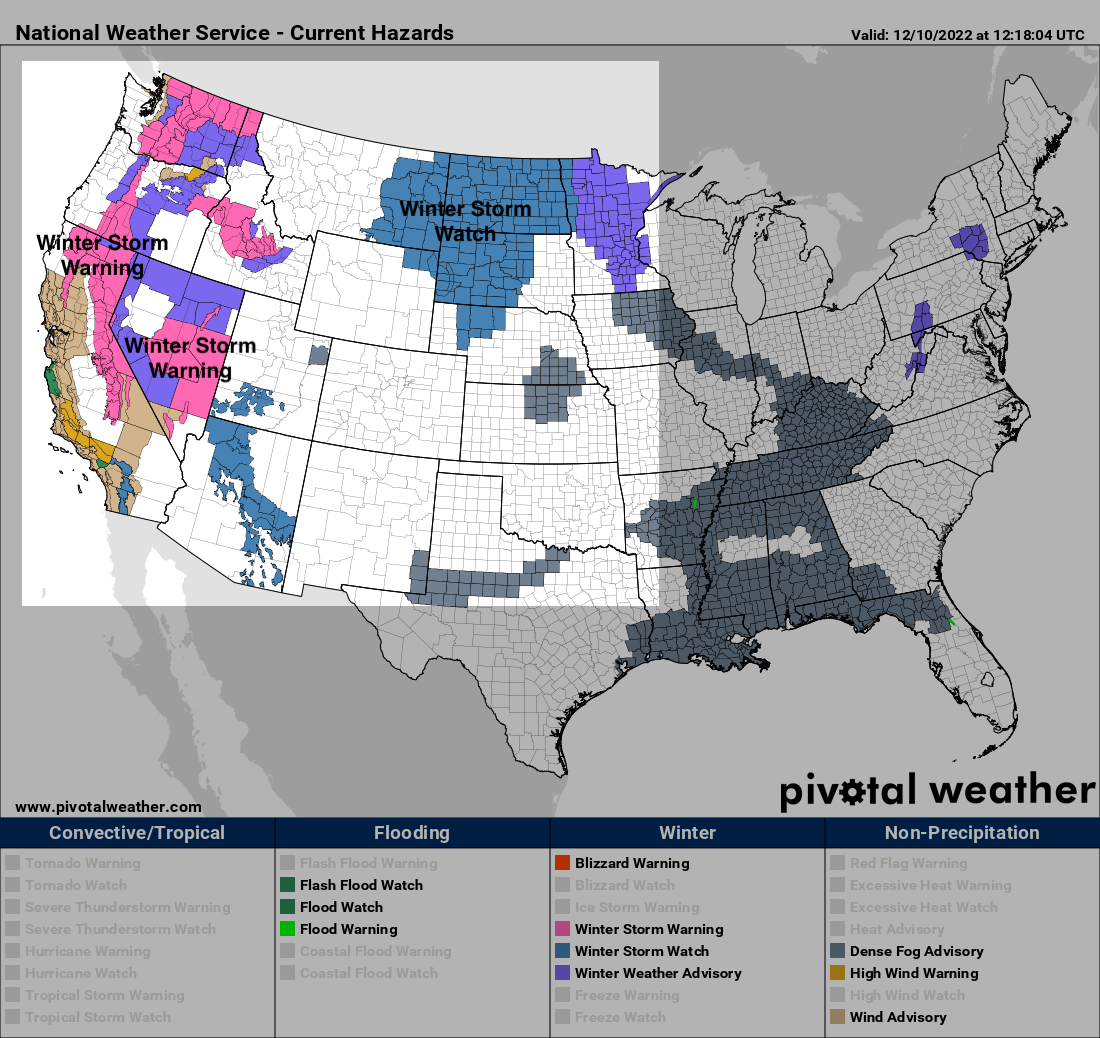
Here we see Winter Storm Warnings (pink) and Advisories (purple) covering portions of several states as heavy snow is expected to increase tonight and tomorrow for these areas. To our northeast, we see a large Winter Storm Watch in place, in anticipation of the impacts this system will bring to the northern High Plains next week. No winter weather highlights are issued for Colorado at this time.
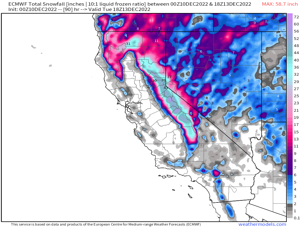
For California snowfall totals will be impressive. The Warning areas greater than 6,000 feet can expect to see easily 2 - 4 FEET of snow over the next couple of days, with some totals in excess of 4 feet possible. Here's a look at the European model forecast for the area, showing those rather grand totals across the Sierra Nevada!
By Monday afternoon the storm starts to push east of the Rockies. As it does, expect rain, snow, and wind to increase across the plains states.
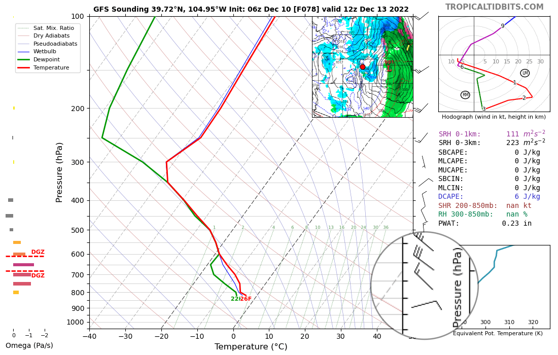
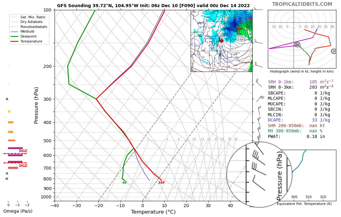
What the impacts are for our specific area as the storm moves east will depend in large part to the ultimate path of the system and where exactly the low re-intensifies as it gets east of the mountains. Right now, most modeling indicates the track won't be favorable for heavy snow along the urban corridor as we will be under the influence of downsloping winds. Instead, the greatest potential for impactful snow right now favors the northern and central mountains, as well as portions of the Northeast Plains of Colorado.
A shift in that track, even by a couple of miles, changes this calculous. So it'll be important to watch the forecast closely over the next several days.
Latest probabilities from the European ensemble model for 3" of snow or more through Wednesday afternoon shows this. Good odds for the mountains, lower odds for the urban corridor (particularly north of Denver), then increasing odds again as you move northeast across the plains and into Nebraska:
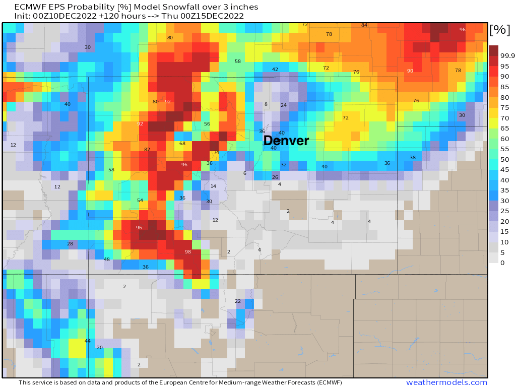
Again, this is mostly due to an unfavorable track of that low as it moves across the state. Most models show only a brief period of shallow upslope for the greater Denver area early Tuesday morning before transitioning to a westerly/northwesterly downslope wind midday, quickly shutting off snow potential along the urban corridor.
So... it's a bit of a wait and see. We'll be watching the data roll in all weekend and see if any trends start to change – either in favor of more snow or less snow for our area. Right now the favored track would mean more of a downslope event for many of us (and less snow), but still some snow and of course colder weather on the way early this week. As you can see in the animation below, which is the 500mb forecast for Tuesday morning from the GFS over its last 10 runs, there's still some jumping around in its placement... details, details.
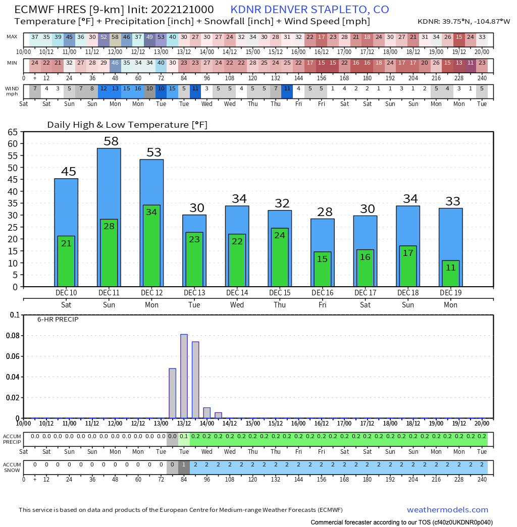
Taken at face value, and still PLENTY of time for things to swing one way or another, the below forecast from the European model looks like a good starting point for the Denver area. Mild over the next couple of days (near 60F on Sunday!), before cooling off considerably Monday night with the chance of snow on the way. This particular model shows about 1 - 4" of snow for Denver at this time.
We'll be in touch!