Denver Weather: Temperature tumble with snow chance to start week

After what was a cold and snowy month across the region in January, February has kicked off with a different tone. Here's this week's State of the Atmosphere.
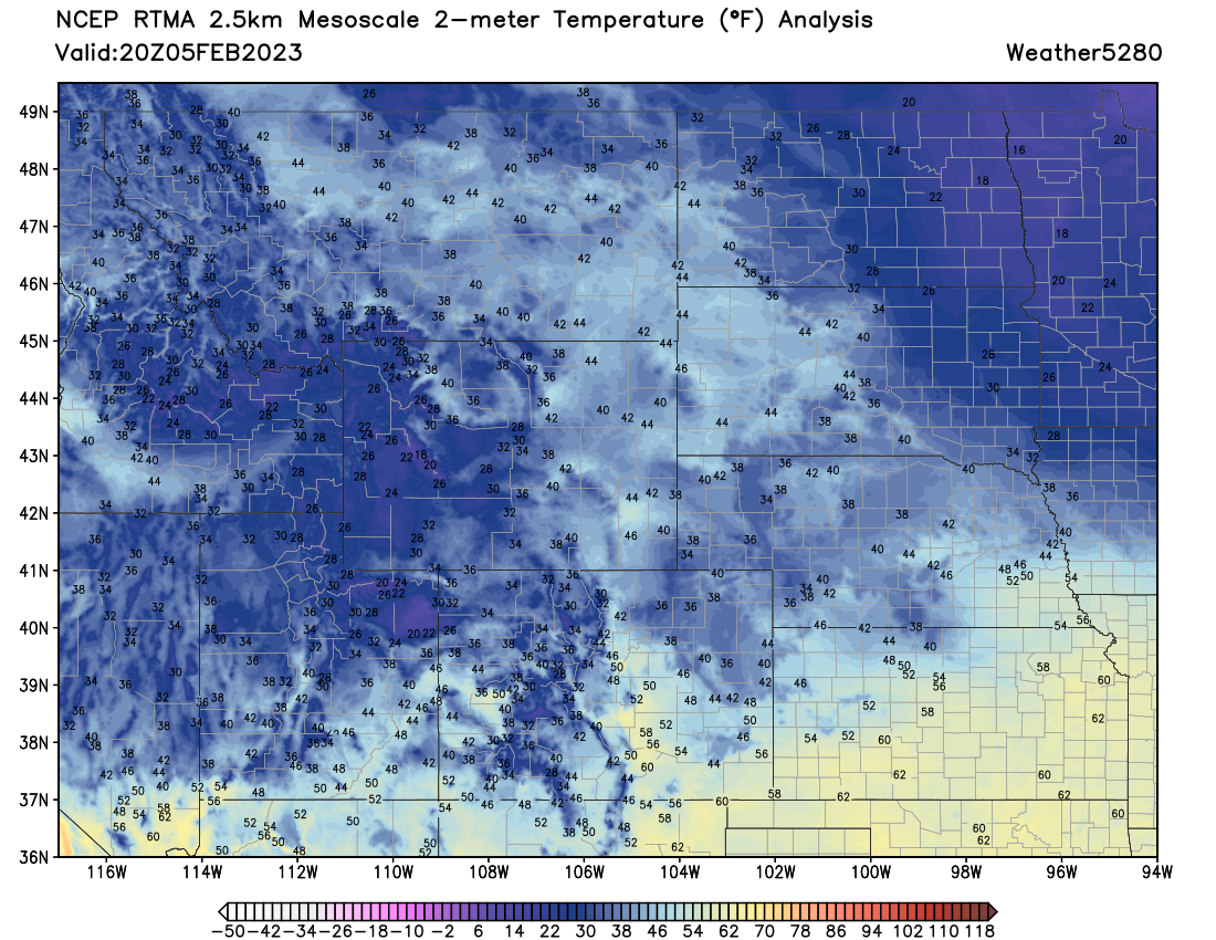
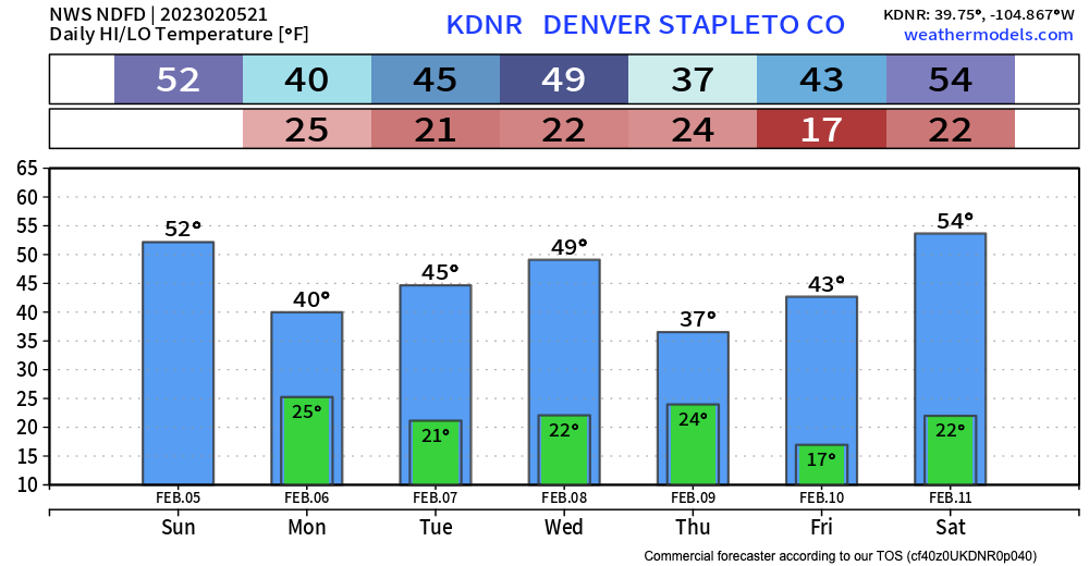
While temperatures remain chilly across parts of the Northeast Plains, we've warmed up to 50°F as of early Sunday afternoon and could add a bit to that before the evening. Regionally we see quite a few 40s on the map east of the mountains, with 50s and 60s across the southern tier:
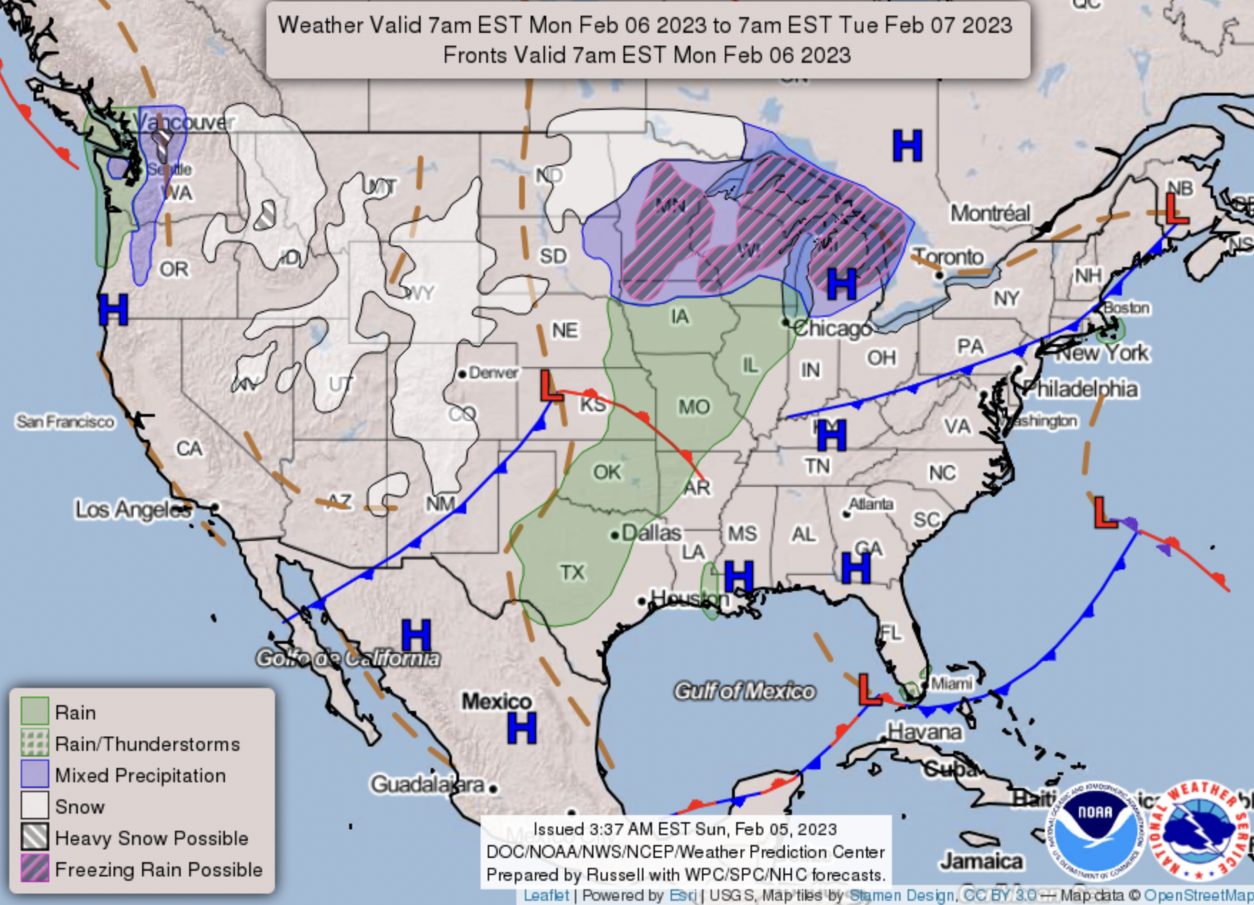
As we discussed on Friday, our next weather system arrives Monday and will knock temperatures a few degrees as it does. As we also discussed on Friday, it doesn't look like it'll pack much of a punch when it comes to snow, however, especially for areas east of the hills.
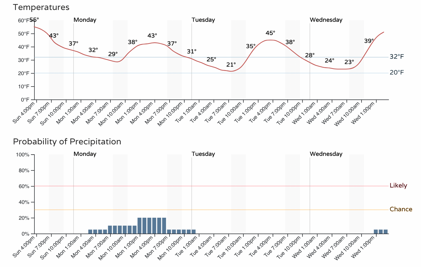
Below is a look at the hourly planner for the greater Denver area. Note about a 20% chance of showers tomorrow, with highs in the low 40s. Little to now accumulation is expected at this time, and some of those showers may very well come in the form of rain!
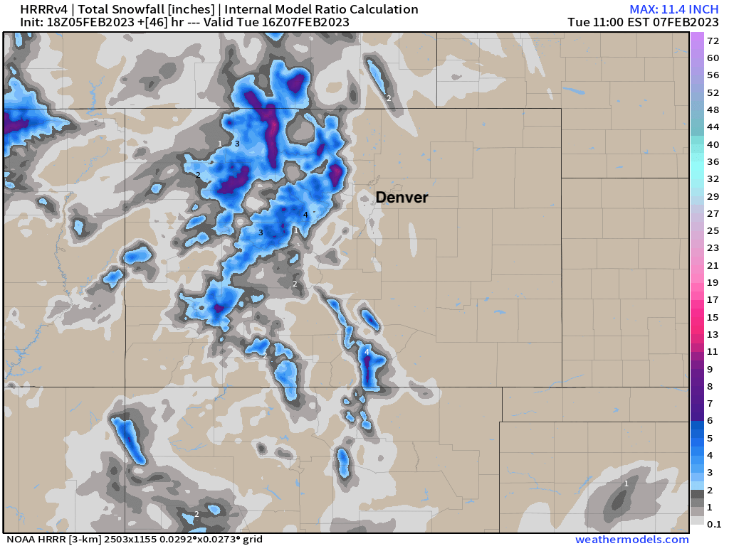
For the mountains the incoming system will bring a round of snowfall. The northern mountains will do best – with 5 to 10" on the way for the Steamboat area – but some accumulation possible for the higher terrain further south between now and Tuesday morning as well:
Another system drops through Wednesday into Thursday that might have at least a bit more of an impact for the urban corridor, as it looks at least marginally colder and perhaps capable of producing a bit more precipitation as well. Still, overall odds aren't all that impressive here either, but something to be mindful of as we head into the work week.
For temperatures in Denver look for tomorrow's system to knock us down to about 40°F for a high (perhaps a few degrees warmer), then we'll warm up a bit into Wednesday before the next front Wednesday night drops temperatures into the 30s for Thursday with that secondary chance of snow.
It looks like ridging returns by Friday and the weekend which will promote warming temperatures across the region once more. We'll see how long that lasts as more troughing builds to our west.
In short, nothing of great concern for the Front Range and urban corridor this week, but keep an eye on the forecast in case that changes. We'll see at least two chances for rain and snow showers this week with a bit of an up-and-down temperature ride as well. And, if you're headed to the high country, enjoy some freshies and travel safe!