
Colorado weather: A mostly quiet and mild weekend on tap, a look a to the next chance of snow

It's been awhile since we've had quiet and mild weather to talk about, but that's where we find ourselves this today. We hope everyone gets out and enjoys a break to the chilly weather we've seen of late this upcoming weekend!
And no, it's not just you, we've been experiencing quite a chilly stretch of weather with some of the coldest anomalies for the last two weeks focused over Eastern Colorado. Meanwhile, the Northeast has seen a continuation of very mild winter weather – though their turn for some cold is on the way.
Here's a look at temperature anomlies over the last 14 days:

Similarly we see it's been a very cold start to the year across our region and much of the West, while the eastern half of the country has been running much warmer than average to start the year.

Preliminary numbers for January show Denver ended the month -6.7°F below average for the month, with a mean temperature of just 25°F. This makes January 2023 the 17th coldest January on record for the city.
It was also a snowy month thanks in large part to the big (for January anyway) storm that moved through mid-month. Denver officially recorded 13.0" of snow last month, double the 6.5" the city sees on average. On the season we have now picked up 36.9" of snow, which is about 10" above average to end January.
The outlook
The national story will be a shot of COLD headed for the Northeast over the next couple of days. Temperatures in Boston, for example, will be in the teens tomorrow and Saturday with overnight lows below zero and windchill values to -15°F – brr!
The NWS hazard map isn't all that exciting outside of the cold across the northern tier and northeast:

Closer to home our main hazard will be some periods of windy weather over the coming days – but with that wind will come milder temperatures, a tradeoff this time of year. We haven't seen a planner like this in quite some time:

Ridging this weekend will keep the state mostly dry and mild:

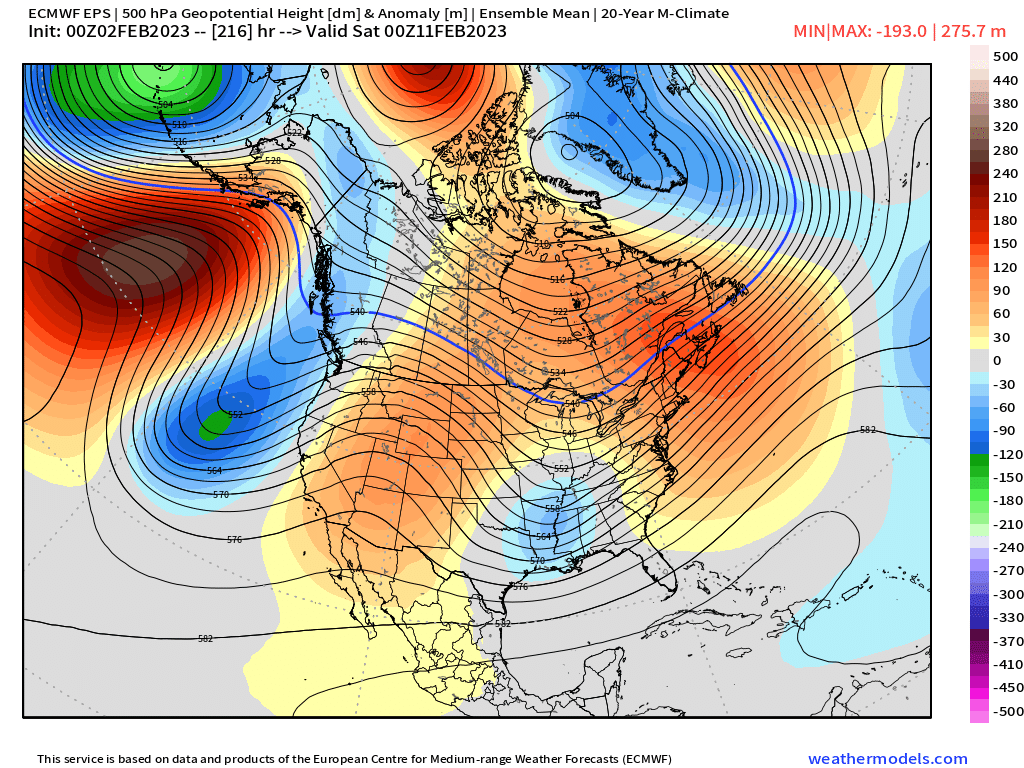
The next system that will bring snow to parts of the state is lurking off the west coast in the image above (valid Saturday night) and will bring some cooler temperatures and that chance of precipitation to our area come Monday and Monday night.
As it moves inland, however, it's forecast to drop pretty far south, so unless we see some shifts in the data over the next couple of days, the impacts for the urban corridor don't look all that significant outside of some cooler temperatures and perhaps some rain and snow showers.

After that system clears Tuesday we see another ridge move overhead for the latter half of the week.
That ridging looks potentially short-lived, with most models indicating troughing sets up across the west for mid-month, with the ridge going back up across the Eastern seaboard. This would be indicative of a return to a more active and cooler pattern for our area after a relative break.

We'll keep an eye on Monday's snow potential for you, but for now, plan on some warmer and quieter days, but lookout for some of those gusty winds from time to time as well!