
Fort Collins does it again, heavy snow delivers more than half a foot of snow to city

You must have sensed our hesitation in last night's update with regard to high-end snow potential along the northern urban corridor. Some of the high resolution, short term models were hinting at the heavier snowfall setting up further west than anticipated (and well west of the Advisory in place) but confidence in this solution was quite low.
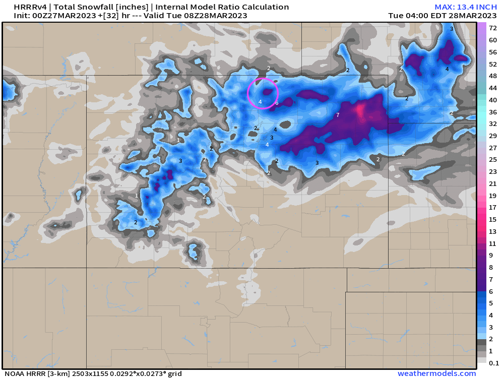
A look at a handful of HRRR snowfall forecast outputs from overnight shows it wobbled about with the placement of the heaviest snowfall... from Monday evening's run (Fort Collins area in pink):
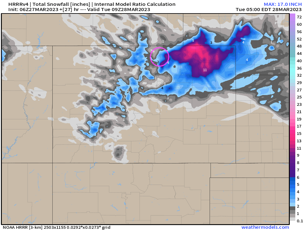
The run two hours later:
And a few runs later:
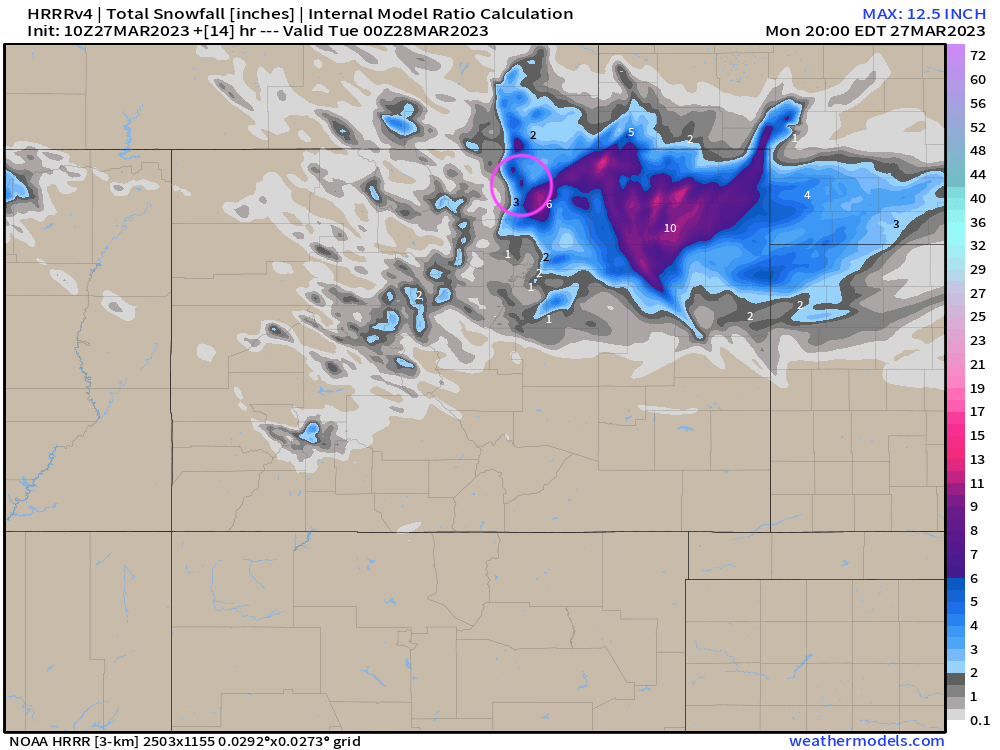
Note the pockets of 6"+ totals in the Fort Collins area, but still most of the heaviest stuff focused east. For the Denver area some Trace totals to 3 and 4" totals. Overall not entirely consistent, but also suggestive of the potential.
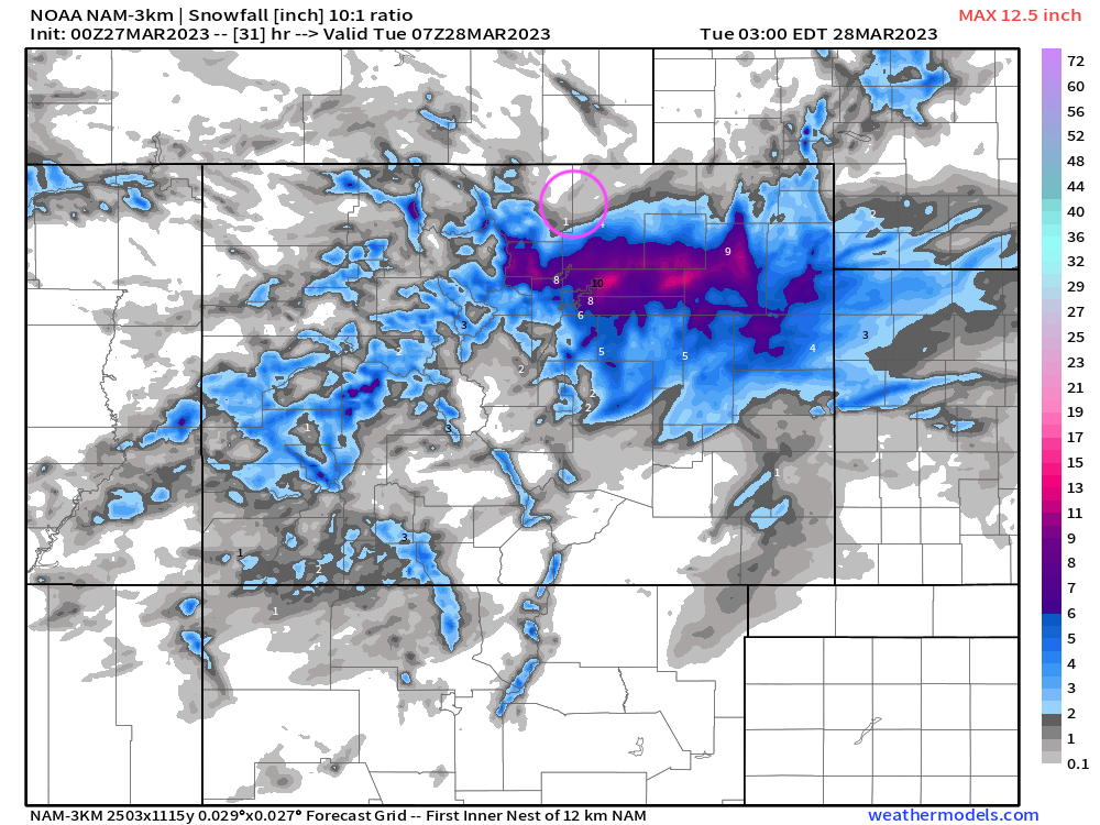
The high-resolution NAM also showed some "boom" potential for the northern urban corridor, but south of Fort Collins, with nearly no snow for FTC and 8 - 12" totals south and southeast of the city.
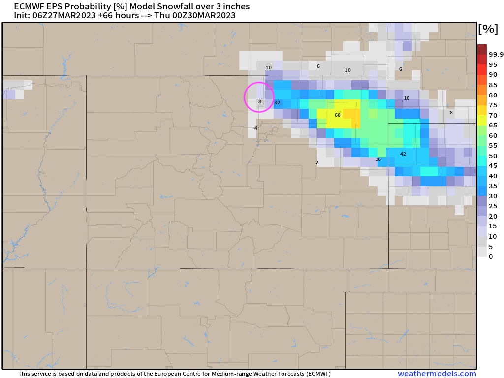
Most guidance suggested only very low-end support for the boom scenario along the I-25 corridor, with the latest European ensemble probabilities putting the odds of 3" of snow or more in the Fort at roughly 8%, and really favoring the northeast plains for the heavier snowfall today.
In the end, all this data proved wrong, and our comment from last night's post proved quite true:
...though some accumulating snow is possible along the urban corridor as well, with even some upside potential – for communities north of Denver in particular...
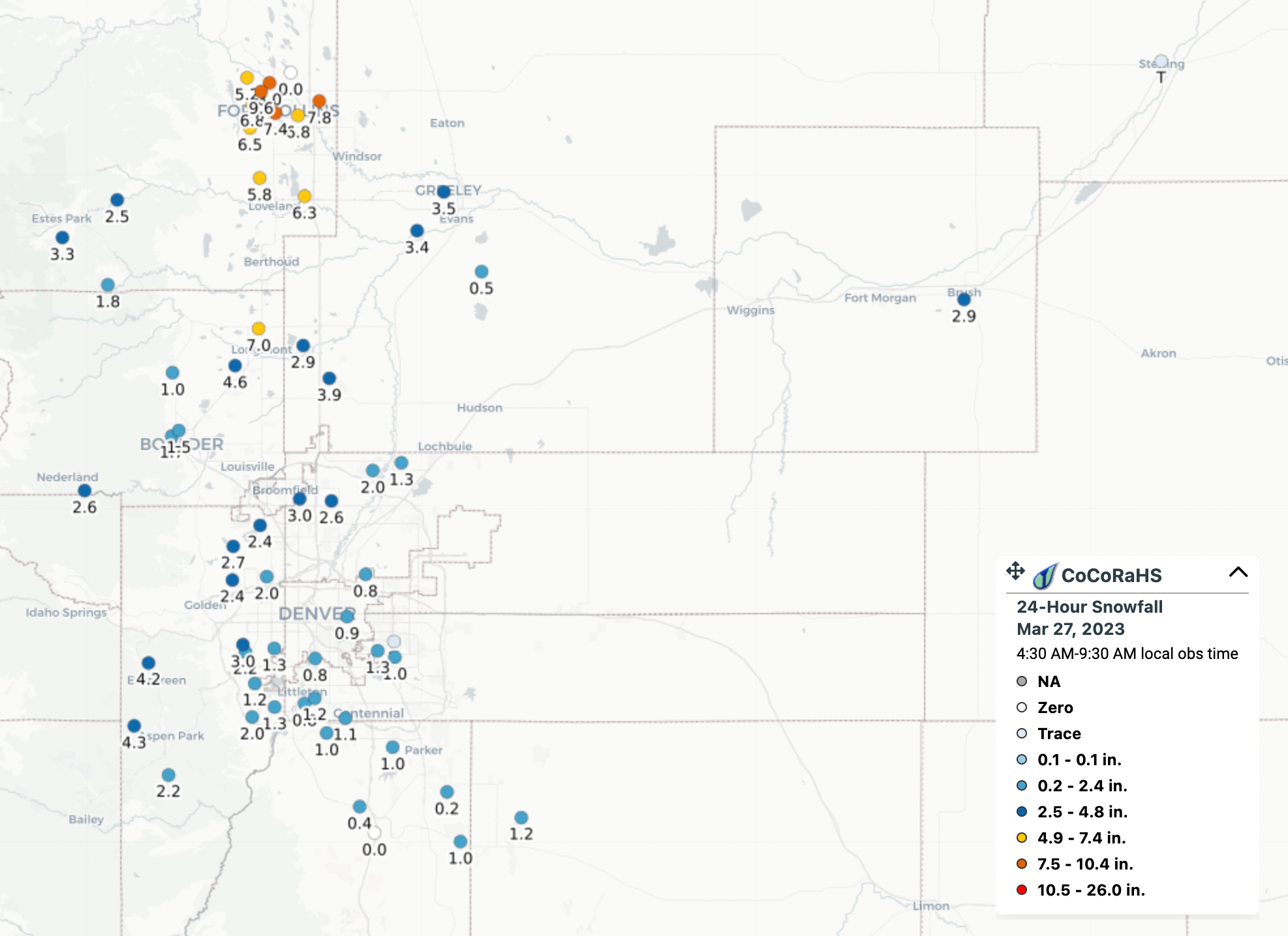
Upside potential indeed! Reports out of Fort Collins this morning are ranging from 6 - 10", with a bit of light to moderate snowfall continuing today, and likely to boost those numbers by an inch or two in some locations.
As of 7am, an average on the snowboard of 9.6", but there are spots in the yard with 11". Also, a patio furniture photo for @KyleClark's archives. Happy Monday! @NWSBoulder #cowx pic.twitter.com/ruLwoLUcmt
— Russ Schumacher (@russ_schumacher) March 27, 2023
In messaging with Russ this morning he informed us that his month to date total for March now sits at 16.5", he is located about a mile west of the official weather station for Fort Collins which was sitting at 6.5" of snow for the month before this morning's snow. The official month to date total for FTC should climb (well?) above the 10" mark with this storm.
Here is a look at CoCoRaHS snowfall totals through 7am from across Northeast Colorado, areas east of I-25 will see the greatest addition to these numbers today:
We got plenty right with last night's forecast as well. Timing worked well, as well as a clear bias toward northern Colorado vs southern reaches. Snowfall totals in and around Denver are coming in nicely within the Trace to 3" range we forecast last night, with the lightest totals south and east, and greater totals north and west.
The heaviest snow has now started to pull away from the I-25 urban corridor and will gradually progress east this morning.
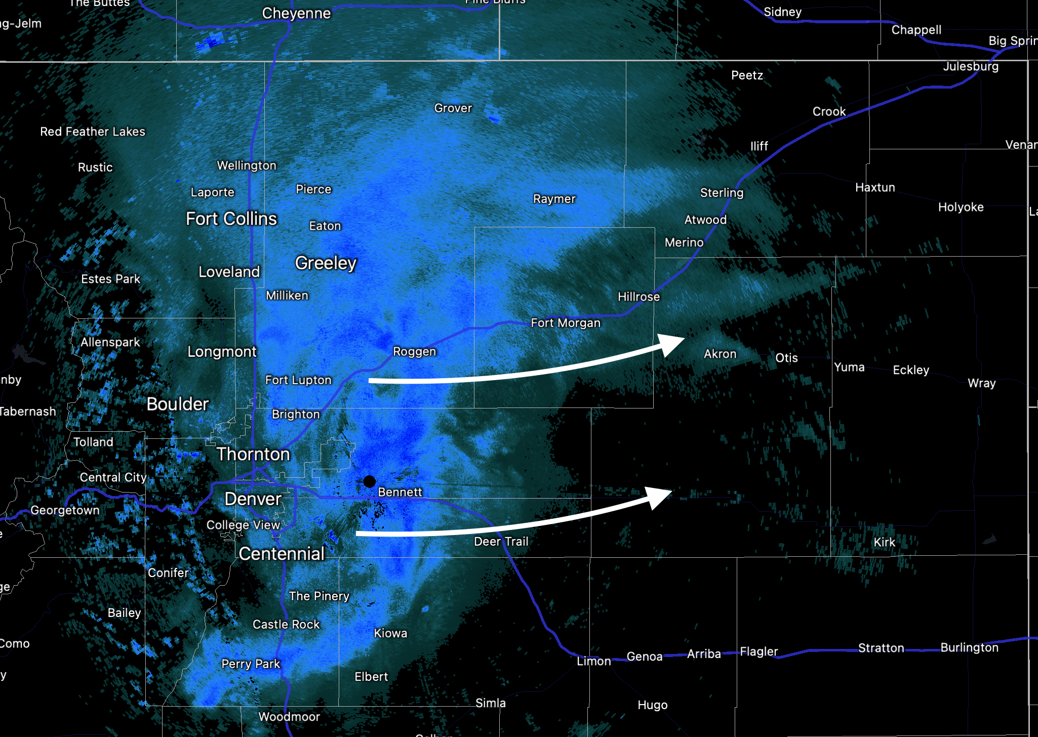
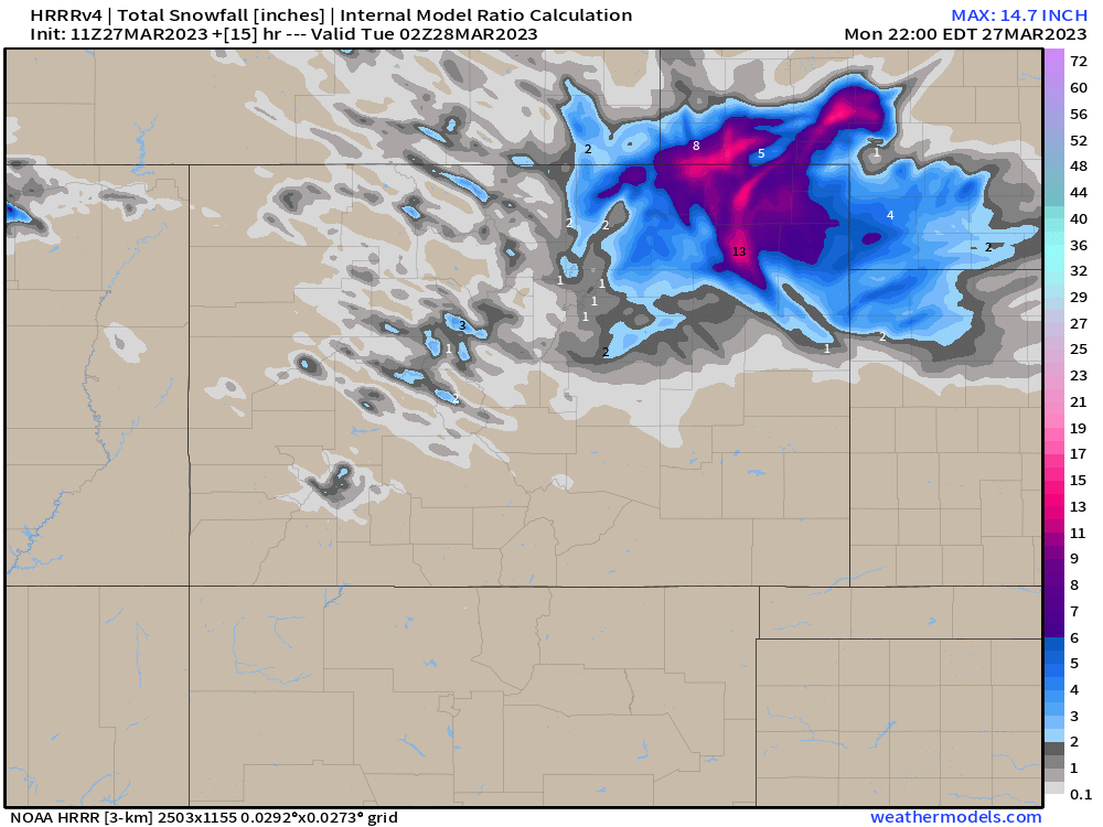
The HRRR continues to show totals in excess of 10" being possible through the course of the day across the Northeast Plains, with most other modeling more in line with the 3 - 7" range we put out last night. In either event, travel will remain quite challenging across much of Northeast Colorado today as snow winds down along the urban corridor, but continues (heavy at times) out east, particularly up and down I-76 leading into Nebraska.
For the Denver metro area look for snow showers to decrease through the morning with highs in the upper 30s. Warmer and drier starting Tuesday across the region!
How much snow have you seen? Share some pics if you've got them!