Sunday PM update: Snow showers for the urban corridor, Winter Weather Advisory for northeast plains

A quick update this evening as we see snow showers developing along the Front Range and urban corridor this evening as another system swings through the state.
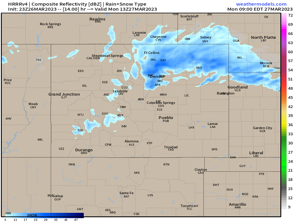
As we discussed in yesterday's update, the heaviest snow is forecast to end up northeast of Denver through Monday – though some accumulating snow is possible along the urban corridor as well, with even some upside potential – for communities north of Denver in particular.
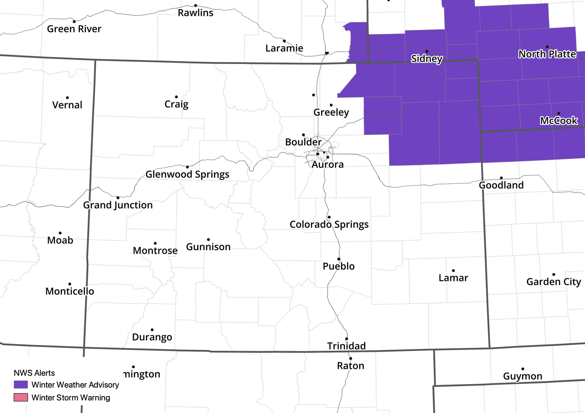
Here's a look at current winter weather highlights across the state, with only Northeast Colorado seeing those advisories at this time, where 3 - 7" of snow will be possible from midnight tonight through Monday afternoon, with winds gusting to 40 mph.
Closer to town we expect again another case of hit and miss accumulation. Where we do see those snow showers move through a Trace to 3" will be possible. Some high resolution models are trying to pull that heavier snow across the northeast plains west a bit which could put some communities north of Denver closer to that 3 - 6" bullseye, but we continue to think the greatest probabilities support that snow staying east of I-25. We'll see.
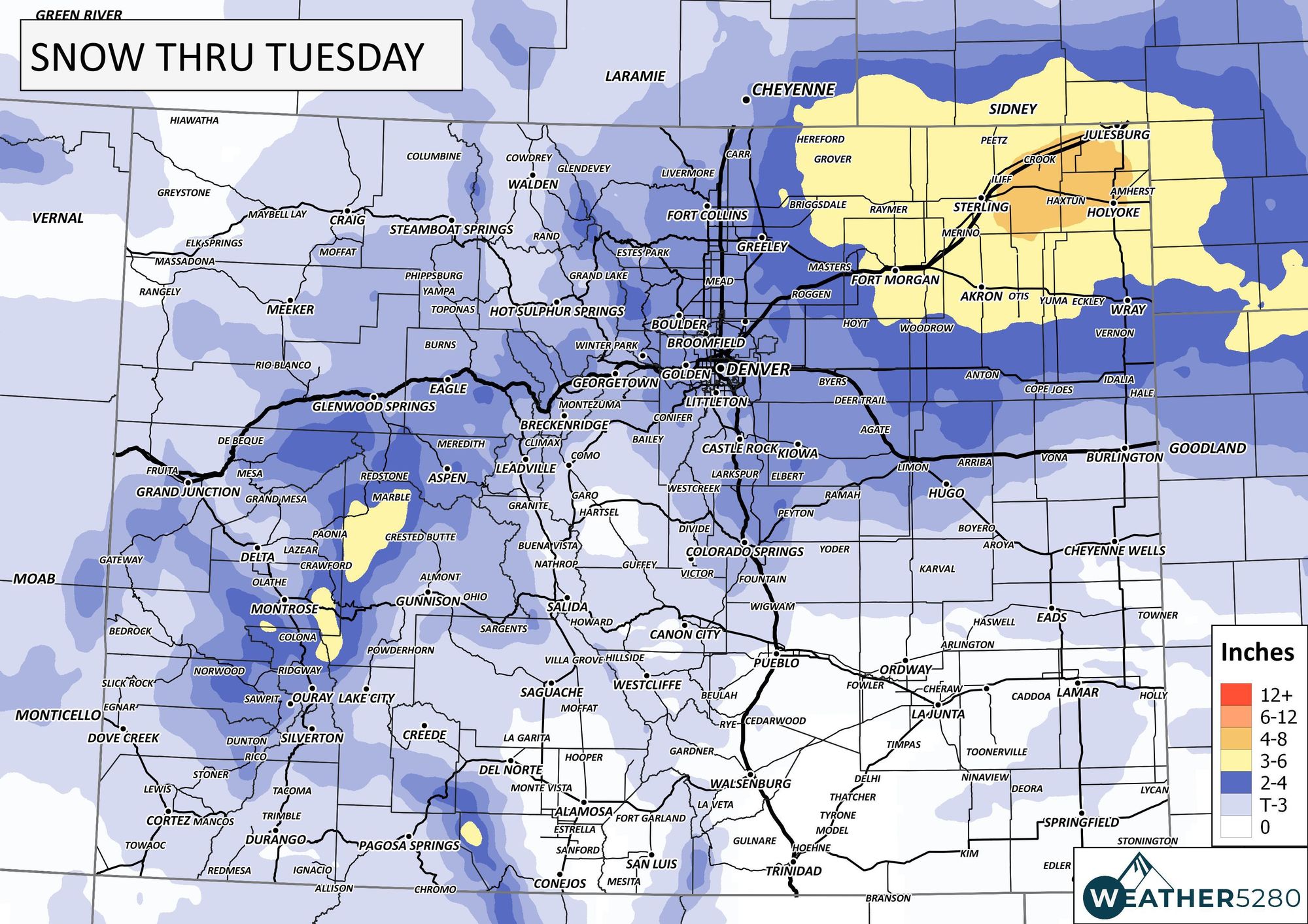
Our latest snowfall forecast is below:
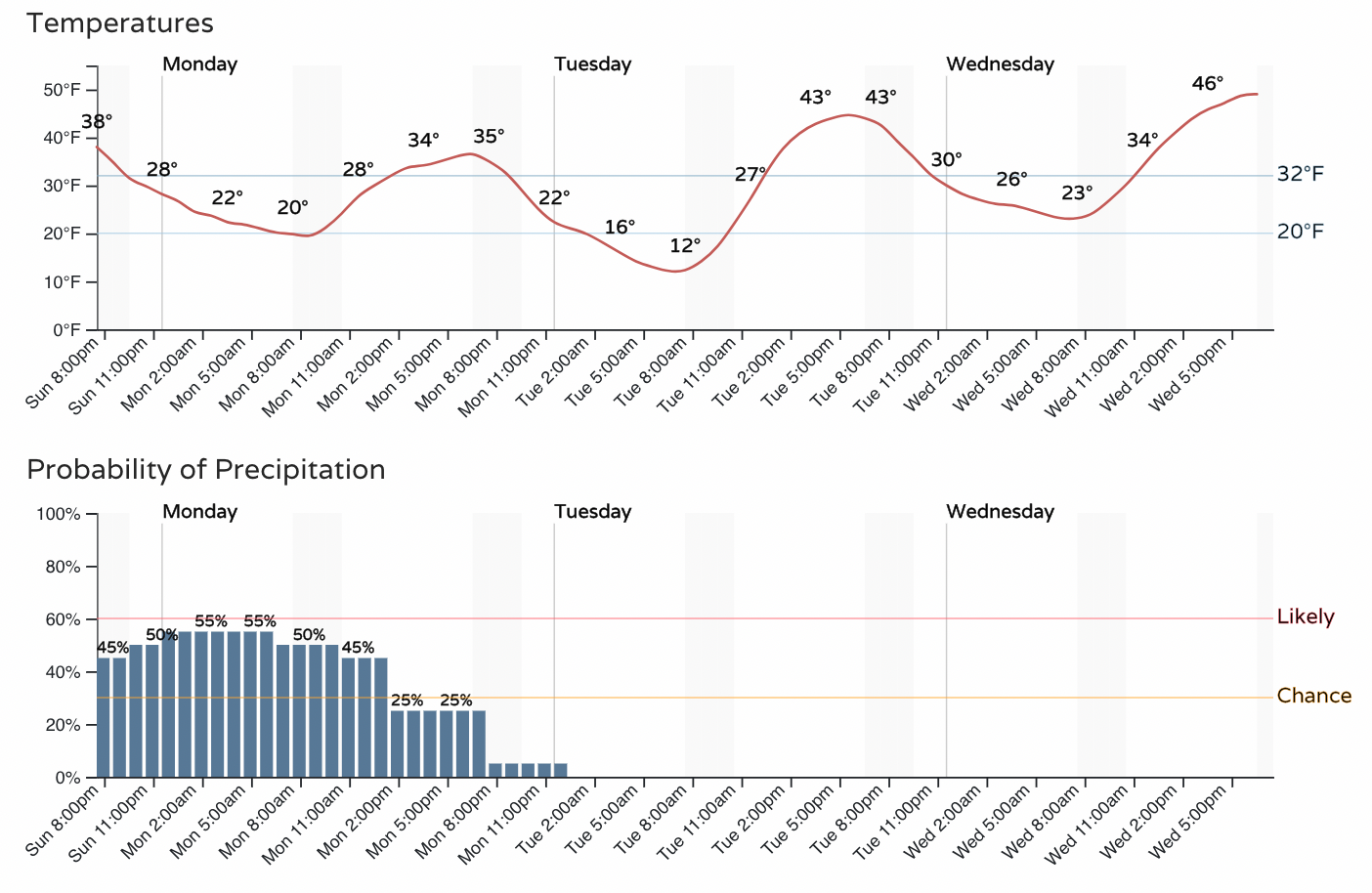
While the best chance of snow may wrap up for Denver before the morning rush... we keep about an equal opportunity for snow showers this evening through about 10am Monday. Even if totals remain on the low side, some impacts to your morning rush are certainly possible, and a few of the showers that develop could produce moderate to heavy snowfall, if even brief.

We'll see the chance of snow showers from Colorado Springs north to the state line tonight and Monday. This system looks most favorable for northern Colorado, so chances are closer to 30% for showers in COS, while more like 60% for Fort Collins. Here's the latest hourly for Fort Collins:
The system will be long gone by Tuesday and with that we'll begin a gradual warmup.
Highs will approach 70°F by Thursday, though with that warmth will come an increase in winds across the state... with, you guessed it, another round of rain and snow for the state looking probable by late Thursday into Friday.
For those in the group eager for more snow along the urban corridor, in a month that is Denver's snowiest on average but so far hasn't lived up to the name this year, the Thursday storm holds some potential but I wouldn't hold my breath.
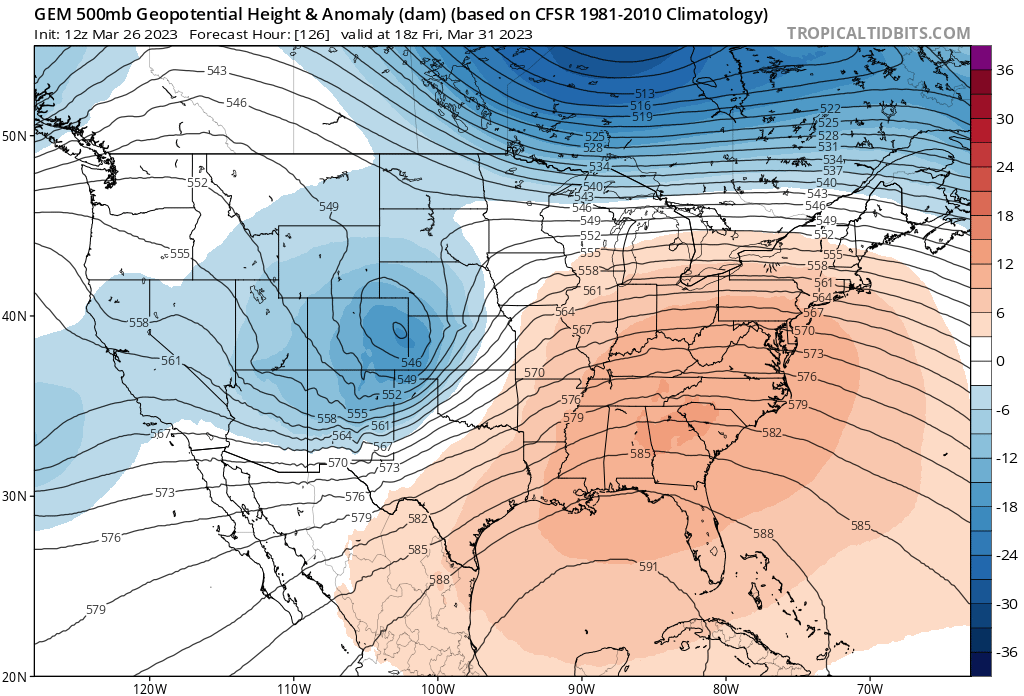
The GFS and Canadian models do show a close low passing over Eastern Colorado Friday morning, and in all it does look a bit better organized than tonight's system, but................. The European remains open with the trough, and most ensemble members from all the global models are very far north, and very progressive with the system as has been the case all month.
So, we won't worry about Thursday night's/Friday's storm just yet, but instead see if we can't pick up a couple inches tonight as this system moves through. If you you travel plans take you northeast along I-76 tonight or Monday morning, it would be advisable to delay that trip until the snow passes.