
The State of the Atmosphere: Sunday, July 30th, 2023

It's hard to believe we're wrapping up the final days of July, 2023. As we head into August our daily average high in Denver starts to fall once more, from an average high of 90°F today though August 2nd, then down to 89°F on August 3rd. By August 31st the average high for the city will be down to 85°F, and we'll be just days away from Denver's earliest snowfall on record (Sept 3, 1961).
July, 2023 seemed to beat all odds when it comes to temperatures across the area, with the average temperature this month in Denver running -1.4°F below average for July. With a max high of 98°F this month in Denver, this marks the first July since 2015 we haven't seen temperatures 99°F or hotter during the month!
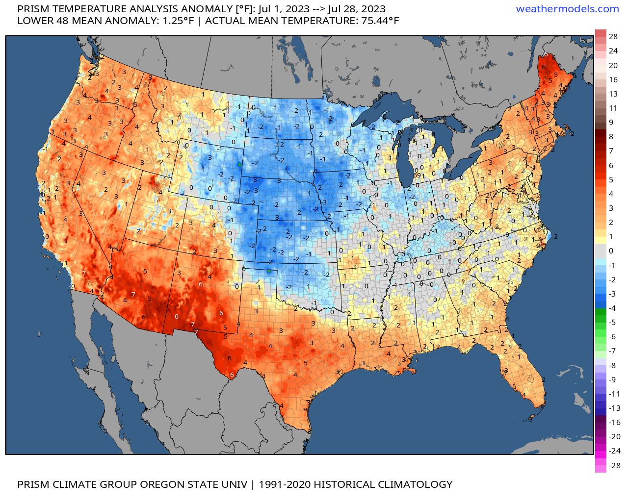
This is most impressive given the record heat across the Southwest and the anemic Monsoon we have seen thus far. In fact, to date Denver is running drier than average (-0.19"), which makes the cooler-than-average anomalies even more notable.
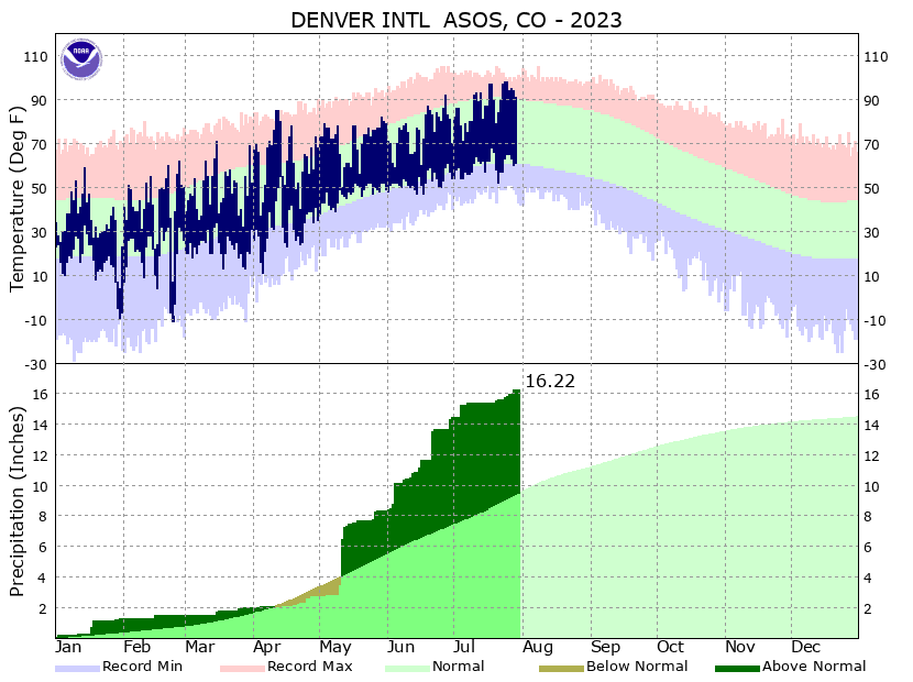
Still, year to date we are doing more than okay in the precipitation department, and all the moisture in the ground has no-doubt help us fend off the worst of the heat. Even if we don't get help from storms today and tomorrow and end the first month since April with below average precipitation, and even if we didn't see any precipitation from now through the end of the year, we'd still end 2023 with a precipitation surplus:
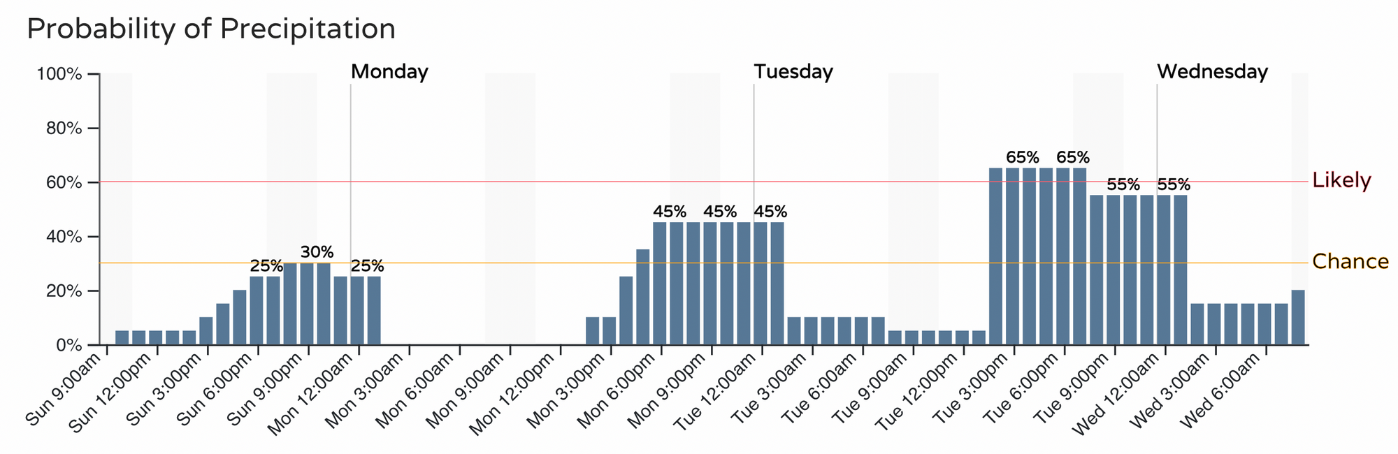
So, how about those rain chances to end July? Well, odds are someone sees storms today and tomorrow, whether or not that's the Denver airport remains to be seen.
For the urban corridor we see a general uptick in rain chances over the next three days, from 30% today to 60 - 70% on Tuesday (and perhaps a bit higher even for Wednesday).
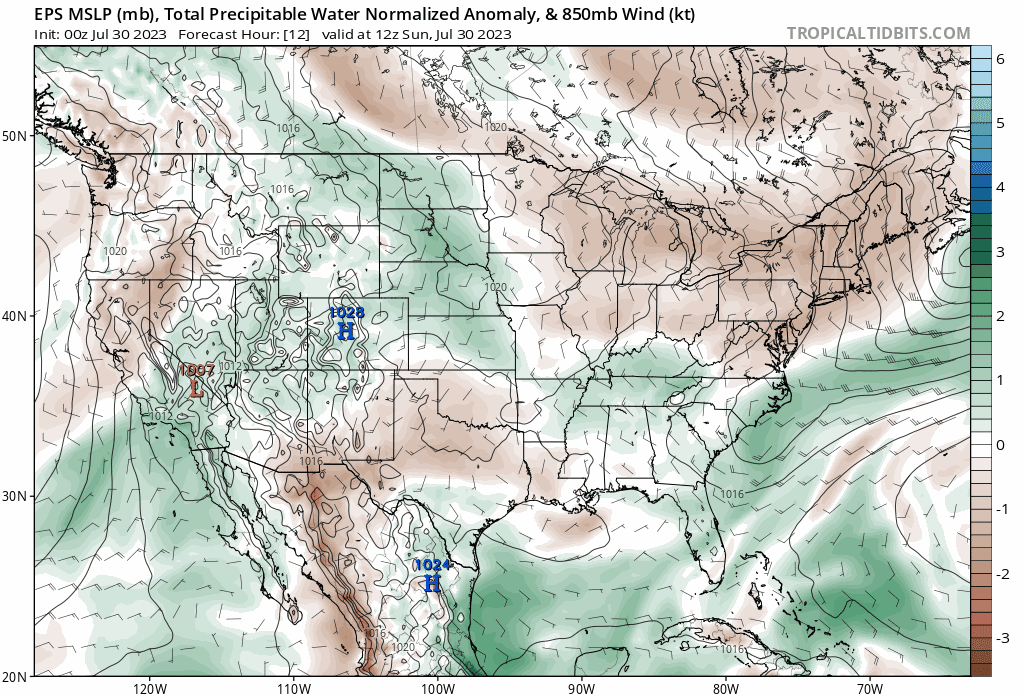
This is thanks in large part to a push of monsoonal moisture arriving over our area this week. If we look at precipitable water (PWAT) anomalies through the end of the week we see we'll be in the green each day – the height of which looks to be Tuesday and Wednesday, before some drying takes place (particularly to our southwest) later in the week.
What this means is that where we do see storms develop this week we could see some good "monsoonal" rainfall occur, and with that the threat of flash flooding should be on our minds. This is particularly true across the higher terrain to Denver's west, where above average precipitation is favored this week:
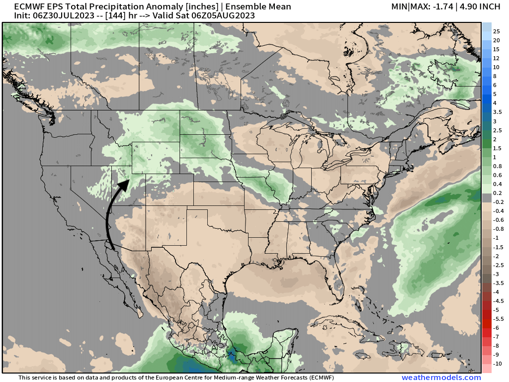
While it's great to see some above average precipitation forecast for Northwest Colorado this week, southeast Colorado may not fair so well. Additionally, for being the heart of the monsoon season, and for those across Arizona stuck in a forever-heat-wave this anomaly map leaves a lot to be desired.
The good news for the Southwest is that the ridge this week will be centered further east than it has been (allowing that monsoonal moisture to advect north, and the potential for Phoenix to see its first sub 110°F day this week since... June??):
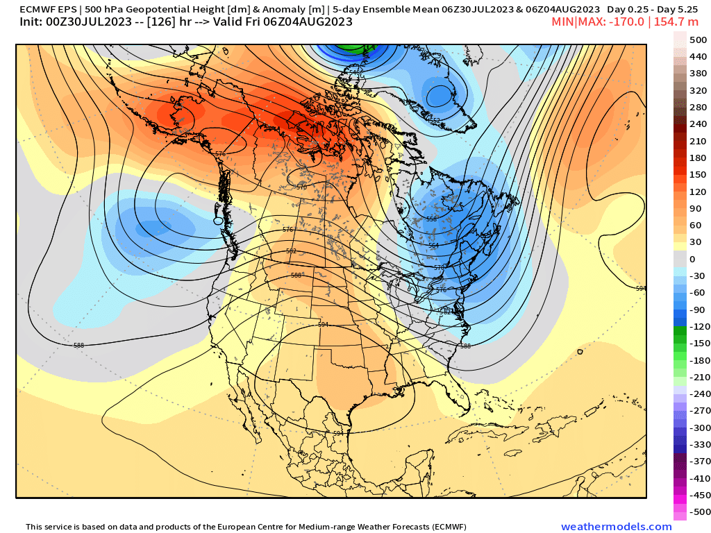
This amplified pattern means another week of above average heat is forecast across much of the southern and central U.S., with parts of Texas once again bracing for the worst of it, but a nice cool down is on the way for New England. Here's a look at temperature anomalies forecast over the next 5 days across North America:
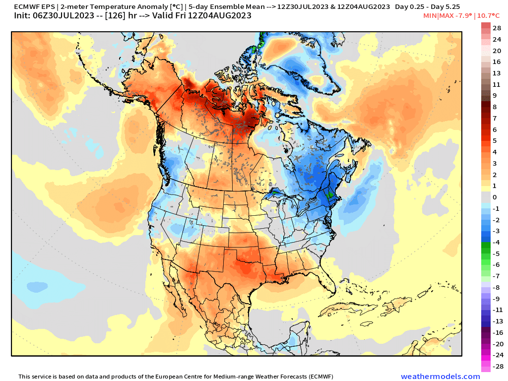
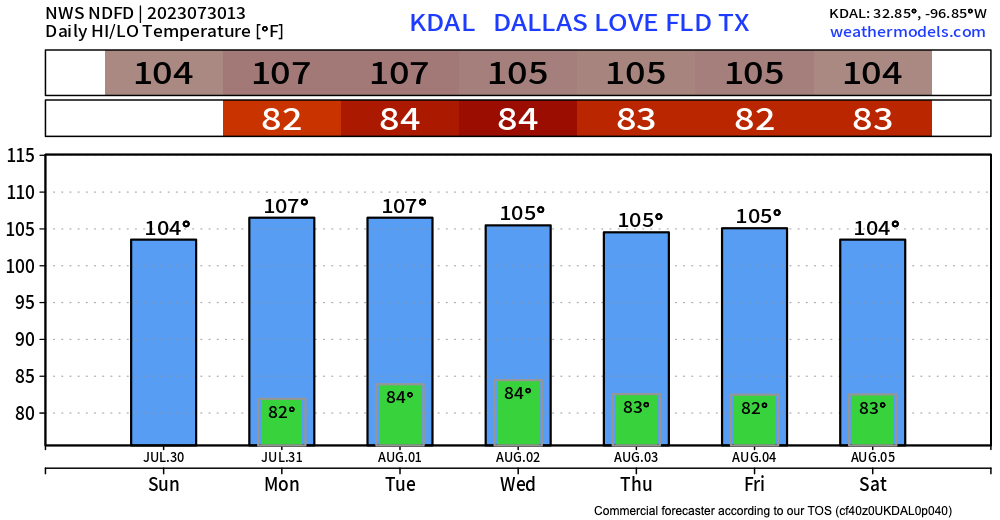
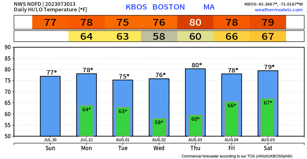
Temperatures will be near average for Northeast Colorado, but Dallas will be baking and is forecast to see highs 104 to 107°F every day this week. Meanwhile, Boston will enjoy a nice cool down with highs in the 70s most afternoons! In fact, every overnight low in Dallas is forecast to be warmer than the high in Boston this week:
Back at home we'll be tracking the rain chances over the next few days and offer more updates as we go along.
Happy end of July, everyone!