Denver area snowfall totals, forecast for remainder of the weekend

It was a bit of a rollercoaster of a forecast to get there, but in the end it all (mostly) worked out. This morning much of the Front Range basks under a blanket of fresh snow, putting us all in the holiday spirit as we inch toward the end of 2023!
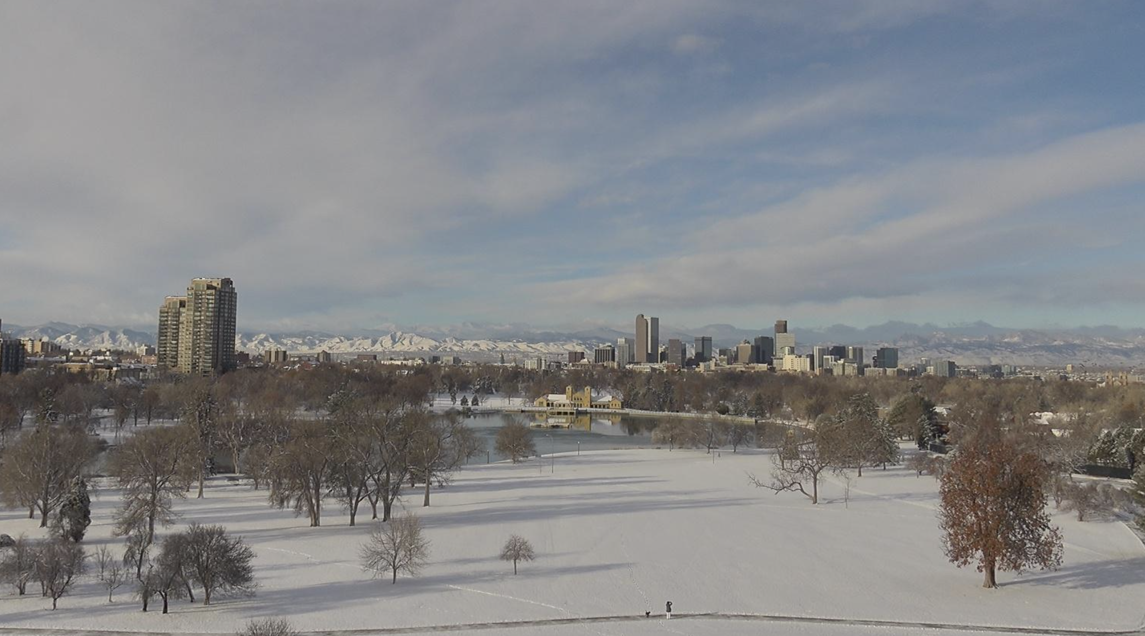
What a wonderful view from City Park this morning of the Mile High City, under about 3" of fresh snow and low clouds starting to lift off the Rockies:

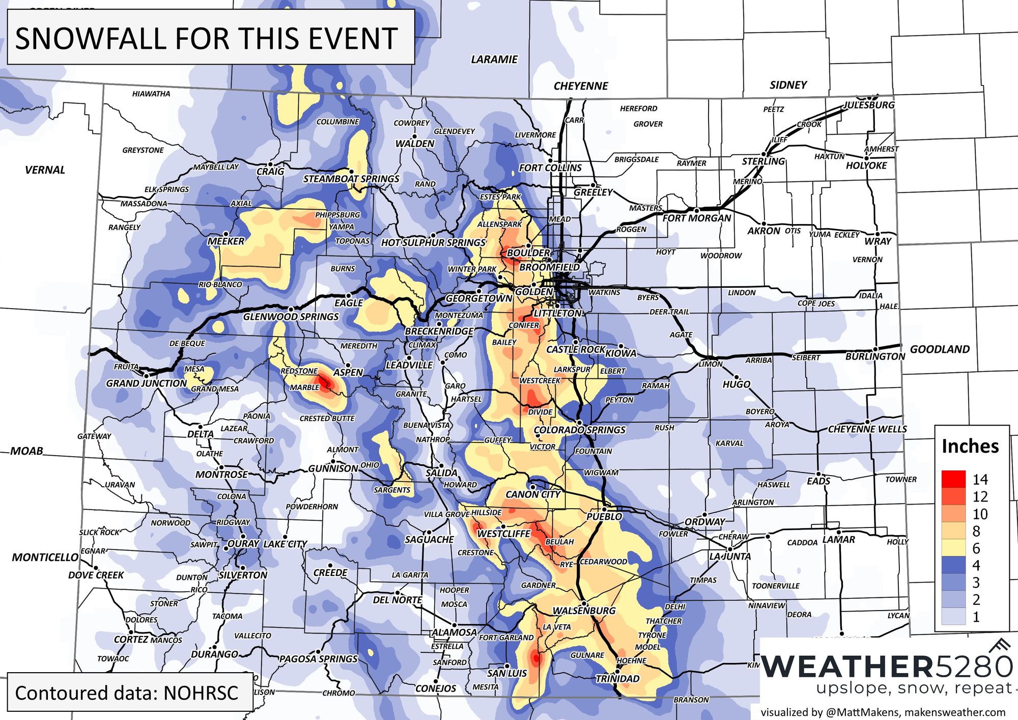
Snowfall totals were all over the map, as expected, from next to nothing across the northern cities like Fort Collins and Greeley, to just north of a foot in some foothill communities west of Denver. The biggest missed opportunity was probably along the Palmer Divide, but even here most areas managed our low-end 3" total or close to.
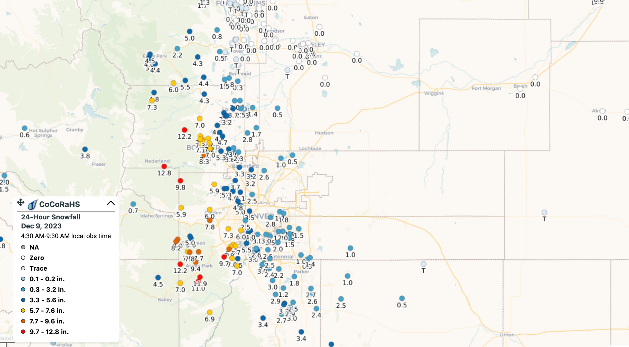
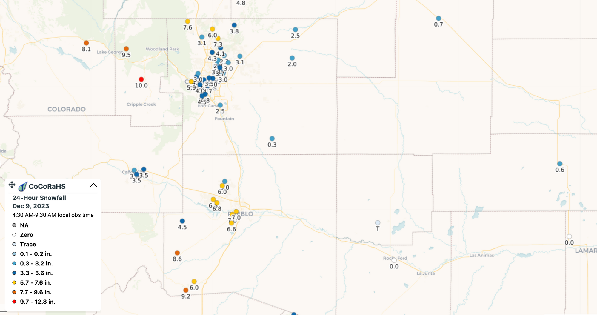
Officially Denver will only log 0.4" of snow from this event, though the bulk of the city saw closer to 2 - 4" of of snow – safely within our 1 - 4" forecast for the Denver area.
Here is a smoothed look at totals from across the area through this morning:
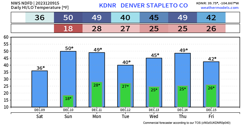
We will remain chilly today with highs only in the 30s to maybe low 40s for most of us Saturday afternoon. Sunday the urban corridor will be back near 50-degrees for a high.
We'll get more into the outlook in our next update, but as we look ahead over the next several days no strong signals for anything major to move through, with temperatures largely seasonal with some ups and downs in those afternoon highs into next week:
We'll keep an eye out for you, and as always stay up to date and weather aware by subscribing to our email list today!