
Winter Weather Advisories posted; Snowfall forecast update as snow arrives in Colorado, Denver area

This hasn't exactly been a fun snowfall forecast to pin down. Some pretty wild up-and-downs in the data over recent days, with little agreement in the data on who sees what and when, with varying jet influences, upslope, and even marginal temperatures at times.
This morning we think things look a bit clearer, and well, the first round of snow has already arrived across parts of the urban corridor and Palmer Divide – so let's see what to expect from the remainder of the day today and tonight.
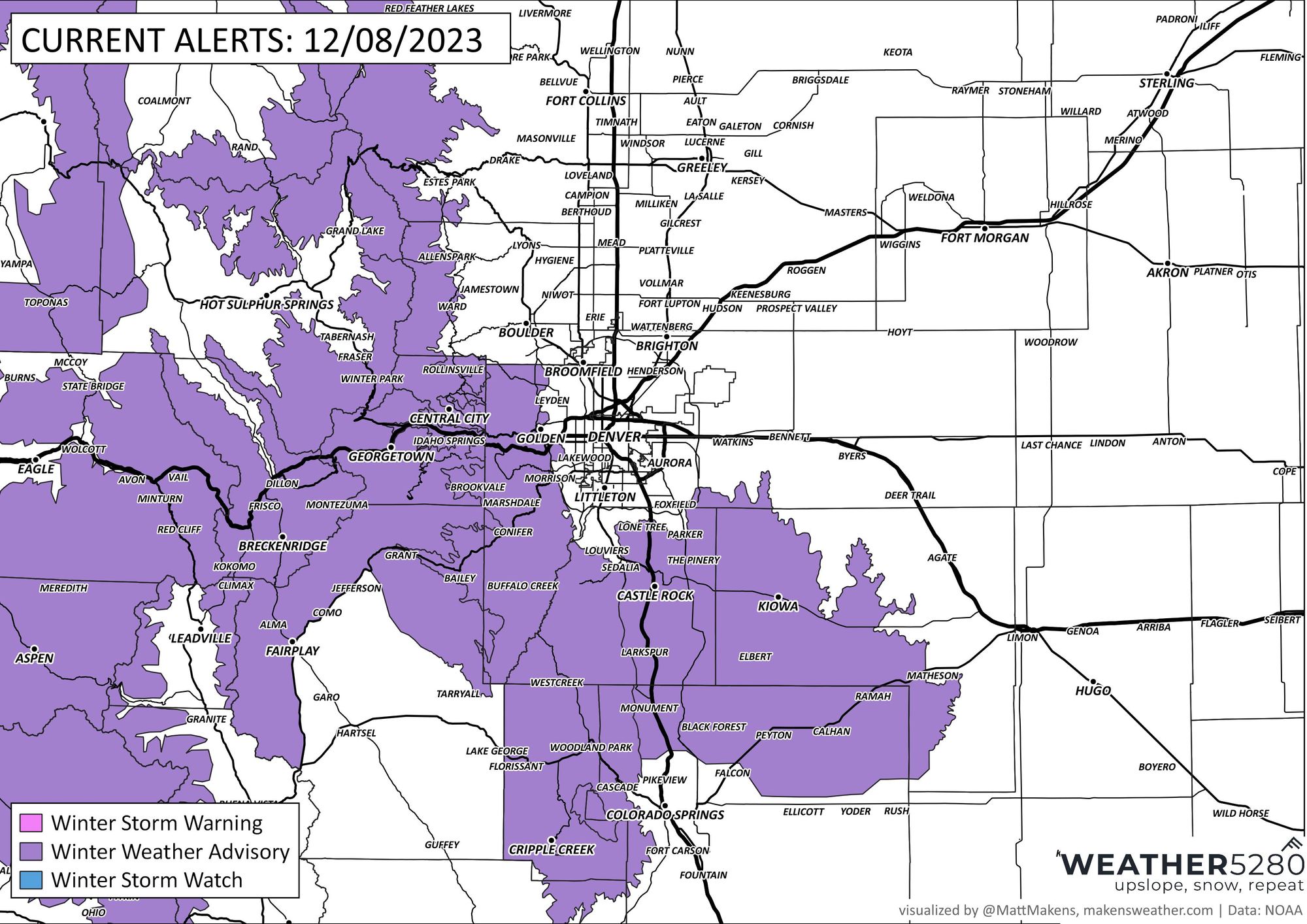
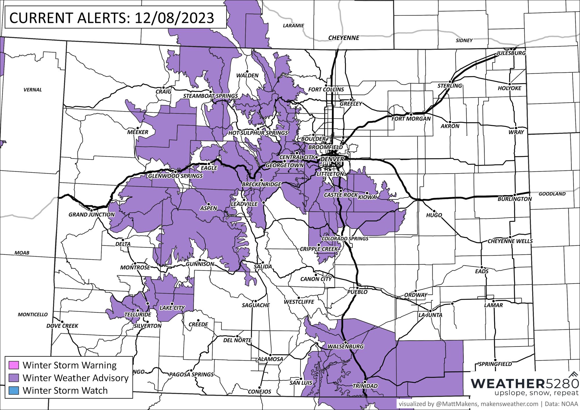
First, a Winter Weather Advisory is in place for the Palmer Divide and foothills west/southwest of Denver. The Advisory goes into effect this evening and continues through Saturday morning. Here is a look at current alerts from the National Weather Service:
While we will see snow around this morning, with even perhaps some brief moderate snowfall, for most areas the best chance of impactful snow holds off until the second push of energy moves through later this afternoon and this evening.
This is in part because temperatures aren't all that cold today and of course the sun will be working to keep at least paved areas from seeing much accumulation, but the second round also should have a bit better dynamics with it. In fact, some models are hinting at some pretty good snowfall rates later this afternoon/evening, especially for those living between Denver and Colorado Springs and up into the immediate foothills. The issuance of a snow squall warning (click for information on what that is) later today for someone wouldn't surprise me one bit.
While we think the greatest potential for the heavier snow showers to develop will likely set up south of Denver and north of Colorado Springs, that doesn't rule out either cities for a boom potential should things shift even slightly. Stay weather aware!
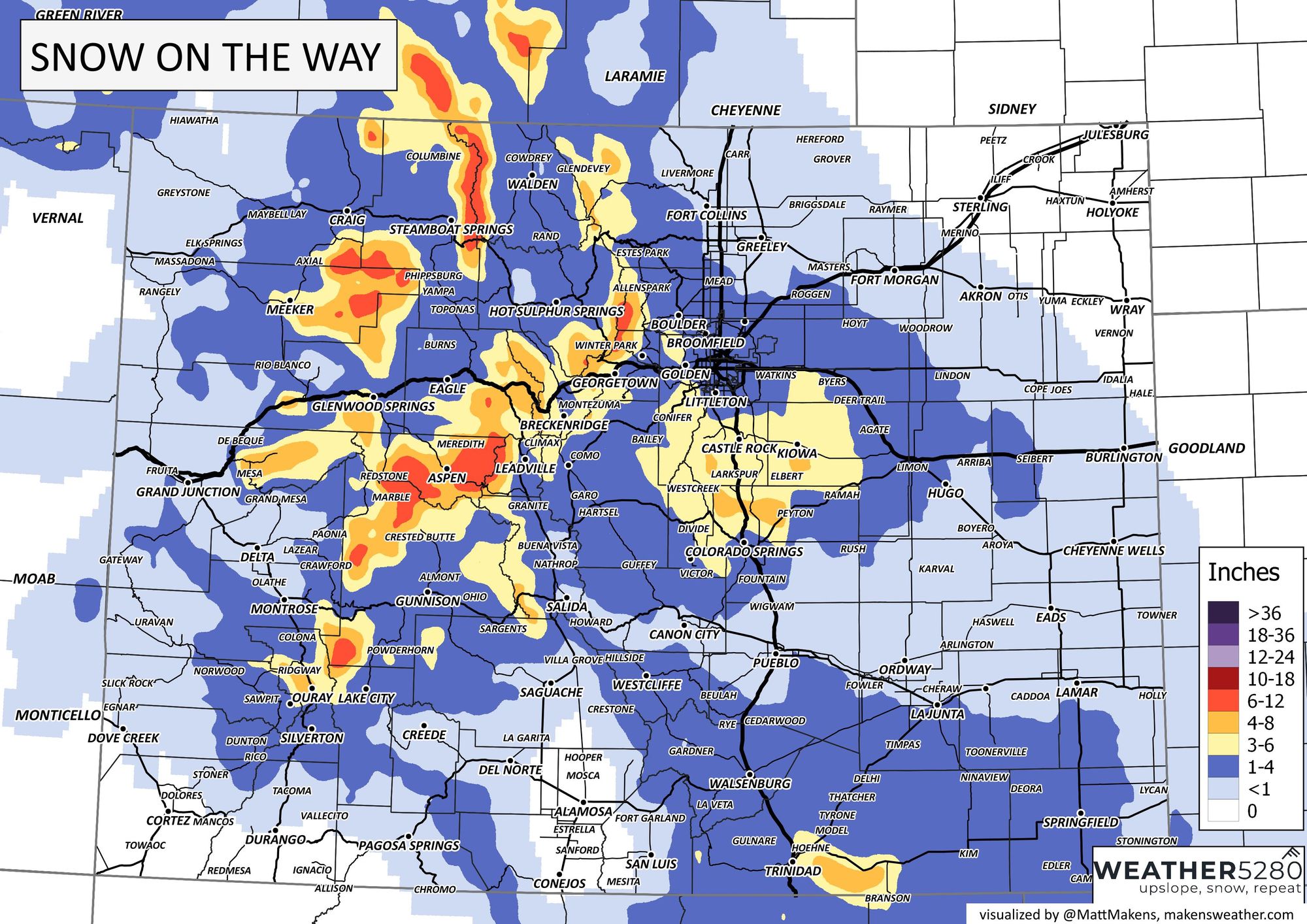
Snowfall forecast
The overall idea, meaning placement of heaviest snow, doesn't change much from our forecast yesterday. We have, however, bumped up totals potential a bit, and we do see higher "boom" snowfall potential today. Those boom scenarios aside, we expect something like the following:
- Fort Collins: T - 1"
- Boulder: 1 - 4"
- DIA: T - 3"
- Denver: 1 - 4"
- Evergreen: 3 - 7"
- Castle Rock: 3 - 7"
- Monument: 4 - 8"
- Colorado Springs: 1 - 4"
And our latest forecast map:

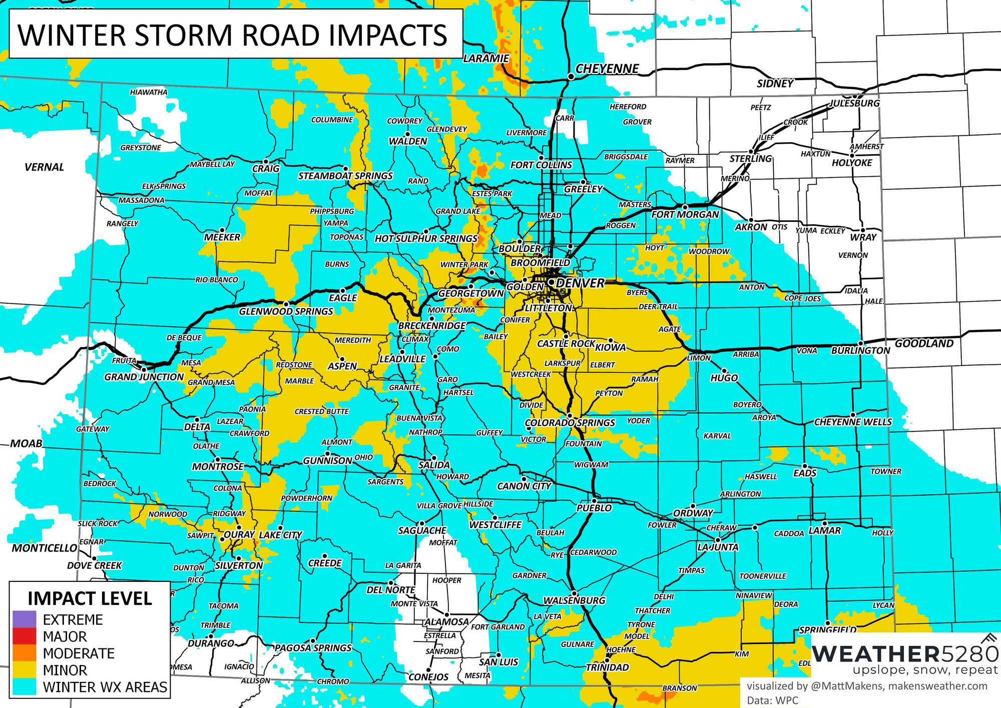
And expected impacts:
As for timing... again, some bands of snow already swinging through this morning (mainly across Denver's south side at the moment), but we'll see those showers off and on into early afternoon, with perhaps a bit of lull before snow ramps up again later today.

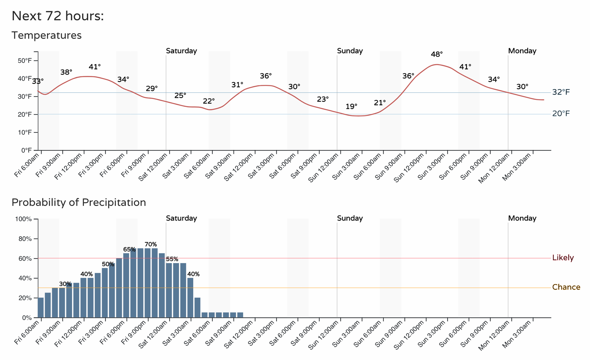
For Denver, the hourly planner looks like this, with snow ending by Saturday morning, but Saturday remaining chilly:
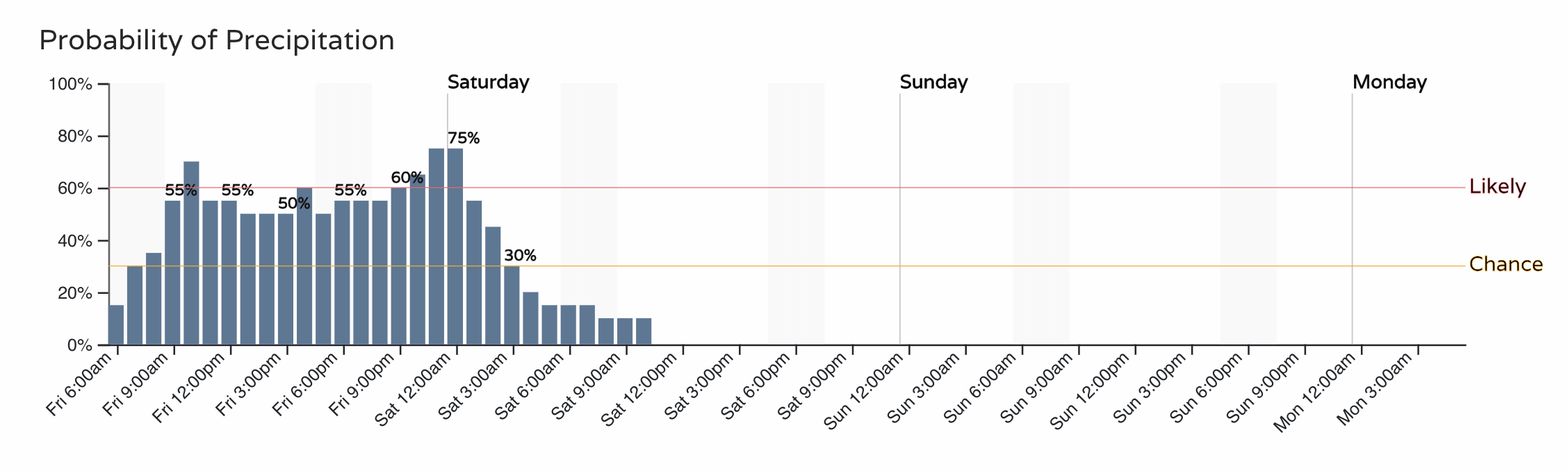
And the timeline for the Colorado Springs vicinity:
We'll keep an eye on things and push along an update if needed later today. As always stay up to date on all our changing weather by subscribing to our email list today!