
Hoping for a White Christmas in Denver? Here's an update on the incoming rain and snow to Colorado this weekend

As we discussed in our last update, we are tracking some moisture headed for Colorado this weekend. Some of that moisture will fall in the form of rain (😱), some in the form of snow (❄️), and some... well may not may not fall at all (🌬️).
There are really two systems we are tracking for the holiday weekend. The first is a wet but warm system which will climb out of the southwest today and Friday before eventually bringing some impacts to the state Friday night and Saturday. The second is a trailing system that will kick across the state on Sunday (and perhaps into Monday, depending on the scenario you're inclined to believe).
The first system is coming from the wrong direction if you like your water in the form of snow and not rain in late December. The second will have a bit more cold air to tap, but it may not have much moisture to work with. With regard to the second, there's also a lot of uncertainty in how it'll move through – the Euro is slower and deeper with the trough (better snow potential for the Front Range), while the GFS moves it through quickly as an open wave.
Here's a look at where the two systems are forecast to be centered early Saturday morning:
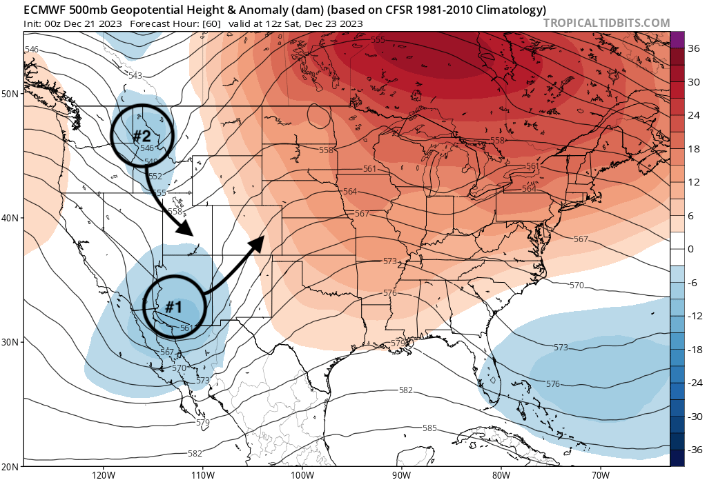
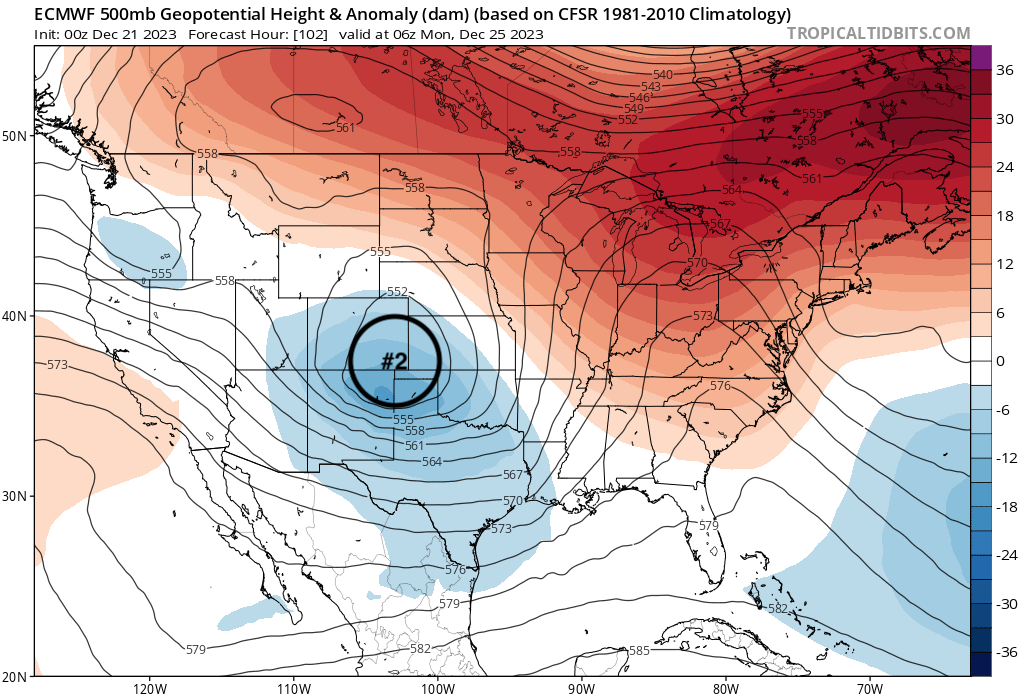
By Saturday evening system #2 is gaining ground on system #1 but they never really manage to phase, which leaves system one without meaningful cold, and system two (perhaps) without meaningful moisture – unless it ultimately digs a bit deep and slower on Sunday.

By early Christmas morning the European tries to do just that, and has a close (albeit broad) low in a decent spot for us to pick up some snow.
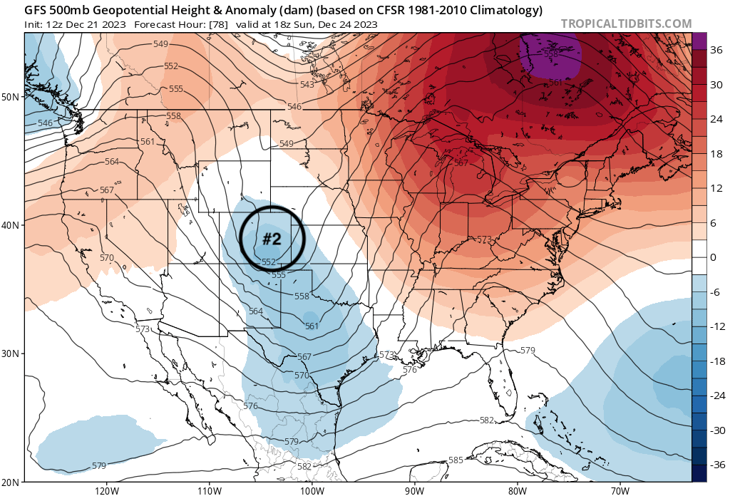
The GFS meanwhile is WAY faster and open with the low, tracking it through eastern Colorado already Sunday morning – about 12 hours faster than the Euro above.
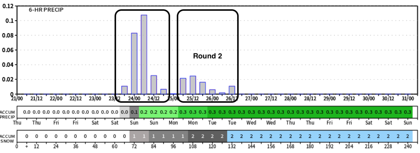
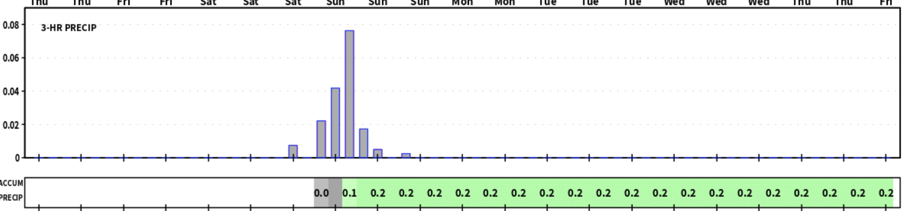
If you we look at the 3-hourly precipitation forecast from the Euro vs the GFS we see the Euro (top) with precipitation ramping up Saturday PM (half or more of it rain), with another round Sunday night and keeping us unsettled on Christmas Day. The GFS meanwhile shows only round #1 in any meaningful way.
So how much snow am I getting or is Santa bringing rain?
What does all this mean, and what are the odds you'll see a fresh blanket of snow on the ground for Christmas Day?
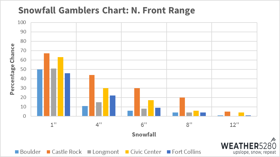
It's as fantastic question and one we aren't likely to have much confidence in until we get a bit closer to the weekend. Snowfall gambler charts would put the chance of 1" of snow or more before Christmas at about a 50% chance right now for most of the northern urban corridor, with some trailing high-end potential show things end up coming together right.
Our hope is today's data starts to narrow in on things as bit more and we'll be able to add some confidence to these numbers. Should the GFS solution pan out I would think these odds are about right. If the second system gets its act together a bit more it could be we see the gamblers tick up a bit in our next update.
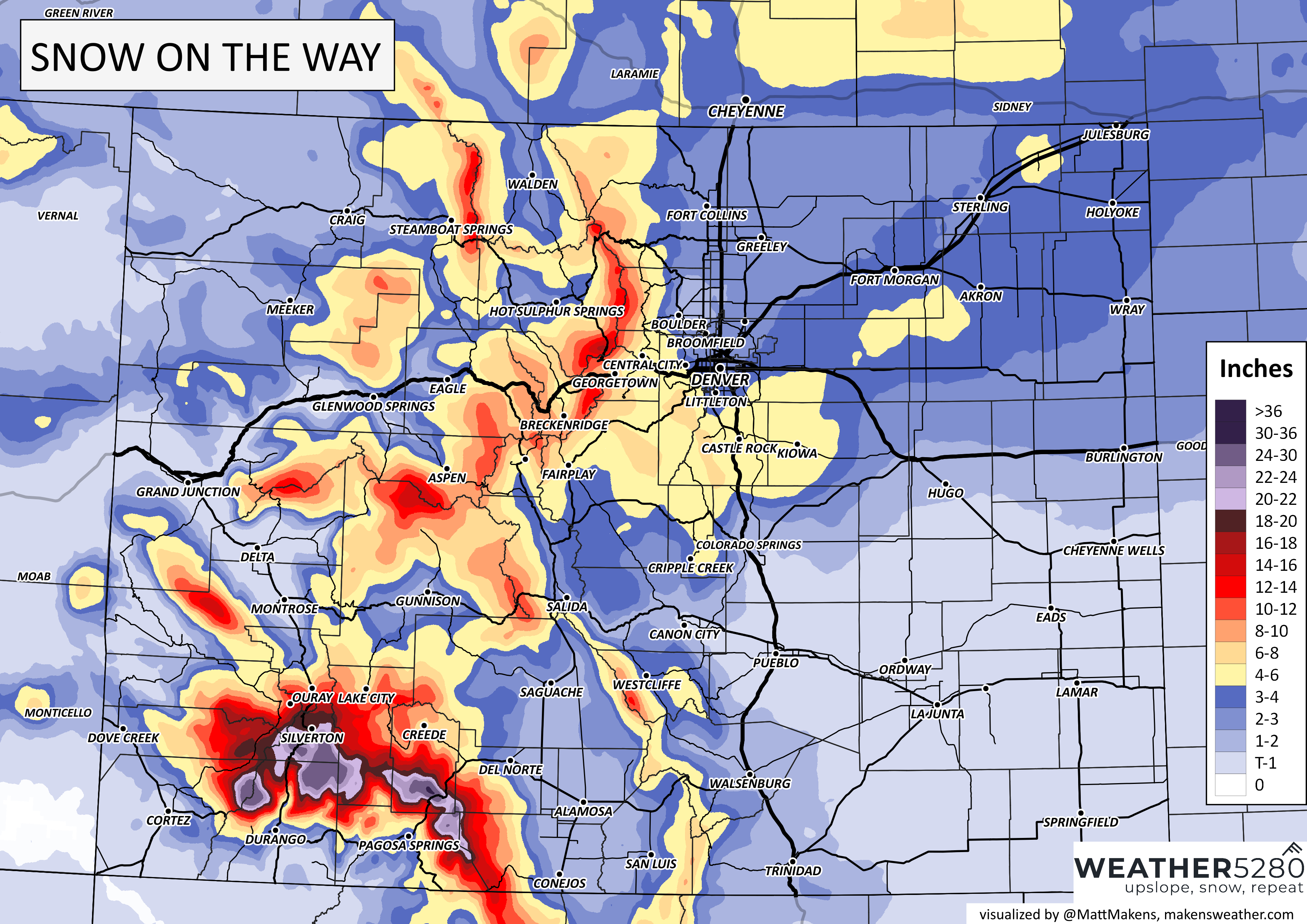
For an early idea on how much snow we expect to see across the state this weekend, here's a map. These numbers are almost certain to change between now and the weekend, so stay tuned!
Travel impacts
Obviously with the wet weather in the forecast folks will be concerned about their travel plans heading into the holiday weekend.
If you're flying in or out of DIA you should be good on Friday and most of the day Saturday before rain and eventually rain mixed with snow hits the forecast later in the day Saturday into Sunday morning. We see gradual improvements across the area Sunday with perhaps a round #2 Sunday PM into Monday, perhaps not.
At the moment I wouldn't be all too worried about travel disruptions at DIA, but of course that's subject to change – and given the number of folks moving through the airport this weekend it won't just be the local weather we need to worry about.
In our next update we'll dig in a bit more on snowfall totals and impacts, and can pass along any updates on travel concerns we have at that time as well.
Please subscribe to our email list to stay ahead of the storm!