Snowpack numbers are dismal across Colorado and the West, will January deliver the goods?

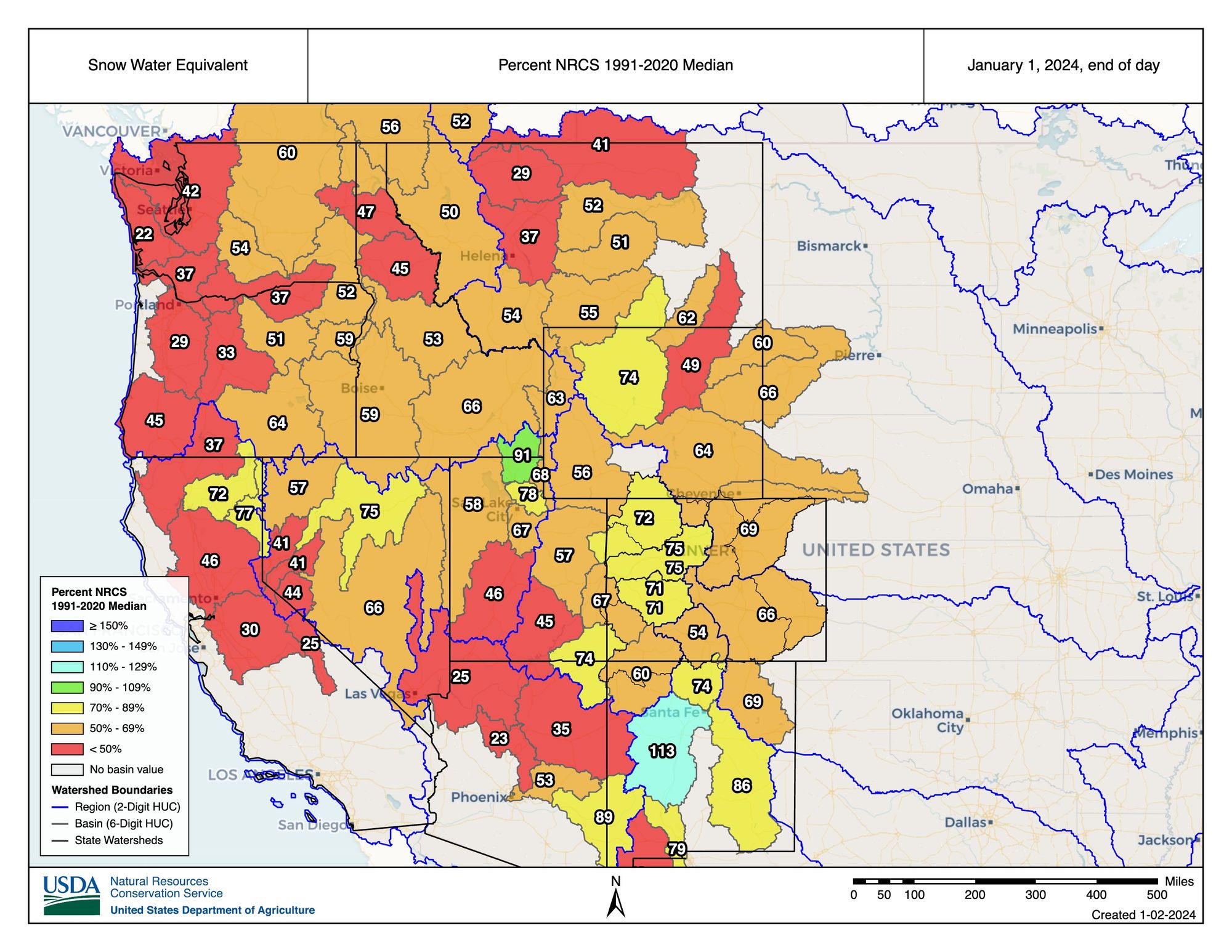
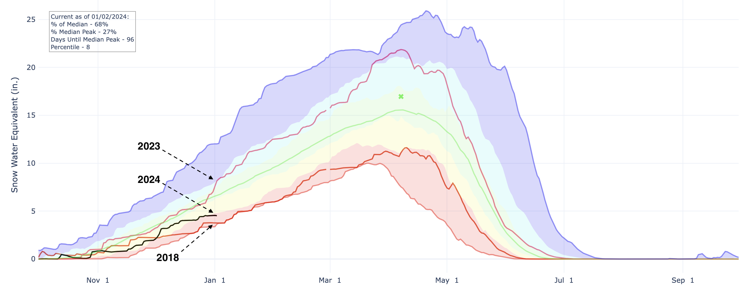
It's the worst start to to a new year for snowpack across Colorado since 2018, with the median snowpack running at just 68% to start 2024. Ouch!
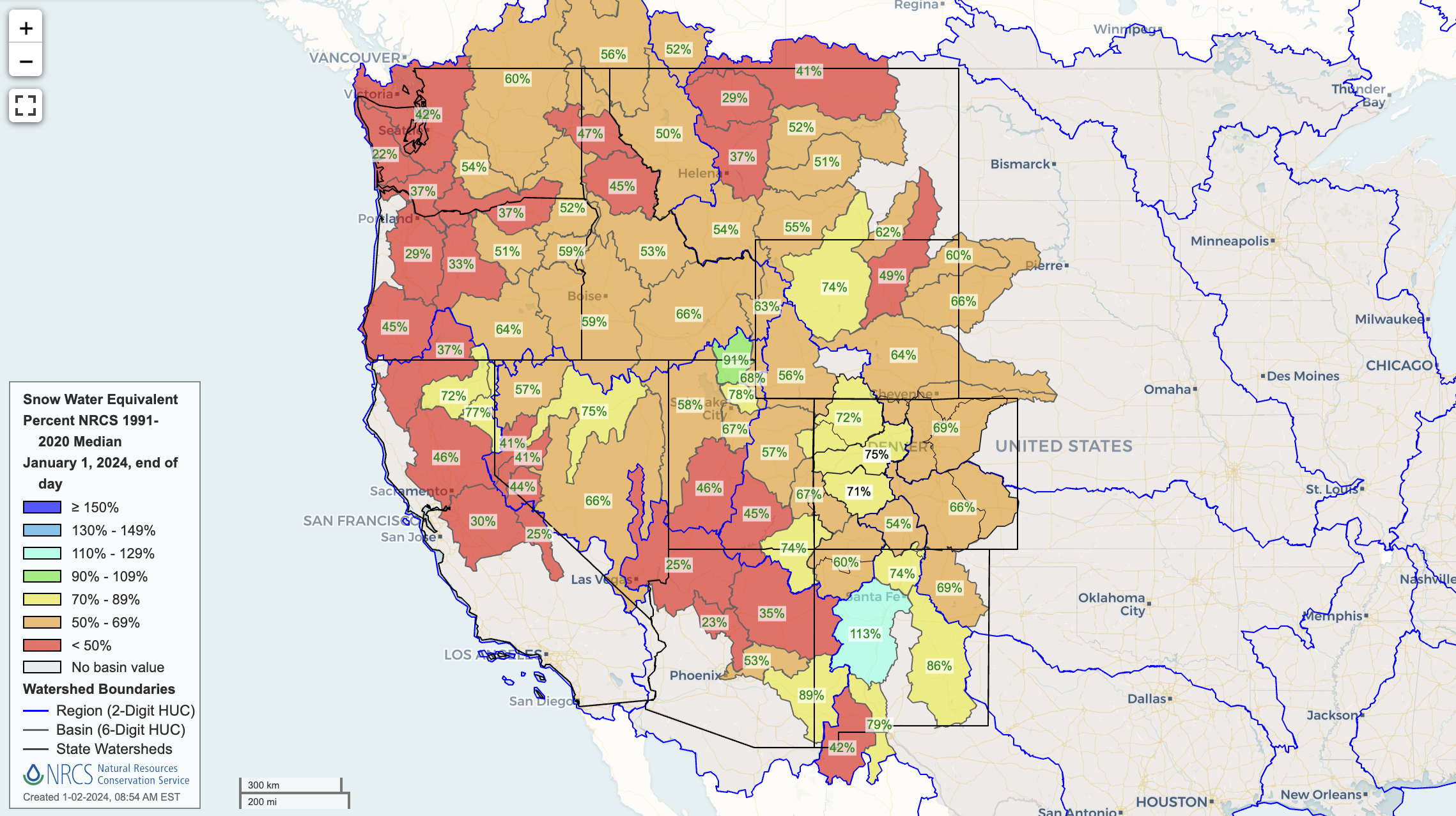
The troublesome snowpack numbers aren't unique to Colorado either. Across the west we see the majority of basins running below average to date, and in perhaps a majority of cases well below that longterm average. Basins running 70% of better of median are in few company.
This year's issue isn't just that it's been dry, but it's also been warm. What weather California has seen has come in the form of rain in many cases, an issue we've seen closer to home as well in recent storms.
Snowpack boost in January?
We've discussed in prior updates that the wave train does appear to really crank up here to start the year, which in theory should put us in arguably the best position yet this season to cash in on some snow across the region. The animation below shows the 500mb pattern for the next 10 days as advertised by the European ensemble mean, and you can see one wave (blue) diving into the great basin then swinging east.
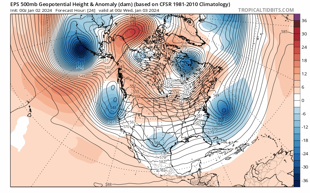
This pattern would support quite a bit of cold air to work its way into the pattern, something that's been nothing short of lacking thus far this season. It'll be gradual, but should current guidance hold (we'll see!) we should be seeing quite a bit of actual cold across the CONUS, the western two thirds in particular, as we head into the middle part of January.
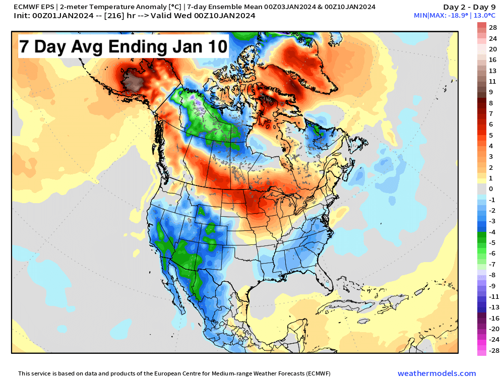
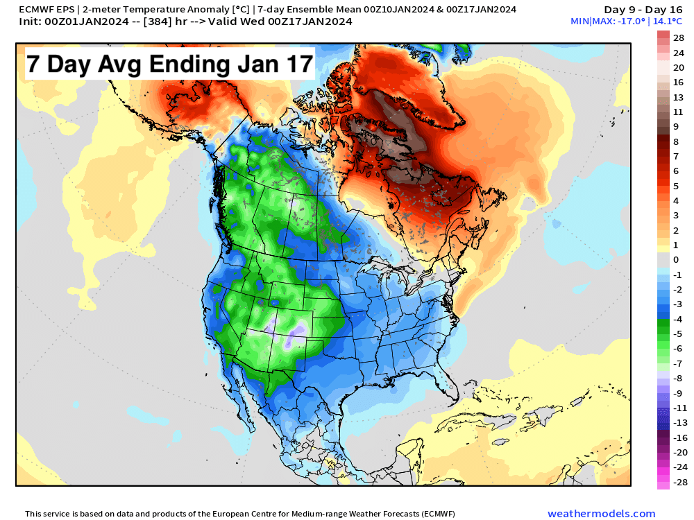
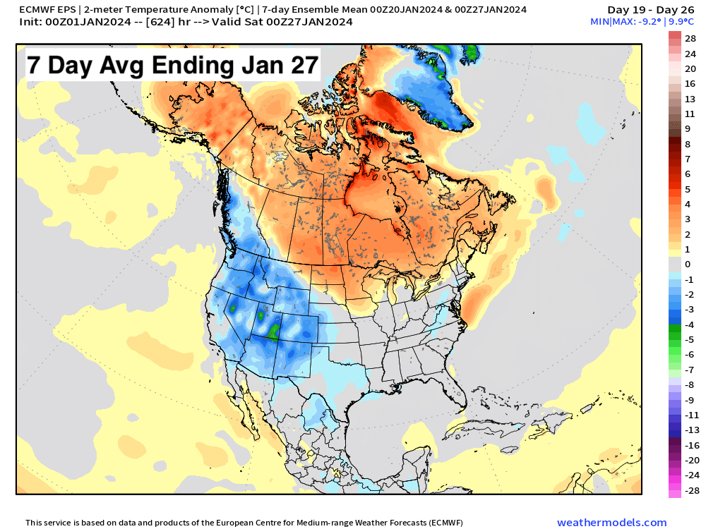
Below are the latest forecast 7-day average temperature anomalies through the last days of January. Greatest confidence in the cold infiltrating the states comes during the second week of the month.
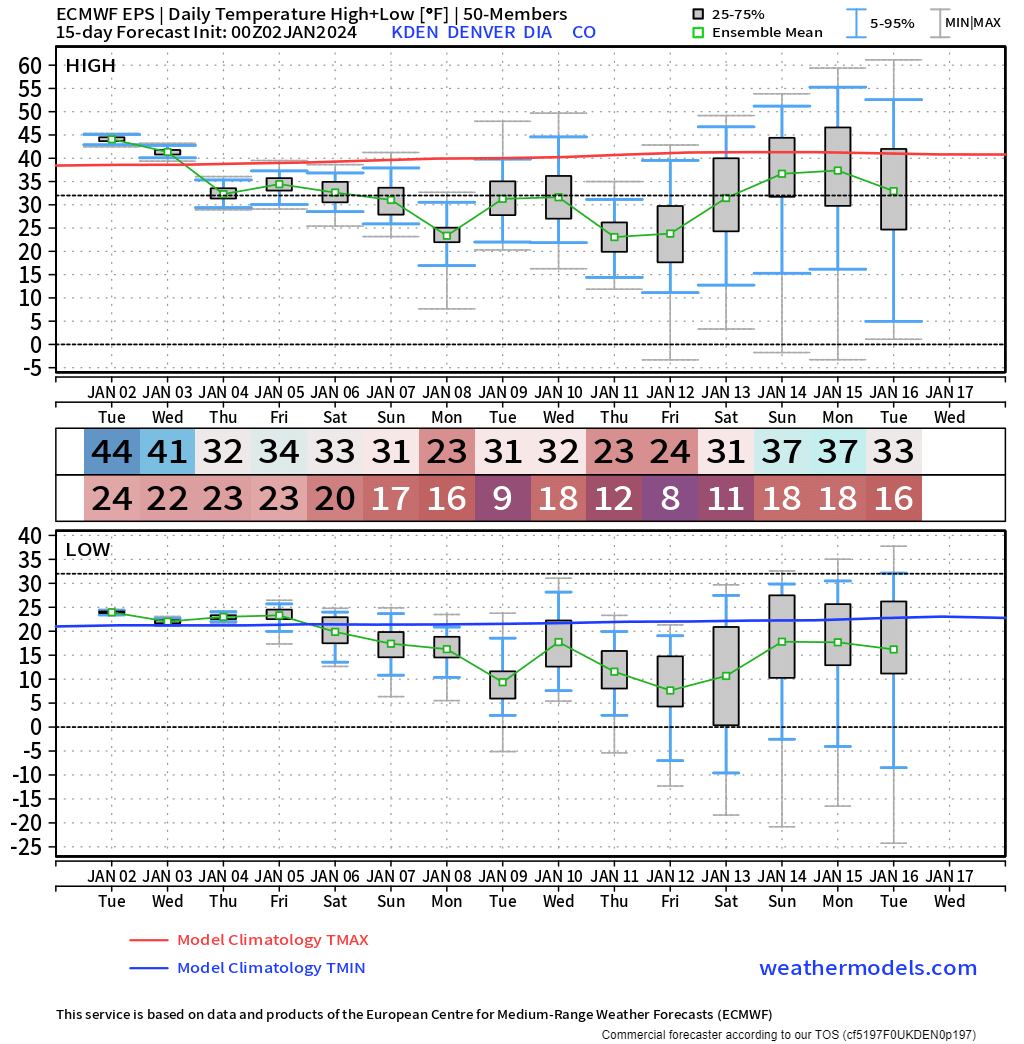
For a day-to-day look at what is possible in the Denver area, here are the highs and lows. Notice, some single-digit temperatures are possible during this cold snap.
As for snow and not just cold? Well, the details will come, but again, the pattern would support a much-needed lifeline for snowpack across the West, as well as a likely far more active winter pattern from the Plains east across the CONUS. Still, as you'll see below, it may not be enough to dig us out of the hole, especially for some locations where the pattern will continue to swing-and-miss.
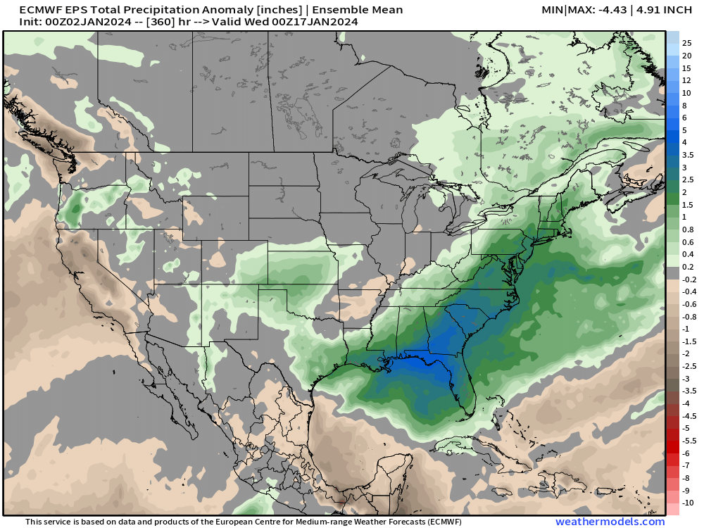
The latest European ensemble mean forecast through Jan 17 shows above average precipitation for parts of the intermountain west (yay!), eastern Colorado (particularly those areas south/east), and across the Southeast U.S. and up the eastern seaboard. Not a great look for California, and a bit of a concerning look for the northern and central mountains of Colorado as well.
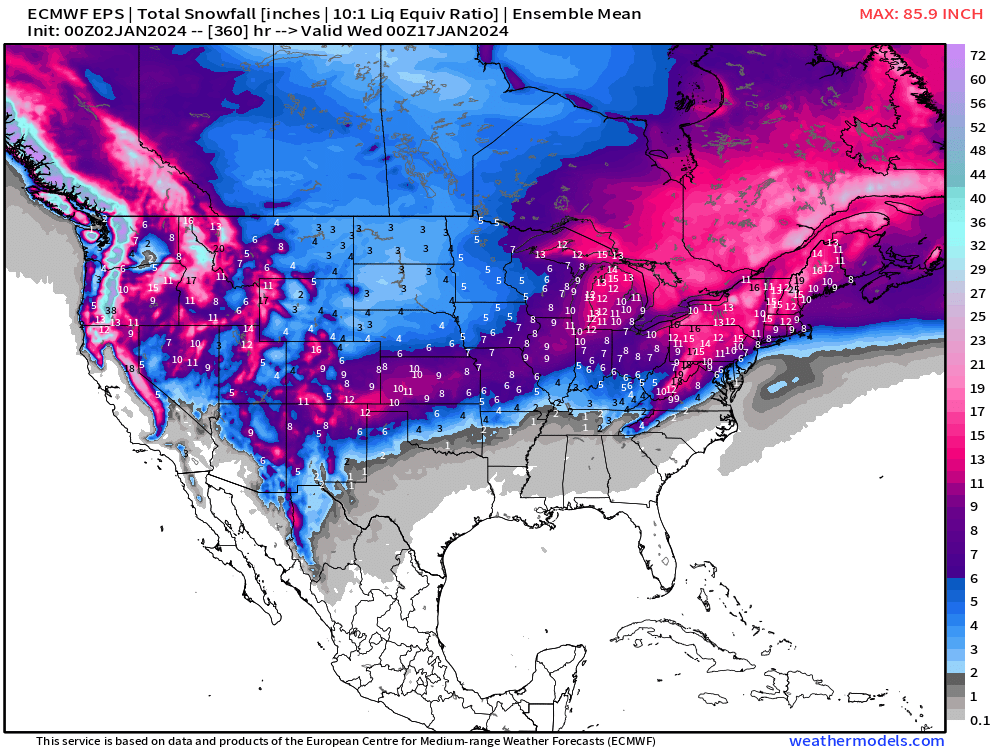
As for snow? Pretty healthy looking snowfall map overall for the next 15 days I would say, but the devil, as always, is in the details. Let us hope!
Remember to subscribe to our email list if you haven't already. We'll stay on top of any cold ... and snow?? ... that may be headed your way to start the year, and pass along updates to you as we do!