
Multiple waves of snow to hit Colorado and parts of Denver metro area

We are almost to the weekend, and if you are a skier and plan to be on the hills, you'll see some freshies. If you aren't leaving the metro areas, you too have a chance of some snow.
Here's a quick animation that shows areas of snow during the weekend.
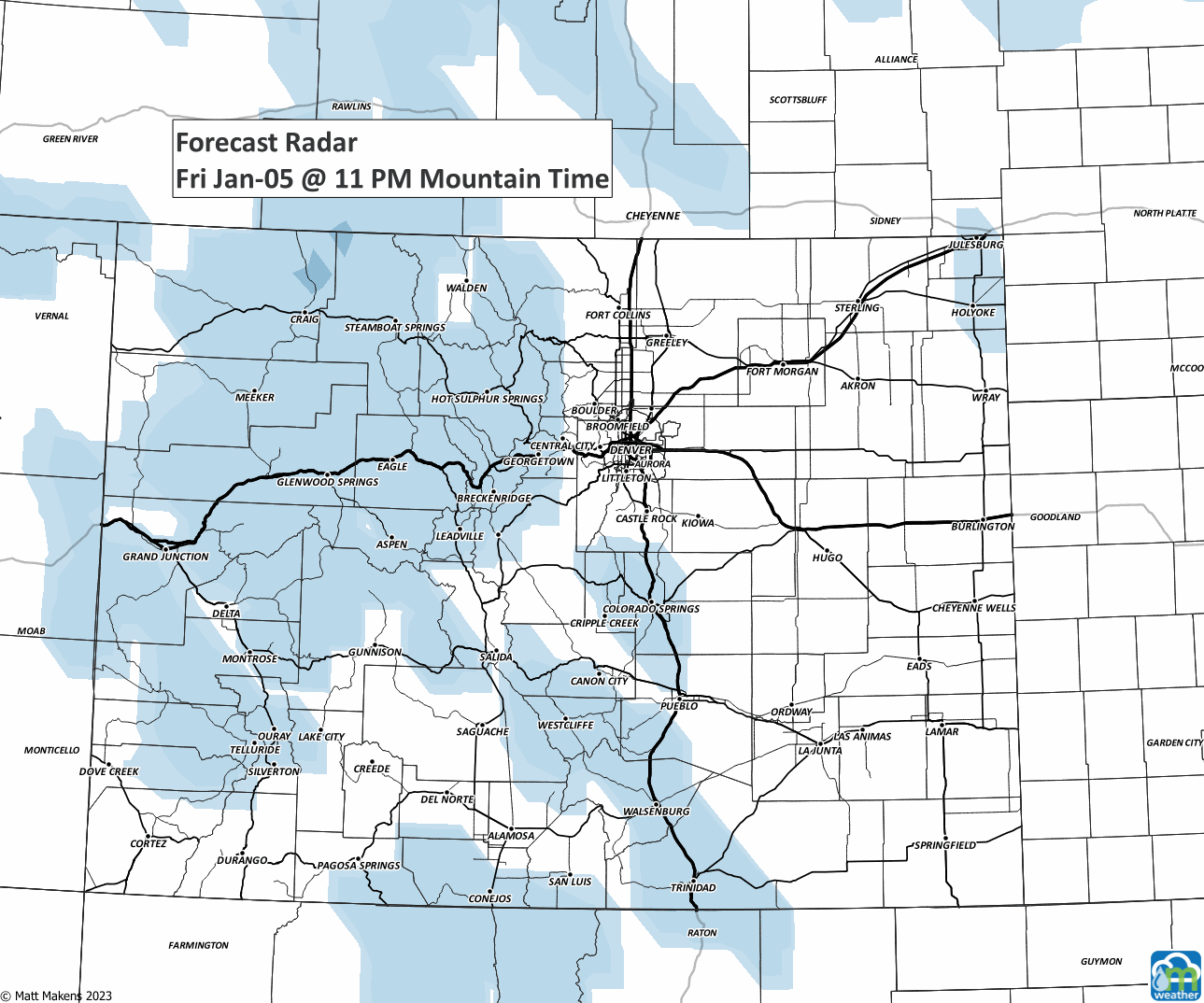
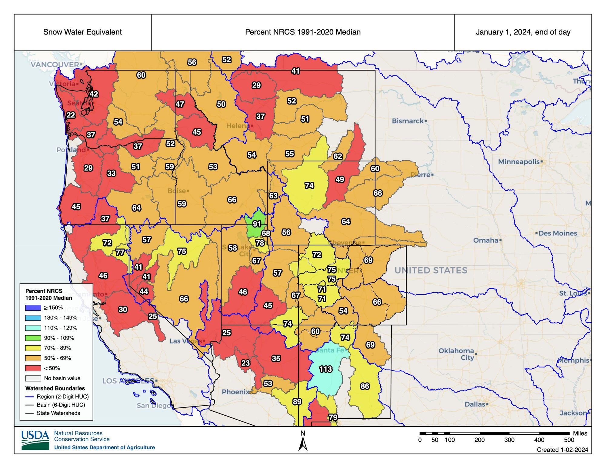
The images for Sunday are what catch my attention, with those deep blues indicating heavy snow over the mountains - a place desperately needing snow. A recent post about just that ->
For this weekend, we have some valuable snow to fall on many ranges.
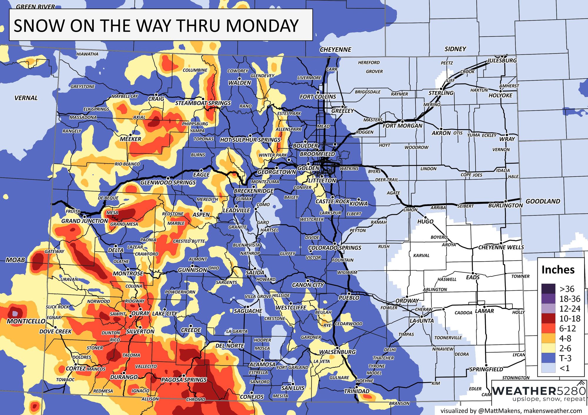
You can see the heaviest snowfall will hit the Grand Mesa and the San Juans. There is some possibility of snowfall for the metro areas too. A dusting toward three inches is possible along the I-25 corridor by Monday afternoon. This will come in two waves, one Saturday and another late Sunday.
Here, this timeline can help sort out the hourly chances for Denver.

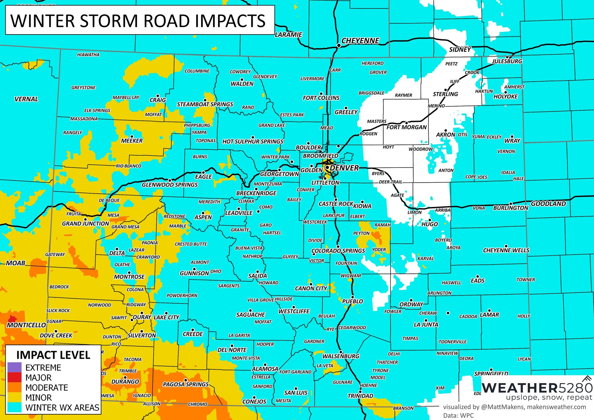
Out of the two, the second wave may carry a higher impact due to timing of that snow and the Monday morning commute. In all, the highest impact for the metro areas is low as compared to the mountains.
This unsettled weather pattern is all part of the more active regime that will control much of January. We discussed this earlier this week here ->
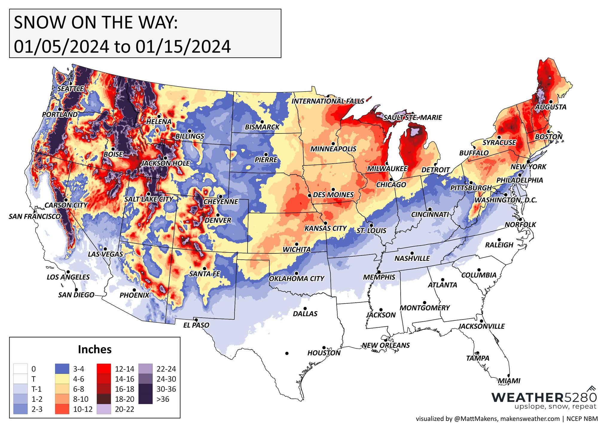
Just for the next ten days, you can see how the storm track discussed in that linked article will result in quite a bit of snowfall across the states.
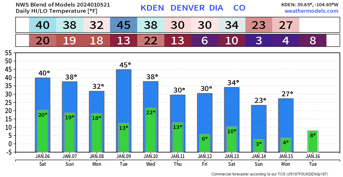
This will come through with some cold air, also. The Central and Northern Plains have dangerous cold settling in, sub-zero, and some of that will try to brush against Colorado. We can sort that out in a future post, but just for general guidance, here are the daily highs and lows for Denver during the next ten days.
We will be back with you to update snowpack, snowfall, and the cold details. A great way you can keep up with this active pattern is by subscribing to our email list!