Winter Storm Warnings and Advisories posted across Colorado, fire relief is knocking at the door

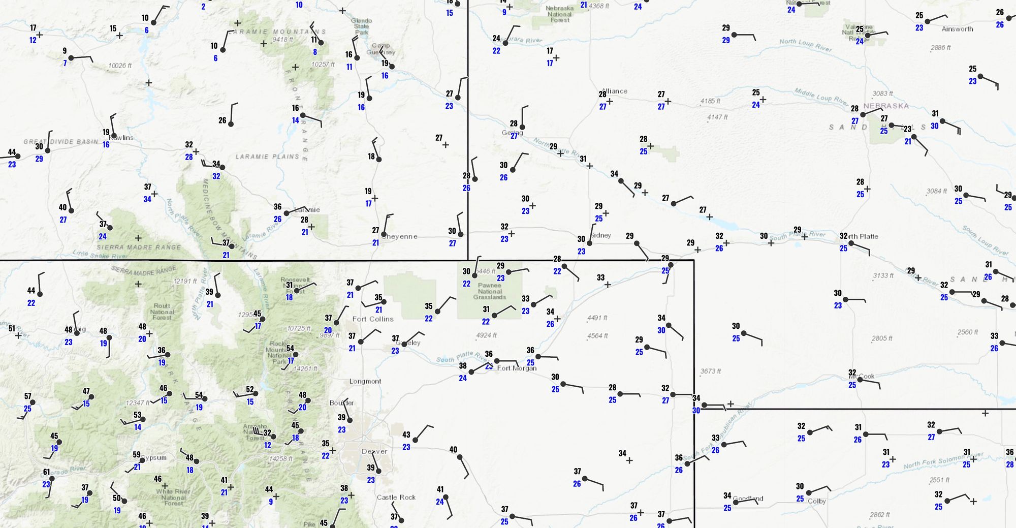
Colder air has been filtering into Northern Colorado all evening, and will continue to do so through the night. A look at observations this evening shows temperatures in the teens and 20s across Southeast Wyoming and Western Nebraska, with readings mostly in the 30s and 40s across the Northeast Plains of Colorado:
Our much anticipated, and much NEEDED storm remains on track this evening. No data since our last update looks all that different this evening, save for where each model places the heaviest snow bands for any given run.
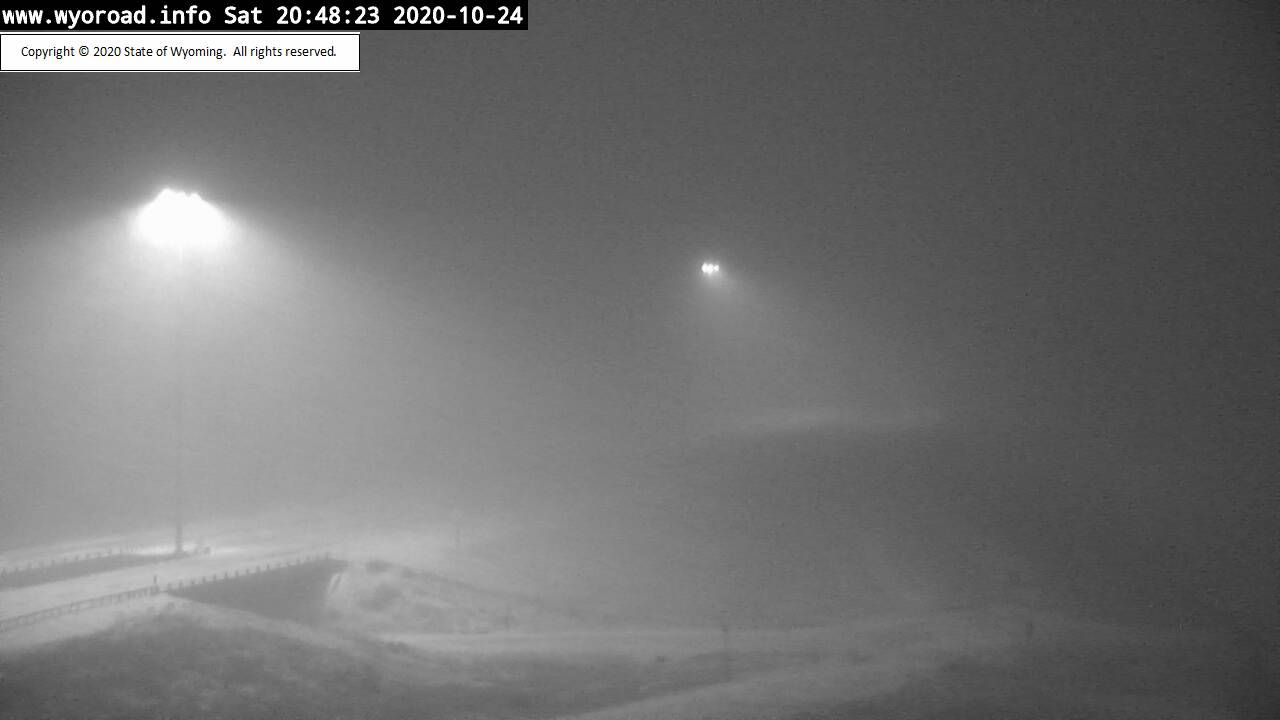
A look at cams north of Cheyenne show the snow that's headed our way. In fact, some of that snow is already making its way across the Colorado/Wyoming state line this evening, with moderate snow being reported in the mountains northwest of Fort Collins. Snow will arrive in Fort Collins in the coming hours, and eventually spread south overnight and into Sunday morning.
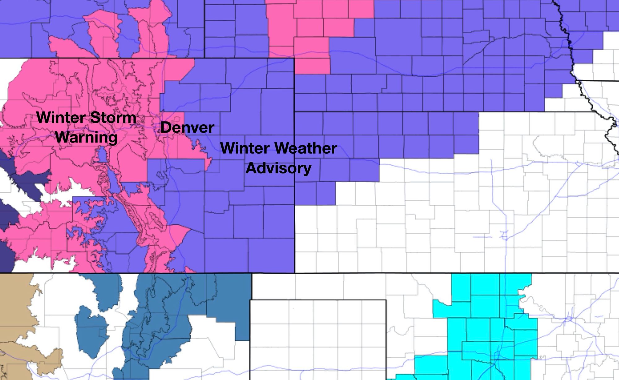
Advisories and Warnings in place
The National Weather Service in Boulder has issued a Winter Storm Warning for Denver and much of the urban corridor.
Castle Rock, Denver, Boulder, Loveland, Fort Collins – you are all under a Winter Storm Warning. It goes into effect Sunday morning at 6am, and remains in effect through 6am Monday. The heaviest snow is expected during the day Sunday and into Sunday night, gradually tapering off from north to south early Monday.
Colorado Springs, Limon, Greeley – you all are under a Winter Weather Advisory. The advisory follows a similar timeline, although those across Southeast Colorado (including COS) will be under the Advisory until Monday PM.
A look at the NWS hazard map shows that most of Colorado is under a winter weather alert this evening, and thank goodness!
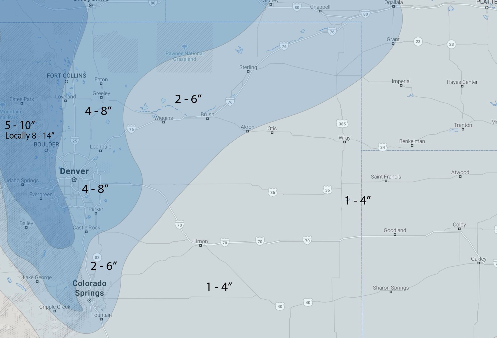
Snowfall forecast
As we mentioned earlier the area we were watching closest for the need to change was Colorado Springs. Data today continues to suggest that a nice band may impact the COS area, which could bring some localized 3 - 7" totals to its metro area. We'll go ahead and pull the 2 - 6" range down to cover COS, but still keep the heaviest totals from Castle Rock north.
For the I-25 corridor we'll stick with 4 - 8". Could we see some 10" totals here? For sure. Bands are gonna band, and figuring out exactly where that extra jet help is going to cause problems for our forecast is never easy. In general, we think 4 - 8" will hold, as you get close to the foothills 5 - 10", with locally over a foot possible.
Here's our latest map, this is from early Sunday through Monday:
COLD
The snow is the big story this go around, not necessarily because of how much we're likely to see but because it is so badly needed.
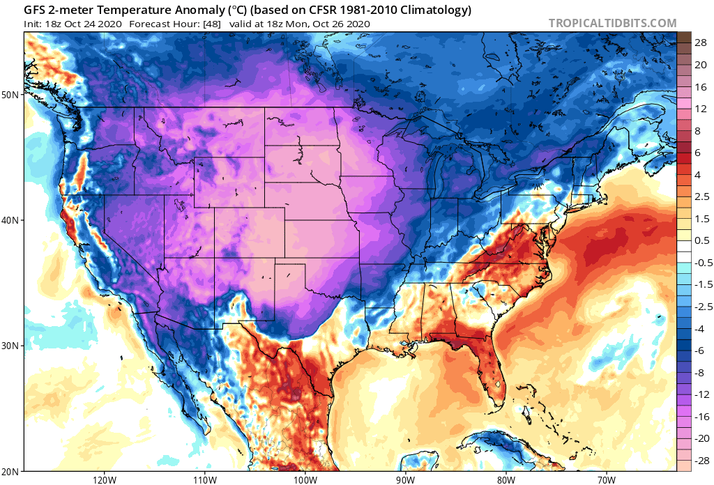
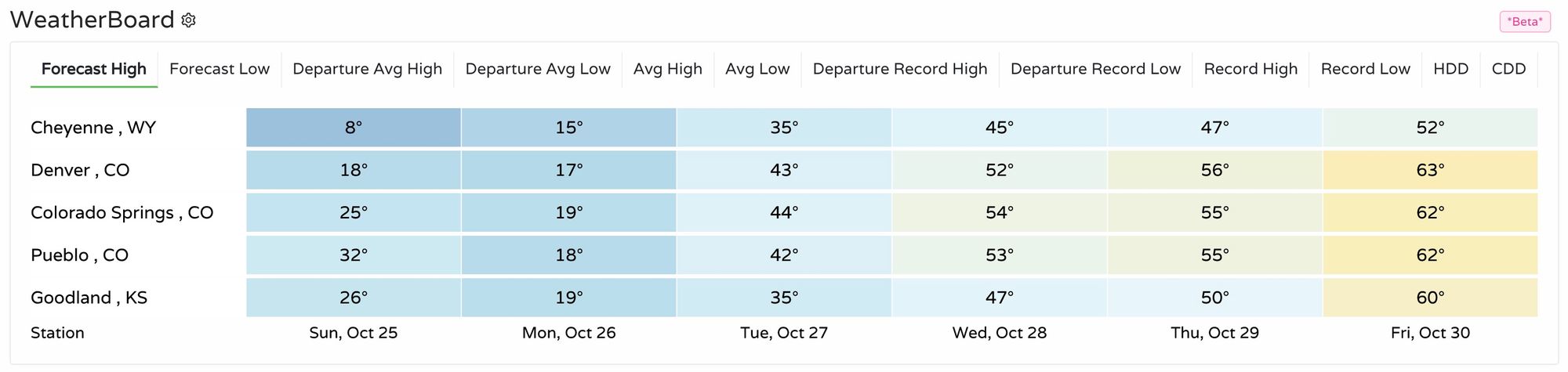
Another big part of the story over the next few days will be the COLD. Perhaps not record setting for Denver, but many areas could set or tie record lows in the coming days, including Colorado Springs.
The hourly outlook shows Denver dropping into the teens Sunday morning and staying there all day. The Broncos game is forecast to kickoff with temperatures around 15°F and snow. By Monday morning temperatures will be near 6°F.
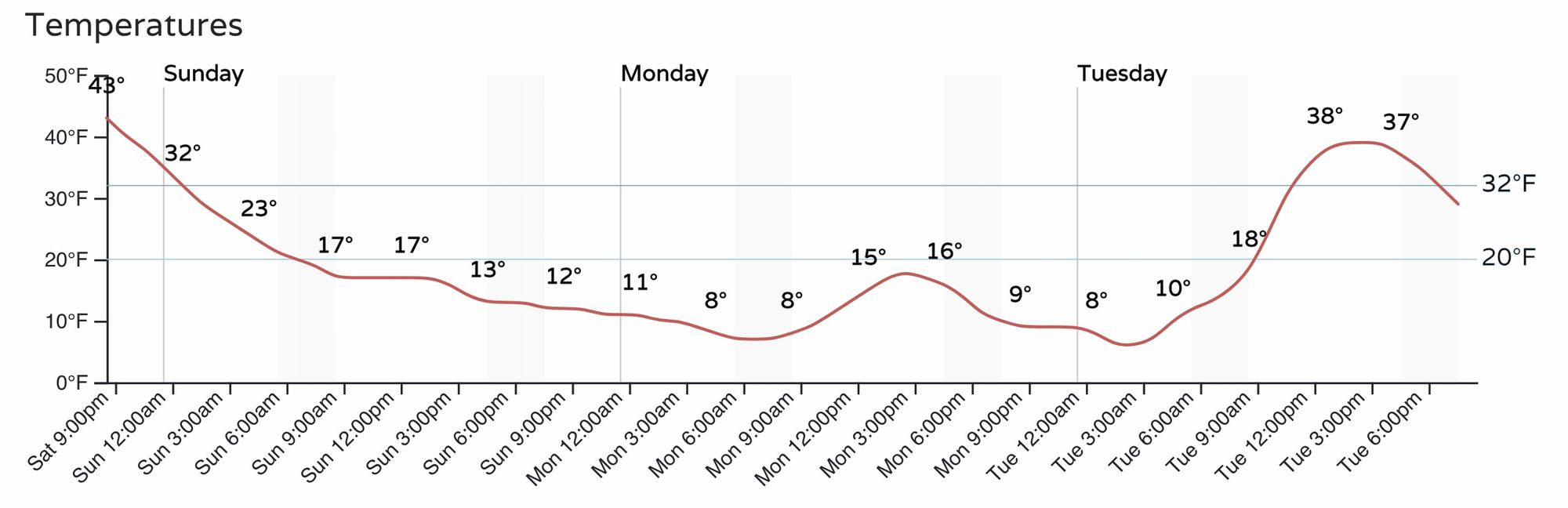
Here are the forecast highs for the coming days, with overnight lows in the single digits Sunday night and Monday night:
Bundle up! And keep us posted on how things shake out at your place. We love hearing your snow reports... boom, bust, or otherwise!