Weekend system to bring chillier weather to Denver, and perhaps feet of snowfall to SW Colorado
Temperatures are forecast to drop this weekend – after days of record/near record temperatures – and some areas will see rain and snow, too.
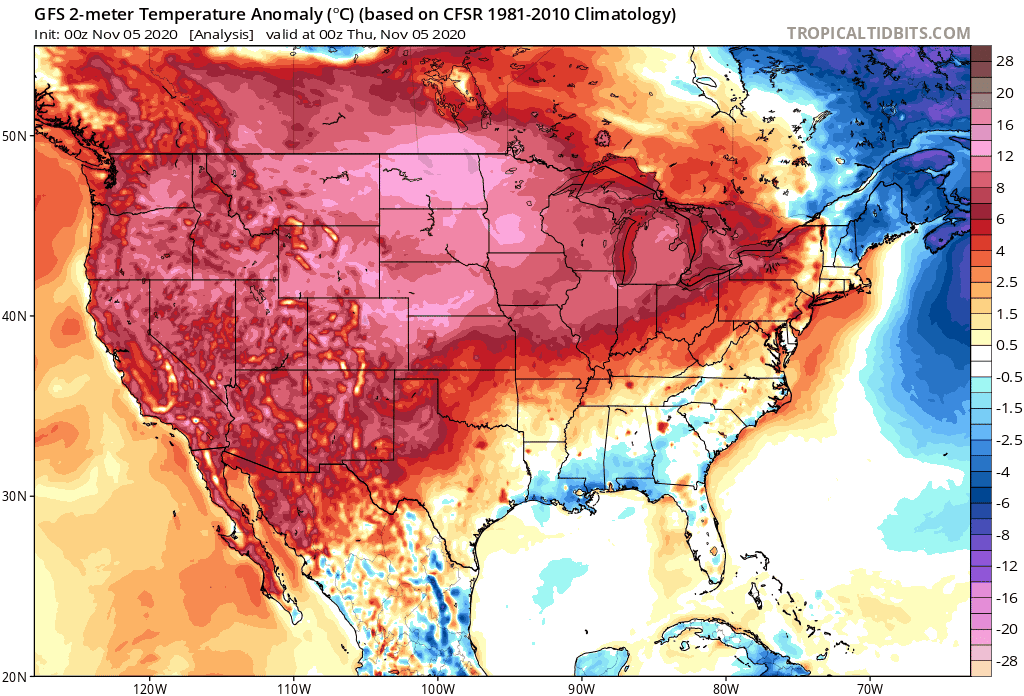
Yesterday, Denver set a record high for November 4th reaching 77°F (the old record was 76°F set in 1915), and also set a record warmest low temperature for the date of 47°F (the old record was 45°F set in 1999). We have several more warm days ahead of us before cooler temperatures return to the forecast.
Let's look at the temperature animation showing the colder than average temperatures headed from the Western to the Central US by the latter half this weekend and into early next week.
On a regional scale, you can see the temperature forecast through Tuesday on our WeatherBoard.
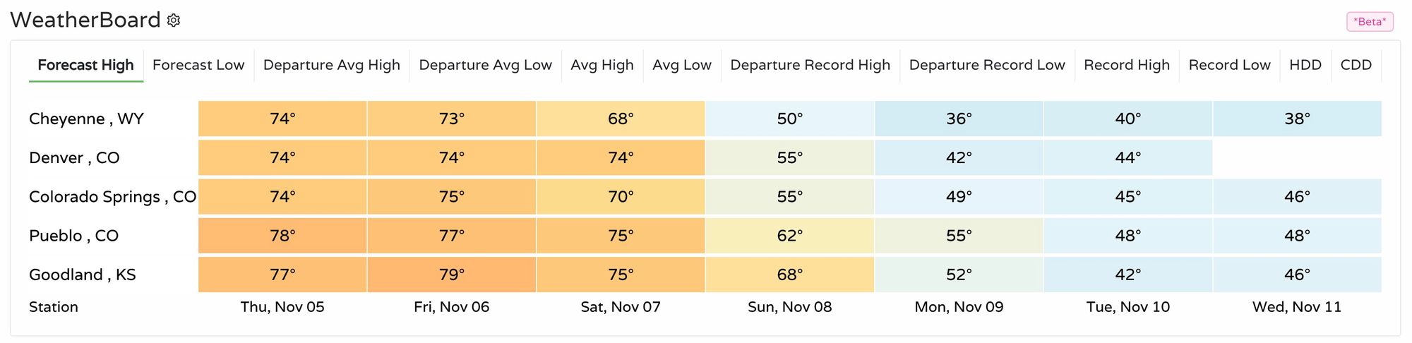
For all cities listed, the forecast for Thursday and Friday is very near record highs. Colorado Springs is likely to tie a record high today, and Cheyenne, WY is forecast to tie its record high Friday based on that forecast.
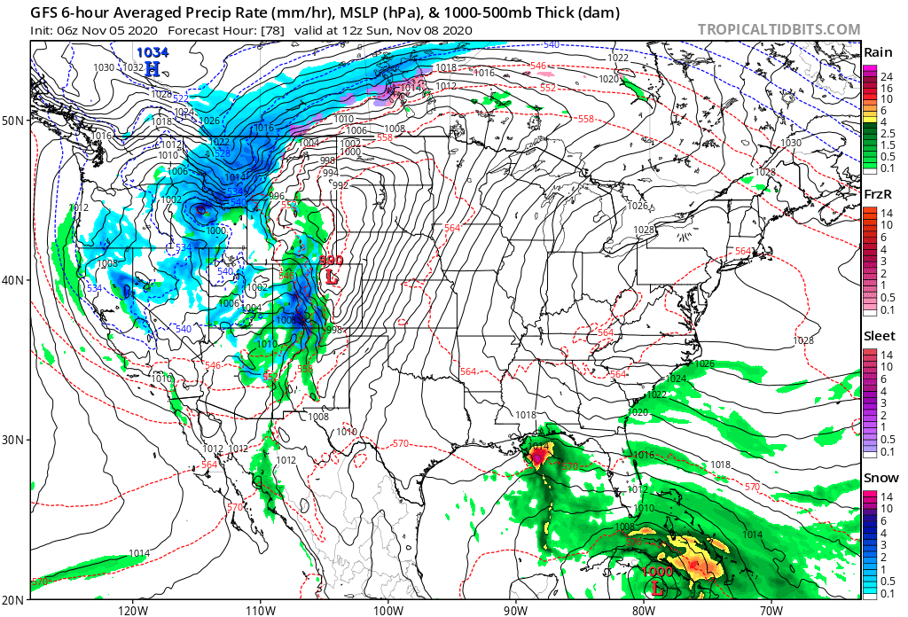
With the temperature change will come some rain and snow for the state, though at this time not all that much is expected east of the Divide.
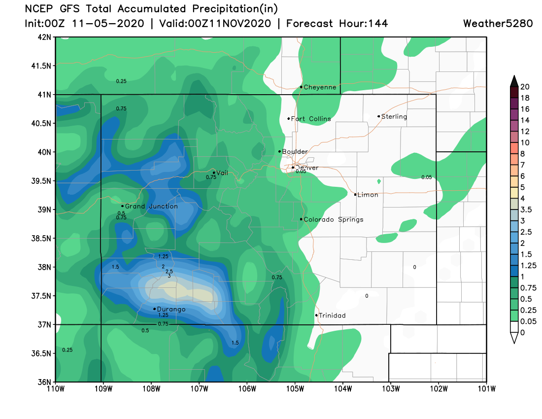
Consistently, the San Juan Mountains are the bullseye for the most water. The image below shows the potential, through Tuesday, for more than three inches of precipitation in parts of the San Juans, yet very little for the metro areas.
Turn to snowfall numbers and a bullseye of a couple feet, if not more, grabs one's attention!
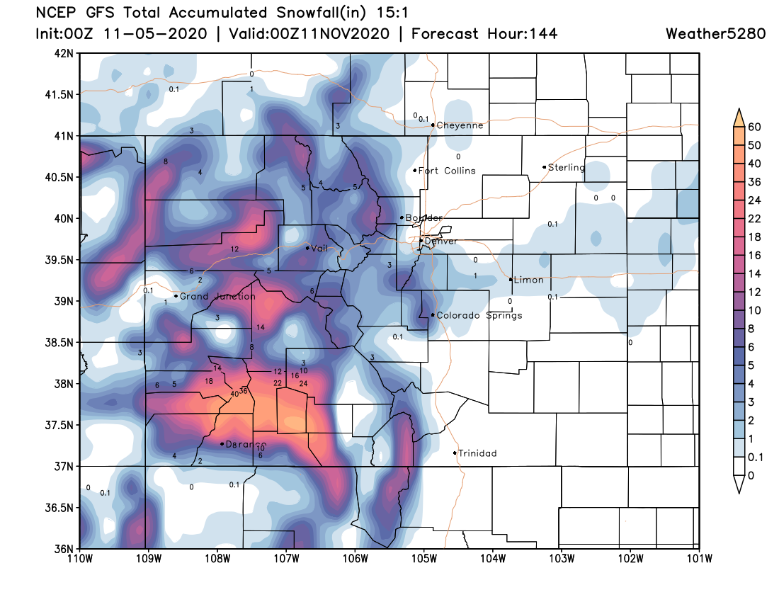
Also through Tuesday, the data thus far hasn't depicted much accumulation for the metro areas.
Something to watch out for regarding the modeled precipitation is what occurs in a band from Colorado to the northern plains states to the east. The regional Euro Ensemble forecast calls for a band of heavier precipitation, mostly snow, as you can see here. At times that band has reached further west and impacted more of Eastern Colorado. We shall see.
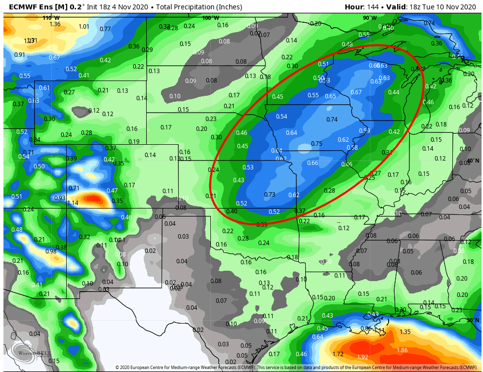
The idea that the most water falls both east and west of the Front Range and metro areas has remained consistent as the models have updated the past several days.
Breaking the data down into our probability of totals, we see low-end probabilities for Denver thus far.
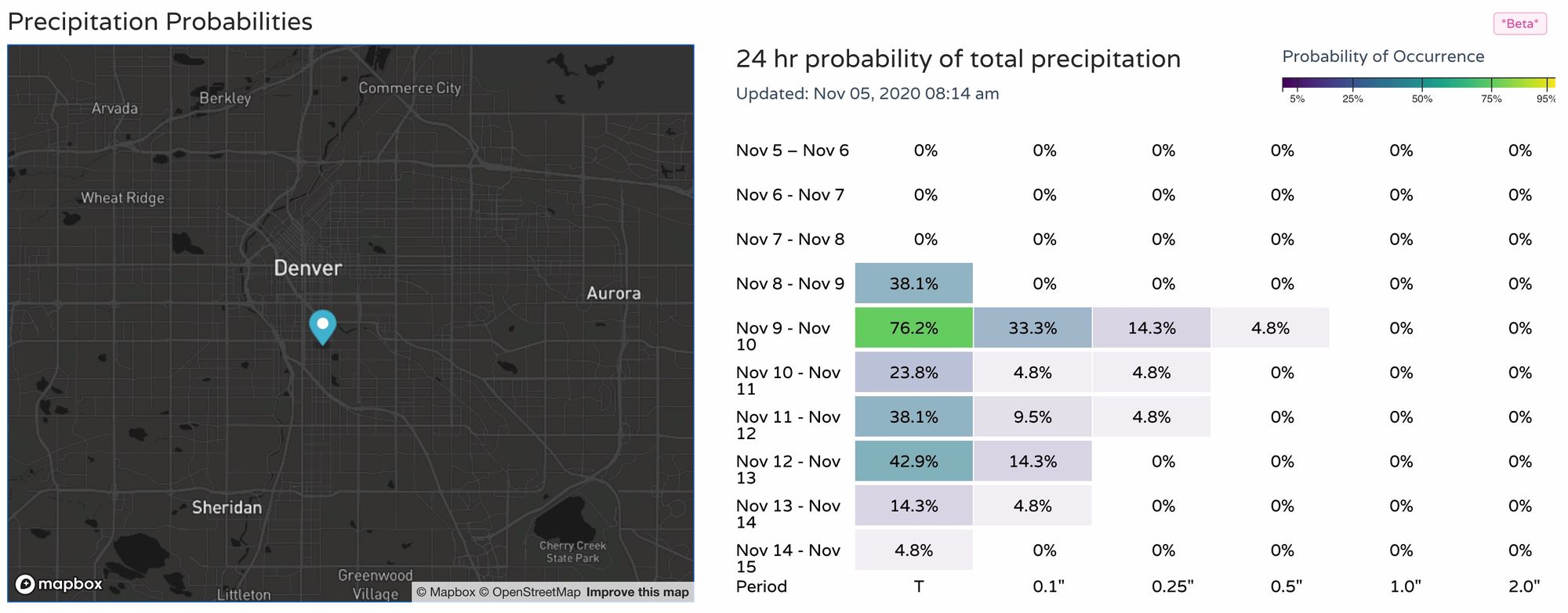
For Monday, the city has a high chance to receive a trace of water, but only a 14.3% probability of reaching a quarter of an inch. Still, a cooler and more "unsettled" pattern on the way, even for the Front Range.
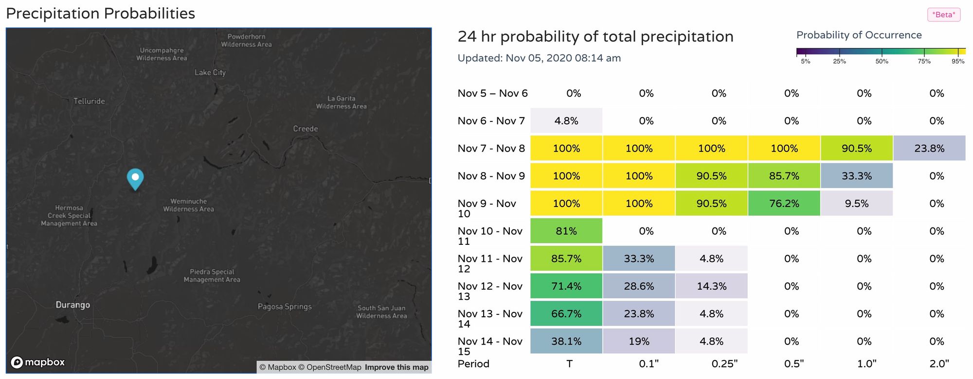
Compare this to probabilities for the Southwest mountains, and you can see the big difference in confidence for meaningful moisture:
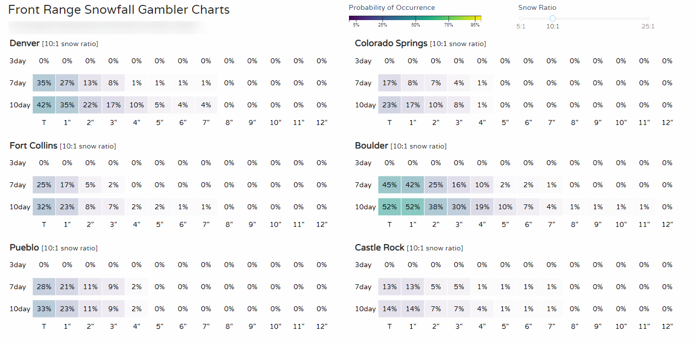
For snow lovers, let's check our Gambler Charts:
So, while we do have a temperature change on the way for the entire state, at this time it does not look like all of us will see meaningful rain and snow.
With a glass half full, there is time to track the system to see if it will develop into a better position to produce higher precipitation totals for the metro areas. A little deeper system would help that outcome, let's see.