Wednesday PM update: November warmth comes to an end for the weekend

We continue to track changes to the weather pattern as our next system will move through the region to end the week, leading to a chilly and unsettled weekend for much of the state.
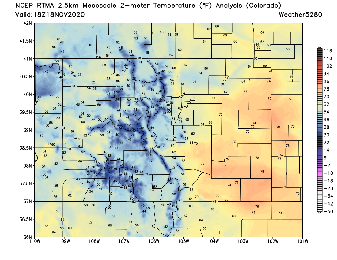
Temperatures as of midday had climbed into the 60s and 70s across most of Eastern Colorado, with low-lying areas hovering in the 50s as of the 18z update. Needless to say, temperatures will once again be well above average today, topping out anywhere from 15 to 30°F above average across the region Wednesday afternoon.

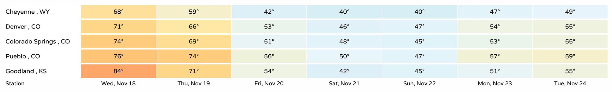
Thursday again will be mild, before cooler weather arrives for Friday and the weekend. A check on our set of region stations shows highs in the 60s and 70s today (mid 80s for Goodland!) and Thursday, before cooling into the 40s and 50s to end the week.
There will be some moisture with the incoming weather change, but perhaps not much. And, if recent data trends continue, those precipitation chances will continue to decrease for most of us. What precipitation does fall will come in both the form of rain and snow across Colorado, as the chilly change won't actually be all that cold given the time of year.
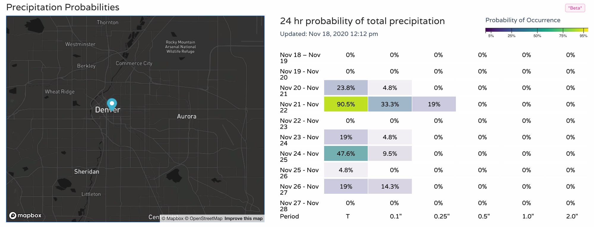
Here's a look at 24 hour precipitation probabilities for Denver. As you can see, pretty low-end, but the best shot at at least something meaningful comes Saturday:
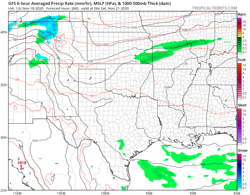
The latest operational run of the America GFS model shows almost no rain or snow for the northern urban corridor this weekend, and only spotty coverage statewide.
Instead, it shows (like we saw last weekend) better snow chances west of the Divide beginning late Friday night:
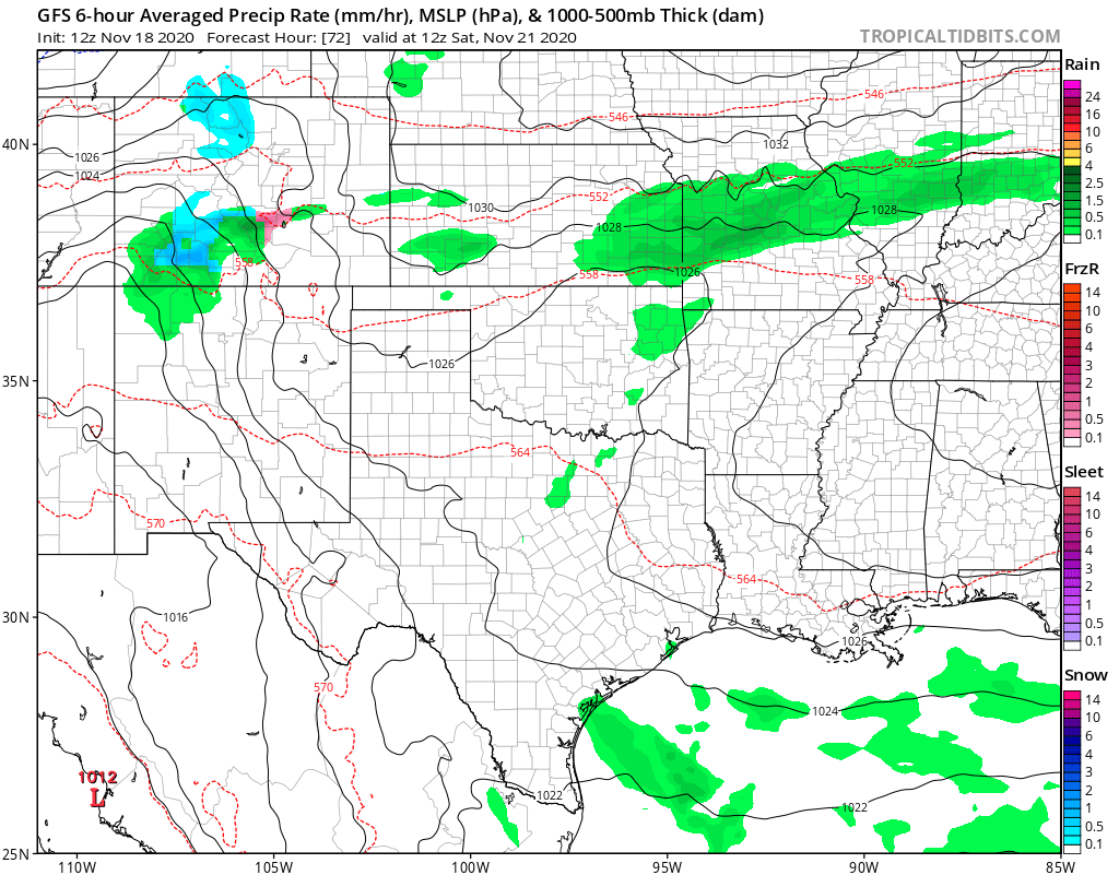
With moisture moving into Southern Colorado for the day Saturday and snow showers coming to end end up north during the day:
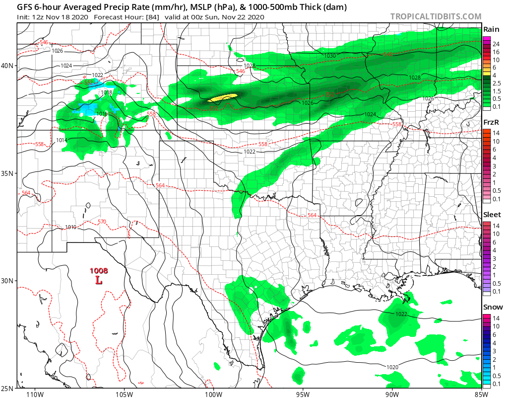
With most of the precipitation on this particular model setting up from Colorado Springs south Saturday night and Sunday:
With marginal temperatures in place we don't expect much snow for even the areas that do see the moisture east of the mountains. Some snow is possible, yes, and even some icing issues Friday night in spots and again Saturday night as temperatures will dip below freezing in most locations these nights.
Still, a high-impact or even drought beneficial storm this does not appear to be. Instead, a cool down from the record and near record heat we've seen across the region this week, and a reminder that yes, it is the second half of November after all!
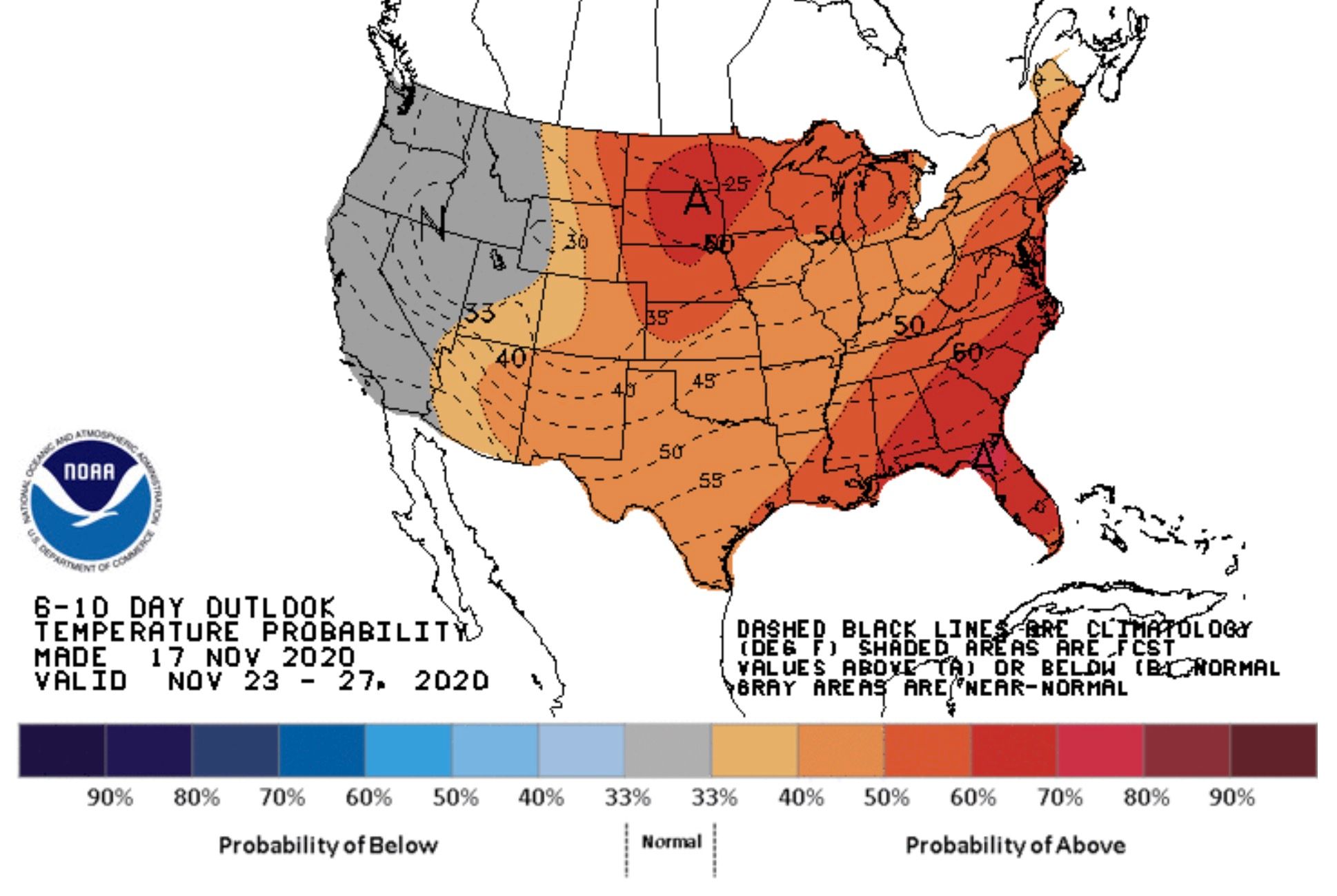
Beyond the weekend, a drier and warmer outlook looks to return. Here's the latest 6 to 10 day outlook (Monday - Friday of next week) showing temperatures much above average for the eastern two thirds of the country. Something to watch for is perhaps a more active storm track as indicated in some of the data, which would mean while the means could end up with warmer than average temperatures next week – perhaps we catch a quick system or two. We'll see.