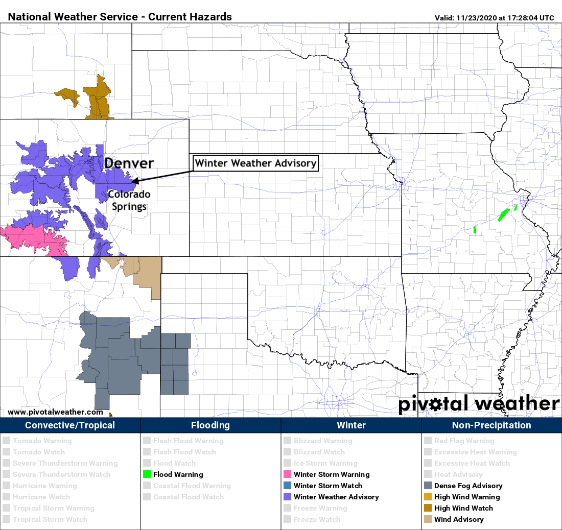
Winter Weather Advisory posted for the Palmer Divide and foothills, rain and snow arrive tonight

We continue to track the chance of rain and snow that will arrive this evening to our area and stick with us into Tuesday.
As we discussed last night, given temperatures and the speed of this system, we expect the greatest accumulation to occur west and south of Denver, though some accumulation in the city proper will be possible as well. If the changeover from rain to snow can occur earlier than anticipated, perhaps we see some high-end totals in the city as well – though at this time, that is the lower probability scenario.
The NWS in Boulder seems to agree. With that, they have issued a Winter Weather Advisory for the foothills west of Denver and the Palmer Divide, but not for Denver proper or Colorado Springs to our south. Here is the Advisory map as of Monday morning:

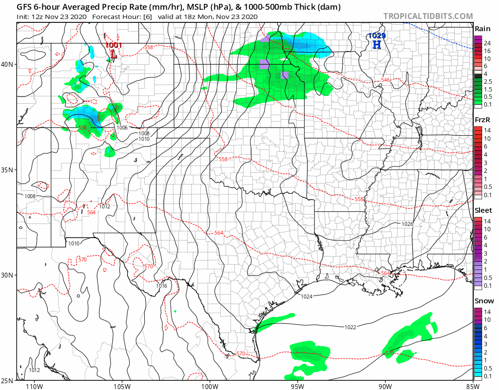
Rain and snow will increase in coverage through the day across the high country, and eventually spill out over the plains this evening and overnight. Heavy snow has already been falling across portions of Southwest Colorado today, but that coverage will expect north then east as the day progresses.
The animation below takes us from this morning through Tuesday night. Note a mix of greens and blues across Eastern Colorado, indicating that some areas will see rain then snow, and a mix of rain and snow. The storm becomes more organized as it moves east of us Tuesday evening.
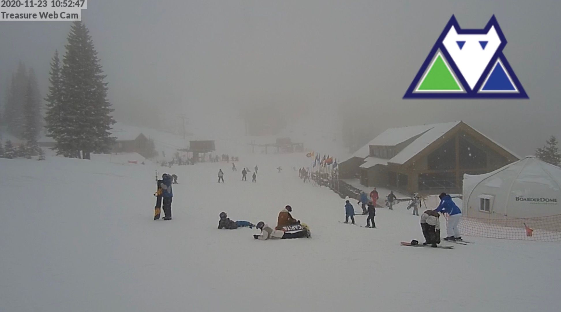
Speaking of the heavy snow across Southwest Colorado, here's a look at Wolf Creek Ski Area this morning, where upwards of 7" of snow fell overnight, with several more expected through Monday night:
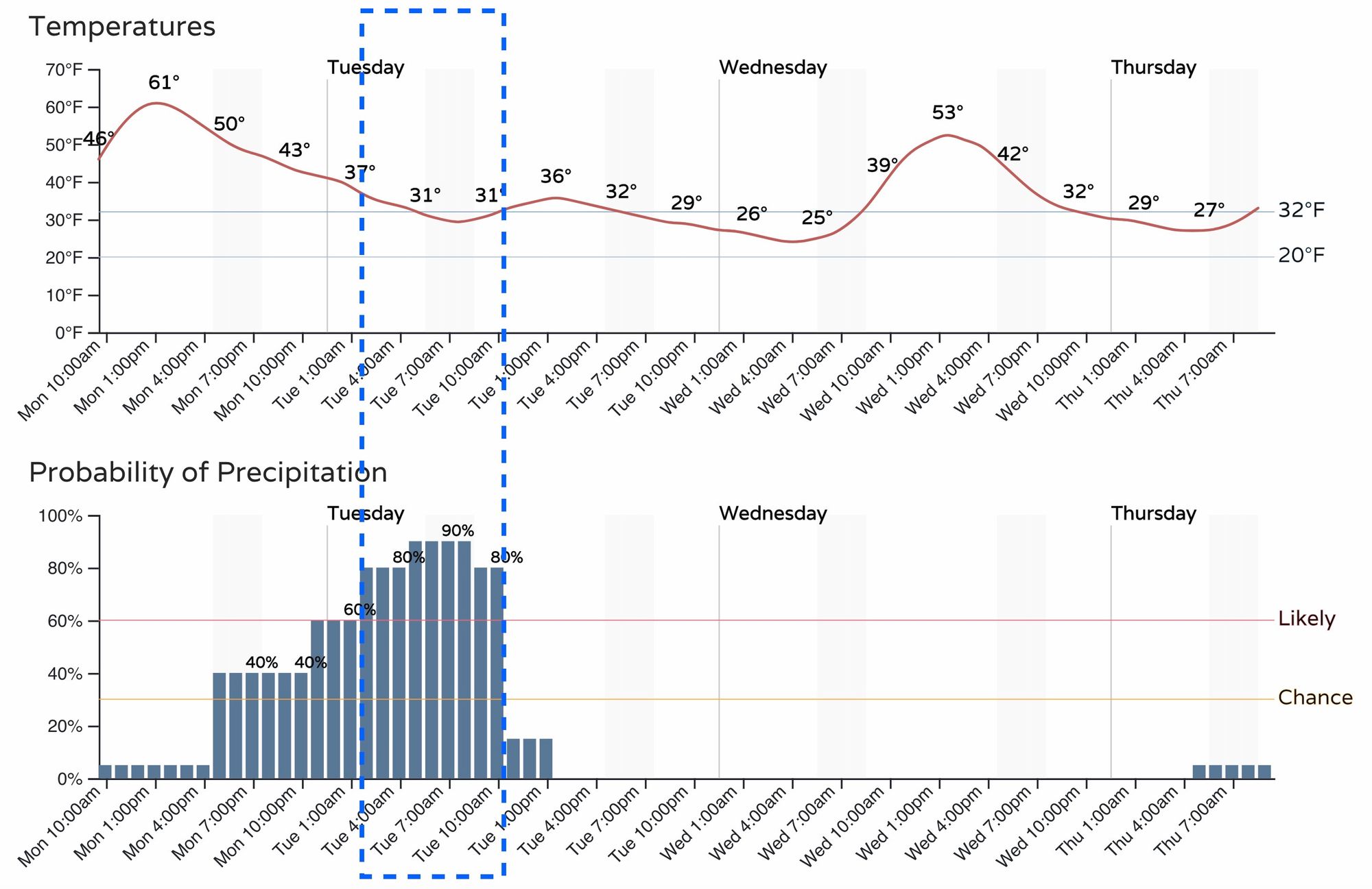
Should current timings hold, look for the greatest chance for measurable snow in Denver to come between about 3am tonight and 11am Tuesday morning. Prior to that precipitation is expected in the form of rain, or rain and snow, and precipitation should start to come to an end by mid to late morning Tuesday for most of us:
How much snow?
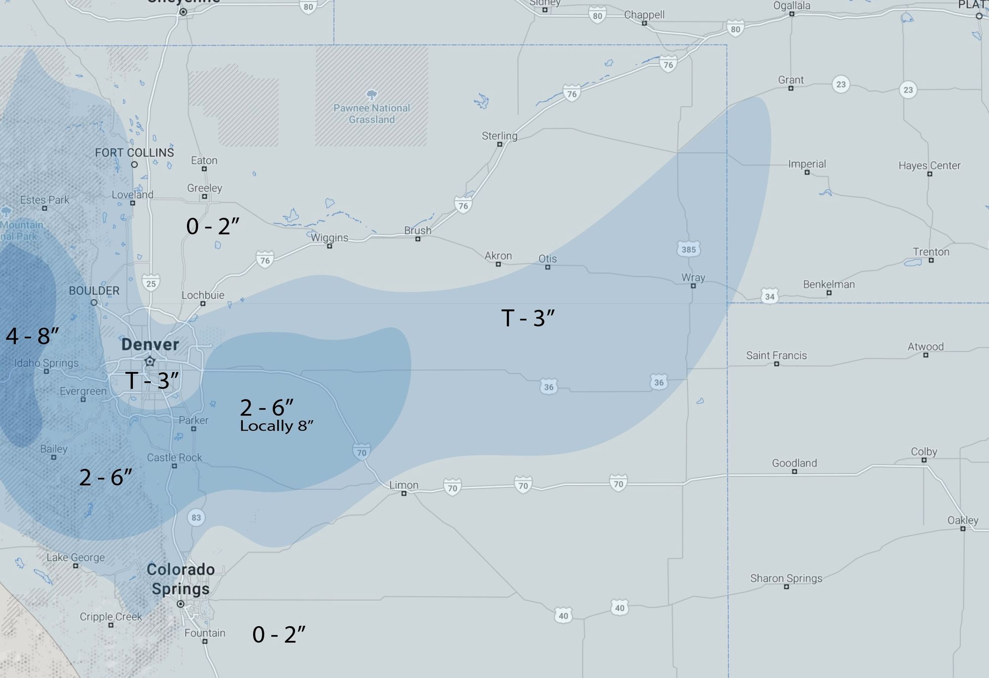
As for how much snow to expect? Our numbers today don't look all that different from what we laid out last night. The Advisory from the NWS has 3 - 6" mentioned for the Palmer Divide where we had 2 - 5". The 3 - 6" range is probably a safer bet, as there is some upside potential with this system especially at slightly higher elevations outside of the cities. In fact, if we see some 8" totals across portions of the Divide by Tuesday afternoon we would not be shocked.
In Denver we still think a Trace to 3" covers pretty well. Yes, some models have at times produced more like 3 - 6" for the city, but that remains probabilistically less likely at this time. For the suburbs west, south, and southeast of town (Highlands Ranch, Parker, etc) odds at ending up in a more like 2 - 5" or 3 - 6" range are higher than downtown.
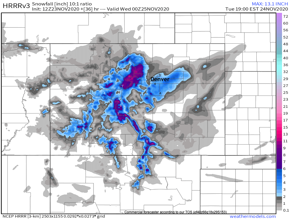
Below is a look at the latest HRRR high resolution model. It fits pretty well our thinking. Generally 0 to 2" north of Denver, Trace to 3" for Denver proper/airport, 2 - 5" on the south and southeast side, with locally 6"+ across the Palmer Divide and points east of DIA (Byers, Agate, Last Chance may all do okay with this setup). As you'll see below, probabilities are actually pretty low even across the Palmer Divide – but we think we'll see some bursts of HEAVY snow Tuesday morning in this area where rates could better 2"/hour at times (perhaps a snow squall warning or two even?), which could overcome other issues such as temperatures.
With that, here's our forecast, with big time hit-and-miss totals within these generalized areas:
Some wind too
We'll have some wind to contend with as well. For those areas in the Advisory this is especially true, where wind could gust to 35 mph Tuesday morning.
Even if travel ends up okay in the cities, the surrounding areas could be a mess for the morning commute. If you can avoid travel between Denver and Colorado Springs, and points east of town along I-70, that would be advised.
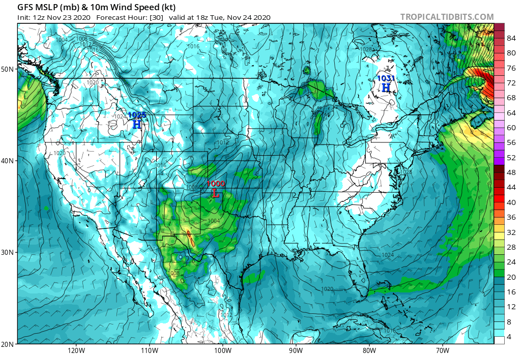
A look at the GFS for Tuesday morning shows those strong winds along and south/southeast of the Palmer Divide. This, combined with heavy snow squalls, will make travel difficult in this area especially:
High uncertainty
There's always uncertainty with snowfall forecasts around here, it's usually about how much. Much of the uncertainty around this one comes down to how much rain vs snow each location will see. There's still some differences in the strength and track of the storm as well (should it wrap up a bit more we could see some areas get whacked with heavier snow than anticipated Tuesday morning), but again, there's a lot of uncertainty in that idea as well.
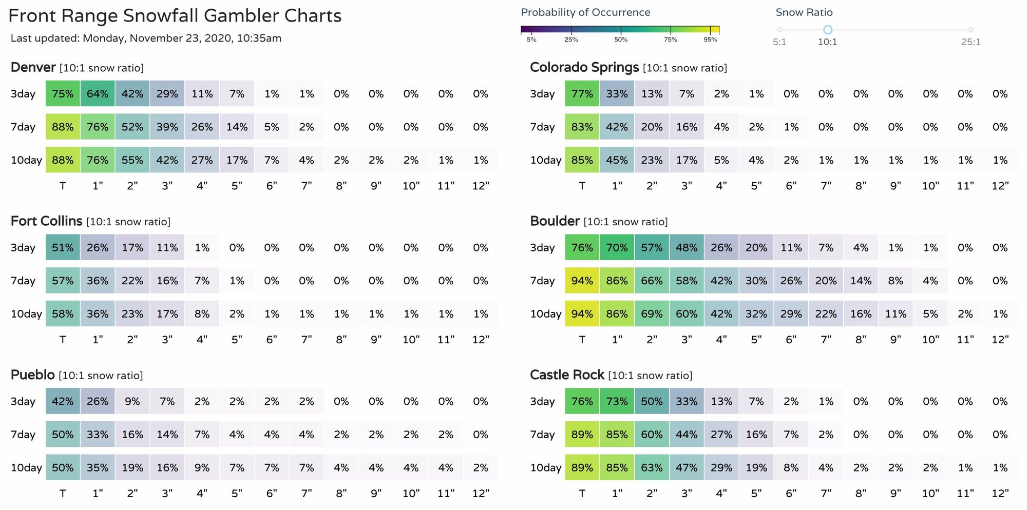
One way we show that uncertainty is with our gamblers. While we have Castle Rock, for example, in the 2 - 6" range, we see our gamblers only showing a 50% chance for 2" of snow or more in the 3-day column! This is in large part because of the spread in solutions still in the data – from 0" to upwards of 8", and the localized nature of the expected bands.
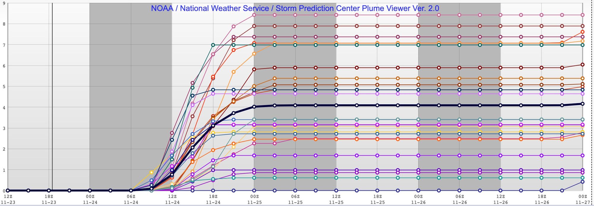
We can see that uncertainty in the SREF model output as well. Its latest mean forecast for south Denver is sitting at 4" (black line), but you can see that some members produce as much as 8.5" of snow, and some as little as 0 inches:
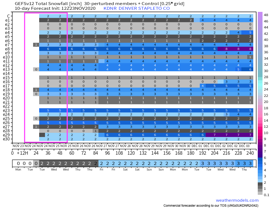
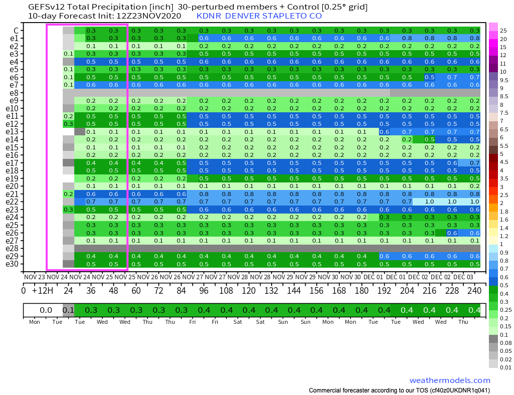
And finally, if you look at the GEFS forecast below (snow top, precipitation bottom), you'll see many of its members (30 along the y axis) show 0" of snow for Denver, while most show at least 0.1" of liquid – meaning it has many ensemble members keeping us as rain, or mix, or ... melty.
With the dynamic nature of this system, the expected temperature issues, and the expected bursts of heavy snow (perhaps in town, but more likely south and east of the city proper), we expect a wide variety of totals across the region by Tuesday afternoon. Boom, bust, and everywhere in between.
In the end, best to be prepared for winter driving conditions if you have to be out from late tonight through Tuesday across Eastern Colorado – and if you can avoid travel, please do!
Let us know how things shake out at your place, and we'll continue to watch for any changes to the outlook that may come our way as we head into this evening.