Updated snowfall forecast as data indicates support for greater snowfall along the northern Front Range, less snow for others

Well, well, well. Overnight data has trended snowier with the incoming snow event tonight. Nearly all models showing more snowfall across the greater Denver area from where they were a day or two ago. In fact, most models show appreciable snowfall for the area tonight, focusing the heaviest snow along and west of I-25. The National Weather Service has extended its Winter Weather Advisory to include the foothills west of the urban corridor, which seems prudent.
The two trends we're watching today are timing and track. Timing looks a bit slower, both the with onset of snow this evening and the ending time of snow Thursday morning. As for track, most models have come north of where they were the last couple of days, hence the greater totals showing up in most of the data for Denver and the northern urban corridor. The question is if these trends will hold true!
Looking through the morning model runs shows most support a good 3 - 6" snow for much of the Denver metro area, with more west and south. Really the only model not showing the heavier snowfall is the European, which of course is concerning. Most models still at least hit our low-end for Colorado Springs, but if the northerly trend continues, a bust is on the table there. We've lowered snowfall potential a bit further south to account for this.
You'll recall the storm two weeks ago that buried the Front Range foothills. The European and its ensemble handled that event better than many others. It had 0.35" to 0.5" of precipitation for higher elevations west of I-25, which worked out. So far, the model just hasn't latched onto the higher-end event as the others have.
If we look at the last two runs (oldest bottom left, newest right) we do see it's upped its QPF forecast in the most recent run – but still has most of us in the 0.1" to 0.3" QPF range (1 to 2" for the city, 3 - 6" for the foothills). Compare that to the GFS, which really hasn't changed in days, and its 0.5" to 0.8" QPF (5 to 10"+ of snow) across the greater Denver metro area and you can see the huge difference in possible outcomes depending on what solution you're inclined to believe.
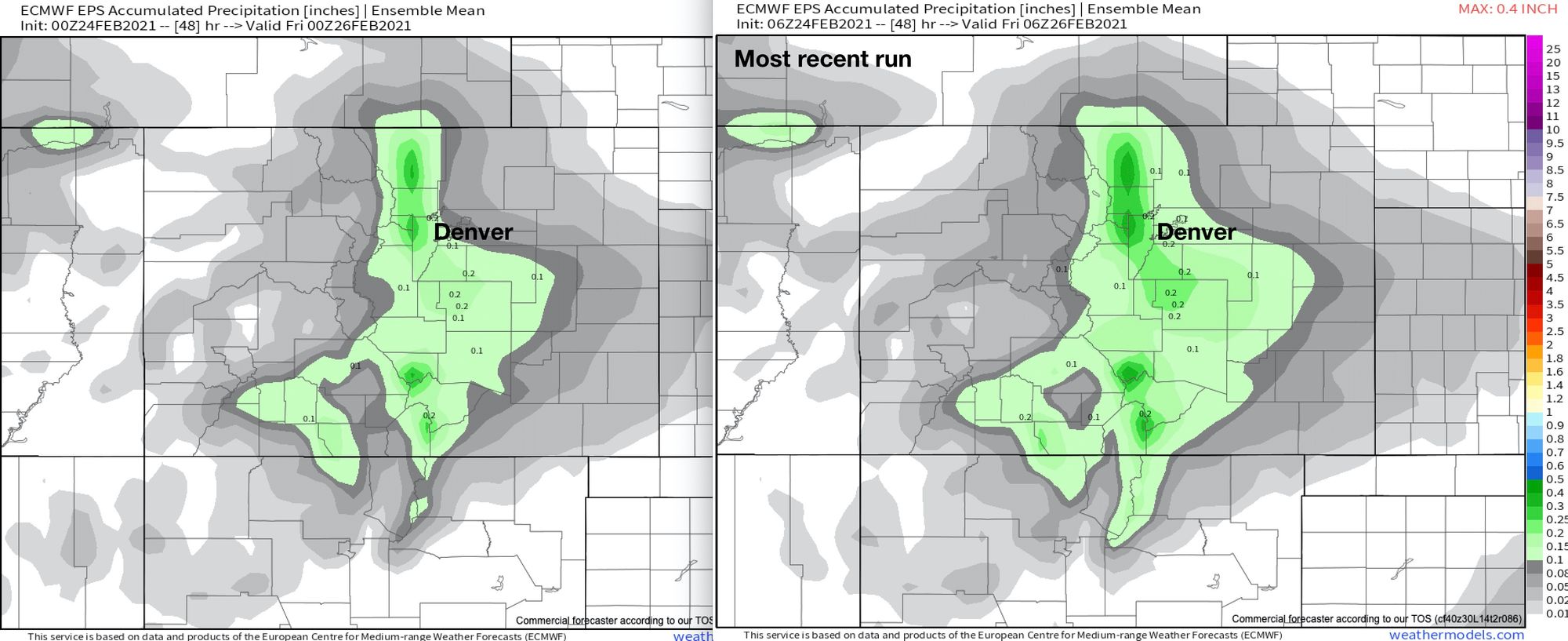
Given it's the Euro, and the consistency in each of its runs, it's pretty hard to throw it out completely. But, if the upslope advertised by some of the other models (GFS) is anywhere near on par, we could see a nice boom snowfall for many locales tonight.
Let's take a look at some other models.
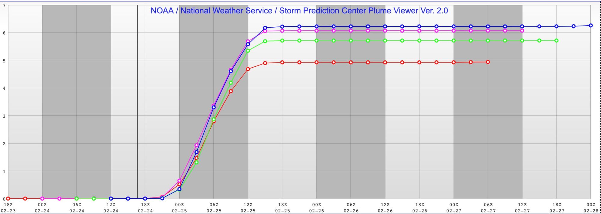
Here's the lates SREF plumes for south Denver. The oldest run is the red line, the newest is the blue – an uptick in totals, but overall pretty consistent in the means, showing about 6" of snow for the southern metro area.
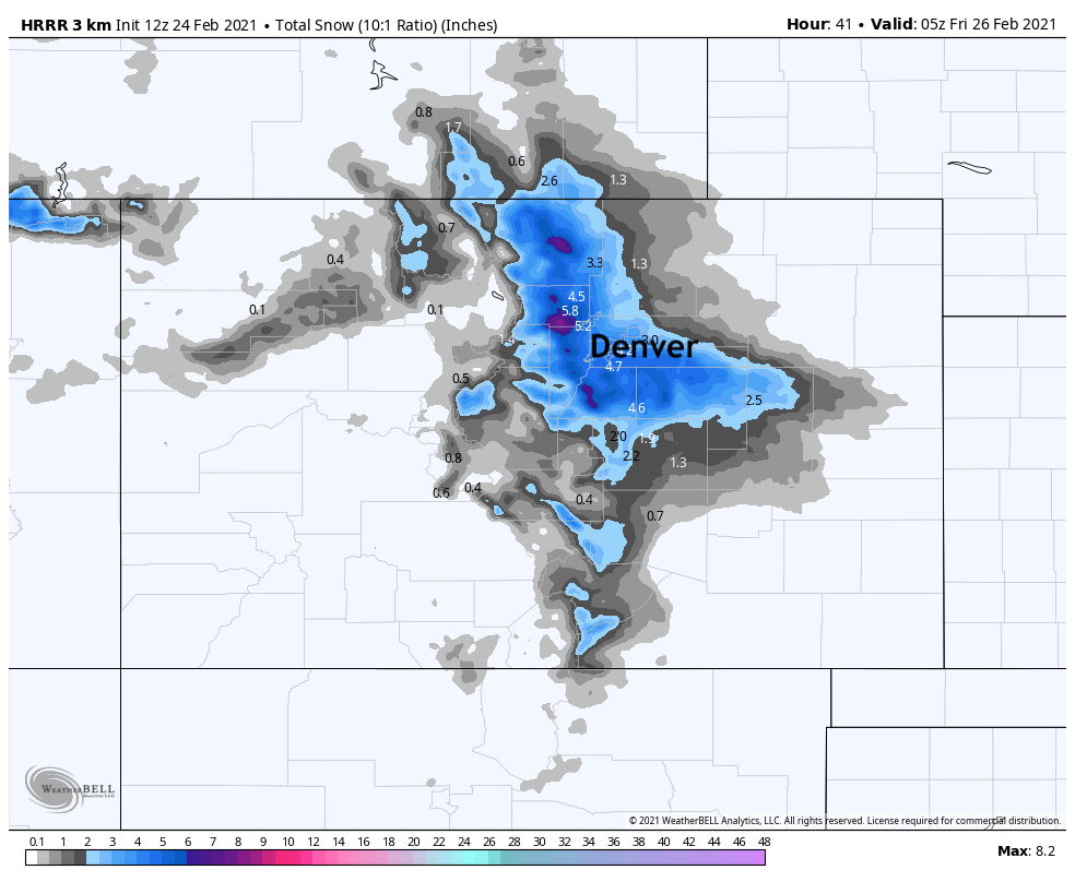
The extended HRRR model hints at a more northerly bias (bust for Colorado Springs), and a nice 3 - 6" snow event for the Denver metro area, with pockets of 6"+ for the Front Range foothills:
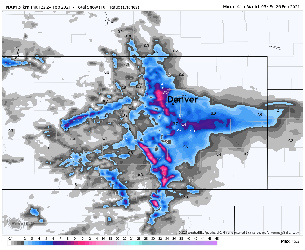
The latest high-resolution NAM model shows 3 - 6" for Denver as well, with a good number of spots up over 8" of snow in Boulder, Jefferson, Douglas, and Elbert counties. This model is more often than not overdone, at least in its coverage of the greatest totals.
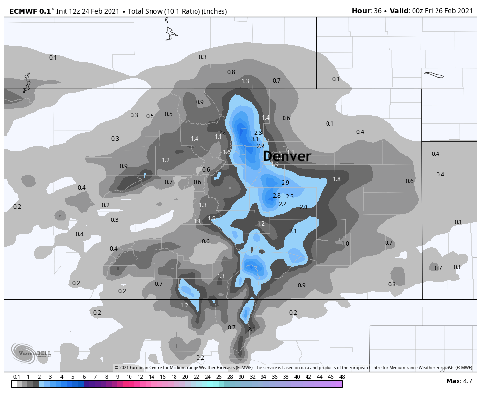
And here's the 12z European. Not quite as exciting, right? Greatest snowfall for Boulder county, the western Palmer and (unlike the HRRR) Colorado Springs. For Denver it remains in the 1 - 3" range, which has been pretty darn consistently so for the last several days now. So, if you're looking to be skeptical of our more bullish numbers below, 🚨 here's that reason 🚨!
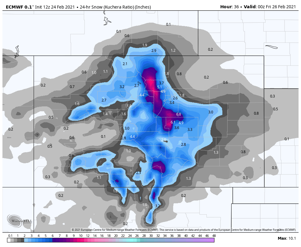
Looking at the Euro snowfall forecast using the Kuchera ratio (which we don't often consider), we get closer to the other models. And, given the placement of the heaviest snow (in line with recent storms) give some confidence in the high-end potential we've been discussing:
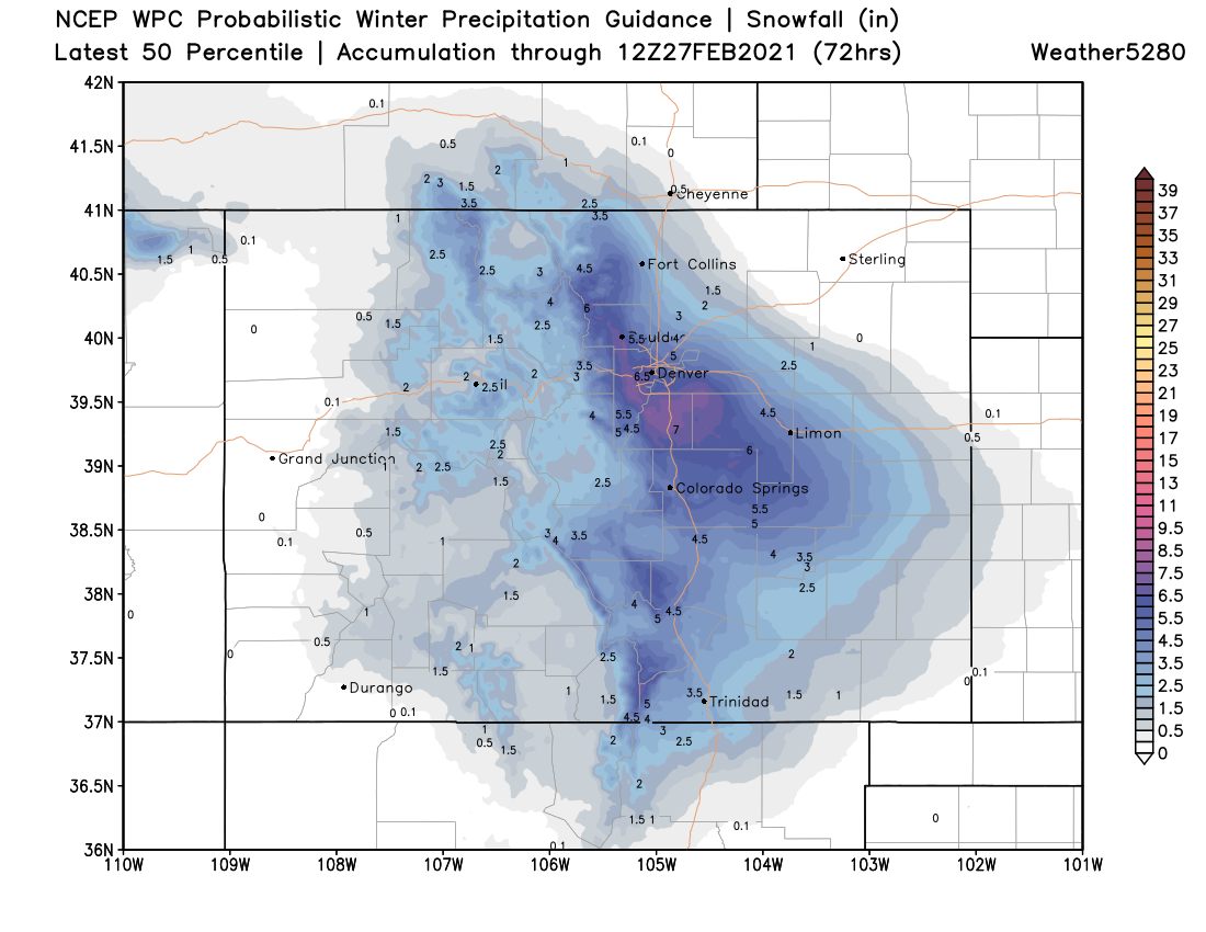
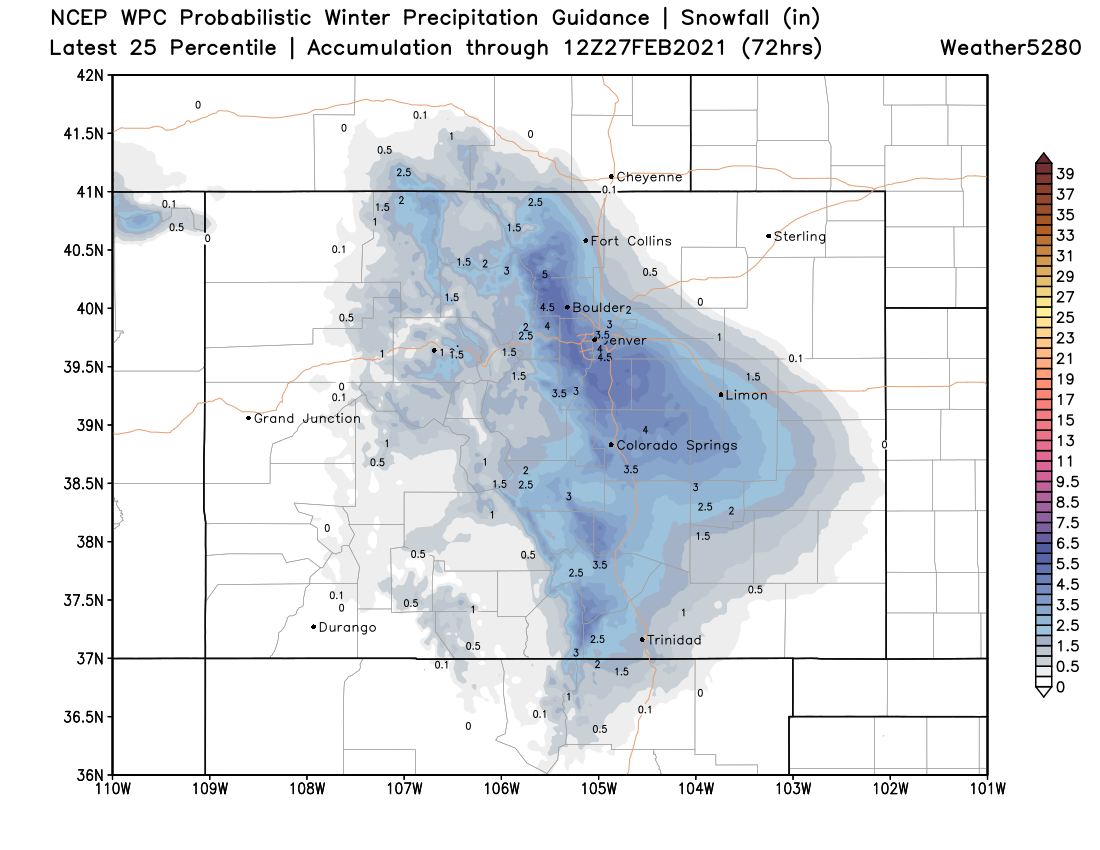
Finally, a look at the 50th percentile guidance from the WPC shows some pretty bullish numbers as well! That's easily 3 - 6" for Denver proper, with 5 - 10" for the foothills and Palmer.
A more conservative look would be the following with 2 - 5" for the city, and 4 to 8" for the foothills and Palmer. This sits as bit better with out thinking.
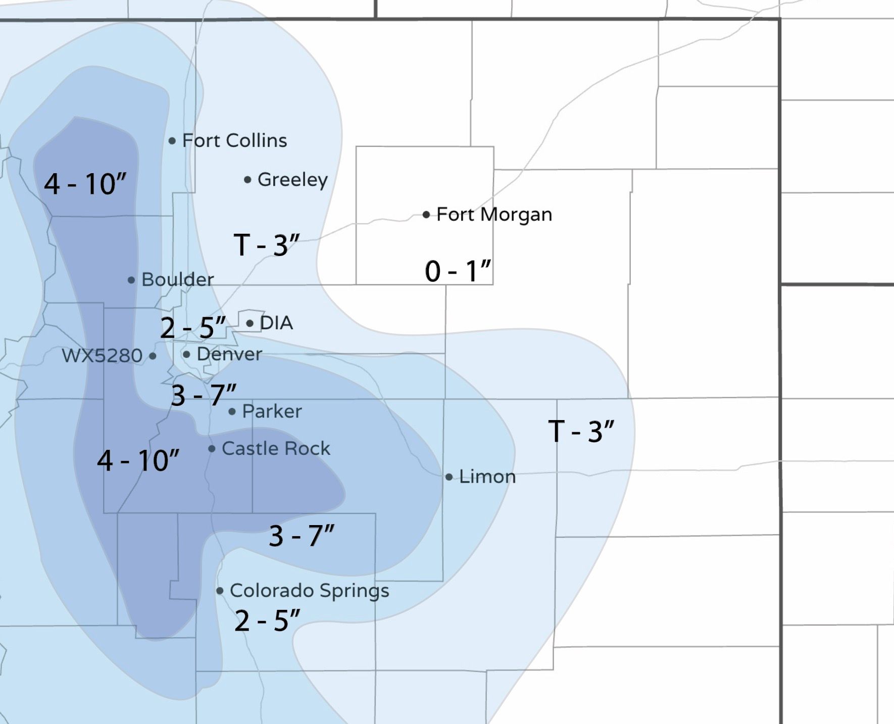
So, what does that mean for our forecast? Well, we've gone ahead and upped our totals a bit, and pulled things further north than what we had yesterday. Downtown Denver and most of the northern urban corridor right along I-25 will be in the 2 - 5" range, DIA in the Trace to 3" range. As you head west and south look for totals from 3 - 7" for the Denver suburbs, with lesser totals again as you move south of the Palmer Divide into Colorado Springs. The foothills and Palmer Divide will be in our 4 - 10" range (locally higher) totals. Given the morning data, the greatest bust potential looks to be the Colorado Springs metro, with greater boom potential for the Denver/Boulder area.
Our latest forecast:
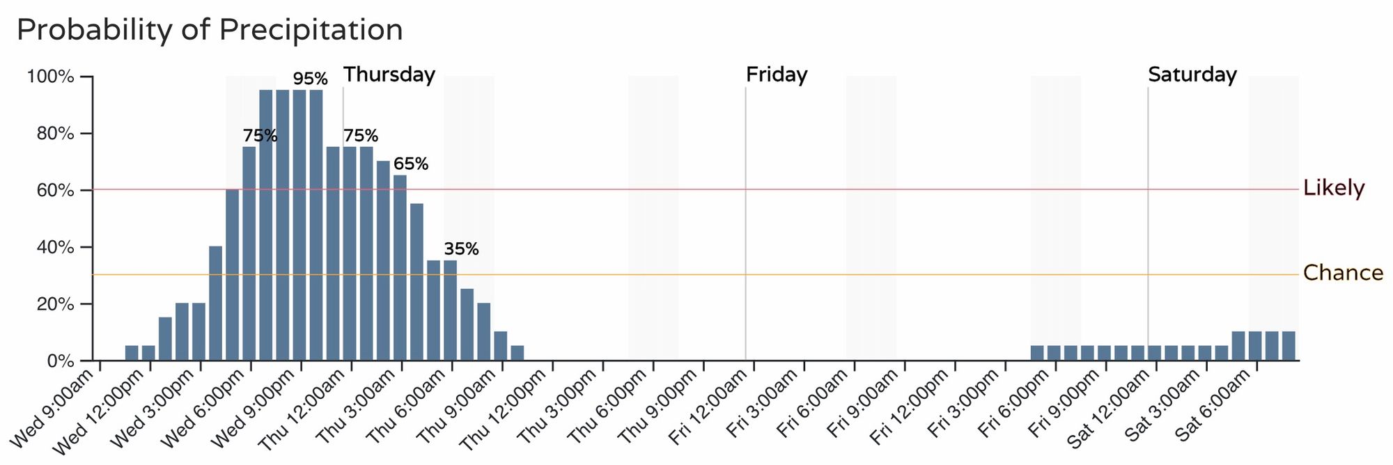
As for timing? Look for things to develop perhaps a bit slower than previously advertised, especially at lower elevations east of the hills as it'll take some time for moisture to increase this evening. For Denver, we still like the best chance of snow coming at the tail end of tonights commute through the early hours Thursday morning. Most likely the bulk of the snow will be done falling by your Thursday morning drive.
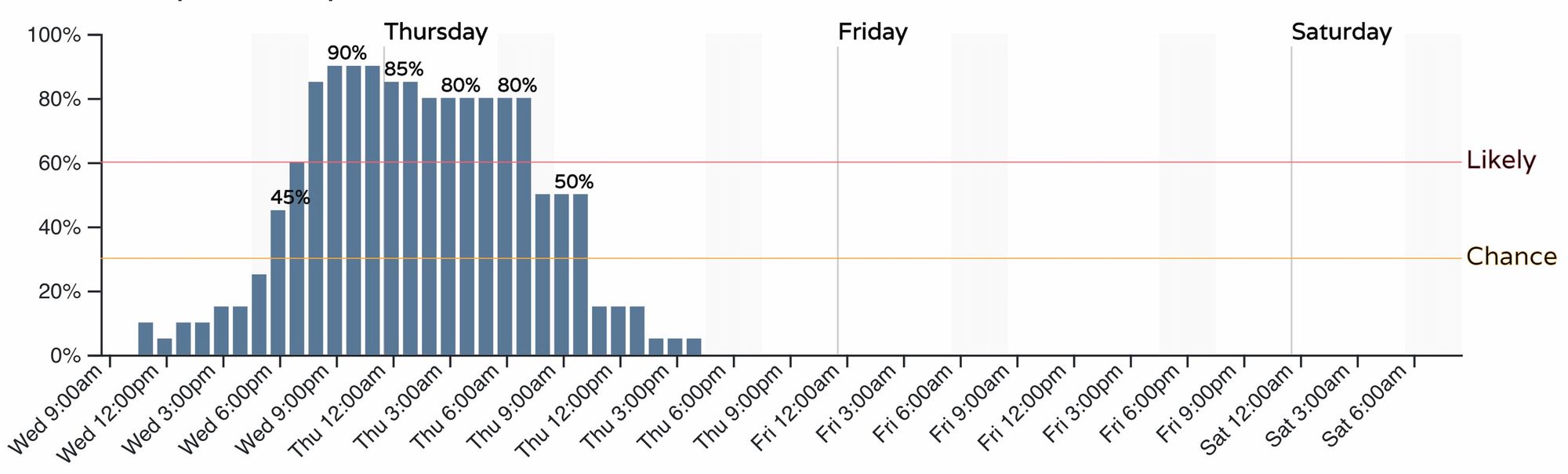
For Colorado Springs we see the snow chance bleed into the morning commute a bit more as the storm may be slower to exit on Thursday.
A lot to watch, no doubt.
The note we left you with yesterday was that the boom potential was low. Today it's higher, but so too is the bust potential! Most data supports a moderate snow event for many locations tonight, but let's see if the European beats all the others once more.