Record highs forecast today, relief from the heat and rain on tap for the weekend across Colorado

There's going to be a transition within the atmosphere from late this week through early next week that will bring cooler temperatures and higher rain chances to most, if not all, of Colorado.
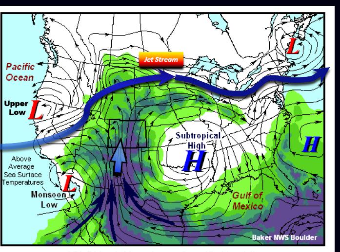
This transition is part of the seasonal monsoon pattern that is trying to establish itself across the American Southwest. In this case, the monsoonal pattern is breaking down and shifting west, during which some moisture from the Northern US will be moving from north to south across the state.
Remember, the monsoon is a seasonal weather pattern that results in higher than normal precipitation across the region.
Thus far, the only above average rainfall has been in sections of New Mexico, Arizona, Southern California and Nevada, Utah and parts of Western/Southwestern Colorado:
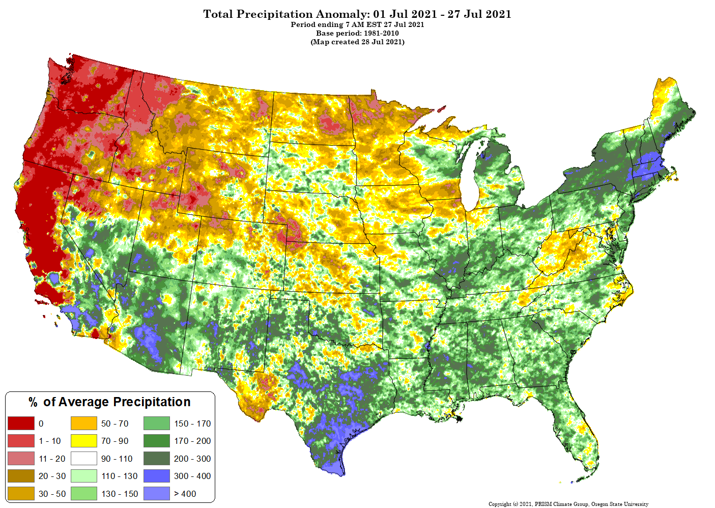
Much of Northern Colorado is quite a bit drier than average in July and awaits the next push in some moisture which we expect this weekend.
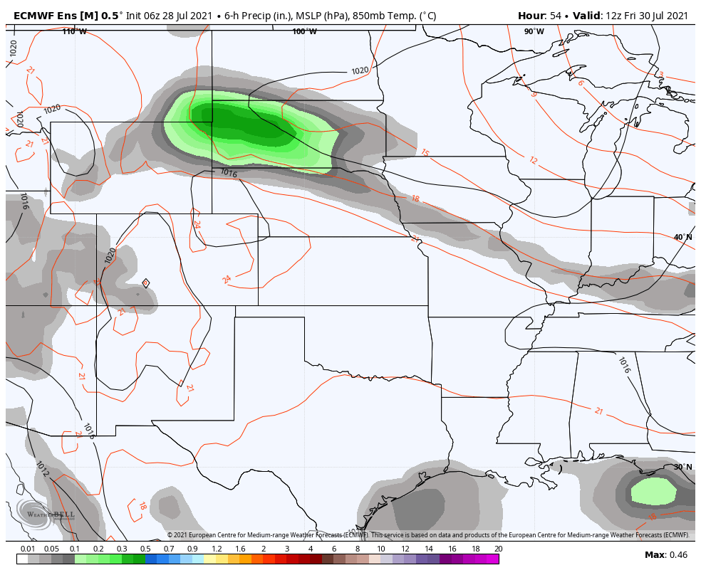
I'll highlight the area of moisture Friday morning to our north:
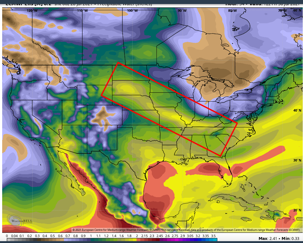
And by Sunday morning that area of moisture has moved across our region as it heads south. You can see that the browns and purples across eastern Colorado have been replaces with greens/yellows, indicating higher precipitable water (PWAT) values across the region:
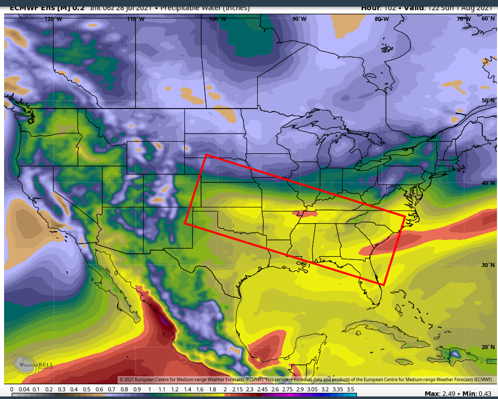
Those two colorful maps above are showing how much water is in the atmosphere that translates into heavy rainfall if storms develop.
Let's now watch an animation across the region showing areas of rain from Friday morning through Sunday night.

That animation shows a bit area of heavy rainfall over the Dakotas and Nebraska moving its way to the deep south, meanwhile we have an increased coverage of rain showers (all that green) popping up on Colorado Friday through the weekend.
How that translates to rain chances is shown here for Denver. Insiders and Pros can access the interactive map to select any location's data here.
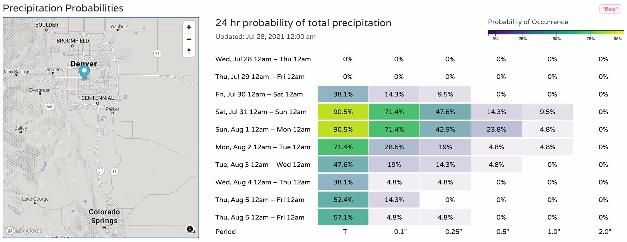
We see a much higher chance of rain is set to return to the metro area for the weekend. And, not just for the city but across much of the state.
Colorado can expect to potential for the following rainfall totals this weekend.
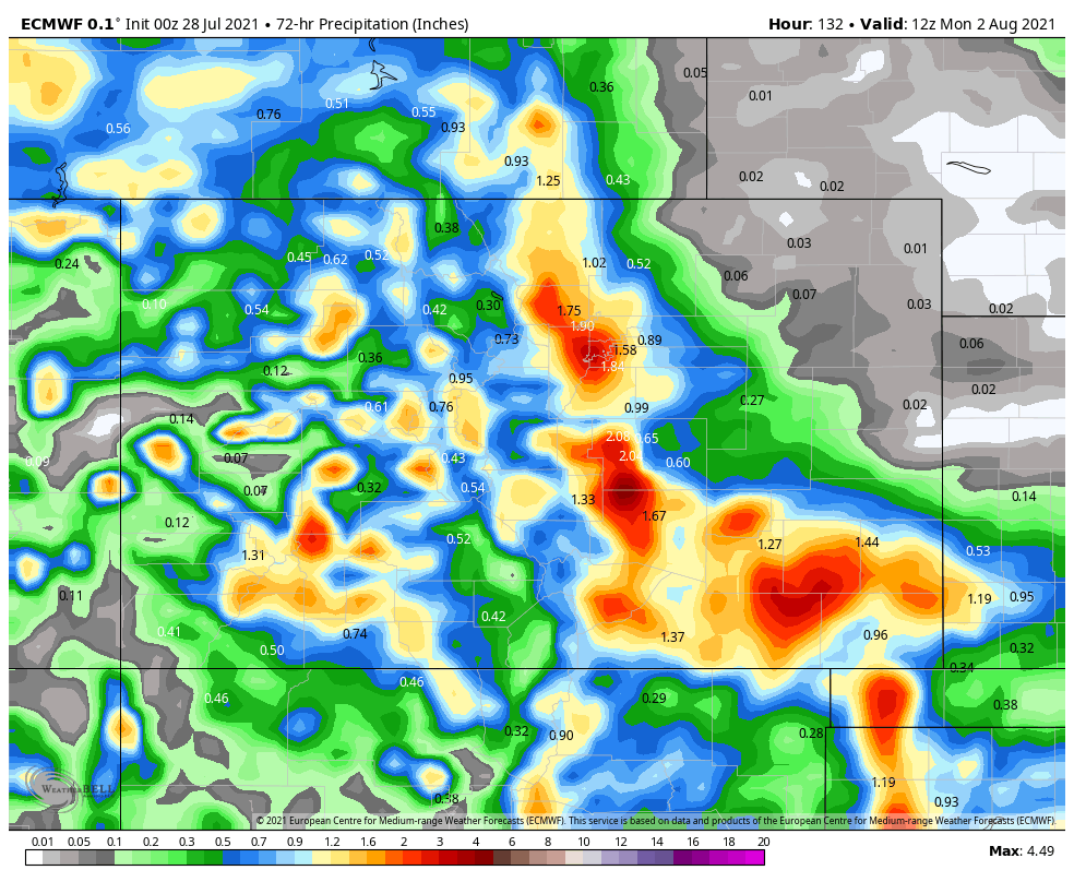
Again, that is a rough estimate at this time, but does indicate the chance for very heavy rainfall at times. The driest part of the state is the northeast, the wettest is the southeast and Front Range Mountains.
Sadly, this does need to be considered as another flooding and rock slide risk, so travelers and campers beware.
We will have more on the hourly rain chances for multiple locations later this week as we head into the weekend. For now, consider this a heads up. For me, I hope the rain pans out at my place as my property surely needs it. For you, I hope rain is favorable also.
I'm not done yet.
I teased you in the headline with cooler temperatures. So let's take a look at the cooler days ahead, but not before touching on today's possible record-heat.
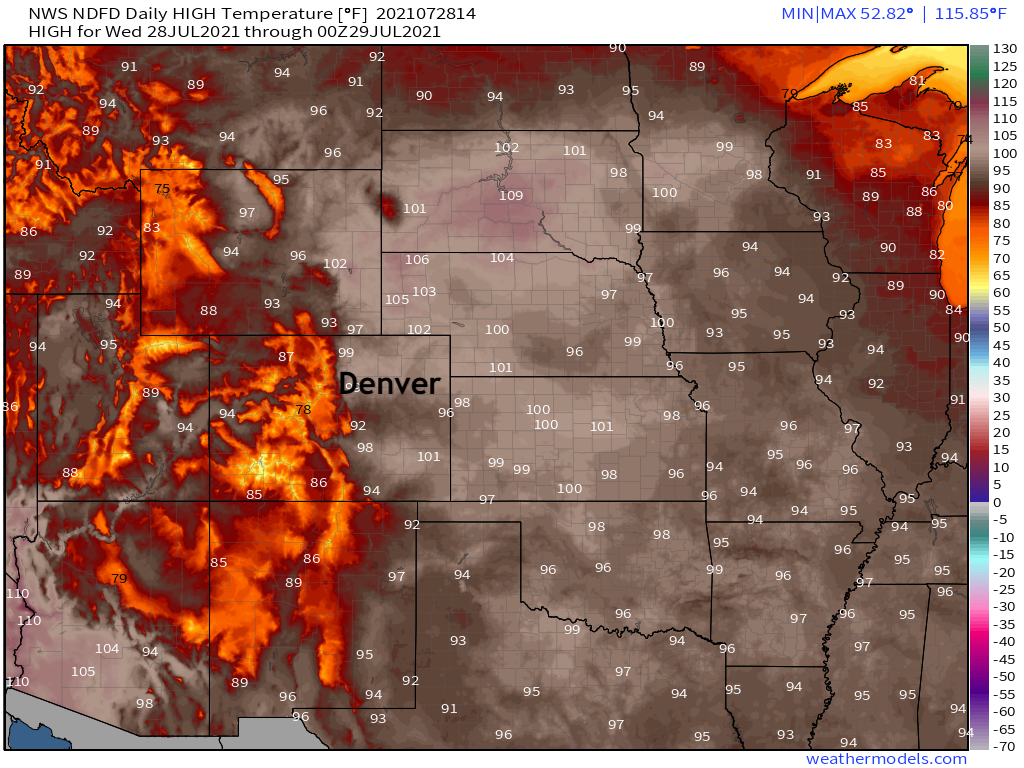
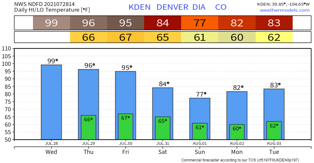
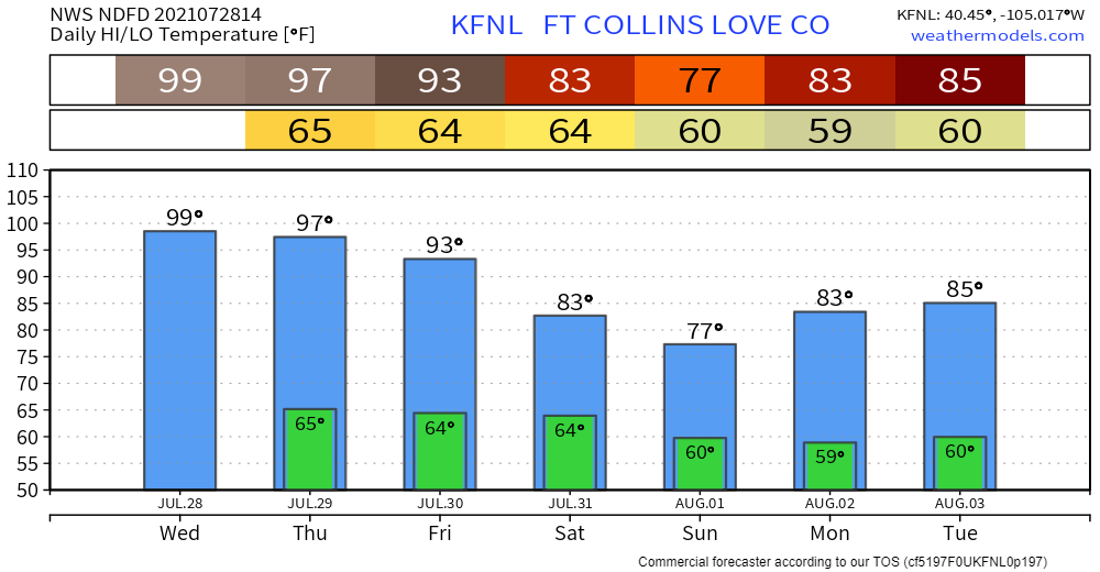
Forecast highs across the plains states will be quite hot today, with locations from Texas to North Dakota in the upper 90s or even 100+ degrees this afternoon. Denver's current forecast is for a high of 100°F, which if managed would be a record high for the date. The current record for July 28th is 98°F, set back in 1876.
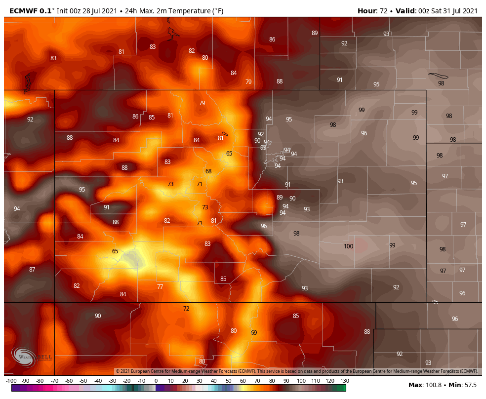
Friday, remains hot – 90s for the plains and metro areas as well as the west, 80s for the mountains:
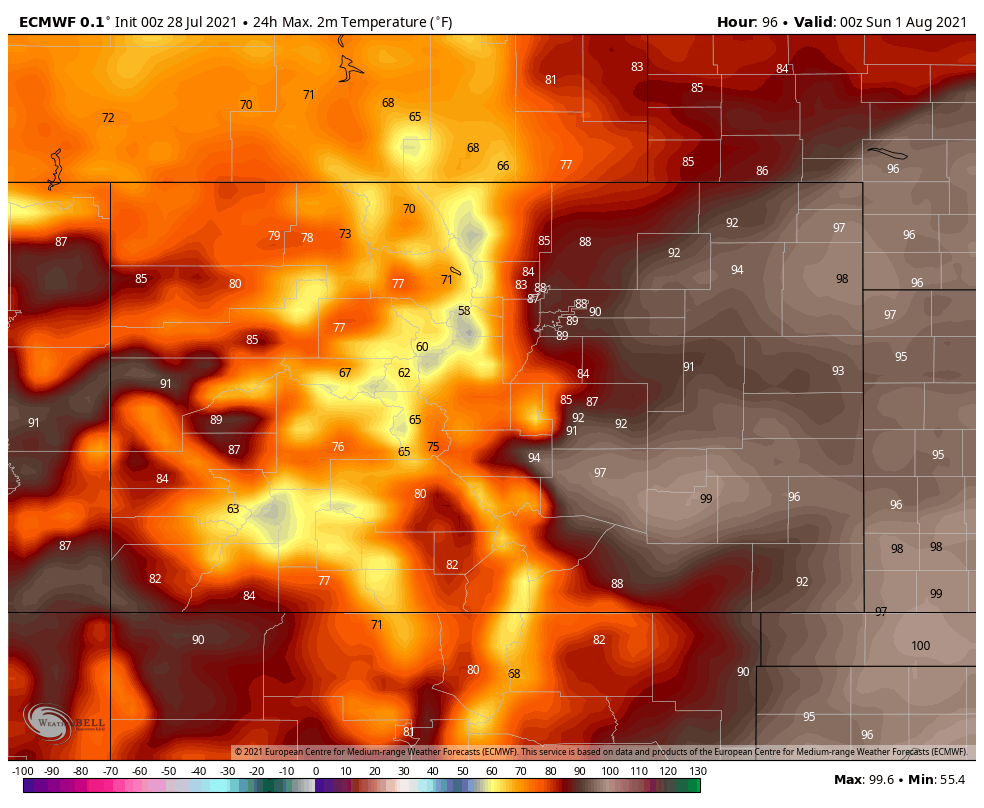
Saturday cools off by ten or more degrees in the mountains and northern Colorado as the 90s shift to the eastern plains and skirt the Denver area.
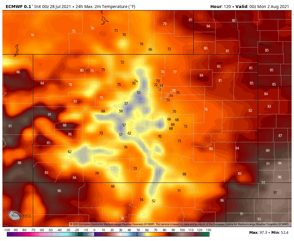
By Sunday, most of the state is in the 60s to 70s, with the warmer temperatures near the east and west state lines.
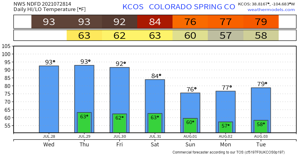
Looking at Colorado Springs, Denver, and Fort Collins planning forecasts:
For me personally, I'm more excited about the rain prospects but I'll take a few days in the 80s and 70s, too. Let's hope it pans out!