The State of the Atmosphere: Sunday, January 30th, 2022

We'll piece together one more mild day across the area Monday ahead of big changes on the way this week. A push of very cold air will arrive Tuesday and stick with us through Thursday, with a good chance of at least some light snow up and down the Front Range as well.
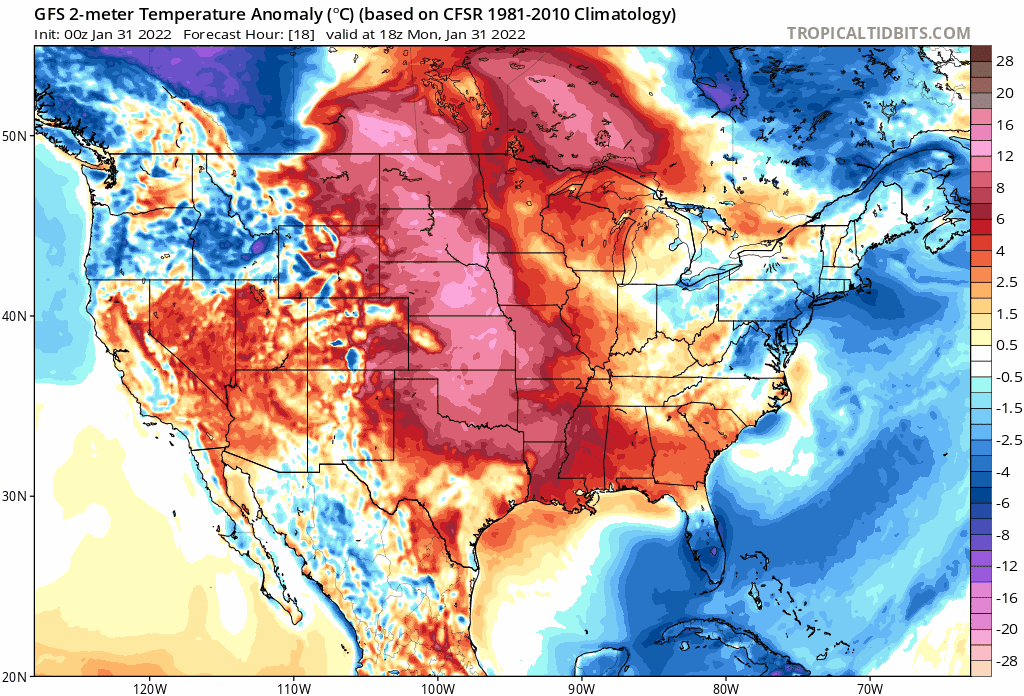
The cold will mean business, especially after this weekend's mild weather. Here's a look at all the warmth that will be replaced in the coming days as bitter cold air drops south across the plains:
For Denver, and Northeast Colorado this means highs in the 50s once more on Monday, but sharply colder Tuesday behind the initial cold front that will impact the state. Reinforcing cold air will work its way into Colorado Wednesday morning and keep us in the deep freeze through Thursday it appears.

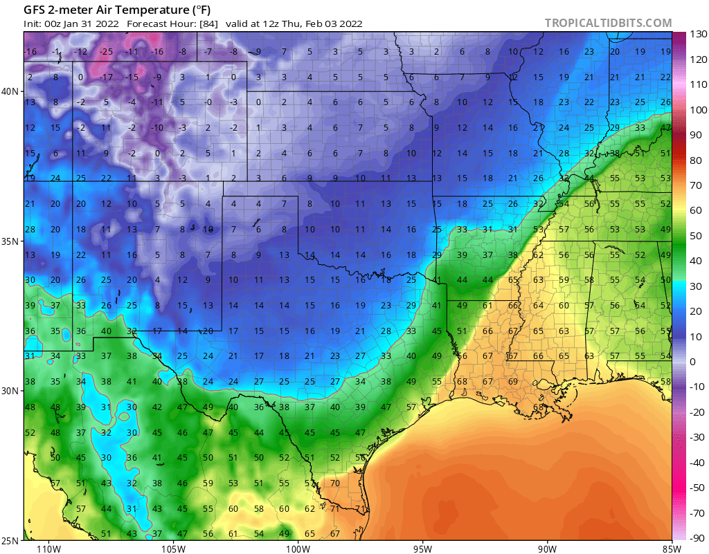
Lows Thursday morning across the northern tier will be very cold, some -30F or more very cold, with single digits and below zero temperatures common across the central and northern high plains:

Accompanying the cold will be a prolonged chance of snow. Really, anywhere from Tuesday morning through Wednesday afternoon we could see snow showers and flurries across the urban corridor.
The best chance for the metro areas to see accumulating snow looks to be Tuesday night into Wednesday when the best upslope will be in place. We'll quantify that by saying "best" doesn't necessarily mean "great" with some models not showing much in the way of upslope even during this window, at least as you move east of the higher terrain.
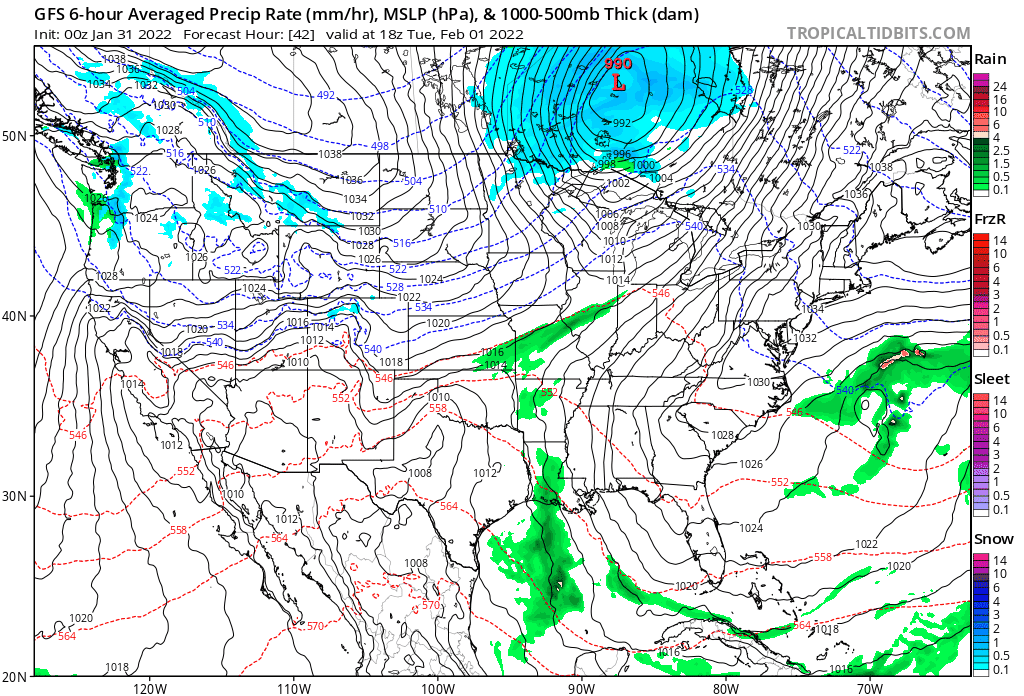
Watching the animation below from the GFS tonight, it shows this prolonged period of light snow across the state, but with a close eye you can see plenty of gaps in its coverage along the urban corridor (and a notable signal for wintry weather on the way for the southern and central plains by late week). The gaps around Denver are indicative of this model showing more of a southeast wind rather than easterly upslope for Denver as it has shown in prior runs. A trend? Or a fluke? We'll see.
With that, it's got some great snowfall for the northern Front Range foothills this week (upwards of 6" or so) but much less along the urban corridor and points east, where dynamics may not be as favorable.
The 18z European model was a bit more optimistic still with snow potential in the city, but it too favors areas north and west of the city for the heaviest snowfall. Places like Boulder, Loveland, Fort Collins (and locations to their west) may all end up in a better spot for the more meaningful snow Tuesday night than Denver and the Palmer Divide, but of course this could still change.
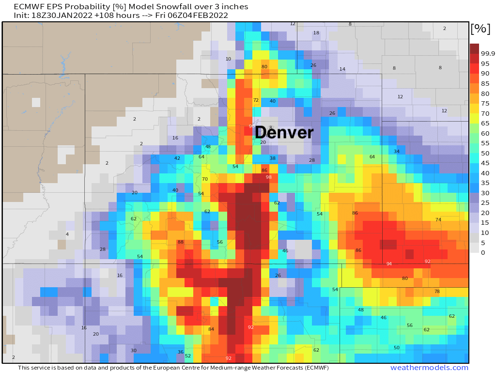
The probabilities for 3" of snow or more from the European ensemble would confirm this as well, with a healthy look for the COS region and Southeast Plains as of this afternoon as well:

It'll take some work to narrow down snowfall totals, but tomorrow should offer a clearer idea of which way this event is trending. An early guess would put some of the northern cities/immediate foothills in the 5"+ range, with a 3 - 6" range for the Denver area. Should the GFS be on to something tonight, we could see the low-range totals go down a bit as it's really not excited about snow in Denver.
We'll touch base tomorrow and see how things look on both the cold and snow fronts, but for now... plan on sharply colder temperatures by Tuesday, and some snow-and-go commutes by the middle part of the week along the Front Range and eastern plains.